

The Nomads Outdoors Group Inc.
Powered by
Past events
All events
Past events
Aug
25
2019
Past Event
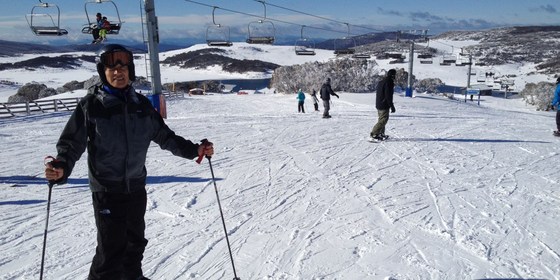
Ski Week at Falls Creek
Cosela Alpine Club
25 Aug 2019 13:00 – 30 Aug 2019 16:00
Five days of cross-country skiing, downhill skiing and/or snowboarding, staying in a cosy lodge at Falls Creek.
GRADE | LENGTH | TYPE: Your choice (choose slopes and equipment to match your skills) – cross-country skiing, downhill skiing and/or snowboarding.
ACTIVITY DESCRIPTION:
A 5-day, or part thereof, ski trip to Falls Creek is being planned for Sunday 25th to Friday 30th August. We will be staying at the cosy Cosela Alpine Lodge which provides ski-in ski-out access from Wombats Ramble with no oversnow transport requirements. This will be a cross-country ski, downhill ski and/or snowboard week leaving Melbourne on Sunday and leaving Falls Creek the following Friday.
FURTHER INFORMATION: www.cosela.com.au/Winter/index.html.
MEETING TIME | LOCATION: Sunday afternoon, Cosela Alpine Lodge, Falls Creek.
MAP REFERENCE: Melway Map X922 grid H10 | Google map goo.gl/maps/V7fBUEiNBb62.
DIRECTIONS: There are coach services from Melbourne, Mt Beauty and many other locations to Falls Creek. There are long-term parking facilities in Mt Beauty if you don’t wish to take your car up the mountain. If driving, take the Hume Freeway (M31) to Wangaratta then the Great Alpine Road (B500), turning off to Mt Beauty. On arrival at Falls Creek you should request to unload your luggage at the steps beyond the CFA station, which is lit at night, as you are staying at Cosela and don't need oversnow transport. After unloading, you will return to the attendant to be directed to a parking place. Cosela lodge can then be reached by travelling up the steps and across Snowgum Lane (see map at www.cosela.com.au/Winter/Map.html).
DISTANCE | TIME FROM GPO: 391km, 4.5 hours.
FOOD: It's advisable to bring food for the period of your stay; group catering arrangements will be organised after registration. Breakfast cereal, milk, bread, jam, condiments, tea and coffee are provided by the lodge. There’s a local food store for last minute supplies and oversights.
COST: The accommodation cost will be $105 per Nomads member per night. You can come for the full time or part thereof. GET a TICKET to indicate your intention to attend. The leader will then contact you to confirm dates & times, and to organise payment. Not a Nomads member? Purchase a temporary one-month membership before getting your tickets (cost $8).
APPAREL | FOOTWEAR: Bring sheets and pillowcases, towel, washer and toiletries, plus ski gear to suit all possible conditions (or hire it in Mt Beauty or Falls Creek). Don’t forget warm, comfortable clothing for after-ski activities. If driving you will be required to carry chains (these can be hired in Mt Beauty), and you should ensure your radiator has antifreeze.
LEADER | BOOKING: Les B. | ASAP to ensure you don't miss out on accommodation. Email the Leader if you have any questions. Members can access leader contact details under Members | Leader Contacts when logged in to the website.
HOME BACK TO LIST OF EVENTS MEMBERSHIPS
Aug
25
2019
Past Event
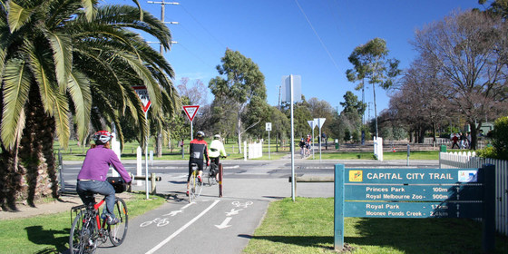
Cycling the Capital City Trail
Beer DeLuxe Fed Square
10:30 – 16:00
Enjoy a leisurely winter ride along the Capital City Trail around inner Melbourne.
GRADE | LENGTH | TYPE: A relatively easy 30 km cycling circuit with many early exit options if needed.
ACTIVITY DESCRIPTION:
The plan is to start with a coffee at Beer Deluxe, Federation square. The best bike parking option is beside the river on Birrarung Marr (between Swanston Street and the MCG, and between the Federation Square Car Park and the river). The ride will be starting from the bike parking. From Federation Square we'll follow the Main Yarra Trail in an anticlockwise direction, with lunch probably at the Doutta Galla Hotel in Flemington. However, if we have significant rain or other delays, there are many other lunch possibilities such as Lentil as Anything at the Abbotsford Convent, The Great Northern Hotel on Rathdowne St or various cafes in Lygon St. After lunch we'll continue around the Capital City Trail through Docklands and back to the starting point, or whatever point you decide to exit. This is a fairly easy ride of around 30 km and there are many train exit options all along the way.
MEETING TIME | LOCATION: 10:30am in the beer garden of the Beer Deluxe Cafe, Federation Square.
MAP REFERENCE: Melway map X893 grid C9 or map 1B grid Q10 | Google map goo.gl/maps/FLiFH5Gapz5CXZjh9.
APPAREL | EQUIPMENT | FOOD: Bike, helmet and spare tube. Dress for the forecast weather conditions. Don't forget drinking water and warm, waterproof layers. Lunch will be purchased along the way, probably at the Doutta Galla pub.
LEADER | BOOKING: Alan D. | by Friday 23rd August. Email the Leader if you have any questions. Members can access leader contact details under Members | Leader Contacts when logged in to the website.
HOME BACK TO LIST OF EVENTS MEMBERSHIPS
Aug
18
2019
Past Event
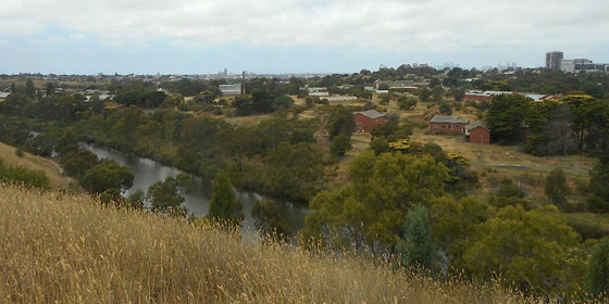
Maribyrnong River Trail Walk
Flinders Street Railway Station
10:12 – 16:00
Take in the sights including Maribyrnong River Viaduct, Quang Minh Buddhist Temple, Maribyrnong Explosives Factory and impressive city views with this pleasant Sunday walk along the Maribyrnong River.
GRADE | LENGTH | TYPE: A moderate 14km point-to-point walk with public transport links.
ACTIVITY DESCRIPTION:
Commencing from Milleara Shopping Centre in Keilor East, this walk follows the Maribyrnong River through to Maribyrnong Road in Ascot Vale. There are many interesting sights to be viewed from vantage points along the river trail. The first vantage point looks across to the impressive railway trestle bridge of the Maribyrnong River Viaduct. A short way along the river the Quang Minh Buddhist Temple sits high atop the opposite river bank. We'll find a picnic table in Canning Reserve or Tea Gardens Reserve for our lunch break. Following lunch we'll take some tracks high above the river to come across several vantage points for city views and to look down into the abandoned Department of Defence site. The site incorporates the Maribyrnong Explosives Factory and many other defence industry buildings looking much as they did when in use last century. The 128 hectare site is in the process of being sold with the potential for development of several thousand dwellings. Toward the end of the walk we pass through Afton Street Conservation Reserve and Riverside Park to reach the end of our journey at Maribyrnong Park. We'll catch a number 57 tram which departs Maribyrnong Park/Maribyrnong Road in Ascot Vale every 12 minutes for the 35 minute journey back to the city.
MEETING TIME | LOCATION: In the front carriage of the Craigieburn train departing Flinders Street Railway Station at 10:12am or meet the group en route by arrangement with the event leader.
MAP REFERENCE: Melway map 43 grid H9 | Google map goo.gl/maps/NMdRVJfVevp.
TRANSPORT: Access to and from this walk is by public transport only. We will travel to Essendon Railway Station in the front carriage of the Craigieburn train departing Flinders Street Railway Station at 10:12am. From Essendon we will take a 465 bus to Milleara Shopping Centre in nearby Keilor East. For the return journey number 57 trams depart Maribyrnong Park/Maribyrnong Road in Ascot Vale every 12 minutes for the city. All travel is within myki zones 1 & 2 with weekend daily caps of $6.40 full fare, $3.20 concession and free for seniors.
FOOD: Carry lunch, snacks and water for your needs throughout the day.
APPAREL | FOOTWEAR: Wear comfortable walking boots/shoes and dress to meet the forecast weather conditions.
LEADER | BOOKING: Peter Tocknell | by Thursday 15th August for visitors and Saturday 17th August for members. Email the Leader if you have any questions. Members can access leader contact details under Members->Leader Contacts when logged in to the website.
HOME BACK TO LIST OF EVENTS MEMBERSHIPS
Aug
06
2019
Past Event
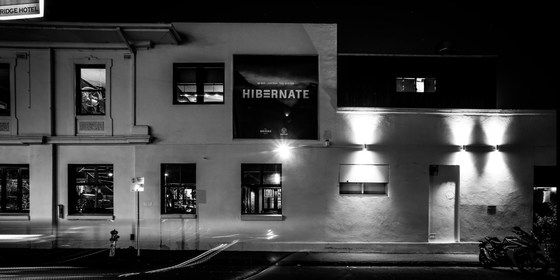
Monthly Social Night - August
642 Bridge Rd
19:30 – 21:30
Our regular monthly social night - this month at the Bridge Hotel in Richmond.
ACTIVITY DESCRIPTION:
Join us for our monthly social evening where members can enjoy a meal, talk about upcoming events, compare notes on past activities and float ideas on events they would like to see run.
MEETING TIME | LOCATION: 7:30pm | The Bridge Hotel, 642 Bridge Rd, Richmond.
MAP REFERENCE: Melway map 2H grid G7 | Google map goo.gl/maps/dJCpD49m4DbrtSMy9.
PUBLIC TRANSPORT: Tram #48 (via Collins St) or #75 (via Flinders St) to stop 22.
LEADER | BOOKING: Garry O. | by Monday 5th August. Email the Leader if you have any questions. Members can access leader contact details under Members | Leader Contacts when logged in to the website.
HOME BACK TO LIST OF EVENTS MEMBERSHIPS
Jul
28
2019
Past Event
Creeks and Coast Walk - Williams Landing to Altona
Flinders Street Railway Station
09:47 – 16:00
Coastal wetlands and tidal creeks are yours to explore and enjoy by joining this casual walk alongside waterways west of the city.
GRADE | LENGTH | TYPE: A moderate 12km point-to-point walk with public transport links.
ACTIVITY DESCRIPTION:
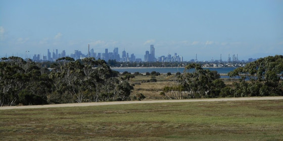
This walk passes through creek and coastal reserves which offer a combination of parkland and natural landscapes to enjoy along the way. Our walk commences at Williams Landing Railway Station, crossing over the freeway on the pedestrian bridge then on to Skeleton Creek Trail. The walk along the Skeleton Creek Trail takes us past some urban reserves and wetlands until reaching the coastal Cheetham Wetlands. The walk continues along the edge of Cheetham Wetlands and then passes through Truganina Park where we will visit the 100 Steps of Federation monument and take in the vistas of the city skyline from the west. We cross over Laverton Creek and walk past the Truganina Explosives Reserve before following the beachside Esplanade through to Altona Pier. From the pier it is just a short walk to Altona Railway Station where trains depart every 20 minutes for the 35 minute journey back to the city.
MEETING TIME | LOCATION: In the front carriage of the Werribee train departing Flinders Street Railway Station at 9:47am or meet the group en route by arrangement with the event leader.
MAP REFERENCE: Melway map 43 grid H9 | Google map goo.gl/maps/NMdRVJfVevp.
DISTANCE / TIME FROM GPO: The walk commences at Williams Landing Railway Station which is 23km and 42 minutes by train from the city. Our return journey takes 35 minutes from Altona Railway Station which is 17km from the city.
TRANSPORT: Access to and from this walk is by public transport only. We will travel to Williams Landing Railway Station in the front carriage of the Werribee train departing Flinders Street Railway Station at 9:47am. For the return journey trains depart Altona Railway Station every 20 minutes. All travel is within myki zones 1 & 2 with weekend daily caps of $6.40 full fare, $3.20 concession and free for seniors.
FOOD: Carry lunch, snacks and water for your needs throughout the day.
APPAREL | FOOTWEAR: Wear comfortable walking boots/shoes and dress to meet the forecast weather conditions.
LEADER | BOOKING: Peter Tocknell | by Saturday 27th July for members and Thursday 25th July for visitors. Email the Leader if you have any questions. Members can access leader contact details under Members->Leader Contacts when logged in to the website.
HOME BACK TO LIST OF EVENTS MEMBERSHIPS
Jul
21
2019
Past Event
Southside Cycling
Southern Cross Station
10:30 – 16:00
A gentle, relaxing winter's cycle ride through Docklands, South Melbourne and Middle Park.
GRADE | LENGTH | TYPE: Easy, approximately 28 km, cycling circuit.
ACTIVITY DESCRIPTION:
We'll depart from Southern Cross Station at 10.45am heading along Collins St West to join up with the Capital City Trail. We head south on that to cross the Yarra via Webb Bridge, onto the Yarra Edge waterside promenade. We'll stop there for a coffee (optional) at Hooks at the Yarra, 50 River Esplanade, Docklands, which has plenty of bike parking and outdoor seating.
Upon departing from the cafe, we continue along the waterfront promenade to the end of the path, which connects with Lorimer Street to head west and eventually join the nature trail under Westgate Bridge, which we follow around to Sandridge Beach. Continuing along the Beaconsfield Parade cycling path we cut inland to the Middle Park Hotel, 102 Canterbury Rd, Middle Park for lunch.
After lunch we'll make an anti-clockwise circuit of Albert Park Lake then cross St Kilda Rd to the Shrine of Remembrance, follow the cycleway around the back of the Botanical Gardens (Anderson Road) and the cycleway following Alexandra Ave back into the city, coming up onto Princes Bridge to cross the Yarra to Flinders Street Station. If anybody wishes to, they can easily follow the Capital City Trail from there around to Collins Street and back to Southern Cross Station.
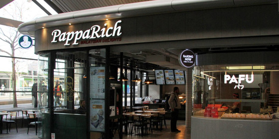
MEETING TIME | LOCATION: 10.30am at Southern Cross Station, at the cycle parking outside Pappa Rich Cafe, 3 Collins St, Melbourne. This is close to the Collins St tram stop outside Southern Cross Station.
MAP REFERENCE: Melway map 2E grid K6/K7 | Google map goo.gl/maps/sCAivYpvUK2WWGQz9.
APPAREL | FOOTWEAR: helmet, spare tube and dress according to the weather forecast. Warm, waterproof layers strongly recommended.
LEADER | BOOKING: Michael C. | by Thursday 18th July. Email the Leader if you have any questions. Members can access leader contact details under Members | Leader Contacts when logged in to the website.
HOME BACK TO LIST OF EVENTS MEMBERSHIPS
Jul
14
2019
Past Event
Bacchus Marsh By Train and On Foot
Southern Cross Railway Station
10:16 – 16:40
Take a train journey out west for a wintertime wander around Bacchus Marsh.
GRADE | LENGTH | TYPE: Easy, approximately 9 km, with shorter options of 6.5 km or 4 km, circuit walk on sealed and unsealed footpaths.
ACTIVITY DESCRIPTION:
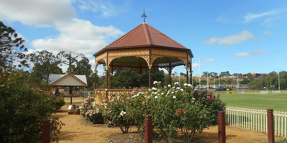
It’s wintertime and it’s cold so let’s rug up and head off to do Bacchus Marsh by train and on foot. This is a relatively short and easy walk with shorter options of 6.5km and 4km available for anyone who chooses. The Werribee River flows between the township and the railway line and we’ll take a wander along the foot tracks alongside the river. Firstly we’ll take a loop to the west, giving the first chance to opt-out of a section. A reserve on the banks of the river with undercover picnic tables will be our lunch spot. After lunch we’ll head in an easterly direction along the river then turn to flank the township passing by market gardens. We’ll head through to Masons Lane Reserve and take in the scenic vistas of the hills to the north. This second loop gives another option for those who wish to take a shortcut and meet us as we head for a cafe in the township for coffee. A final crossing of the river and a wander through Maddingley Park will take us back to the station for the return journey to the city. Our choice of trains are scheduled to arrive back at Southern Cross Railway Station at 3:40pm and 4:40pm.
MEETING TIME | LOCATION: Meet in the front carriage of the Wendouree train departing Southern Cross Railway Station at 10:16am or join the group en route by arrangement with the event leader.
MAP REFERENCE: Melway map 43 grid E9 | Google map goo.gl/maps/bCGTVY7pXX72.
TRANSPORT: Access to this walk is by public transport only. We travel by V/Line train with a 45 minute journey to Bacchus Marsh on the Wendouree train departing Southern Cross Railway Station at 10:16am. For the return journey we will aim to catch the 2:52pm or 3:52pm train from Bacchus Marsh which are scheduled to arrive at Southern Cross Railway Station at 3:40pm and 4:40pm, respectively. All travel is within myki zones 1 & 2 with weekend daily caps of $6.40 full fare, $3.20 concession and free for seniors.
FOOD: Carry lunch, snacks and water for your needs throughout the day.
APPAREL | FOOTWEAR: Comfortable walking boots/shoes and dress according to the weather forecast.
LEADER | BOOKING: Peter Tocknell | by Saturday 13th July for members and Thursday 11th July for visitors. Email the Leader if you have any questions. Members can access leader contact details under Members->Leader Contacts when logged in to the website.
HOME BACK TO LIST OF EVENTS MEMBERSHIPS
Jul
07
2019
Past Event
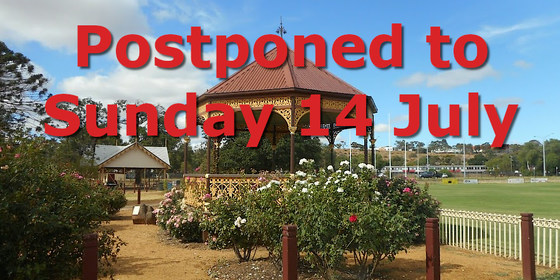
Bacchus Marsh By Train and On Foot - Postponed to Sunday 14 July
Southern Cross Railway Station
10:16 – 16:40
Take a train journey out west for a wintertime wander around Bacchus Marsh. This event has been postponed until Sunday 14 July due to public transport issues.
GRADE | LENGTH | TYPE: Easy, approximately 9 km, with shorter options of 6.5 km or 4 km, circuit walk on sealed and unsealed footpaths.
ACTIVITY DESCRIPTION:
It’s wintertime and it’s cold so let’s rug up and head off to do Bacchus Marsh by train and on foot. This is a relatively short and easy walk with shorter options of 6.5km and 4km available for anyone who chooses. The Werribee River flows between the township and the railway line and we’ll take a wander along the foot tracks alongside the river. Firstly we’ll take a loop to the west, giving the first chance to opt-out of a section. A reserve on the banks of the river with undercover picnic tables will be our lunch spot. After lunch we’ll head in an easterly direction along the river then turn to flank the township passing by market gardens. We’ll head through to Masons Lane Reserve and take in the scenic vistas of the hills to the north. This second loop gives another option for those who wish to take a shortcut and meet us as we head for a cafe in the township for coffee. A final crossing of the river and a wander through Maddingley Park will take us back to the station for the return journey to the city. Our choice of trains are scheduled to arrive back at Southern Cross Railway Station at 3:40pm and 4:40pm.
MEETING TIME | LOCATION: Meet in the front carriage of the Wendouree train departing Southern Cross Railway Station at 10:16am or join the group en route by arrangement with the event leader.
MAP REFERENCE: Melway map 43 grid E9 | Google map goo.gl/maps/bCGTVY7pXX72.
TRANSPORT: Access to this walk is by public transport only. We travel by V/Line train with a 45 minute journey to Bacchus Marsh on the Wendouree train departing Southern Cross Railway Station at 10:16am. For the return journey we will aim to catch the 2:52pm or 3:52pm train from Bacchus Marsh which are scheduled to arrive at Southern Cross Railway Station at 3:40pm and 4:40pm, respectively. All travel is within myki zones 1 & 2 with weekend daily caps of $6.40 full fare, $3.20 concession and free for seniors.
FOOD: Carry lunch, snacks and water for your needs throughout the day.
APPAREL | FOOTWEAR: Comfortable walking boots/shoes and dress according to the weather forecast.
LEADER | BOOKING: Peter Tocknell | **This event has been postponed until Sunday 14 July due to public transport issues.** Email the Leader if you have any questions. Members can access leader contact details under Members->Leader Contacts when logged in to the website.
HOME BACK TO LIST OF EVENTS MEMBERSHIPS
Jul
02
2019
Past Event
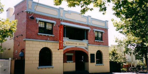
Spring Planning & Social Night
Kingston Hotel
19:00 – 21:30
Our quarterly planning night, in conjunction with the regular monthly social night.
ACTIVITY DESCRIPTION:
Do you want to see more of a particular activity, or do you have a particularly favourite area of Victoria you would like to share with others? Do you have an idea for something apart from the regular walks? Come along to the planning meeting, and then stay for our monthly social evening where members talk about upcoming events, share a meal and compare notes on past activities. All members are welcome – you don't have to volunteer for an activity. New members are especially invited to this meeting as an orientation to Nomads activities.
MEETING TIME | LOCATION: 7pm | Kingston Hotel, 55 Highett St, Richmond for planning followed at around 7:30pm by the monthly social event.
MAP REFERENCE: Melway map 2G grid H4 | Google map goo.gl/maps/FmV6iTSDJis.
PUBLIC TRANSPORT AND PARKING:
Train: Mernda / Hurstbridge line to West Richmond Station.
Tram: #48 or #75 to stop 14.
Car: There is limited parking available in Highett Street.
LEADER | BOOKING: Richard C. | by Monday 1st July. Email the Leader if you have any questions. Members can access leader contact details under Members -> Leader Contacts when logged in to the website.
HOME BACK TO LIST OF EVENTS MEMBERSHIPS
Jun
30
2019
Past Event
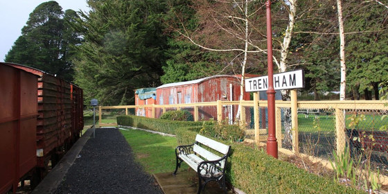
Trentham to Lyonville: Domino Track Circuit Walk
Trentham Railway Station & Visitor Information Centre
10:30 – 16:00
Take in a little history while exploring scenic countryside in Victoria’s central goldfields region.
GRADE | LENGTH | TYPE: Moderate, 12 km circuit walk that takes in lunch at the Radio Springs Hotel, 1 High St, Lyonville.
ACTIVITY DESCRIPTION:
Starting at the former Trentham Railway Station (now a museum), we will follow The Domino Rail Trail (part of the original railway from Daylesford to Carlsruhe) to Lyonville, where lunch will be held at the Radio Springs Hotel. After lunch we will return via The Domino Trail, with a small diversion, back to Trentham. Afternoon tea will be taken in the RedBeard Historic Bakery for those still hungry.
FURTHER INFORMATION: www.radiospringshotel.com.au.
MEETING TIME | LOCATION: 10:30am at the car park next to the Trentham Railway Station, Victoria St, Trentham.
MAP REFERENCE: Melway map X909 grid E10 | VicRoads map 59 grid G8 | Google goo.gl/maps/PqVX9FNsrYk.
DISTANCE | TIME FROM GPO: 95 km, 1 hour and 30 minutes.
LUNCH: At the Radio Springs Hotel, so pre-registration by the cut-off time for this walk is essential to enable a booking to be made for lunch. The menu can be viewed on the website. Main courses range from $25 to $35. Members who do not wish to lunch at the hotel can BYO their own food and beverage and find a suitable rest spot within the Lyonville Hamlet.
APPAREL | FOOTWEAR: Suitable boots are recommended, as the ground may be wet or damp. Layered clothing as this is an event in the high country where temperatures can vary dramatically and unexpectedly.
LEADER | BOOKING: Cahal F. | by Thursday 27th June. Email the Leader if you have any questions. Members can access leader contact details under Members | Leader Contacts when logged in to the website.
HOME BACK TO LIST OF EVENTS MEMBERSHIPS

Jun
23
2019
Past Event
Nomads Winter Solstice Dinner
350 High St
18:30 – 21:00
Our annual special dinner - non-members welcome!
GRADE | TYPE: Easy – Social Event.
ACTIVITY DESCRIPTION:
Join us for our annual Winter Solstice Dinner. BYO - wine only. The meal is a 3 course set menu. There are lots of meat and vegetarian options included. We will be aiming to start eating around 6:45pm.
MEETING TIME | LOCATION: 6:30pm at the Wild Yak Tibetan Restaurant, 350 High St, Northcote.
MAP REFERENCE: Melway map 30 grid F8 | Google map goo.gl/maps/Jc1JHGSumsp.
DISTANCE | TIME FROM GPO: 6 km, 20 minutes.
PUBLIC TRANSPORT: Tram 86 from Bourke St to stop 34 | Mernda line train to Northcote Station | bus 508.
COST: $37 including booking fee.
LEADER | BOOKING: Greg W. | Late registrations acceptable but please phone 0468 889 142. Email the Leader if you have any questions. (Don't try to phone or SMS the leader, as their phone will not be monitored). Members can access leader contact details under Members | Leader Contacts when logged in to the website.
HOME BACK TO LIST OF EVENTS MEMBERSHIPS
Jun
16
2019
Past Event
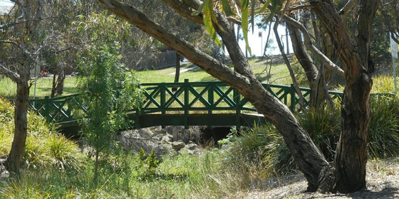
Broadmeadows Valley Walk - Roxburgh Park to Broadmeadows
Flinders Street Railway Station
10:12 – 16:00
Enjoy a gentle walk through the open spaces of the Broadmeadows Valley, passing by indigenous bushland and grassland.
GRADE | LENGTH | TYPE: Moderate, approximately 12 km, point-to-point walk on sealed and unsealed walking and cycling tracks.
ACTIVITY DESCRIPTION:
This winter’s day walk offers a good opportunity to get outdoors, socialise and get some exercise. We’ll carry on regardless of the weather, just dress accordingly to keep warm and dry. The walk commences at Roxburgh Park Railway Station as we make our way through quiet streets and urban reserves to reach the Broadmeadows Valley Trail. We follow the shared walking and cycle paths through the open spaces of the Broadmeadows Valley reserves for the majority of this walk. A good planning feature of the trail is the use of underpasses at most streets, leaving only a few road crossings for the entire journey. Throughout the walk we pass by patches of remnant and re-vegetated bushland and grassland. There are several covered picnic tables spread along the route for our use for rest breaks and lunch. Some plane spotting throughout the day is topped off with a view from the hill in Johnstone Street Reserve across to Tullamarine Airport. To conclude the walk we make our way through to Broadmeadows Railway Station to commence the return journey. Trains depart for the city every 20 minutes. We should arrive back in the city between 3:00pm and 4:00pm.
MEETING TIME | LOCATION: Meet in the front carriage of the Craigieburn train departing Flinders Street Railway Station at 10:12am or join the group en route by arrangement with the event leader.
MAP REFERENCE: Melway map 43 grid H9 | Google map goo.gl/maps/NMdRVJfVevp.
TRANSPORT: Access to this walk is by public transport only. We travel by Metro train with a 39 minute journey to Roxburgh Park on the Craigieburn train departing Flinders Street Railway Station at 10:12am. The return journey to the city takes 35 minutes by train from Broadmeadows Railway Station. All travel is within myki zones 1 & 2 with weekend daily caps of $6.40 full fare, $3.20 concession and free for seniors.
FOOD: Carry lunch, snacks and water for your needs throughout the day.
APPAREL | FOOTWEAR: Comfortable walking boots/shoes and dress according to the weather forecast.
LEADER | BOOKING: Peter Tocknell | by Saturday 15th June for members and Thursday 13th June for visitors. Email the Leader if you have any questions. Members can access leader contact details under Members->Leader Contacts when logged in to the website.
HOME BACK TO LIST OF EVENTS MEMBERSHIPS
