

The Nomads Outdoors Group Inc.
Powered by
Past events
All events
Past events
Jan
06
2019
Past Event
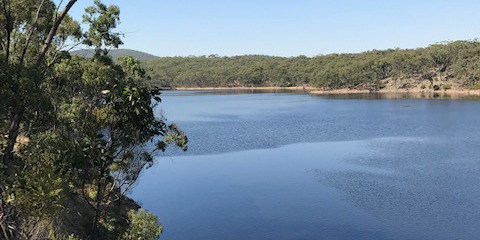
Mixed Nude Walk & Swim - Djerriwarrh Reservoir, Toolern Vale
1486 Diggers Rest-Coimadai Rd
10:15 – 16:00
A naturist walk in a scenic, remote location not too far from Melbourne.
GRADE | LENGTH | TYPE: Medium, approximately 9 km circuit walk. About 3 hours walking time plus 1 hour lunch and swim stop. We walk on 4WD tracks, single lane walking trails and kangaroo pads. About 3 km is on kangaroo pads and the walking speed is quite slow. There are some moderate hills but they are not that long.
MEETING TIME | LOCATION: Meet at 10:15am at the Toolern Vale General Store for coffee and registration. The exact address is 1486 Diggers Rest-Coimadai Rd. We plan to drive to the start of the walk at about 10:45am. There is a good car park opposite the General Store.
MAP REFERENCE: Melway map 331 grid G5 | Melway Key Map 7 grid E3 | VicRoads Map 78 grid B3. | Google map goo.gl/maps/nZfzrbFUSJr.
WALK LOCATION: Entry is via a private farm property north west of Toolern Vale.
DISTANCE | TIME FROM GPO: 50 km, 45 minutes. Travel via the Calder or Western Highways.
FOOD and BEVERAGES: Lunch, snacks, water/drink to take on the walk.
APPAREL: Comfortable shoes/boots. Shorts or similar to wear at the start and finish of the walk, while on private property. Sunscreen, sunhat, sunglasses. Towel to dry off after swimming. If the day is a bit cool or you need protection from the sun, clothes can be worn to keep you comfortable. Lightweight sandals or thongs would make it easier to walk on the small stones at the edge of the reservoir when you go in for a swim.
ACTIVITY DESCRIPTION:
This event is for Naturists. A lovely remote spot, not far from Melbourne where we can shed our clothes and enjoy naturist walking and swimming. The reservoir is quite a large body of water and there is plenty of water there all year round. The reservoir is hidden in the Pyrete Forest and is most picturesque.
We have visited this reservoir two or three times before and are hoping to find a different way in to it this time.
Afternoon Snacks and Drinks: After the walk we will return to the Toolern Vale General Store to collect the cars that we didn't take to the start of the walk. If desired, we can have a cool off drink or coffee there, or if some would prefer we could drive to Melton for a beer or coffee at Mac's Hotel, 322 to 332 High St, Melton (11 km and 10 minutes drive from Toolern Vale).
LEADER | BOOKING: Russell W. | by Thursday 3rd January. Email the Leader if you have any questions. Members can access leader contact details under Members->Leader Contacts when logged in to the website.
Jan
01
2019
Past Event
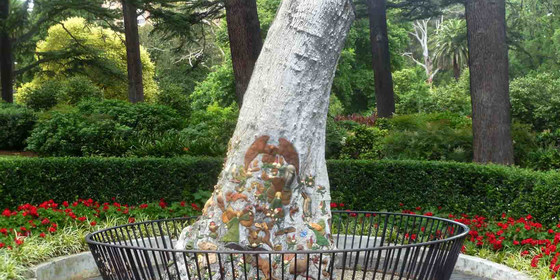
New Years Day Picnic - Fitzroy Gardens "CANCELLED"
The Fairies Tree
12:00 – 16:00
PICNIC CANCELLED DUE TO INSUFFICIENT INTEREST
Start the new year with a relaxed picnic in the Fitzroy Gardens followed by a stroll around the expansive park.
GRADE | TYPE: Easy, social.
MEETING TIME | LOCATION: 12 noon at the Fairies Tree opposite the miniature Tudor Village and old Pavillion Cafe, Fitzroy Gardens, East Melbourne.
MAP REFERENCE: Melway map 44 grid B8 | Google map goo.gl/maps/ttBUYt2Y1sx.
DISTANCE | TIME FROM GPO: Approximately 2 km, 15 minutes by public transport.
PUBLIC TRANSPORT: Fitzroy Gardens are easily accessible by trams 48 and 75 along Wellington Pde and Mernda/Hurstbridge line trains to nearby Jolimont station.
FOOD and BEVERAGES: All available in the nearby CBD.
APPAREL: Dress appropriately for forecast weather conditions and wear comfortable footwear for walking around the gardens.
ACTIVITY DESCRIPTION:
Happy New Year! Let us celebrate the arrival of the new year and new resolutions by getting together in the delightful Fitzroy Gardens for a BYO everything picnic. Remember to also bring something comfy to sit on and protection from the harsh Summer sun.
LEADER | BOOKING: Peter N-G. | by Monday 31st December. Email the Leader if you have any questions. Members can access leader contact details under Members->Leader Contacts when logged in to the website.
Dec
29
2018
Past Event
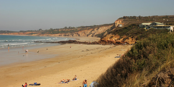
Anglesea Beach Day Trip for Lunch, Walk & Optional Swim "CANCELLED"
Southern Cross Station
10:15 – 16:00
"EVENT CANCELLED DUE TO ADVERSE WEATHER CONDITIONS & LACK OF INTEREST"
Head to a local Surf Coast beach for a walk and swim during the Christmas/New Year holiday week.
GRADE | TYPE: Easy, social.
MEETING TIME | LOCATION: 10:15am at Melbourne Southern Cross Station inside the front carriage of the 10:30am Waurn Ponds (Geelong) service.
MAP REFERENCE: Melway map 43 grid E9 | Google map goo.gl/maps/NSbSRwfkLb22.
DISTANCE | TIME FROM GPO: Approximately 114 km, 2 hours by train/coach.
FOOD and BEVERAGES: All available at Southern Cross or in Anglesea. Remember to bring at least 1 litre of water.
APPAREL: Dress appropriately for the forecast weather conditions and as it is a day beside the seaside and we do like to be beside the sea please bring everything you need for that sort of day including something comfy to sit on and especially protection from the harsh Summer sun.
ACTIVITY DESCRIPTION:
Enjoy a day during the festive season on a Surf Coast beach including a picnic lunch, maybe a swim and a walk along the beach and around this pretty town.
Note: this Anglesea Beach visit may be rescheduled to the next day, Sunday 30th December, if the weather forecast is not favourable for the Saturday.
LEADER | BOOKING: Peter N-G. | by Friday 28th December. Email the Leader if you have any questions. Members can access leader contact details under Members->Leader Contacts when logged in to the website.
Dec
26
2018
Past Event
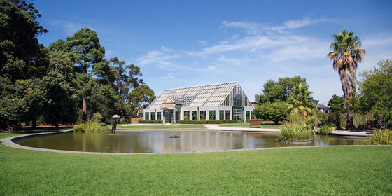
Boxing Day/Orphans Xmas Picnic, Stroll - St Kilda Botanical Gardens "Sunny 26 Degrees"
St Kilda Botanical Gardens
12:00 – 16:00
Enjoy a leisurely post-Xmas picnic lunch followed by a stroll around the St Kilda Botanical Gardens.
GRADE | TYPE: Easy, social with a short walk.
MEETING TIME | LOCATION: 12 noon inside the Herbert St entrance outside the toilets. At approximately 12:15pm we will move to a shady location near the Canary Island Date Palm. If you are a late arrival, you will need to search for us or try to contact the leader by phone.
MAP REFERENCE: Melway map 58 grid B12 | Google map goo.gl/maps/iXQqoq9eNtM2.
PUBLIC TRANSPORT:
Tram: 96 to the Acland St terminus then cross Barkly St | there are various other tram services in nearby Chapel St, Carlisle St and Brighton Rd.
Bus: 246 bus along Barkly St alighting at Acland St | 600/606 buses along Mitford St.
DISTANCE | TIME FROM GPO: Approximately 8 km and 40 minutes by public transport.
FOOD and BEVERAGES: All available on nearby Barkly and Acland Sts. Always remember to carry at least one litre of water.
APPAREL: Dress appropriately for the forecast weather conditions, with comfortable footwear for walking around the gardens.
ACTIVITY DESCRIPTION:
For those who find themselves alone on the Christmas/Boxing Day public holidays we are having an Orphans Xmas on Boxing Day, so whether you feel like some company or just feel like a picnic in the delightful St Kilda Botanical Gardens then join us. Remember it is BYO everything including something comfy to sit on and protection from the harsh rays of the Summer sun. After lunch we can have a leisurely stroll through the gardens.
LEADER | BOOKING: Peter N-G. | by Monday 24th December. Email the Leader if you have any questions. Members can access leader contact details under Members->Leader Contacts when logged in to the website.
Dec
16
2018
Past Event
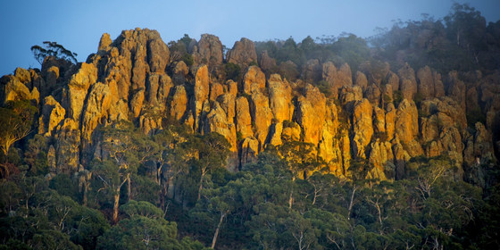
Woodend to Hanging Rock Circuit Walk & Picnic with Miranda
Southern Cross Station
08:45 – 16:00
Enjoy a Sunday walk in the historic goldfields region, with a picnic and exploration of the mystical, intriguing and beautiful Hanging Rock.
GRADE | LENGTH | TYPE: Moderate, 16 km circuit walk.
MEETING TIME | LOCATION: 8:45am at Melbourne Southern Cross Station in front carriage of the 9:02am Bendigo service.
MAP REFERENCE: Melway map 1A grid A6 | Google map goo.gl/maps/rGAqyBs7jmp.
DISTANCE | TIME FROM GPO: Woodend is approximately 71 km from Melbourne and approximately 1 hour by train.
FOOD and BEVERAGES: All available at Southern Cross Station or Woodend for the journey – BYO picnic for lunch at Hanging Rock. Remember to bring at least 1 litre of water.
APPAREL: Dress appropriately for the forecast weather conditions with comfortable footwear for walking beside public roads and around Hanging Rock.
ACTIVITY DESCRIPTION: Enjoy a train ride, a walk alongside country roads and that infamous "Picnic at Hanging Rock" with maybe even Miranda, Marion or Miss McCraw in attendance in spirit. "Picnic at Hanging Rock" was a novel written by Joan Lindsay and subsequently turned into a motion picture masterpiece by director Peter Weir, about a group of schoolgirls and their teachers who travel to the rock at the turn of the 20th century for a Picnic with three of them disappearing without a trace. It was always believed to be based on a true story, but before her death Lindsay was said to have revealed that it was historical fiction. It is all for you to decide.
Our day will commence at Melbourne Southern Cross Station where we will board the 9:02am Bendigo service for our journey to Woodend from where we will walk alongside country roads for approximately 8 km until we reach the picnic area at Hanging Rock ($4 entry fee) where we can gaze upon this geological marvel before setting down in a shady location to enjoy our BYO-everything lunch. After lunch we may climb the rock to explore its many natural features – do not get lost now – and maybe even walk around the base.
Our return to Woodend will be at our leisure via the same route to enjoy some afternoon tea before boarding a return train service to Melbourne which operate hourly.
LEADER | BOOKING: Peter N-G. | by Thursday 13th December. Email the Leader if you have any questions. Members can access leader contact details under Members->Leader Contacts when logged in to the website.
Dec
09
2018
Past Event
SkyHigh to Silvan Reservoir Walk with Public Transport Links
Ringwood Station
09:58 – 17:00
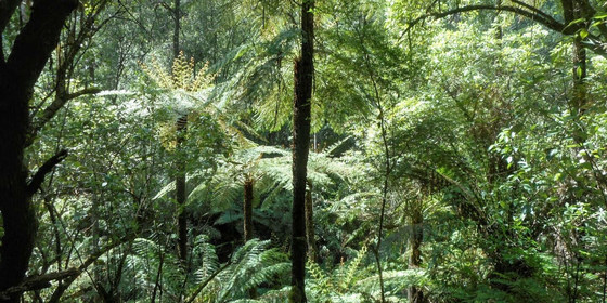
Take in impressive city views and waterfalls with scenic bushland walks through eucalypt forests and ferny gullies.
GRADE | LENGTH | TYPE: A moderate 10 km point-to-point walk with some steep downhill sections on bush tracks.
MEETING TIME | LOCATION: In the front carriage of the Lilydale train at Ringwood Railway Station departing from Ringwood at 9:58am.
MAP REFERENCE: Ringwood Railway Station: Melway map 49 grid G8; Google map https://goo.gl/maps/Qw3wpoNCzmG2.
DISTANCE | TIME FROM GPO: The train journey from Flinders Street to Ringwood is 50 minutes. By road the drive to Ringwood is approximately 30km, allow at least 40 minutes. There is ample parking at Ringwood Railway Station.
PUBLIC TRANSPORT: Access to and from this walk is by public transport only, meeting in the front carriage of the Lilydale train at or before Ringwood. For travel from the city, take the Lilydale train which departs Flinders Street at 9:06am and meet and travel with the group in the front carriage if you wish. At Ringwood we will all meet in the front carriage of the 9:58am Lilydale train. We will leave the train at Croydon for a connecting bus to SkyHigh, Mount Dandenong. For the homeward journey we will take a bus from Monbulk Road, Silvan with the option to travel in either direction, depending on timing, to take us to either the Belgrave or Lilydale station for a train back to or through Ringwood. All travel is within the Myki metro zones with a weekend daily cap of $6.30 (free for seniors).
FOOD: Pack food for lunch and snacks. At least 1 litre of water must be carried.
APPAREL | FOOTWEAR: Wear a hat and clothing to meet the forecast weather conditions and footwear suitable for walking on unsealed footpaths and bush tracks.
ACTIVITY DESCRIPTION: This event utilises two bus routes which provide a scenic journey and an ideal transport option for point-to-point walks in the Mount Dandenong, Olinda and Silvan areas. To commence this walk we arrive on the bus at SkyHigh, Mount Dandenong where we will take some time to enjoy the impressive views of the city, suburbs and countryside below. There is a café at SkyHigh for those who wish to have a coffee before we set off on our walk. From SkyHigh we set off on a steep bush track and walk down through the Mount Dandenong Arboretum to meet Olinda Creek and then on to the Olinda Falls Reserve. There are two side tracks to access viewing areas for the Olinda Falls, the first is less than fifty metres long and the other is a one hundred and forty metre walk down and back up steep rock steps. After visiting the falls we continue down a steep bush track following the Olinda Creek gully until we reach a quiet gravel road. We will follow the road on a bush track alongside it and will stop along the way for our lunch break. After following the road for around one kilometre we turn back into the bush to make our way along vehicle tracks through eucalypt forest and ferny gullies to reach Silvan Reservoir Park. A final walk along a foot track will take us to the bus stop on Monbulk Road to commence the homeward journey. The anticipated time of return to or through Ringwood is 5pm.
FURTHER INFORMATION: www.skyhighmtdandenong.com.au.
LEADER | BOOKING: Peter Tocknell | by Thursday 6th December. Email the Leader if you have any questions. Members can access leader contact details under Members->Leader Contacts when logged in to the website.
Dec
04
2018
Past Event
Annual Pre-Christmas BBQ
Yarra Bank Reserve
18:30 – 21:00
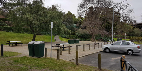
Join us for the popular annual Christmas BBQ beside the Yarra River in a tranquil, little-known park in Hawthorn.
GRADE | LENGTH | TYPE: Social.
MEETING TIME | LOCATION: From 6:30pm in Yarra Bank Reserve, on the Hawthorn side of the Yarra River (under the Bridge Rd bridge).
MAP REFERENCE: Melway map 2H grid H6 | Google map goo.gl/maps/Pg178knfSVN2.
DISTANCE / TIME FROM GPO: 5km by car – enter the reserve via corner of Creswick and Denham Streets, Hawthorn or park in Creswick St. Public transport is to Tram Stop 23 (Burwood Road / Church Street junction) via either route 48 (from Collins St) or route 75 (from Flinders St).
FOOD and BEVERAGES: The Nomads will supply pre-meal nibbles plus bread and salads to accompany the main meal. You need to BYO your preferred main meal item for the BBQ. All beverages are BYO. A limited supply of disposable plates, cups and cutlery will be available. You are recommended to bring your preferred utensils.
APPAREL: Daylight saving will be active. Bring insect repellent plus a lightweight and waterproof jacket if showers are forecast. It is likely to turn cool once the sun sets.
ACTIVITY DESCRIPTION:
Join your friends on the banks of the Yarra River at Hawthorn for a pre-Christmas BBQ in lieu of our monthly indoors social evening. The venue is a secluded spot that is protected from wind and extreme sun. The reserve has four tables with bench seats and two BBQs. Water is on-tap and a public toilet is located on Creswick St.
LEADER | BOOKING: Garry O. | by Sunday 2nd December. Email the Leader if you have any questions. Members can access leader contact details under the Members->Leader Contacts tab when logged in to the website.
Nov
25
2018
Past Event
Coolart Homestead & Wetlands Walk
Coolart Wetlands And Homestead
11:15 – 16:00
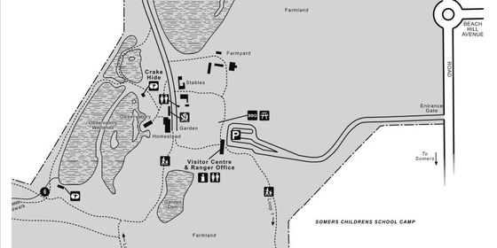
Have a relaxing Sunday visit, not too far from Melbourne, to view a historic mansion, walk around some wetlands and perhaps take a stroll along the Balnarring beach. Travel via public transport is possible.
GRADE | LENGTH | TYPE: Easy, approximately 8km, circuit walk.
MEETING TIME | LOCATION: 11:15am at the Information Centre, Coolart Homestead, Lord Somers Rd, Somers.
MAP REFERENCE: Melway map 193 grid H9 | Google map goo.gl/maps/mHyVFk3BqhH2.
DISTANCE | TIME FROM GPO: 80 km, approximately 1 hour 30 minutes to drive, 2 hours 45 minutes by public transport.
TRANSPORT:
Car: the Coolart Historic Area is located next to Lord Somers Camp and accessed off Lord Somers Rd, Somers.
Public transport: Take the Frankston train that departs Flinders Street platform 7 at 8:33am, arriving in Frankston at 9:38am. Change to the 10:09am #782 bus (Bay C), which arrives at the main entrance of the Coolart Area at 11:14am. For your return, you can catch either the 3:26pm or the 5:29pm #782 bus (which would have you arriving at Flinders Street Station at 5:56pm or 7:59pm respectively).
FOOD: Carry lunch, snacks and at least 1 litre of water.
APPAREL | FOOTWEAR: Comfortable walking boots/shoes and dress according to the weather forecast.
ACTIVITY DESCRIPTION: The Coolart Homestead is a fine example of a Victorian Mansion built in the late 19th Century, and can be visited for free. It is surrounded by woodlands and wetlands with several bird observation hides and various walk options through the woodlands and wetland areas, beside the Merricks Creek and along the foreshore of Westernport Bay. We’ll have lunch in the ornamental gardens.
FURTHER INFORMATION: parkweb.vic.gov.au/explore/parks/coolart-h.a.
LEADER | BOOKING: Alan D. | by Thursday 22nd November. Email the Leader if you have any questions. Members can access leader contact details under the Members->Leader Contacts tab when logged in to the website.
Nov
18
2018
Past Event
Lerderderg State Park - The Scenic Rim - Sun 18 Nov
Lerderderg State Park
10:00 – 17:00
View details and BOOK>>
Grade/Length/Type:Moderate/Difficult 15.2km/6hr circular walk
Approx Distance/Time from GPO: 80km from GPO. Allow 1.5 hours by car.
Meeting Point/Time: Mackenzies Flat Picnic Area at 10:00am. Google map goo.gl/maps/eixdyYa2N5A2.
Directions: Follow the Western Highway and turn off to Bacchus Marsh. Drive 1.8km along the C704 towards Gisborne, then turn left along the Lerderderg Gorge Road and follow it 5.4km to Mackenzies Flat Picnic Area.
Melway/VicRoads Map Ref: Melway Map X909, Grid F11.
Meals: Bring lunch, snacks and water.
Footwear: Sturdy walking footwear. Walking poles may be handy.
Apparel: Dress for the occasion. Bring warm clothing if needed and certainly bring wet weather gear in case of inclement weather. Take sunscreen, sunglasses and hat.
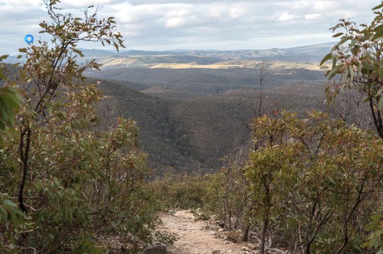
Activity Description: The circular walk follows walking trails and management vehicle tracks with a couple of strenuous ascents and a short section involving some easy scrambling. Walking poles would be handy. The walk takes in Grahams Dam, Lerderderg Weir and the Blackwood Ranges Track.
RSVP: Geoff L. | by Thursday 15th November. Email the Leader if you have any questions. Members can access leader contact details under the Members->Leader Contacts tab when logged in to the website.
Nov
17
2018
Past Event
Naturist Walk with afternoon tea & overnight camping option in Yarra Valley
Macclesfield Hall
17 Nov 2018 10:15 – 18 Nov 2018 16:00
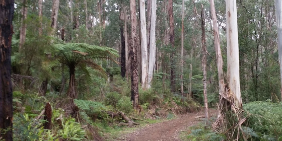
This is a walk for naturists. We will be walking through an area of secluded bushland in the Yarra Valley (very similiar to the walk last year). Lunch will be beside a small stream, if there's enough water maybe a cooling splash in the creek. After the walk we are invited to a nude afternoon tea at an interesting garden nearby with the option of staying overnight in your own tent.
GRADE | LENGTH | TYPE: This is an easy-medium walk of 8km approximately following fire access trails with diversions through the bush. The gradient is moderately gentle.
MEETING TIME | LOCATION: 10:15am at the carpark between Macclesfield Primary school and the community hall. The address is 405 Macclesfield Rd, Macclesfield.
MorningTea
There are no cafes in Macclesfield, however there will be hot water, tea and coffee available at the meeting place. If you have a thermos, extra hot water would be appreciated. Emerald township (just before Macclesfield) has cafes, bakery and shops for last minute provisions. After registration we will drive 4km to the afternoon tea house where we can drop off eskys & food. At this point we can do some car pooling before driving the next 8km to the start of the walk.
MAP REFERENCE: Melway map 309 grid C5; Google map goo.gl/maps/aGCUAS5c5o82.
DISTANCE | TIME FROM GPO: 60km, allow 1 hour. Travel via Monash or Eastlink freeways, taking the Wellington Rd exit towards Emerald in the hills. No public transport - if you need a lift mention this on meetup or contact the leader who may be able to coordinate something with another walker.
FOOD: Carry lunch, snacks and water.
APPAREL | FOOTWEAR: Comfortable walking shoes / boots shorts etc for start & end of walk, plus sunscreen, hat and sunglasses. A small towel for after a splash in the creek.
ACTIVITY DESCRIPTION: This is a walk for naturists in the scenic Yarra Valley. We will ramble in a secluded area of forest, following fire access trails. Lunch will be beside a stream ... if there's enough water maybe a refreshing splash in the creek.
AFTERNOON TEA / OVERNIGHT OPTION
After the walk, we are invited to have a nude afternoon tea at an interesting private garden nearby. Theres a large deck to relax on with views over the valley, plus ... a soothing splash in the pool. Those staying overnight will put up their tents etc. A BBQ and kitchen for cooking dinner will be available. Please bring meat, salads, drinks, cakes etc. Food can be dropped off at the house after we leave the meeting place, on our drive to the forest.
LEADER | BOOKING: Robert A. preferably by Wednesday 14th November. Email the Leader if you have any questions. Members can access leader contact details under the Members->Leader Contacts tab when logged in to the website.

Nov
13
2018
Past Event
Social Night: Pride Of Our Footscray Bar, Footscray
Pride of our Footscray Community Bar
19:30 – 21:30
Our regular monthly social night - this month in multicultural Footscray (delayed a little due to the Melbourne Cup). This event is free to all (visitors very welcome), but please book so we know numbers to reserve tables.
MEETING TIME | LOCATION: 7:30pm in the Pride of our Footscray Community Bar, 1/88 Hopkins St, Footscray.
MAP REFERENCE: Melway map 2S (that’s 2-ess, not 25) grid G8 | Google map goo.gl/maps/TeNoBvUseAu.
DISTANCE / TIME FROM GPO: 6km, 15 minutes. Train to Footscray Station, or buses 216, 219, 223, 402, 406.
ACTIVITY DESCRIPTION:
Join us for our monthly social evening where members can enjoy a meal, talk about upcoming events, compare notes on past activities and float ideas on events they would like to see run.
This very gay oriented bar proved very popular back in June. Transport and parking is excellent, so it’s easy for our “wise men from the east” to attend! This pub has a novel approach to menus: they provide several menus from a diverse selection of local cafes. Order from the menu of your choice, and the food gets delivered to your table!
LEADER | BOOKING: Garry O. | by Monday 12th November. Email the Leader if you have any questions. Members can access leader contact details under Members->Leader Contacts when logged in to the website.
Nov
11
2018
Past Event
Bushcraft Day - Mt St Leonards Area
Donnellys Weir Picnic Area
10:30 – 16:00
Gather some skills to help you remain safe, and enjoy being in the bush together, plus a small stroll with friends in beautiful Alpine Ash forest.
GRADE | LENGTH | TYPE: Easy to medium, 6–8km, circuit walk with some short climbs.
MEETING TIME | LOCATION: 10:30am at Donnellys Weir picnic ground.
MAP REFERENCE: Melway map 270 grid G5 | Google map goo.gl/maps/SpuPtS66zZ22.
DISTANCE | TIME FROM GPO: 65km from GPO. Allow 1 hour and 10 minutes drive.
TRANSPORT: Turn right at Donnellys Weir Road (off St Leonards Rd), then turn left after about 700m. There is a shallow ford through Donnellys Creek on the way. Public Transport not available. We will maximise carpooling.
FOOD: Carry lunch and water. Afternoon tea will be provided near the cars.
APPAREL | FOOTWEAR: Sturdy walking boots as we will be leaving defined tracks. Warm and/or waterproof clothes as dictated by the weather forecast. Hat, sunscreen, as usual.
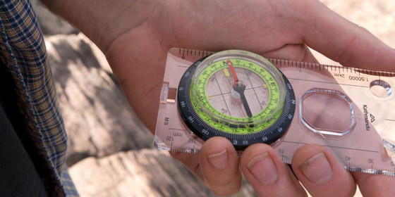
EQUIPMENT: Bring your compass and GPS if you use one. 1:30,000 and 1:25,000 topographic maps are now available online at services.land.vic.gov.au/maps/imf/search/Topo30Front.jsp. However, the maps we will use on the day will be provided.
ACTIVITY DESCRIPTION:
Roger H. will organise an interesting and fun day of instruction, to allow members to be safe, feel confident and explore independently in the bush. They will act in conjunction with experienced members who will be on the event, who will share their knowledge and experience. The emphasis will be very much on practical exercises rather than theory – in short, work for the legs as well as the brain. We aim to make this a pleasant social event out in some beautiful bushland near Melbourne. More information will be provided closer to the date. All members are encouraged to attend, particularly those interested in exploring tracks and trails in National Parks and Forest Reserves. We will have afternoon tea in Healesville on the way home.
LEADER | BOOKING: Roger H. | by Thursday 8th November. Email the Leader if you have any questions. Make sure you get a personal confirmation so we know you are coming. Members can access leader contact details under the Members->Leader Contacts tab when logged in to the website.
