

The Nomads Outdoors Group Inc.
Powered by
Past events
All events
Past events
Oct
31
2019
Past Event
Melbourne Cup Weekend at Yanakie & Wilsons Promontory
Corner Inlet
31 Oct 2019 18:00 – 05 Nov 2019 13:00
Enjoy the comfort of a home stay, together with access to the world class Wilsons Promontory National Park for day walks.
GRADE | LENGTH | TYPE: Easy – day walks and beach activities.
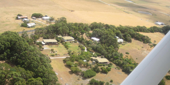
ACTIVITY DESCRIPTION:We have a private house at Yanakie overlooking Corner Inlet just near the park entrance. You can come down for as many days as you like. It is quite flexible.
There are many nice day walks in the area. We will decide where to walk each day taking into account the condition of the weather and the participants. The base offers hot showers, comfortable accommodation and a log fire to warm up if the day is cold. There is a range of gay themed movies to watch in the evening for movie buffs.
FURTHER INFORMATION: Park Notes: parkweb.vic.gov.au/explore/parks/wilsons-promontory-national-park.
MEETING TIME | LOCATION: You can arrive any time from Thursday as arranged with the leader. You will be given location details after registering.
MAP REFERENCE: Melway map X928/628 grid C10 | VicRoads map 103 grid D7 | Google map goo.gl/maps/Pf13PDTA4bqdHaDW8. Detailed directions will be provided after the RSVP date.
DISTANCE | TIME FROM GPO: Approximately 195 km. Yanakie is 2.5 hours drive from Melbourne towards Wilsons Promontory.
TRANSPORT: Public transport not available. We will try to maximise car-pooling as parking is limited at the house.
FOOD: Bring supplies for your own breakfast and lunch. Communal night meals will be arranged once the numbers are known. There are staples at the house like sugar, tea etc.
COST: Free entry to the National Park. Donation towards any meals that are provided.
ACCOMMODATION: There are a limited number of beds for the early birds, some floor space and plenty of tent space in the garden. Bring linen and towels.
APPAREL | FOOTWEAR: Warm waterproof gear and changes of clothing. Summery attire is also likely to be needed. It might be warm enough to dive into the sea. Light comfortable walking footwear.
LEADER | BOOKING: Roger H. | by Monday 28th October. Email the Leader if you have any questions. Members can access leader contact details under Members | Leader Contacts when logged in to the website.
HOME BACK TO LIST OF EVENTS MEMBERSHIPS
Oct
26
2019
Past Event
Mixed Naturist Bushwalk near Lancefield, Optional BBQ & O/night
Lancefield
26 Oct 2019 10:15 – 27 Oct 2019 16:00
This event is now FULLY BOOKED (Fri 4 Oct) for the BBQ and Overnight.
Any further RSVP's will be placed on a WAITLIST.
There are still 3 places left for the Day Walk.
________________
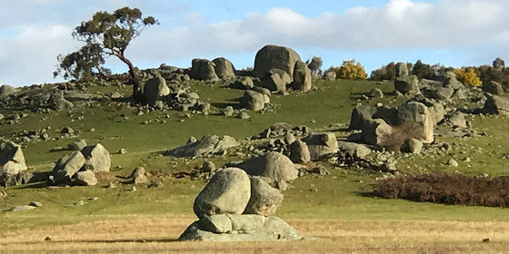
A naturist walk of easy to medium difficulty through three new farms in the granite boulder Stonehenge country north of Lancefield. A picturesque creek, some untouched forest and great views from two of the nearby hills.
GRADE | LENGTH | TYPE: Easy to Medium 6 km naturist circuit walk. There is some easy walking on kangaroo mown pastures, a little bit of log hopping along the creek and a few moderate inclines. To get to the views from the hills will take a bit more effort, but if you like you can travel around the bottom of the hills and we will meet you again as we come down.
MEETING TIME | LOCATION: 10:15am at a farmhouse 15 km north of Lancefield. The exact address will be sent to those who have purchased a ticket, replied on Meetup or emailed the Leader by 10am on Thursday 24th October. We plan to drive 3 km to the start of the walk at about 11am.
Tea, coffee and snacks will be provided at the farmhouse. If you'd like egg and bacon sandwiches/rolls and a latte etc, the best place to get these would be from a cafe in Romsey, 8km before Lancefield. Lancefield has a Farmers Market on Sat 26th. Parking will be difficult, with often long queues in the coffee shops.
MAP REFERENCE: Melway map X909/609 grid J7.
DISTANCE | TIME FROM GPO: 87 km and 1 hour 15 minutes from the GPO. The farm and the town of Lancefield are due north of Tullamarine Airport.
PUBLIC TRANSPORT: Catch the 8:02am Metro train from Southern Cross to Sunbury station arriving at 8:47am. At Sunbury catch the 9am Regional Bus to Lancefield. From there we will need to arrange a ride to the farm for you.
FOOD: Carry lunch, snacks and water.
APPAREL | FOOTWEAR: Sunscreen, hat, sunglasses. Wear comfortable walking shoes/boots. Shorts may be required to walk on one of the hills - not sure yet. A small towel to dry off after a swim in the farm dam.
ACTIVITY DESCRIPTION:
SATURDAY WALK: This walk is for naturists. After meeting and parking all the cars at the overnight farmhouse, we will take some of the cars 3 km to a neighbouring property. From there we should be able to get ourselves comfortably unattired and start our walk through the picturesque countryside along the creek and up into the forest with the huge granite boulders. There are a couple of neighbouring properties with partially cleared hills which provide great views across this unique countryside. If the weather is warm enough we can have a dip in a farm dam. After our day in the outdoors we can then head back to the overnight farmhouse for drinks and snacks at around 4pm.
OVERNIGHT: Optional evening BBQ, overnight, breakfast and lunch at the farmhouse. After the walk we have been invited back for further nude socialising at the very comfortable farmhouse with its great open fire.
SLEEPING: For those staying overnight, there are two made-up queen size beds. Other people can sleep on the carpeted floor in the spare bedroom or the lounge room - please BYO sleeping bag, sleeping mat/lilo, pillow etc. There are a couple of spare doonas and a couple of spare foam sleeping mats at the property. Or if you like, you can put up your tent on the back lawn. There is also room for campervans etc.
BBQ: BYO meat and drinks. Basic salads and bread will be supplied. A few desserts and other snacks would be appreciated.
TOWELS: Please BYO towels for sitting on and for a shower.
BREAKFAST: is supplied, and for Sunday lunch there are always plenty of leftovers from the night before.
OTHER OPTIONS: For those who would like to have a look around the very picturesque scenery at the overnight farm on the Sunday morning, we may be able to do a short walk of about 1 to 2 hours along Mollison Creek or to the Gorge.
If you are unable to come on the Saturday walk you may still like to come for the BBQ, overnight stay and Sunday activities. You may arrive at the farmhouse any time after 2pm on the Saturday.
COST: $7, free for Nomads financial members. (Please note, the cost for the event has increased to $7 as we now need to fund our use of the Melbourne Naturists Meetup site).
LEADER | BOOKING: Russell W. One ticket covers all activities you may wish to participate in - walk, BBQ and/or overnight. Email the Leader if you have any questions. Members can access leader contact details under Members | Leader Contacts when logged in to the website.
RSVP FOR OVERNIGHT ACCOMMODATION: If you wish to stay overnight, you will need to SEND AN EMAIL to our farmhouse host on colinpat7@bigpond.com to book your accommodation. Please state what accommodation you would like - bed, floor, tent or campervan. Please also include a contact phone number.
Sleeping places in the house are limited to 18.
There is no limit on tents and campervans.
There a limit of 40 on the number of day trippers.
Alternative Accommodation.
Lancefield has a Motel, and a Bed & Breakfast place.
HOME BACK TO LIST OF EVENTS MEMBERSHIPS
Oct
13
2019
Past Event
The Briars Park and Balcombe Creek Walk - Mount Martha
785 Mornington East Bus Departing From Bus Bay D in Young Street at Frankston Railway Station
10:40 – 17:00
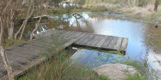
Discover two lesser known gems of the Mornington Peninsula with this scenic walk through The Briars Park Wildlife Sanctuary and Balcombe Creek Estuary Boardwalk.
GRADE | LENGTH | TYPE: An easy 11 km point-to-point walk with public transport links.
ACTIVITY DESCRIPTION: A bus journey from Frankston takes us to Craigie Road in Mount Martha where we take a track through a bushland reserve to reach The Briars Park. Upon entering the park we’ll take the short Wetland Walk stopping briefly at the Boonoorong and Chechingurk bird hides. We’ll return to the park’s visitor centre where there is a choice of undercover or outdoor picnic tables for our lunch break. After lunch we head off through the park’s Wildlife Sanctuary on the 4 km Ker-Bur-Rer Walk. Leaving The Briars Park, we'll then head through to the Mount Martha township on the Balcombe Creek Estuary Boardwalk. A coffee or a rest on the beach will fill the time should we need to wait for a bus to commence the homeward journey.
FURTHER INFORMATION: The Visit Mornington Peninsula website has further information about The Briars Park Walking Trails & Balcombe Creek Estuary Boardwalk.
MEETING TIME | LOCATION: Arrive in time to catch the 785 Mornington East Bus departing at 10:40am from Bus Bay D in Young Street at Frankston Railway Station.
MAP REFERENCE: Melway map 102 grid D2 | Google map goo.gl/maps/dNCfwu7kcbmndAH87.
DISTANCE / TIME FROM GPO: The train journey between Flinders Street and Frankston Station takes just over 1 hour. By road the drive to Frankston is approximately 55 km, allow at least 1 hour.
TRANSPORT: Access to and from this walk is by public transport only. We will catch the 785 Mornington East Bus departing at 10:40am from Bus Bay D in Young Street at Frankston Railway Station. Ample parking is available in the station carpark on the opposite side of the station accessed from Fletcher Road. For public transport from the city, take the Frankston train which departs Flinders Street Railway Station at 9:23am and meet and travel with the group in the front carriage if you wish. The bus journey from Frankston to Craigie Road Mount Martha takes 35 minutes. For the return journey we will take a bus from the Mount Martha township for a 45 minute journey to arrive back at Frankston Railway Station before 5:00pm. Trains depart Frankston Railway Station every 10 minutes for the journey back to the city. All travel is within myki zones 1 & 2 (zone 2 only for the bus from Frankston) with weekend daily caps of $6.40 full fare, $3.20 concession and free for seniors.
FOOD: Carry lunch, snacks and water for your needs throughout the day.
APPAREL | FOOTWEAR: Wear comfortable walking boots/shoes and dress to meet the forecast weather conditions.
LEADER: Peter Tocknell | Email the Leader if you have any questions. Members can access leader contact details under Members->Leader Contacts when logged in to the website.
BOOKING: This event is limited to a maximum of 12 participants. Obtaining a ticket from The Nomads website is essential. Visitor tickets are available up to Thursday 10th October unless shown on the website as "Sold Out". Members are encouraged to obtain their ticket by Thursday 10th October however member free tickets will remain available after this date unless shown on the website as "Sold Out" or "Sale Ended". Please confirm that you have obtained a ticket by visiting thenomadsinc.tidyhq.com/member/events or by checking your "Order confirmation" email.
HOME BACK TO LIST OF EVENTS MEMBERSHIPS

Oct
12
2019
Past Event
2019 Ballarat International Foto exhibition
Southern Cross Station
09:00 – 16:00
Ballarat International Foto Biennale provides the opportunity to explore the worlds best in professional and amateur photography. A majority of exhibitions are FREE and are located in the central area of this historic (by Australian standards) city.
NOTE: this event has been rescheduled from 6 October so as not to clash with the MQFF eXtra mini festival.
GRADE | LENGTH | TYPE: Social, between 3 and 6 km of walking from venue to venue on concrete and bitumen.
ACTIVITY DESCRIPTION:
Enjoy a trip to Ballarat for the Ballarat International Foto Biennale, a multi faceted event running from 24th August to 20th October 2019. The printed guide runs to over 90 pages outlining a wide range of visual arts installations. Recommended is the display of Soldiers (from Israel), a highly stylised and provocative set of photographs that focus on the intermediary moments between privacy and intimacy within the rigid framework of military life. Another exhibition is the Four More Celebrations of The Human Form which contains work by four local photographers, including past Nomads member, Ross Spirou. Ross will host the group at the venue in Armstrong St.
The departure time is set for arrival just prior to 11am, as past experience indicates this will allow extra time to inspect more exhibitions. For those travelling by train, a personal printed guide will be distributed for your perusal en route so that you can make a selection of “must see” exhibitions.
FURTHER INFORMATION: ballaratfoto.org | www.vline.com.au | www.ptv.vic.gov.au.
MEETING TIME | LOCATION: Southern Cross Station at 9am for a departure at 9:16 or Ballarat Station at 10:40am.
MAP REFERENCE: Melway map 1A grid A7 | Google map goo.gl/maps/Ce6dFLdutEBu8BRL7.
DISTANCE | TIME FROM GPO: Ballarat Station is 159 km, 84 minutes by train or via the Western Freeway (M8) by car. If travelling by car, meet in the foyer of the Ballarat Station next to Platform 1 by 10:40am.
PUBLIC TRANSPORT: Train from Southern Cross arrives in Ballarat at 10:40am. Travel in the front car (West Melbourne end). Check the monitor for the platform allocation but be aware of potential late platform changes. Return fares are $31.08 (Full) and $15.54 (Concession). Free suburban travel included and myki card required. Return trains leave on the hour such as 4:13pm, 5:13pm or 6:13pm.
FOOD: A sit down lunch will be held at Irish Murphy’s Ballarat, 36 Sturt Street at 12:30pm. Please be sure to register so a group booking can be made. You can check the menu at: www.murphysballarat.com.au/food-menu.
APPAREL | FOOTWEAR: Casual including sturdy footwear. Ballarat can be cooler than Melbourne, so a light wrap may be required - check the forecast at www.bom.gov.au. Remember your camera plus sunscreen and a wide brim hat.
LEADER | BOOKING: Garry Oliver. | by Wednesday 9th October. Email the Leader if you have any questions. Members can access leader contact details under Members | Leader Contacts when logged in to the website.
HOME BACK TO LIST OF EVENTS MEMBERSHIPS

Oct
01
2019
Past Event
Summer Planning & Social Night
364 Victoria St
19:00 – 21:30
Our quarterly planning night, in conjunction with the regular monthly social night, at Loi Loi Chinese and Vietnamese Restaurant, Richmond.
ACTIVITY DESCRIPTION:
Do you want to see more of a particular activity, or do you have a particularly favourite area of Victoria you would like to share with others? Do you have an idea for something apart from the regular walks? Come along to the planning meeting, and then stay for our monthly social evening where members talk about upcoming events, share a meal and compare notes on past activities. All members are welcome – you don't have to volunteer for an activity. New members are especially invited to this meeting as an orientation to Nomads activities.
MEETING TIME | LOCATION: 7pm | Loi Loi Chinese and Vietnamese Restaurant, 364 Victoria St, Richmond.
LEADER | BOOKING: Garry O. | by Monday 30th September. Email the Leader if you have any questions. Members can access leader contact details under Members -> Leader Contacts when logged in to the website.
HOME BACK TO LIST OF EVENTS MEMBERSHIPS
Sep
29
2019
Past Event
St Kilda to Brighton Walk
Catani Gardens Rotunda
10:30 – 16:00
A leisurely, scenic walk around part of Port Phillip Bay.
GRADE | LENGTH | TYPE: Easy, 7 km point-to-point walk.
ACTIVITY DESCRIPTION:
Enjoy a leisurely walk encompassing some iconic Port Phillip Bay scenery from St Kilda to Brighton Beach, from where we can return towards the CBD by train.
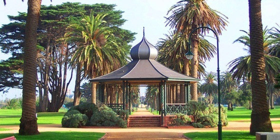
MEETING TIME | LOCATION: Meet at 10:30am at the Bicentennial Rotunda in Catani Gardens, St Kilda.
MAP REFERENCE: Melway map 2N grid J5 | Google map goo.gl/maps/5gMZgLJQd7dctf5R6.
PUBLIC TRANSPORT: trams 3/3a, 16 or 96 to stop 135 (Jacka Bvd / Fitzroy St) or tram 12 to the terminus (Park St / Fitzroy St).
FOOD: Lunch, 1 litre water and snacks if desired. There are several water refill points along the way.
APPAREL | FOOTWEAR: Wear comfortable walking shoes suitable for concrete paths, and dress to meet the forecast weather conditions.
LEADER | BOOKING: Michael C. | by Thursday 26th September. Email the Leader if you have any questions. Members can access leader contact details under Members | Leader Contacts when logged in to the website.
HOME BACK TO LIST OF EVENTS MEMBERSHIPS
Sep
27
2019
Past Event
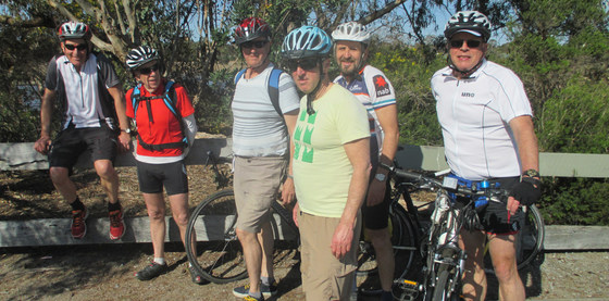
Friday Cycling - AFL Weekend
Watergardens Station
09:54 – 14:30
Join the regular Friday Cycling group for a scenic Maribyrnong River ride on the AFL public holiday Friday.
GRADE | LENGTH | TYPE: Medium, 32 km point-to-point cycling with public transport connections.
ACTIVITY DESCRIPTION:
Take advantage of the AFL public holiday to join the regular Friday cyclists. We will start at Watergardens Station at 9:54am. This is a little earlier than normal, but being a public holiday, there shouldn't be any problems putting bikes on trains during what would normally be the peak hour period. The lunch location is almost at the end of the ride, so the early start time will allow us to ride a little more leisurely than usual and still eat at a reasonable hour.
The Sunbury train that departs Flinders Street Station platform 4 at 9:19am should arrive at Watergardens Station at 9:54am. We'll have a coffee near the station, then ride along the Taylors Creek Trail to the end at Green Gully Close. From there we'll follow the trail along the top of Green Gully Rd and into Brimbank Park, then follow the Maribyrnong Trail. Lunch will be at the Anglers Tavern in Maribyrnong. After lunch we'll continue along the Maribyrnong Trail the short distance to South Kensington Station and optionally beyond. Total distance to South Kensington is 32 km. In case of emergency, there are early exit options at Keilor Plains (not too far from the Keilor Hotel), Ginifer or Albion (via Western Ring Road Trail) or Moonee Ponds.
Monday morning's forecast for Friday looks quite pleasant: "11 to 22 degrees. Partly cloudy. Slight (30%) chance of a shower, most likely later in the day. Winds northerly 15 to 25 km/h turning northwesterly during the day", so that should put the wind behind us most of the way. Don't forget warm layers plus some light wet weather gear, just in case.
The group rides virtually every Friday of the year, so if you’ve been wanting to meet them, but are usually working on Fridays, this is a great opportunity to join them.
MEETING TIME | LOCATION: 9:54am at Watergardens Station, or catch the 9:19am Watergardens train from Flinders Street Station.
FOOD: No need to bring lunch, as we will stop for lunch at the Anglers Tavern. Don’t forget to carry water though.
APPAREL | FOOTWEAR: Bike, helmet and a spare tube that matches your bike in case of a puncture, since not all bike tyres are the same size! Dress to match the forecast weather conditions.
LEADER | BOOKING: Alan D. | by Thursday 26th September. Email the Leader if you have any questions. Members can access leader contact details under Members | Leader Contacts when logged in to the website.
HOME BACK TO LIST OF EVENTS MEMBERSHIPS
Sep
24
2019
Past Event
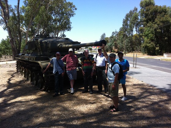
Midweek lunch and walk at Seymour
Seymour
10:20 – 18:35
Have a relaxing train ride to Seymour with the weather warming up. A pub lunch, Vietnam Veterans Commemorative Walk and a walk along the Goulburn river.
GRADE | LENGTH | TYPE: Easy, approximately 7 km circuit walk on concrete, bitumen and gravel.
ACTIVITY DESCRIPTION: Travel will be by train (car optional). On arrival at Seymour it is a 5 minute walk to the Railway Club Hotel situated on Main Street across from the station, but we will have a quick look at a D3 steam loco in JW Elliot Reserve next to the station first. After lunch (1 hour 15 minutes) we will walk to the Goulburn River, via the Vietnam Veterans Commemorative Walk, then have a look at a historic log lock up and courthouse. We then go for a 5 km return walk along the Goulburn River Walking Track. The actual length of the walk will depend on how much time we have left after lunch and how long it takes us to get to the river. On our return walk to the station, on leaving the river track we will walk through Kings Park which is mostly a sports precinct.
FURTHER INFORMATION: www.vline.com.au | www.metrotrains.com.au | www.ptv.vic.gov.au
MEETING TIME | LOCATION: 10:20am at Southern Cross Railway Station (at train), or stops en route. We will travel in the front car. Check monitors for platform.
MAP REFERENCE: Melway map 1A grid A6, and X910 grid M6 | Google map goo.gl/maps/gcbu3cMGtcpZpZ4z9.
DISTANCE | TIME FROM GPO: Southern Cross Railway Station 600 metres, 20 minute walk. Seymour 115 km. 90 minutes by train.
TRANSPORT: Myki Card only. Full fare $24.92, Concession $12.46. Train Departs Southern Cross Station at 10:32am. Stops at Broadmeadows and Craigieburn only in the suburban area. Arrives Seymour at 11:54am. Return train departs Seymour at 4:13pm, arriving Southern Cross at 5.46pm. Stops only at Craigieburn and Broadmeadows in the suburban area. The next train departs Seymour at 5:13pm, arriving Southern Cross at 6:35pm.
FOOD: Bistro lunch. Starters $7 - $10, main $18 (roast) - $28, vegetarian available, desserts about $10, plus drinks. Bring snacks and at least 1 litre of water for walk.
APPAREL | FOOTWEAR: Casual. Sunglasses, hat, sunscreen, repellent, camera. Comfortable walking boots/shoes and dress according to the weather forecast.
LEADER | BOOKING: Paul K. | by Sunday 22nd September. Email the Leader if you have any questions. Members can access leader contact details under Members | Leader Contacts when logged in to the website.
HOME BACK TO LIST OF EVENTS MEMBERSHIPS
Sep
22
2019
Past Event
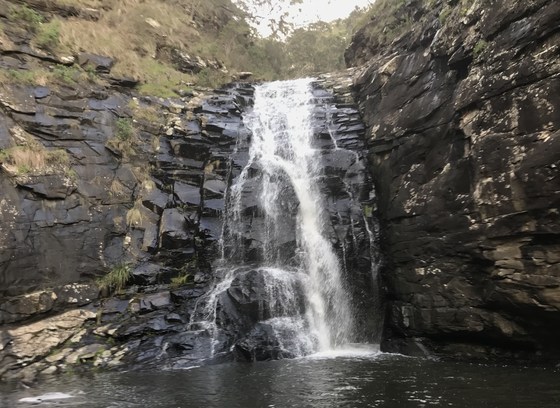
Sheoak Falls and Environs
Sheoak Falls Car Park
09:30 – 17:00
Enjoy a Sunday visiting the rainforest, tree ferns, waterfalls, rivers and cliffs in the Great Otway National Park near Lorne.
GRADE | LENGTH | TYPE: Medium to hard (grade 3), 19 km, 7.5 hour circuit walk, with option to make it shorter by 6.5 km
MEETING TIME | LOCATION: 9:15am for a 9:30am start, at the Sheoak Falls Car Park.
ACTIVITY DESCRIPTION: The walk is on marked trails but there are sections which involve some steady climbing/descending which may include some man-made steps. If there has been recent rain parts of the track may be muddy.
The walk starts and finishes at Sheoak Falls Car Park, near Lorne. We first visit Sheoak Picnic Area, taking in Sheoak Falls and Swallow Cave along the way. From the picnic area we do a couple of return walks. One is to The Canyon while visiting Won Wondah Falls and Henderson Falls on the way. Lunch is at Sheoak Picnic Area. After lunch, depending on the group, you have the option to do the other return walk (6.5 km) to the Lower Kalimna Falls or return directly back to finish at the Sheoak Falls Car Park.
FURTHER INFORMATION: https://www.visitgreatoceanroad.org.au/assets-regional/Uploads/lorne-walks-and-waterfall.pdf
MAP REFERENCE: Melway map X911 grid B11 | Google map goo.gl/maps/D8UpRD4QQktskqsv7.
DISTANCE | TIME FROM GPO: 150 km, approximately 2 hours 15 minutes from Melbourne GPO by car.
FOOD: Carry lunch, snacks and at least 2 litres of water.
APPAREL | FOOTWEAR: Comfortable walking boots/shoes and dress according to the weather forecast. Walking poles may be handy.
LEADER | BOOKING: Geoff L. | by Thursday 19th September. Email the Leader if you have any questions. Members can access leader contact details under Members | Leader Contacts when logged in to the website.
HOME BACK TO LIST OF EVENTS MEMBERSHIPS
Sep
14
2019
Past Event
Mixed Naturist Union Hill Lake Walk (Sun) & Optional BBQ/Overnight (Sat)
50 Eureka St
14 Sep 2019 17:00 – 15 Sep 2019 16:00
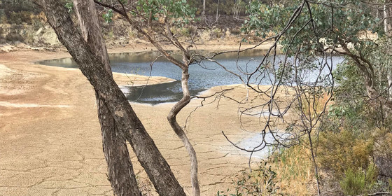
A pleasant and fairly easy naturist bushwalk through open forest to visit a Chinese Dam (swim if you like), a good sized Forest Lake (Union Hill Mine Tailings Lake - contaminated, but looks nice in Spring), sand caves and a very old earthen water channel (the Poverty Gully Water Channel) still used today. Optionally preceded by a Saturday evening BBQ and overnight at Chewton.
GRADE | LENGTH | TYPE: Easy to medium 6 km circuit walk mostly through the open forest and on 4WD tracks.
ACTIVITY DESCRIPTION:
This event is for Naturists. On Saturday evening enjoy a relaxing naturist BBQ with spa, heated pool and two massage tables. There are two pot belly fires to keep you warm. After that there is accommodation in the insulated Big Shed with beds available, or you can camp in the back garden. On Sunday morning there is a cooked breakfast available at about 8.30am.
The walk will start from the rear of the Chewton house and travel through undulating open forest to visit some of the interesting relics from over 100 years ago, some of which are still being used today. If we get good Spring rains the Mine Lake should look rather attractive. But don't swim in it, or drink the water, this was constructed before the days that we looked after the environment! In contrast the small water dams built by the gold miners are very low tech, picturesque waterholes and are quite safe to swim in. Our return trip will be on a different course from the outward journey and we expect to get back to the Chewton house by about 4pm.
If you wish to do the Sunday walk without the overnight BBQ, that is quite OK. You will need to obtain your ticket on the Nomads website and then arrive at the Chewton house at 10am for registration, so that you will be ready for a 10:30am departure.
MEETING TIME | LOCATION: Meet at the rear of the house at 50 Eureka St, Chewton.
FOR THE SAT BBQ & OVERNIGHT: Meet at approximately 5pm, BBQ and dinner starts at 6:30pm.
FOR THE SUN BUSHWALK: Meet at 10am for registration. Walk starts at 10:30am from the Chewton house (tea and coffee available at the house).
MAP REFERENCE: Melway map X909/909 grid D6 | Google map goo.gl/maps/H6yzfyPuVgex6Si19.
DISTANCE | TIME FROM GPO: 120 km. Allow 1 hour 30 minutes.
PUBLIC TRANSPORT:
FOR SATURDAY: Catch the 3:22pm V/Line train from Southern Cross Railway Station to Castlemaine Railway Station arriving at 4:48pm. From there we can arrange a lift for you to the BBQ and overnight venue in Chewton.
FOR SUNDAY: Catch the 7:20am V/Line train from Southern Cross Railway Station to Castlemaine Railway Station arriving at 8:48am and change to Regional bus 6 which departs at 8:56am. Alight at Van Heurck/Duke St (at 9:07am) and walk 20 minutes to Eureka St. Alternatively, contact the leader to see if a lift can be organised.
FOOD:
BBQ & SATURDAY OVERNIGHT: BYO meat and drinks. Salads, bread and dessert will be supplied.
SUNDAY BUSHWALK: You will need to carry your lunch with you for the Sunday bushwalk. You can provide your own, or if you like we can order a cut lunch for you. Rolls & sandwiches ($6.50), cakes & slices ($3 or less) and fruit (about $1). These will be delivered to the Chewton house on the Sunday morning. Ordering details will be provided later.
APPAREL | FOOTWEAR:
SATURDAY EVENING, SPA & MASSAGE: Please BYO towels which are needed for sitting on, placing on the massage table and drying yourself. There is a spa, 4m heated pool and 2 massage tables. There is comfortable furniture to relax on and chat. Easy to remove footwear and maybe a robe for outside, as the temperature outside will most likely be cool to cold overnight.
SATURDAY OVERNIGHT: For those staying overnight, there are various beds available (double and single). BYO linen, blankets and pillows or sleeping bag. There is room for tents in the back garden. Beds that are in the house will be given to those with greater needs.
SUNDAY BUSHWALK: Sunscreen, hat, sunglasses. Wear comfortable walking shoes/boots. A small towel to dry off if you'd like a swim.
COSTS:
SATURDAY BBQ: To cover the cost of providing salads and dessert, plus heating the Big Shed and the spas, there is a charge of $15. You will need to pay online to our hosts, Steve and Brett, before the event (RSVP and payment will be set up from the 1st September).
OVERNIGHT WITH BREAKFAST: To add accommodation with a cooked breakfast included on Sunday morning, the cost is an additional $10 to $15 (yet to be determined) - again paid on-line to the hosts before the event.
SUNDAY WALK: $5, free for Nomads financial members. Please Get a Ticket.
RSVP and BOOKING:
BBQ, OVERNIGHT STAY & SUNDAY BREAKFAST: Limits will be placed on the number of people that can attend. To request attendance, email Steve on cosmex.melb@gmail.com. To secure your RSVP booking, a payment must be received by 11th September. Steve will email you with acceptance of your RSVP and check for any food and or sleeping requirements, as well as provide instructions for payment. A confirmation of payment email will also be sent once payment is received. If the BBQ and or Overnight is booked out you will be offered to go on a waitlist. If you need to cancel your booking, and have made a payment, this will be refunded if a replacement person is found.
SUNDAY WALK: Please GET a TICKET here, preferably by Wednesday 11th September.
LEADER: Russell W. | If you have any questions you can contact the Leader on leaderrussellw.thenomadsinc@mail.tidyhq.com. Members can access leader contact details under Members | Leader Contacts when logged in to the website.
HOME BACK TO LIST OF EVENTS MEMBERSHIPS
Sep
08
2019
Past Event
Plenty River Trail Walk - Greensborough to Heidelberg
Flinders Street Railway Station
09:58 – 16:00
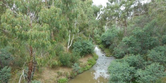
There's urban parkland, natural bushland and farmland to enjoy by participating in this walk along the Plenty River Trail.
GRADE | LENGTH | TYPE: A moderate 12 km point-to-point walk with public transport links.
ACTIVITY DESCRIPTION: Our walk commences at Greensborough Railway Station with a short walk along the street to meet the Plenty River Trail. The walk along the Plenty River Trail offers a combination of urban parkland, natural bushland, and farmland to enjoy along the way. We follow the trail until we meet the Yarra River Trail near Heidelberg. We will then make our way through parkland then a short walk along the street to Heidelberg Railway Station.
FURTHER INFORMATION: www.banyule.vic.gov.au/Events-activities/Parks-reserves.
MEETING TIME | LOCATION: In the front carriage of the Hurstbridge train departing Flinders Street Railway Station at 09:58am or meet the group en route by arrangement with the event leader.
MAP REFERENCE: Melway map 43 grid H9 | Google map goo.gl/maps/NMdRVJfVevp.
DISTANCE / TIME FROM GPO: The train journey from Flinders Street to Greensborough is 47 minutes.
TRANSPORT: Access to and from this walk is by public transport only. We will travel to Greensborough Railway Station in the front carriage of the Hurstbridge train departing Flinders Street Railway Station at 09:58am. For the return journey trains depart Heidelberg Railway Station every 20 minutes. All travel is within myki zones 1 & 2 with weekend daily caps of $6.40 full fare, $3.20 concession and free for seniors.
FOOD: Carry lunch, snacks and water for your needs throughout the day.
APPAREL | FOOTWEAR: Wear comfortable walking boots/shoes and dress to meet the forecast weather conditions.
LEADER: Peter Tocknell | Email the Leader if you have any questions. Members can access leader contact details under Members->Leader Contacts when logged in to the website.
BOOKING: This event is limited to a maximum of 12 participants. Obtaining a ticket from The Nomads website is essential. Visitor tickets are available up to Thursday 5th September unless shown on the website as "Sold Out". Members are encouraged to obtain their ticket by Thursday 5th September however member free tickets will remain available after this date unless shown on the website as "Sold Out" or "Sale Ended". Please confirm that you have obtained a ticket by visiting thenomadsinc.tidyhq.com/member/events or by checking your "Order confirmation" email.
HOME BACK TO LIST OF EVENTS MEMBERSHIPS
Sep
03
2019
Past Event
Monthly Social Night - September
Riversdale Hotel
19:00 – 21:30
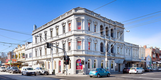
Our regular monthly social night - this month at the Riversdale Hotel.
ACTIVITY DESCRIPTION:
Join us for our monthly social evening where members can enjoy a meal, talk about upcoming events, compare notes on past activities and float ideas on events they would like to see run.
Tuesday night is “parma night” at the Riversdale Hotel – $13.90 parma with chips and salad.
MEETING TIME | LOCATION: 7pm | Riversdale Hotel, 277 Auburn Rd, Hawthorn East.
MAP REFERENCE: Melway map 45 grid F12 | Google map goo.gl/maps/qrJD25xdC5zxV2FJA.
PUBLIC TRANSPORT: Tram #70 or #75 to stop 36 (Auburn Rd & Riversdale Rd).
LEADER | BOOKING: Garry O. | by Monday 2nd September. Email the Leader if you have any questions. Members can access leader contact details under Members -> Leader Contacts when logged in to the website.
HOME BACK TO LIST OF EVENTS MEMBERSHIPS
