

The Nomads Outdoors Group Inc.
Powered by
Past events
All events
Past events
Jan
19
2020
Past Event
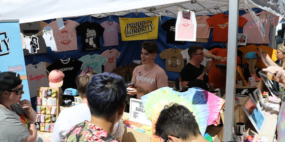
Midsumma Carnival Stall Manning
Alexandra Gardens
10:00 – 18:00
Have a heap of fun meeting new people, and promoting The Nomads club at Midsumma Carnival. We have obtained a stall, and need some volunteers to man it.
GRADE | LENGTH | TYPE: Easy.
ACTIVITY DESCRIPTION:
Your club has got a stall at Midsumma Carnival, and needs members to volunteer an hour or two of their time on Carnival Day. You only need to be your enthusiastic self, and tell people about the benefits and fun of participating in our outdoors activities. Guidance will be provided on what to say and do. We hope to have a minimum of two people manning the stall at any time throughout the day.
All members that volunteer can take home (and wear on the day) one of our new branded shirts.
FURTHER INFORMATION: https://www.midsumma.org.au/info/midsumma-carnival/
MEETING TIME | LOCATION: Shift times are 10am-noon, noon-2pm, 2-4pm or 4-6pm. When you register, please indicate when you might be available to volunteer (drop down options). Location is Alexandra Gardens (hard to miss on Carnival Day).
MAP REFERENCE: Melway map 2F grid K7 | Google map goo.gl/maps/mHyVFk3BqhH2.
DISTANCE | TIME FROM GPO: 1 km south of the GPO. Walking is recommended, or take public transport, as there is very limited parking.
TRANSPORT: Take a train to Flinders St, or a tram to Federation Square or the Arts Centre in St Kilda Rd.
FOOD: There are plenty of food stalls and free water fountains. Remember to stay hydrated.
APPAREL | FOOTWEAR: Wear something that looks outdoorsy. Members who register their time will be given a Nomads shirt to wear, that they can take home.
LEADER | BOOKING: Garry O. or Roger H. | by Saturday 18th January. Email the Leader if you have any questions. Members can access leader contact details under Members | Leader Contacts when logged in to the website.
HOME BACK TO LIST OF EVENTS MEMBERSHIPS
Jan
11
2020
Past Event
Postponed to 1st & 2nd February - Gembrook Mixed Naturist Walk & Opt Overnight at Helios Naturist Club
11 Jan 2020 10:15 – 12 Jan 2020 16:00
THIS EVENT HAS NOW BEEN RESCHEDULED TO 1 & 2 FEBRUARY 2020, DUE TO BAD WEATHER IN NOVEMBER AND A CLASH FOR HELIOS IN JANUARY.
Tickets purchased for November or January have been automatically transferred to February. If you're unable to attend in February, please contact the leaders for a refund.
Jason T. on leaderjasont.thenomadsinc@mail.tidyhq.com or Russell W. on leaderrussellw.thenomadsinc@mail.tidyhq.com.
Let's hope we get good weather for an enjoyable and relaxing weekend in February.
Jan
07
2020
Past Event
Autumn Planning & Social Night
893 Burke Road, Hawthorn East Vic 3123
19:00 – 21:30
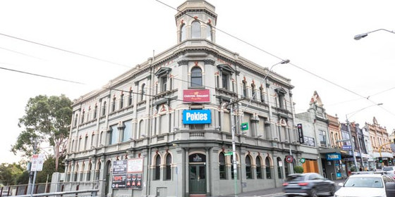
** NOTE: last-minute change of venue to Palace Hotel, 893 Burke Rd, Hawthorn East.
Our quarterly planning night, in conjunction with the regular monthly social night, at the Palace Hotel, East Hawthorn (opposite the Camberwell Station).
ACTIVITY DESCRIPTION:
Do you want to see more of a particular activity, or do you have a particularly favourite area of Victoria you would like to share with others? Do you have an idea for something apart from the regular walks? Come along to the planning meeting, and then stay for our monthly social evening where members talk about upcoming events, share a meal and compare notes on past activities. All members are welcome – you don't have to volunteer for an activity. New members are especially invited to this meeting as an orientation to Nomads activities.
MEETING TIME | LOCATION: 7pm | Palace Hotel, 893 Burke Road, Hawthorn East.
LEADER | BOOKING: Garry O. | by Monday 6th January. Email the Leader if you have any questions. Members can access leader contact details under Members -> Leader Contacts when logged in to the website.
HOME BACK TO LIST OF EVENTS MEMBERSHIPS
Jan
04
2020
Past Event
Pt Addis Naturist Beach Day with Optional Cliff Top Hike in the IronBark Basin. *Rescheduled to Sat Jan 4th*
Point Addis carpark
10:30 – 21:00
Update:
Hi Everyone
Given the poor weather forecast for this Sunday, (17 cool rain and windy), we have made a decision to move the beach day to this Saturday 4th Jan. We apologise for the late notice and the fact that some of you may have other plans but you will agree that we need a reasonably warm day to fully enjoy this wonderful beach. The following weekend is also looking rather dreary weather wise so we are left with this Saturday. We will be assisting those who require car pooling shortly. Please reach out if you have any questions regarding this event. Hope to see you there! In the nude Jason, Peter & Russell.
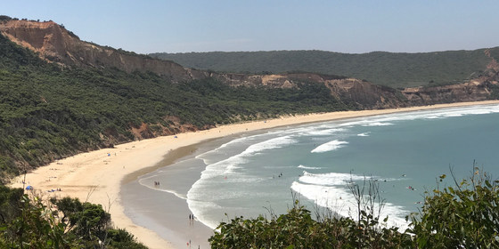
Enjoy a pleasant naturist beach day, with a leisurely lunch and swim. An optional late afternoon/evening clifftop hike with spectacular views with dinner following is also being offered as part of this event.
GRADE | LENGTH | TYPE: Easy, approximately 1.5 km walk from the car park to the lunch spot on the beach. There are quite a few steps from the road down to the beach, but you can always take your time. The afternoon/evening hike is graded as Medium (Iron Bark Forest is rather flat with a few uphill steps and tracks on a long gradual climb with a few steeper sections through the basin and along the cliffs).
ACTIVITY DESCRIPTION:
Enjoy a pleasant clothes-free beach day, with a leisurely lunch and swim. Optional activities include body surfing in a moderate surf and a 1 km beach walk to the rocky headland towards Southside. As the tide will go out during the day, we could if you like walk around the headland for another kilometre to the very end of the naturist beach at Southside.
The optional afternoon/evening clifftop hike through the IronBark basin will take place after the official beach day finishes. You do not need to make a separate booking to come along, you can decide at the end of the beach day if you wish to join us for the hike.
The evening hike is proposed to run from about 4.30pm/5pm to about 8pm following a visit to the Great Ocean Rd Chocolaterie & Ice Creamery (a short car trip from the beach) as part of our afternoon tea and chocolate tastings. The hike route chosen will be one of two options that will be decided upon on the day subject to interests from those attending and the time the walk commences. (Weather conditions permitting).
At the conclusion of the walk, all participants are invited to an optional dinner (Approx. 8pm) at the local Chinese Restaurant in Torquay to end a most enjoyable day out.
Option 1 Evening Walk (Clothed):
IronBark Basin Hike: (3km return trip)
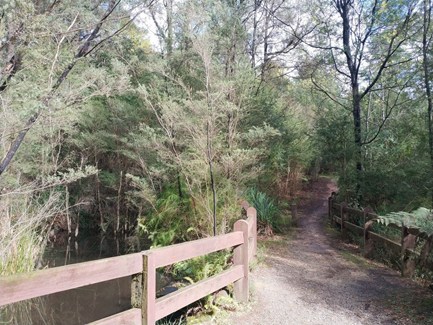
A very pleasant hike through the Ironbark Basin, which is part of the massive Great Otway National Park. A mostly sheltered forest trail with features of spectacular clifftop views of Addiscott Beach. At first the trail enters a Stringybark woodland, scattered with Ironbark trees and an understory of Wattle, Grass Trees and ground covers. The walk affords not only spectacular views of the coast, with opportunities for animal and birdwatching, with insights into the local indigenous culture explaining the use of bush food by the local Koori people. Bring your cameras!
Option 2 Evening Hike (Clothing Optional):
Jarosite Mine & Dam Hike: (4km round trip)
This walk curves inland through Iron Bark Forest and you work you way uphill on a long gradual climb through some wonderful grasstree and stringybark forest. After a short look at the Jarosite Mine Dam we reach the site of the old abandoned jarosite mine. The mine workings once covered an area of 100ha before it closed in 1927. Bird life is usually rich and varied with Honeyeaters, Robins, Fantails and Wattlebirds the most common in the area. Clifftop views are also given.
Day Runsheet:
10:30am - Start of beach day/swim at Point Addis
3:30pm - Leave the beach for an optional visit to the the Great Ocean Rd Chocolaterie & Ice Creamery for afternoon tea and tasting. (Optional)
4:30pm/5pm Approx- Start of the IronBark Basin Hike (Optional)
8pm - Head to the local Chinese restaurant in Torquay for Dinner. (Optional)
9pm Approx - Leave Torquay bound for Melbourne
MEETING TIME | LOCATION: 10:30am at Point Addis beach car park in Pt Addis Rd (this is on the right hand side of the road and is about 500 metres before the end of the road on the Pt Addis headland). Departure from beach at 3:30pm for optional visit to the Great Ocean Rd Chocolaterie & Ice Creamery.
MAP REFERENCE: Melway key map 15 grid A21 | Google map goo.gl/maps/w3hMeN4CigLwvQiV6
COST: There is no charge for this special beach day. However, you should still book via the Nomads website to attend - see below.
FOOD: Lunch, snacks and drinking water.
APPAREL | FOOTWEAR: Sunscreen, hat, repellent, towel, footwear if sand is hot. Shorts required to get from the car park to the appropriate section of the beach. Beach umbrella or shade equipment could be useful.
BOOKING: By Friday 3rd January. Click on Get Tickets to book.
LEADERS | BOOKING: Jason T & Peter H. | Email the leaders: Jason T & Peter H if you have any questions. Members can access leader contact details under Members | Leader Contacts when logged in to the website.
HOME BACK TO LIST OF EVENTS MEMBERSHIPS
Dec
29
2019
Past Event
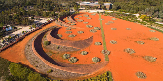
Christmas Leftovers Picnic @ Cranbourne
Royal Botanic Gardens Victoria - Cranbourne Gardens
10:30 – 17:00
How to use up the leftover food from Christmas celebrations combined with some post Christmas exercise via a relaxing Sunday visit, not too far from Melbourne, to view the stunning Australian gardens at the Cranbourne site of the Royal Botanical Gardens. Travel via public transport is possible, but a bit slow.
GRADE | LENGTH | TYPE: Easy, up to 8 km walking around the site.
ACTIVITY DESCRIPTION:
We have visited the Cranbourne site of the Royal Botanical Gardens a number of times in the past and each time there has been expansion and new developments to explore. There will be two sessions to explore the garden area with a lunch break in between. Lunch will take place at one of the two picnic areas (Stringybark or Woodlands depending on space availability). This will provide an opportunity to use up leftover food from Christmas.
MEETING TIME | LOCATION: 10:30am outside the Visitor Centre (in the Boon Wurrung Cafe complex). Entry to the gardens is via Ballarto Rd - if coming from Cranbourne on the South Gippsland Highway, turn right into Ballarto Rd about 500 metres past the racecourse.
MAP REFERENCE: Melway map 133 grid F10 | Google map goo.gl/maps/mHyVFk3BqhH2.
DISTANCE | TIME FROM GPO: 56 km, approximately 1 hour to drive via the Monash Freeway, 1 hour 49 minutes by public transport.
TRANSPORT: Train to Cranbourne then bus #796 from the Station to the intersection of Ballarto Rd and the South Gippsland Highway followed by a walk to the Gardens.
FOOD: Bring lunch, snacks and at least 1 litre of water and other beverages of choice. NB: You must take home all your rubbish, etc. Optional afternoon tea in the on-site Boon Wurrung Café at 4pm sharp (it closes at 4:45pm).
APPAREL | FOOTWEAR: Sunglasses, hat, sunscreen, insect repellent if you have sensitive skin, plus your camera. Comfortable walking boots/shoes and dress according to the weather forecast.
FURTHER INFORMATION: rbg.vic.gov.au/visit-cranbourne. The gardens are open from 9am to 5pm. No pets allowed.
BOOKING: By Thursday 26th December (Boxing Day) via Get Tickets.
LEADER: Garry O. | Email the Leader if you have any questions. Members can access leader contact details under Members | Leader Contacts when logged in to the website.
HOME BACK TO LIST OF EVENTS MEMBERSHIPS
Dec
08
2019
Past Event
Altona To Williamstown Coastal Walk
Flinders Street Railway Station
10:07 – 16:00
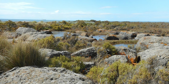
Coastal wetlands and birdlife feature in this casual walk from Altona Pier to Point Gellibrand.
GRADE | LENGTH | TYPE: An easy 11 km point-to-point walk with public transport links.
ACTIVITY DESCRIPTION: This walk follows the coast from Altona Pier to Point Gellibrand at Williamstown. Along the way we will pass through Altona Coastal Park on the site of the former Williamstown Racecourse, Jawbone Nature Conservation Reserve, Williamstown Beach and Point Gellibrand Coastal Heritage Park. A large amount of coastal birdlife can be observed in the area. The coastal salt marsh ecosystems we pass by are unusual to find so close to a major city. The industrial, residential and boating activities of the area add to the variation of landscapes to be observed throughout the walk.
MEETING TIME | LOCATION: In the front carriage of the Werribee train departing Flinders Street Railway Station at 10:07 am or meet the group en route by arrangement with the event leader.
MAP REFERENCE: Melway map 43 grid H9 | Google map goo.gl/maps/NMdRVJfVevp.
DISTANCE / TIME FROM GPO: The walk commences at Altona Railway Station which is 17km and 35 minutes by train from the city. The return journey takes 37 minutes from Williamstown Railway Station.
TRANSPORT: Access to and from this walk is by public transport only. We will travel to Altona Railway Station in the front carriage of the Werribee train departing Flinders Street Railway Station at 10:07am. For the return journey trains depart Williamstown Railway Station every 20 minutes. All travel is within myki zones 1 & 2 with weekend daily caps of $6.40 full fare, $3.20 concession and free for seniors.
FOOD: Carry lunch, snacks and water for your needs throughout the day.
APPAREL | FOOTWEAR: Wear comfortable walking boots/shoes and dress to meet the forecast weather conditions.
LEADER: Peter Tocknell - Email the Leader if you have any questions. Members can access leader contact details under Members->Leader Contacts when logged in to the website.
BOOKING: This event is limited to a maximum of 12 participants. Obtaining a ticket from The Nomads website is essential. Visitor tickets are available up to Thursday 5th December unless shown on the website as "Sold Out". Members are encouraged to obtain their ticket by Thursday 5th December however member free tickets will remain available after this date unless shown on the website as "Sold Out" or "Sale Ended". Please confirm that you have obtained a ticket by visiting thenomadsinc.tidyhq.com/member/events or by checking your "Order confirmation" email.
HOME BACK TO LIST OF EVENTS MEMBERSHIPS
Dec
07
2019
Past Event
Mixed Naturist Walk: Wombat State Forest & old logging camps near Blackwood
The Garden of St Erth Cafe
10:15 – 16:00
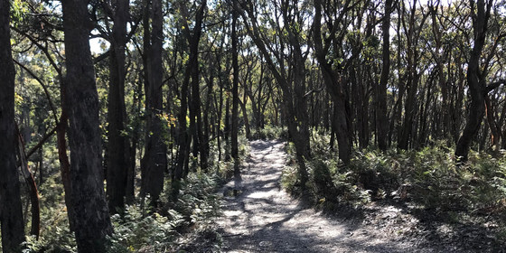
Enjoy a naturist walk through the forest, and a jaunt along the top of the Great Dividing Range.
GRADE | LENGTH | TYPE: Easy to medium 8 to 9 km circuit walk along 4WD tracks, the occasional walking track and through the open forest. There are a couple of steep sections, but we will take our time.
ACTIVITY DESCRIPTION:
This event is for naturists, especially for those frustrated by the lack of sunny days on the weekends recently. On Saturday 30th November the forecast for Saturday 7th December was going to be sunny and 24C - too good to miss!! By Sunday, the max temp for Saturday 7th December from different forecasters ranged from 17C, 21C to 26C! So who knows what it's going to do. However it's not supposed to rain, and there's supposed to be quite a bit of sunshine, so let's go!
The tracks are generally easy walking with only a few short steep bits. We are hoping to visit some of the old tree logging camps, set up many years ago and now abandoned. We may even get a few views from the top of the range if the trees haven't grown too much, though the forest is now quite tall. The walk is planned to finish by 4pm.
We know this event will unfortunately clash with a few other naturist events on this weekend. However this walk is for those who can't attend these. For those who miss out we can run this event again in a future season.
Afternoon Tea/Drinks: After the walk we will return to the Blackwood township, where we can have cool drinks, a beer or a coffee at the Blackwood Hotel at 22 Martin St, Blackwood.
MEETING TIME | LOCATION: 10:15am in the car park or in the cafe of "The Garden of St Earth" at 189 Simmons Reef Rd, Blackwood. Good coffee, tea and snacks are available. This cafe is 5 minutes west of the Blackwood township on a narrow bitumen road, blind corners, be careful. At the start of the Blackwood township turn left on to Simmons Reef Rd. From the meeting place we can do a car convoy, or take your car to the start of the walk which is about 5 km away on a good gravel road. Mobile coverage at the cafe is poor. If necessary you could try a text, or phone the cafe on (03) 5368 6514.
MAP REFERENCE: Meeting point Melway map 909 grid E11 | Google map goo.gl/maps/trokqyqR2rpfuxn29. The walk start is located west of the cafe, probably on Lerderderg Rd.
DISTANCE | TIME FROM GPO: 91 km. Approximately 1 hour 15 minutes.
PUBLIC TRANSPORT: V/Line train leaves Southern Cross Railway Station at 8:16am and arrives in Ballan Railway Station at 9:21am. From here we will need to arrange a pick up for you. If you'd like a lift from Melbourne, send an email to Russell and we can probably arrange a ride for you.
FOOD: Lunch, snacks, water/drinks to take on walk.
COST: $7, free for Nomads members.
APPAREL | FOOTWEAR: Comfy shoes/boots. Sunscreen, sunhat, sunglasses. Small towel to dry off if we find a swimming hole. Shorts could be needed at the start and finish of the walk. You could probably share a day pack between two if you like.
BOOKING: Preferably by Thursday 5th December. Click on Get Tickets to book.
LEADER | BOOKING: Russell W. | Email the Leader if you have any questions. Members can access leader contact details under Members | Leader Contacts when logged in to the website.
HOME BACK TO LIST OF EVENTS MEMBERSHIPS
Dec
03
2019
Past Event
Annual Pre-Christmas BBQ
Yarra Bank Reserve
18:30 – 21:30
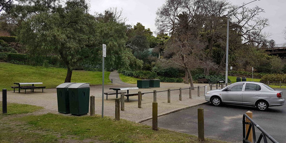
Join us for the popular annual Christmas BBQ beside the Yarra River in a tranquil, little-known park in Hawthorn.
GRADE: Social.
ACTIVITY DESCRIPTION:Join your friends on the banks of the Yarra River at Hawthorn for a pre-Christmas BBQ in lieu of our monthly indoors social evening. The venue is a secluded spot that is protected from wind and extreme sun. The reserve has four tables with bench seats and two BBQs. Water is on-tap and a public toilet is located on Creswick St.
MEETING TIME | LOCATION: From 6:30pm in Yarra Bank Reserve, on the Hawthorn side of the Yarra River (“under” the Bridge Rd bridge).
MAP REFERENCE: Melway map 2H grid H6 | Google map goo.gl/maps/mjZWxZRLASy.
DISTANCE | TIME FROM GPO: 5 km by car – enter the reserve via the corner of Creswick and Denham Streets, Hawthorn or park in Creswick St. Public transport is to Tram Stop 23 (Burwood Road / Church Street junction) via either route 48 (from Collins St) or route 75 (from Flinders St).
FOOD and BEVERAGES: The Nomads will supply pre-meal nibbles plus bread and salads to accompany the main meal. You need to BYO your preferred main meal item for the BBQ. All beverages are BYO. A limited supply of disposable plates, cups and cutlery will be available. You are recommended to bring your preferred utensils.
APPAREL | FOOTWEAR: Daylight saving will be active. Bring insect repellent plus a lightweight and waterproof jacket if showers are forecast. It is likely to turn cool once the sun sets.
LEADER | BOOKING: Garry O. | by Sunday 1st December. Email the Leader if you have any questions. Members can access leader contact details under Members | Leader Contacts when logged in to the website.
HOME BACK TO LIST OF EVENTS MEMBERSHIPS
Nov
23
2019
Past Event
Beach Day at Sunnyside Beach, Mt Eliza
Sunnyside Road
10:30 – 16:00
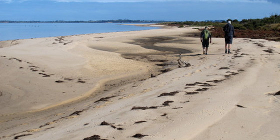
A leisurely day at the beach with a Port Phillip Bay vista in the distance.
GRADE | LENGTH | TYPE: Easy, social day with short walks along the beach.
ACTIVITY DESCRIPTION:
Enjoy a leisurely day sun baking, walking, swimming and socialising with other Nomads on the beach. Sunnyside Beach is the only officially designated clothes-optional beach on the east side of Port Phillip Bay.
FURTHER INFORMATION: www.melbourneplaygrounds.com.au/sunnyside-beach-mount-eliza#.XVd7kOgzZPY.
MEETING TIME | LOCATION: 10:30am in the Sunnyside Beach Car Park at the end of Sunnyside Rd, Mt Eliza.
MAP REFERENCE: Melway map 104 grid K5 | Google map goo.gl/maps/ggsox7nN4KDiCa5z9.
DISTANCE | TIME FROM GPO: 66 km, 1 hour 10 minutes via M1 and M3 | 79 km, 1 hour 20 minutes via M3.
PUBLIC TRANSPORT: From Flinders Street Station, catch the 8:23am Frankston train to Frankston, arriving at 9:28am. The 785 bus departs from Bay D at Frankston Station at 9:40am. Get off at the George Vowell Institute Blind/Nepean Hwy, Mt Eliza at 9:55am. From there it is a 1.3 km walk to the Sunnyside Beach Car Park. Alternatively, contact the leader, who may be able to arrange car sharing for you.
FOOD: Lunch, snacks, plenty of water/drinks as there are no local facilities immediately available.
APPAREL | FOOTWEAR: : Beach towel, shade (no shade available on beach), shoes (to cross small rock outcrop to beach location), sunscreen, hat, sunglasses, shorts (even if you intend to be naked, to get to the nude section of the beach).
LEADER | BOOKING: Michael C. | by Wednesday 20th November. Email the Leader if you have any questions. Members can access leader contact details under Members | Leader Contacts when logged in to the website.
HOME BACK TO LIST OF EVENTS MEMBERSHIPS
Nov
22
2019
Past Event
Great Vic Bike Ride: Robe – Port Fairy – Torquay
Robe
22 Nov 2019 18:00 – 01 Dec 2019 16:00
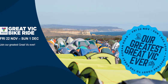
Join a group of Nomads on either a 5-day or 10-day option of this year's Great Vic Bike Ride: Robe – Port Fairy – Torquay (ride from Robe to Port Fairy between the 22nd and 26th of November and/or from Port Fairy to Torquay between the 27th of November and the 1st of December).
GRADE | LENGTH | TYPE:
A challenging 348 km point-to-point ride from Robe to Port Fairy with mechanics and medical support.
A challenging 304 km point-to-point ride from Port Fairy to Torquay with mechanics and medical support.
ACTIVITY DESCRIPTION:
The annual Great Vic Bike Ride this year has ten days of riding, camping and exploring with new and old friends. Starting in Robe and finishing in Torquay you’ll see the best of Victoria and South Australia by bike, all in the one adventure! A number of Nomads will be participating, so this is a great opportunity to join them on one of Victoria’s most scenic cycling routes through the beautiful coastal and forest landscapes along the Limestone Coast, the Great Ocean Road and through the Great Otway National Park.
FURTHER INFORMATION: bicyclenetwork.com.au/rides-and-events/great-victorian-bike-ride.
MEETING TIME | LOCATION: Various. Coach transport for you and your bike are available from Melbourne or various regional locations to the start and end points of your ride.
COST: The standard price includes all meals, a camping spot, wash facilities, luggage transfer, en-route mechanical support and entertainment. Optional extras include coach transfers to and from Melbourne or regional locations, tent hire, non-tent accommodation, car parking, charging facilities (e-bike or phone) etc. Refer to bicyclenetwork.com.au for details.
FOOD: all provided, including en-route drinks and snacks.
APPAREL | EQUIPMENT: Take your bike and cycling gear suitable for any weather conditions. Choose clothing each day based on the latest forecast for that day. Unless hiring accommodation, take your own tent, bedding, towel and toiletries.
LEADER | BOOKING: Kevin K. | Book and pay on the Bicycle Network website (bicyclenetwork.com.au). It is possible to book up until 5pm on Friday 22nd November, but you should book ASAP to ensure you don’t miss out on the options you would like. After booking, please contact the leader Kevin K. so he can coordinate the group. Email the Leader if you have any questions. Members can access leader contact details under Members | Leader Contacts when logged in to the website.
HOME BACK TO LIST OF EVENTS MEMBERSHIPS
Nov
17
2019
Past Event
Mt Macedon Walk
Mount Macedon
10:30 – 16:00
An energetic walk up in the snow gums with great views over Melbourne and beyond.
GRADE | LENGTH | TYPE: Medium 12 km point-to-point walk, with a 350m climb at the start. Approximately 5 hours.
ACTIVITY DESCRIPTION:
We need to do a 6 km car shuffle at the start as this is a point-to-point walk. This prevents us having to do a steep downhill at the end of the day.
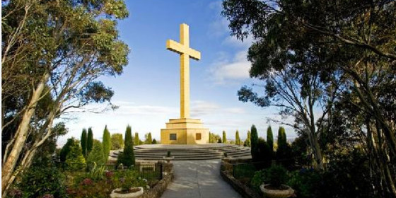
We will start with a 350m ascent up to the memorial cross on the top of Mt Macedon. This will be done slowly at the pace of the slowest walker, so no-one gets left behind. Near the cross we will have morning tea at the Top of the Range Café. From there we will walk to McGregors Picnic Ground for lunch. After lunch we will continue around the Camels Hump, with the option of climbing to the top at 1008m, the highest point in the area. From there we will walk to Sanatorium Lake, which is where the cars were placed before the walk. There are great views of the surrounding country, and a lot of interesting history in the area. Anticipate afternoon tea back at Macedon.
FURTHER INFORMATION: parkweb.vic.gov.au/explore/parks/macedon-r.p.
MEETING TIME | LOCATION: Meeting time 10am at the base of Mt Macedon (the leader will contact you with details).
MAP REFERENCE: Melway map 657 grid G1 | VicRoads map 285 grid R6 / 634 grid F5 | Google map goo.gl/maps/3Xj2qnX9W9X7TUFu7.
DISTANCE | TIME FROM GPO: 65 km. Allow 1 hour 15 minutes drive.
PUBLIC TRANSPORT: Not available. We will maximise car pooling.
FOOD: Bring own lunch and water. We will have morning tea at the Top of the Range Café near the cross.
APPAREL | FOOTWEAR: Check the weather, but it can get quite cold on the top. Warm clothing and rain jacket should be taken. Light comfortable walking footwear. It could be slippery if wet.
LEADER | BOOKING: Roger H. | by Thursday 14th November. Email the Leader if you have any questions. Members can access leader contact details under Members | Leader Contacts when logged in to the website.
HOME BACK TO LIST OF EVENTS MEMBERSHIPS

Nov
12
2019
Past Event
Monthly Social Night - November
Mt View Hotel
19:00 – 21:30
Our regular monthly social night - this time at the Mountain View Hotel.
ACTIVITY DESCRIPTION:
Join us for our monthly social evening where members can enjoy a meal, talk about upcoming events, compare notes on past activities and float ideas on events they would like to see run. The menu special on Tuesdays is $16 burgers - beef, pork, chicken or veggie, served with chips.
MEETING TIME | LOCATION: 7pm | Mountain View Hotel, 68-70 Bridge Rd, Richmond.
MAP REFERENCE: Melway map 2G grid H6 | Google map goo.gl/maps/E7uvkw4KKwaVTD5w5.
PUBLIC TRANSPORT: Tram #48 (via Collins St) or #75 (via Flinders St) to stop 15.
LEADER | BOOKING: Alan D. | by Monday 11th November. Email the Leader if you have any questions. Members can access leader contact details under Members -> Leader Contacts when logged in to the website.
HOME BACK TO LIST OF EVENTS MEMBERSHIPS
