

The Nomads Outdoors Group Inc.
Powered by
Past events
All events
Past events
Apr
26
2020
Past Event
Westgarthtown Urban Walk, Thomastown - CANCELLED
Flinders Street Railway Station
10:00 – 16:00
This event has been cancelled due to the COVID-19 virus. Read this ABC News article in which University of Sydney modelling demonstrates very clearly why staying at home at present can improve our outcome dramatically. Yes, we need to exercise, but for the next few weeks, the message could now not be clearer: STAY AT HOME!
See our Socialising Online page for ways to stay healthy.
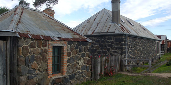
Walk along green reserves in Thomastown and explore the original German colonial village of Westgarthtown that includes the Ziebell Farmhouse, its colonial gardens, Lutheran cemetery and bluestone chapel, where the earliest German settlers established dairy farms. Walk where John Batman met with the local leaders of the Wurundjeri Indigenous people and made a contentious treaty with them in 1835. Reflect on the impressive contribution of these settlers to the formation of Victoria's wealth and diversity, achieved however by the dispossession of the Indigenous first peoples' lands and hunting fields.
GRADE | LENGTH | TYPE: Easy, approximately 7 km, circuit walk.
ACTIVITY DESCRIPTION:
From Thomastown station, we will walk down Main Street, then turn into Edgars Reserve that follows the Edgars Creek and has been re-planted extensively with native vegetation. Within Edgars Reserve, historians believe John Batman "negotiated" a treaty with the Wurundjeri people. We will walk up a pathway to the simple bluestone Lutheran chapel - the oldest operating Lutheran church building in Australia, dedicated in 1856. From the chapel, we'll cross the paddock to the original Ziebell Farmhouse. Ziebell's Farmhouse is open to the public, built between 1851 and 1856 with 61cm walls and is a typical German farmhouse design. Entry fee is $3 per person.
It is surrounded by the original, shady colonial garden that features still healthy 140 year old roses. We’ll have lunch in these gardens, then walk to the oldest Lutheran cemetery in Australia nearby, then onto a heritage walk to see the other German farmhouses that constituted the original village. We'll skirt a sports reserve and return to Edgars Reserve for our return to Thomastown station. We can have an afternoon tea either at a covered outdoor cafe on the heritage walk or back at a reasonable kiosk with seating at Thomastown station. We will catch the 3:35pm train to Flinders St.
MEETING TIME | LOCATION: 10am at Flinders St Station for the 10:08am Mernda train. We'll travel in the front carriage. Gathering time outside Thomastown station 10:50am.
MAP REFERENCE: Melway map 8 grid H5 | Google map goo.gl/maps/NnReL3xVAk84psyH9.
DISTANCE | TIME FROM GPO: 16 km, approximately 40 minutes by train.
TRANSPORT: By train as described above or car parking available at Thomastown station.
FOOD: Carry lunch, snacks and at least 1 litre of water.
APPAREL | FOOTWEAR: Comfortable walking boots/shoes and dress according to the weather forecast.
BOOKING: By Thursday 23rd April | Click on Get Tickets to register.
LEADER: Don V. | Email the Leader if you have any questions. Members can access leader contact details under Members | Leader Contacts when logged in to the website.
HOME BACK TO LIST OF EVENTS MEMBERSHIPS
Apr
18
2020
Past Event
Beginners Wilsons Promontory Overnight Walk - CANCELLED
18 Apr 2020 10:15 – 19 Apr 2020 17:00
This walk will be re-scheduled in Spring when we hope the virus crisis has abated.
See our Socialising Online page for ways to stay healthy.
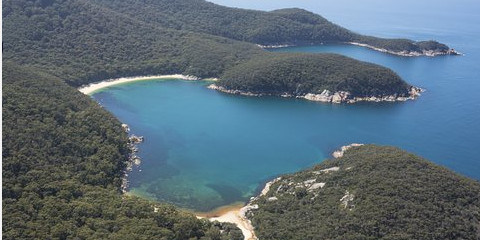
Walk the iconic Prom southern circuit around Sealers Cove, Refuge Cove, and Waterloo Bay with an overnight camping. This is for beginners, and experienced walkers alike. Please register interest ASAP to avoid missing out
GRADE | LENGTH | TYPE: Hard. The track is well formed, but we are walking 17.5 km each day with a pack on our backs, which makes it hard. For healthy people this is not a problem. We will be walking slowly. Numbers are limited to 8.
ACTIVITY DESCRIPTION:
This very scenic walk passes through rainforest and along beaches, with great views from peaks. The track is not difficult, and many people will have walked the section to Sealers Cove. The camp site is beautiful and there are basic drop toilets.
This walk is aimed at beginners. You do not need any special equipment as the leader has plenty to share. A detailed equipment list will be provided for people who have not done overnight walking before.
The walk is after Easter, and not in school holidays, so we will have the place to ourselves. Autumn is the best time at Wilsons Prom with warm sea temperatures and calm weather. If the weather forecast is very wet we will cancel the trip. The emphasis is on having a great experience, and learning to love overnight hiking.
The trip has the following stages:
Thursday 16th and Friday 17th (optional): Stay in a house at Yanakie close to the park entrance. Alternatively, you can drive down Friday night, or drive direct to the start of the walk on Saturday morning.
Saturday 18th: Telegraph Saddle to Refuge Cove via Sealers Cove: A 17.5 km walk along formed track (estimated 5 hours). We will aim to start at Telegraph saddle at 9:30am. If you are driving from central Melbourne on the Saturday morning you will have to leave at 6:30am.
Sunday 19th: Refuge Cove back to Telegraph Saddle via Waterloo Bay: 17.5 km along formed tracks (estimated 7 hours). Then we will drive directly back to Melbourne.
FURTHER INFORMATION: Park Notes: parks.vic.gov.au/places-to-see/parks/wilsons-promontory-national-park/where-to-stay/southern-overnight-hikes.
MEETING TIME | LOCATION: 10:15am at Telegraph Saddle car park on Saturday 18th April, or earlier if you wish, as outlined in the Activity Description above.
MAP REFERENCE: Melway map X928/628 grid C10 | VicRoads map 103 grid D7 | Google map goo.gl/maps/deXQjAAHQ9w. Detailed directions will be provided after the RSVP date.
DISTANCE | TIME FROM GPO: Approximately 225 km. Allow 3 hours drive to the start of the walk from central Melbourne.
PUBLIC TRANSPORT: Not available. We will maximise car-pooling.
COST: $7 pp to camp one night in the park. We will make a group booking 10 days before the walk. No need to pay until 5th April (but Get Ticket here ASAP to ensure you don't miss out on this unique opportunity).
FOOD: A list of suitable bushwalking food will be provided. We will prepare a communal meal on Saturday night for simplicity.
APPAREL | FOOTWEAR: Light comfortable walking footwear. An equipment list will be provided. Don’t worry if you don’t have specialist gear like stove, tent, pack, sleeping mat etc. We have loan-you gear, and since we are only going in good weather we don’t need to pack for snow storms.
BOOKING: ASAP or by Sunday 5th April if places remain. Click Get Tickets to reserve your place.
LEADER | BOOKING: Roger H. | by Sunday 5th April. Email the Leader if you have any questions. Members can access leader contact details under Members | Leader Contacts when logged in to the website.
HOME BACK TO LIST OF EVENTS MEMBERSHIPS

Apr
14
2020
Past Event
Play 500 cards with other Nomads members
19:00 – 21:00
Enjoy a 500 cards game online with other Nomads members from the comfort of your own living room.
GRADE: Easy, so long as you don't fall asleep.
ACTIVITY DESCRIPTION:
In these changing times we can still get together online to play cards together - thanks to the online application Trickster Cards, we plan to have a cards night. The game is 500 according to the standard Australian rules defined by: Rules of 500 in Trickster. If you are familiar with the game, the online version is intuitive and easy to play.
Please select Get Tickets in the normal way for this event. Then we will place you into a game with 4 people, and email you instructions prior to the game on Tuesday with your invitation to the game. Please provide some indication of your experience of the game (beginner, average or expert) so we can match up players. If at any time one of the players has had enough, you can exit the game and the program will provide a robot player to fill in.
There is a text facility to communicate between players during the game. The amount of table talk is up to you.
MEETING TIME | LOCATION: 7pm in your living room.
FOOD: Get a cup of your favorite beverage, and a snack before the game.
BOOKING: By midday on Tuesday 14th April. Click on Get Tickets to register. There is a limit of 16 players.
LEADER: Roger H. | Email the Leader if you have any questions. Members can access leader contact details under Members | Leader Contacts when logged in to the website.
HOME BACK TO LIST OF EVENTS MEMBERSHIPS
Apr
10
2020
Past Event
Annual Good Friday Cycling: Eltham to Fairfield via Main Yarra Trail - CANCELLED
Eltham Station
10:35 – 15:00
This event has been cancelled due to the COVID-19 virus. Read this ABC News article in which University of Sydney modelling demonstrates very clearly why staying at home at present can improve our outcome dramatically. Yes, we need to exercise, but for the next few weeks, the message could now not be clearer: Stay at home!
See our Socialising Online page for ways to stay healthy.
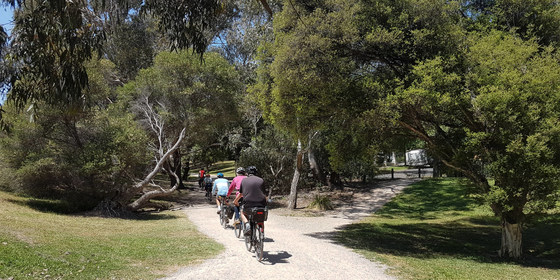
A scenic ride following the Diamond Creek, then the Yarra, from Eltham to Fairfield.
GRADE | LENGTH | TYPE: Relatively easy, 24 km point-to-point cycling with public transport links. This ride is best suited to hybrid or mountain bikes, as some sections of the route are unsealed. The route is relatively flat - as it follows waterways it tends to be slightly downhill, but there are some short uphill sections.
ACTIVITY DESCRIPTION:
Starting at Eltham Station, we’ll cycle a short distance along the Diamond Creek Trail then take a detour for a coffee at the Teapot Cafe, 1 Panther Pl, Eltham. Afterwards, we’ll continue along the Diamond Creek Trail to the junction with the Yarra River, then follow the Main Yarra Trail all the way to Fairfield for lunch, which will probably be at the Fairfield Park Boathouse. After lunch there are many cycling options for you to cycle home if you wish, otherwise there are train stations nearby such as Fairfield or Clifton Hill.
MEETING TIME | LOCATION: 10:35am at the Eltham Railway Station.
MAP REFERENCE: Melway map 21 grid J5 | Google map goo.gl/maps/r9FxToxpWs4t3sv1A.
DISTANCE | TIME FROM GPO: 27 km | 57 minutes by train.
TRANSPORT: The Hurstbridge line train that departs from Flinders Street platform 1 at 9:38am, or West Richmond at 9:51am, arrives in Eltham at 10:35am.
FOOD: lunch will be purchased in Fairfield. Bring 1 litre of drinking water.
APPAREL | FOOTWEAR: Bring your bike plus helmet, and dress according to the weather forecast. A spare tube is recommended, as tyre sizes vary considerably.
BOOKING: By Wednesday 8th April. Click on Get Tickets to register.
LEADER: Alan D. | Email the Leader if you have any questions. Members can access leader contact details under Members | Leader Contacts when logged in to the website.
HOME BACK TO LIST OF EVENTS MEMBERSHIPS

Apr
07
2020
Past Event
Winter Planning & Social Night - IN YOUR LOUNGE ROOM!
19:00 – 21:30
The Winter Planning and Social night will be taking place, but because all pubs are now closed, we will use the online Zoom facility to "meet" online. Bring along your dinner, and a beverage of choice, and join your Nomads friends online.
Our quarterly planning night, in conjunction with the regular monthly social night.
ACTIVITY DESCRIPTION:
Do you want to see more of a particular activity, or do you have a particularly favourite area of Victoria you would like to share with others? Do you have an idea for activities we can undertake while "locked down"? Come along to the planning meeting, and then stay for our monthly social evening where members talk about upcoming events, share a meal and compare notes on past activities. All members are welcome – you don't have to volunteer for an activity. New members are especially invited to this meeting as an orientation to Nomads activities.
MEETING TIME | LOCATION: 7pm | click on https://us04web.zoom.us/j/558088970 to join. Either sign in to Zoom or provide an alias. If asked, choose the Online Video and Computer Audio options. Check out our Zoom Tips page for some background to using Zoom. Just in case you're asked for it (unlikely), the Meeting ID is: 558 088 970.
BOOKING: not required, since we don't need to book the venue. Just click on https://us04web.zoom.us/j/558088970 after 7pm on Tuesday 7 April to attend.
LEADER: Garry O. | Email the Leader if you have any questions. Members can access leader contact details under Members -> Leader Contacts when logged in to the website.
See our Socialising Online page for some suggestions on ways to stay healthy during COVID-19.
HOME BACK TO LIST OF EVENTS MEMBERSHIPS
Mar
29
2020
Past Event
Bushrangers Bay to Cape Schanck Walk - CANCELLED
Bushrangers Bay Walking Track
11:00 – 16:00
** This event has been cancelled due to the COVID-19 pandemic in line with the Victorian Government's order to shut down all non-essential services and in particular for Melbournians to not travel unnecessarily to regional areas. The most reliable source of information about COVID-19 in this rapidly changing scenario is DHHS (Department of Health and Human Services).
See our Socialising Online page for ways to stay healthy.
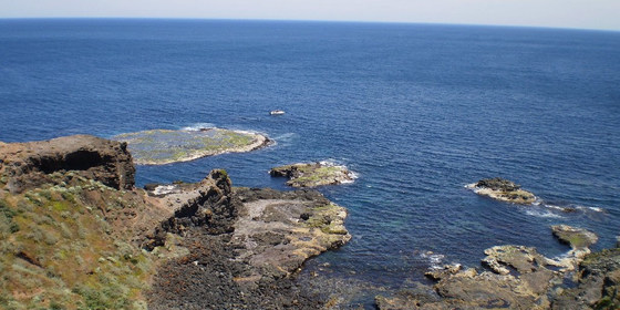
This is a spectacular trail skirting rugged coastline by the waters of Bass Strait.
GRADE | LENGTH | TYPE: Medium 13 km circuit walk.
ACTIVITY DESCRIPTION:
We follow the Main Creek Trail from the car park to Bushrangers Bay. The eucalypt forest gives way to shady thickets of coastal banksia and then to an isolated sandy beach at Bushrangers Bay. From there we follow the trail to Cape Schanck. We’ll have lunch near the 1850s Lighthouse. After lunch, we return the same way and then hopefully, time permitting, have coffee and cake at Flinders Bakehouse.
FURTHER INFORMATION: www.bushwalkingblog.com.au/cape-schanck-to-main-creek-return-mornington-peninsula-national-park-victoria-2/
MEETING TIME | LOCATION: 11am at the start of the Bushrangers Bay Walk and Cape Schanck Walk. When coming from Cape Schanck, this is in the car park on the right (not the first car park on the left) on Boneo Rd (C777: the Rosebud Flinders Rd) in the Mornington Peninsula National Park.
MAP REFERENCE: Melway map 259 grid K8 | UBD map 513 grid A7 | Google map goo.gl/maps/R48zXxjF9Ty.
DISTANCE | TIME FROM GPO: 109 km from Melbourne, allow 1.5 hours.
FOOD: Bring your own lunch and at least 1 litre of water.
APPAREL | FOOTWEAR: Sturdy walking footwear, dress for the weather forecast and bring a raincoat just in case!
BOOKING: By Thursday 26th March. Click on Get Tickets to register.
LEADER: Cahal F. | Email the Leader if you have any questions. Members can access leader contact details under Members | Leader Contacts when logged in to the website.
HOME BACK TO LIST OF EVENTS MEMBERSHIPS
Mar
28
2020
Past Event
Men's Naturist Weekend at a Lancefield Farm + optional Chewton Shed: CANCELLED
Lancefield
28 Mar 2020 11:30 – 30 Mar 2020 13:00
** This event has been cancelled due to the COVID-19 pandemic in line with the Victorian Government's order to shut down all non-essential services and in particular for Melbournians to not travel unnecessarily to regional areas. The most reliable source of information about COVID-19 in this rapidly changing scenario is DHHS (Department of Health and Human Services).
_________________
Enjoy a naturist weekend in the country. It starts with Saturday lunch followed by a nude walk, swim or relax depending on the weather. Evening BBQ and then a socialise around the open fire before sleeping overnight. Sunday: cooked breakfast, relax or walk around the farm, then optional nude social afternoon at the Chewton Shed.
GRADE | LENGTH | TYPE: Easy to medium depending on the activity you choose. Climbing the rocky outcrops on a neighbouring farm for good views requires reasonable fitness.
ACTIVITY DESCRIPTION:
SATURDAY
Arrive: at the farm between 11:30am and 12 noon.
Lunch: BYO lunch. If it is hot, bring a picnic type lunch. If it is cold you could buy a pie or sausage roll in Lancefield, or bring something from home. As well soup will be provided.
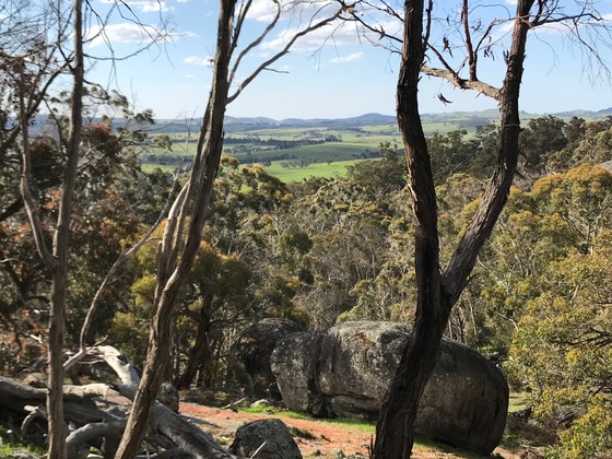
Afternoon Walk: probably about 2 to 3 hours. We could go to some new rocky outcrops on another neighbouring farm. These are quite impressive outcrops and give wonderful views of the surrounding countryside with its huge spherical granite boulders. If we're hot after our walk we could go for a swim in a large new waterhole not far from the farm house where the water is well over your head. Also there is a nice sandy beach to sunbake on together with easy entry to the water. If the weather is not amenable to a naturist walk and swim, we will do a partially clothed walk, or a car tour with short walks. Bring suitable clothes and a light weight rain jacket or umbrella if you think this may be necessary.
Afternoon tea. Bring something to share.
Evening BBQ: BYO meat and drinks. Salads supplied.
Sleeping: see below for sleeping options in the house. There are places for tents and camper vans if you would prefer.
SUNDAY
Breakfast: cooked breakfast
Walk: an easy walk along the creek near the house or elsewhere, or just relax at the house.
Lunch: left overs from Saturday or if the forecast is for a cool day, a casserole will be organised.
Leave the farm by 1pm to go to the Chewton Shed event.
SUNDAY Chewton Shed Nude Social Afternoon: Chewton 2 to 6pm
Afternoon Tea: bring something to share for afternoon tea. Fresh fruit (not cut up), sandwiches, soft drink are always popular.
Cost: $10 cash on the day for facilities, spa, small heated pool, massage workshop, jigsaws.
Info: for more details and to see who is going, go to www.meetup.com/Melbourne-COSMEX-Clothing-Optional-Swim-Massage-Exchange/events/268622916.
SUNDAY / MONDAY AFTER CHEWTON
Anyone who would like to come back to the farm is most welcome to stay there for Sunday night.
MEETING TIME | LOCATION: Arrive between 11.30am and 12 noon at the sheep farm 12 km north of Lancefield. The exact address will be emailed on Thursday 26th March to all those who have booked and paid.
MAP REFERENCE: Melway map 909 grid J8 | Google map goo.gl/maps/hrXrYy1gczTxAPHV9.
DISTANCE | TIME FROM GPO: 87 km, approximately 1 hour 20 minutes to drive.
COST:
COST FOR THE FARM EVENT:
For non-Nomads members: $10. Click on Get Tickets to book your place and pay.
For Nomads financial members: $5 for the farm host. Click on Get Tickets to book your place. You can either select a free farm event ticket and pay $5 cash to the farm host on the day, or purchase a $5 members ticket (the proceeds will then be transferred to the farm host).
COST FOR THE CHEWTON SHED:
$10 cash on the day (sorry no cards). This covers the cost for facilities, spa, small heated pool, massage workshop, jigsaws.
ACCOMMODATION OPTIONS:
2 bedrooms (made up beds): sleeps 4
Library room (carpeted floor): sleeps 3
Lounge rooms: sleeps 8
Total in the house: 15 persons
There are places for tents and camper vans if you would prefer.
APPAREL | FOOTWEAR | SLEEPING:
Comfortable walking boots/shoes, sunscreen, hat, dark glasses. Bring other clothes according to the weather forecast.
OTHER THINGS TO BRING: Saturday lunch items. Evening BBQ meat and drinks. Contributions for the afternoon teas (not too much, we don't eat a lot at these times).
SLEEPING: bring appropriate sleeping gear depending on where you are sleeping.
BOOKING:
FOR THE FARM EVENT: By Wednesday 25th March. Click on Get Tickets to register.
FOR THE FARM ACCOMMODATION: Send an email to our farm host at Accommodation Bookings to book your accommodation. Numbers are limited to 15 so that we can all fit around two large dining tables and also all sleep in the house if desired.
LEADER: Russell W. | Email Leader Russell if you have any questions. Members can access leader contact details under Members | Leader Contacts when logged in to the website.
HOME BACK TO LIST OF EVENTS MEMBERSHIPS
Mar
22
2020
Past Event
Sassafras Creek & Sherbrooke Forest Walk
688 Croydon Bus Departing From Upper Ferntree Gully Railway Station
10:27 – 16:00
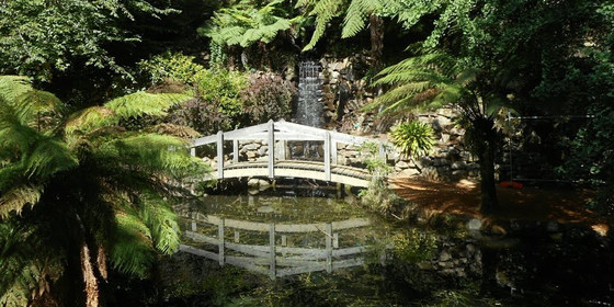
Enjoy a quintessential Dandenongs walk alongside creeks running through ferny gullies, through picturesque cool climate gardens, lunch at picnic grounds in a bush setting and take in the tall green forests along the way.
GRADE | LENGTH | TYPE: A moderate 11km point-to-point walk with a few short steep sections.
ACTIVITY DESCRIPTION: A bus journey from Upper Ferntree Gully takes us to Sassafras to commence our walk on the Sassafras Creek Track. We leave this track at the Alfred Nicholas Memorial Gardens to wander around the ornamental lakes then on past the adjoining Burnham Beeches art deco mansion. Leaving the gardens we enter Sherbrooke Forest to follow bush tracks through to Sherbrooke Falls. A short distance further is O'Donohue Picnic Ground where there are picnic tables in a bush setting for our lunch break. After lunch we take a quiet local road and bush tracks through the forest to Grants Picnic Ground. Coles Ridge Track leads off from the picnic ground and takes us through to Belgrave. To conclude our walk we pass by the Puffing Billy station to reach the Metro station to take a train to commence the return journey.
FURTHER INFORMATION: parks.vic.gov.au/places-to-see/parks/alfred-nicholas-memorial-gardens---gardens-of-the-dandenongs
MEETING TIME | LOCATION: Arrive in time to catch the 688 Croydon bus departing from Upper Ferntree Gully Railway Station at 10:27am.
MAP REFERENCE: Melway map 74 grid E6 | Google map goo.gl/maps/r3r6hjTUrG1VLpH38.
DISTANCE / TIME FROM GPO: The train journey between Flinders Street and Upper Ferntree Gully Stations takes one hour & twelve minutes. For driving directions, distance and time enter your starting location at goo.gl/maps/LRrGrWfuwcoHVccM8.
TRANSPORT: Access to and from this walk is by public transport only. We will catch the 688 Croydon bus departing from Upper Ferntree Gully Railway Station at 10:27am. Ample parking is available in the station carpark. For public transport from the city, take the Lilydale train which departs Flinders Street Railway Station at 9:06am and change at Ringwood for the connecting Belgrave train. Meet and travel with the group in the front carriage if you wish. The bus journey from Upper Ferntree Gully to Sassafras takes sixteen minutes. For the return journey we will take a train from Belgrave Station for a short eight minute trip to arrive at or pass through Upper Ferntree Gully Railway Station before 4:00pm. Continuing the train journey back to the city takes a further hour. All travel from the city is within myki zones 1 & 2 (zone 2 only if starting and ending at Upper Ferntree Gully) with weekend daily caps of $6.50 full fare, $3.25 concession and free for seniors.
FOOD: Carry lunch, snacks and water for your needs throughout the day.
APPAREL | FOOTWEAR: Wear comfortable walking boots/shoes and dress to meet the forecast weather conditions.
BOOKING: This event is limited to a maximum of 12 participants. Obtaining a ticket from The Nomads website is essential. Visitor tickets are available up to Thursday 19th March unless shown on the website as "Sold Out". Members are encouraged to obtain their ticket by Thursday 19th March however member free tickets will remain available after this date unless shown on the website as "Sold Out" or "Sale Ended". Please confirm that you have obtained a ticket by visiting thenomadsinc.tidyhq.com/member/events or by checking your "Order confirmation" email.
LEADER: Peter Tocknell | Email the Leader if you have any questions. Members can access leader contact details under Members->Leader Contacts when logged in to the website.
HOME BACK TO LIST OF EVENTS MEMBERSHIPS
Mar
21
2020
Past Event
Naturist Walking and Camping Weekend - Upper King Valley
14 Mair St
21 Mar 2020 09:00 – 22 Mar 2020 18:00
Sandstone gorges, swimming holes and the occasional spectacular view – with minimalist camping and clothing.
GRADE | TYPE: Saturday day walk is of hard grade, involving extensive wading through shallow water on a bed of slippery rocks, also occasional deep-water wading and some rock scrambling.
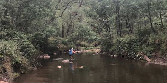
The Saturday day walk is along the bed of Stony Creek, heading west from near Little Paradise Falls. Although its return distance is only about 5 km, it requires you to have at least moderate fitness and physical agility, and to be prepared for accidental (because of slippery rocks underfoot) full immersion of body and day pack. You may therefore need to take waterproofing precautions for at least some of the contents of your day pack.
The Sunday day walk will be easier, and probably will not require you to take waterproofing precautions.
ACTIVITY DESCRIPTION:
This is a naturist event, consisting of two day walks and a Saturday-night camp, in the Alpine National Park, about 20 km south of Whitfield in north-east Victoria. The Saturday out-and-back day walk will be frequently a wade (and possibly an accidental swim) along a rocky river bed to a remote swimming hole for lunch, with a return distance of about 5 km. The Sunday day walk will be of an easier grade, aiming for a mid-afternoon finish.
Overnight camping on Saturday night will involve a 100m walk-in. Because of this, and also because the nearby carpark accommodates a maximum of three cars, bringing only essential and compact camping equipment is a must.
MEETING TIME | LOCATION: 9am Saturday 21st March at the park next to Benalla Information Centre, 14 Mair St, Benalla. If you prefer to come up on the Friday evening, there is limited overnight accommodation available in Benalla.
MAP REFERENCE: Melway map X910 grid V1 | Google map goo.gl/maps/wuo6DAs7XchU64oh7.
DISTANCE | TIME FROM GPO TO MEETING PLACE: 214 km, 2 hours 20 minutes via M31.
TRANSPORT:
Because the location’s carpark accommodates a maximum of three cars, carpooling – meaning at least four persons per vehicle – is a requirement of this trip. If you are driving from Melbourne with fewer than four persons on board, you will need either to pick up passengers (and their gear) in Benalla, or to leave your car there for the weekend (there is unrestricted weekend parking on one side of Mair St), and be transported, with your gear, in someone else’s car.
APPAREL | FOOD | FOOTWEAR
Saturday day walk list:
day pack, made of nylon or other non-absorbent material
shoes, lightweight hiking boots or sandals (not thongs) with good grip on the sole. Waterproofness (or not) is unimportant – in any event, your shoes will be dripping wet by the end of the day. (A second pair of “dry” shoes – NOT carried in your day pack – will therefore be required for Saturday evening and also for the Sunday day walk).
lunch, snacks and 2 litres of water
sunscreen, hat etc
shorts, for carpark and environs
gaiters, for protection against blackberries growing along the river’s banks
drybags or waterproof containers for phones, etc, that you are taking on the walk
towel (optional, must be dry-bagged)
warm clothes (optional, must be dry-bagged)
Saturday evening camp and Sunday day walk list:
tent, sleeping-bag, sleeping-mat etc. Because of limited cargo space in the three vehicles, your total luggage for the weekend should not exceed one large hiking pack (or equivalent), plus one day pack.
picnic rug, for sitting on (bringing folding chairs is not recommended, unless they are super compact)
a second pair of sturdy shoes (that did NOT get wet on the Saturday day walk)
personal items, toiletries, toilet paper and trowel
head torch
warm clothes for evening and overnight
shorts, for carpark and environs (possibly including – but hopefully not –around our campsite also)
Saturday night dinner (and camping stove and fuel, if you are not sharing someone else’s), plus water or other beverages
cup, plate and cutlery
Sunday breakfast
(in day pack) lunch, snacks and 1.5 litres of water
(in day pack) sunscreen, hat etc
BOOKING: By Tuesday 17th March. Click on Get Tickets to register. The event is limited to 11 participants.
The planned event/walk will be cancelled on the evening of Wednesday 18th March if:
(a) the likely fire danger will be too high, or
(b) river levels will be too high (unlikely), or
(c) the weather forecast for that weekend is for unseasonably cold weather.
LEADER: Paul W. | Email the Leader if you have any questions. Members can access leader contact details under Members | Leader Contacts when logged in to the website.
Image: Russell W.
HOME BACK TO LIST OF EVENTS MEMBERSHIPS
Mar
09
2020
Past Event
Daylesford to Sailors Falls Circuit Walk
Lake Daylesford
10:00 – 16:00
Cap off your long weekend at ChillOut Festival with this scenic walk in the goldfields/mineral springs region, or alternatively, do part or all of it as a day walk.
GRADE | LENGTH | TYPE: Easy 5 or 9 km point-to-point walk or moderate 19 km circuit walk. This walk will be done in three stages and, by arrangement with the leader, you will be able to join or leave it at any of Lake Daylesford, Jubilee Lake or Sailors Falls.
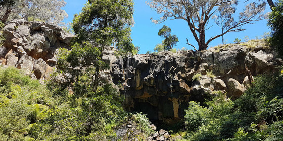
ACTIVITY DESCRIPTION: This very scenic walk passes by lakes and a small waterfall, through many forests, some farmlands and goldfield remnants. Virtually all of the walk is on well formed, signed trails, though in places the surface is a little rough. There are some short climbs, steep at times, but for the most part the route is relatively flat. There are several creek crossings where you can normally step across, but if rain has fallen in the lead up to the walk, you could get wet feet.
The walk consists of three separate components – it's your choice whether you do one, two or all three of them (though you should notify the leader if you don't expect to do all three stages so that appropriate transport can be organised):
STAGE ONE: 5 km – Lake Daylesford to Jubilee Lake: after walking around the lake we follow a couple of short streets to join the Great Dividing Trail which takes us around Cornish Hill and along a former railroad track to the Jubilee Lake Holiday Park, where some of us will have camped for the ChillOut Festival Weekend Camping. We'll rest there for refreshments at the excellent cafe.
STAGE TWO: 5.2 km – Jubilee Lake to Sailors Falls: after refreshments at the Jubilee Lake Cafe, we'll head off through some heavily wooded areas. We'll be mostly heading due south, first along the Great Dividing Trail, then the Three Lost Children Trail. The end of the trail pops out directly opposite the Sailors Falls picnic area, a perfect lunch location, where you can taste some "lemonade like" natural spring water. Anybody who plans to only do the third stage of the walk could arrive early and do some of the walks to and around the falls, though we will visit the falls at the start of the third stage.
STAGE THREE: 9 km – Sailors Falls to Daylesford: from the visitor shelter we'll take the steel stairs down to Sailors Falls. Afterwards, we'll follow the Wallaby Track and Goldfields Track back to Daylesford. On reaching the outskirts of Daylesford we'll divert along a narrow track to follow the pretty Wombat Creek, which eventually takes us back to Lake Daylesford via a couple of operational mineral springs.
FURTHER INFORMATION:
Bushwalking Victoria: Daylesford Forests, Lakes and Falls.
This walk, along with the Nomads ChillOut Morning Community Bushwalk and the Nomads Mixed Naturist Bushwalk and optional swim on Saturday 7th March, forms part of the ChillOut Festival Camping Weekend, where you can camp at the Jubilee Lake Holiday Park and participate in some of the Nomads walks and ChillOut Festival activities. If you are not a Nomads member but plan to attend more than one Nomads ChillOut Weekend activity, we suggest you take out a 1 month temporary membership (cost $8) prior to booking any events, to avoid paying the visitor fees.
MEETING TIME | LOCATION:
10am beside the Bookbarn Cafe at the Lake Daylesford car park, 2 Leggatt St, Daylesford.
11.30am approximately at the cafe of the Jubilee Lake Holiday Park.
1pm approximately at the visitor shelter of the Sailors Falls Mineral Springs, Ballan-Daylesford Rd, Sailors Falls.
MAP REFERENCE: Melway map X909 grid C9 | Google map - see MEETING TIME | LOCATION above.
DISTANCE | TIME FROM GPO: Via Western Fwy 118 km, 1 hour 25 minutes | via Calder Fwy 117 km, 1 hour 30 minutes.
FOOD: Carry lunch, snacks and at least 1 litre of water. You will be able to sample natural spring water in the second and third walk stages.
APPAREL | FOOTWEAR: Comfortable walking boots/shoes and dress according to the weather forecast. Depending on recent rainfall, you may get wet feet in some creek crossings. Some sections contain sharp rocks.
BOOKING: by Friday 6th March | click on Get Tickets to book.
The ChillOut weekend consists of a number of Nomads events. If you are not a Nomads member but plan to attend more than one Nomads ChillOut Weekend activity, we suggest you take out a 1 month temporary membership (cost $8) prior to booking for the events you wish to attend, to avoid paying multiple visitor fees. Once you have taken out your membership, to confirm your bookings select Get Tickets on each event that you wish to attend.
LEADER: Robert H. and Alan D. | Email Alan or email Robert if you have any questions. Members can access leader contact details under Members | Leader Contacts when logged in to the website.
HOME BACK TO LIST OF EVENTS MEMBERSHIPS
Mar
07
2020
Past Event
Mixed Naturist Bushwalk with optional Swim, Chillout Weekend
31 East St
14:15 – 17:00
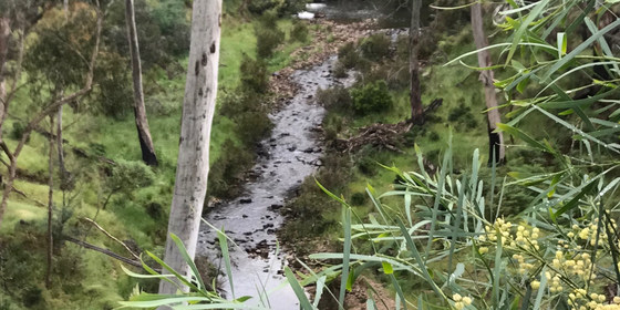
Enjoy a pleasant clothes-free stroll in the forest followed by an optional swim, during the ChillOut Festival weekend at Daylesford.
GRADE | LENGTH | TYPE: Easy to medium, approximately 3.5 km circuit walk.
ACTIVITY DESCRIPTION:
This event is for naturists. Enjoy a pleasant clothes-free stroll through the tall trees and along the picturesque creeks in the forest near Daylesford. A good chance for a chat, or just enjoy the pleasure of being in the forest, without clothes. The country is generally undulating, though there are a couple of short steep sections. The walk should finish by about 4:30pm. We can head then for our swimming place and can swim until about 5:30 to 6pm when some of us will need to return to Daylesford for the Saturday night activities.
The swimming place is about 10 minutes drive from Daylesford. People can leave from the swimming place whenever they need to return to Daylesford.
FURTHER INFORMATION: This walk, along with the Nomads Chillout Saturday Morning Community Bushwalk on Saturday 7th March and the Nomads Daylesford to Sailors Falls Circuit Walk on Monday 9th March, forms part of the ChillOut Festival Camping Weekend, where you can camp at the Jubilee Lake Holiday Park and participate in some of the ChillOut Festival activities. If you are not a Nomads member but plan to attend more than one Nomads ChillOut Weekend activity, we suggest you take out a 1 month temporary membership (cost $8) prior to booking any events, to avoid paying the visitor fees.
MEETING TIME | LOCATION: 2.15pm at Bolton's Takeaway, 31A East St, Daylesford. There is plenty of parking on the vacant grassy block on the SE corner of East St and Mink St. This shop is 1.2 km east of Vincent St (Daylesford's main street). If you would like a lift from Daylesford, send a message to 0417 311 710, or post a comment on Meetup and we will try to arrange a ride for you.
MAP REFERENCE: Melway map X909 grid C9 | Google map goo.gl/maps/ETcZnnjGD1R2.
DISTANCE | TIME FROM GPO: 114 km | 1 hour 25 minutes.
TRANSPORT: provide transport details here, if appropriate.
COST: Free for Nomads members, $5 for non-members. However if you are a non-member and have paid your $10 for the Morning Chillout walk, you can come along for free. Click on Get Tickets to register to attend.
FOOD: You may wish to bring about 600ml of water. However as the walk is relatively short you may just wish to have a drink before we depart, and have another when we return to the cars for a snack and a drink. Food is not required but you can take a snack if you like.
APPAREL | FOOTWEAR: Sunscreen, hat, dark glasses, repellent (maybe). Wear comfortable walking shoes/boots. Shorts etc. for the start and end of the walk. A small towel to dry off after the swim.
BOOKING: Preferably by Friday 6th March. Click on Get Tickets to register.
The ChillOut weekend consists of a number of Nomads events. If you are not a Nomads member but plan to attend more than one Nomads ChillOut Weekend activity, we suggest you take out a 1 month temporary membership (cost $8) prior to booking for the events you wish to attend, to avoid paying multiple visitor fees. Once you have taken out your membership, to confirm your bookings select Get Tickets on each event that you wish to attend.
LEADER | BOOKING: Jason T. | Email the Leader if you have any questions. Members can access leader contact details under Members | Leader Contacts when logged in to the website.
HOME BACK TO LIST OF EVENTS MEMBERSHIPS
Mar
07
2020
Past Event
Chillout Saturday Morning Community Bushwalk
Bryces Flat Picnic Area
10:15 – 12:45
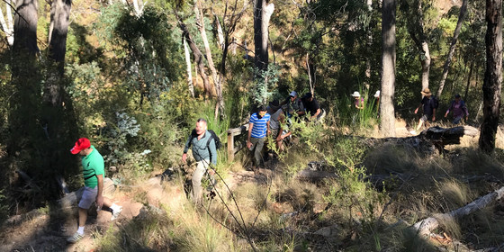
Join The Nomads for a walk during the ChillOut Festival in the bush along the picturesque Sailors Creek with views to the mountains beyond.
GRADE | LENGTH | TYPE: Easy, approximately 4 km, circuit walk.
ACTIVITY DESCRIPTION:
The walk is approximately 4 km long and is done at a relaxed pace, though it does have a couple of short steep sections. We will stop for a break and refreshments in the forest. Bring water, hat, apply sunscreen, wear sensible shoes. A good chance to make new friends.
FURTHER INFORMATION: This walk, along with the Nomads Mixed Naturist Bushwalk and optional Swim on Saturday 7th March and the Nomads Daylesford to Sailors Falls Circuit Walk on Monday 9th March, forms part of the ChillOut Festival Camping Weekend, where you can camp at the Jubilee Lake Holiday Park and participate in some of the ChillOut Festival activities.
MEETING TIME | LOCATION: 10:15am at Bryces Flat Picnic Area, 150 metres past 137 Bald Hill Rd, Hepburn, on the left hand side. It is 6 km and 10 minutes drive from the Daylesford Town Hall.
FOOD: Refreshments - drinks, fruit & snacks (included in the fee), will be provided at the halfway point.
COST: $10 for visitors and $5 for Nomads Members.
APPAREL | FOOTWEAR: Comfortable walking boots/shoes and dress according to the weather forecast.
BOOKING: Preferably by Friday 6th March. | Click on Get Tickets to book.
The ChillOut weekend consists of a number of Nomads events. If you are not a Nomads member but plan to attend more than one Nomads ChillOut Weekend activity, we suggest you take out a 1 month temporary membership (cost $8) prior to booking for the events you wish to attend, to avoid paying multiple visitor fees. Once you have taken out your membership, to confirm your bookings select Get Tickets on each event that you wish to attend.
LEADER: Russell W. | Email the Leader if you have any questions. Members can access leader contact details under Members | Leader Contacts when logged in to the website.
HOME BACK TO LIST OF EVENTS MEMBERSHIPS
