

The Nomads Outdoors Group Inc.
Powered by
Past events
All events
Past events
Aug
09
2020
Past Event
Lollipop Creek & Werribee River Walk - CANCELLED
Southern Cross Station
10:30 – 16:00
Due to the COVID-19 restrictions currently in force by the Victorian Government, this event has been cancelled but will occur on a future date yet to be advised. Please check our website regularly for updates. See our SOCIALISING ONLINE page for some suggested activities during the lockdown period.
Enjoy a gentle walk alongside Lollipop Creek & Werribee River. Limit of 10 participants.
GRADE | LENGTH | TYPE: An easy 10 km point-to-point walk with public transport links.
ACTIVITY DESCRIPTION:
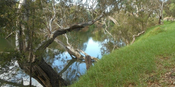
This urban walk follows creek, floodway and river reserves which offer a combination of parkland and natural landscapes to enjoy along the way. Our walk commences at Wyndham Vale Railway Station with a short stroll through Manor Lakes Linear Park which takes us into the Lollipop Creek Reserve. The walk along the Lollipop Creek Trail takes in some of the re-vegetation and conservation measures along the waterway and surrounding wetlands. The croaking of frogs and chirping of birds are likely to be heard coming from the creek and wetlands. Approximately 4 km into the walk we leave Lollipop Creek to follow a path along grassy open space and floodway to reach the Werribee River Linear Reserve. For the remainder of the walk we will follow the Werribee River passing by natural vegetation including some impressive River Red Gums. On reaching Werribee the trail passes under the railway line near the station. Trains depart Werribee Railway Station every 20 minutes for the 50 minute journey back to the city.
MEETING TIME | LOCATION: In the front carriage of the Waurn Ponds train departing Southern Cross Railway Station at 10:30am or meet the group en route by arrangement with the event leader.
MAP REFERENCE: Melway map 43 grid E9 | Google map goo.gl/maps/bCGTVY7pXX72.
DISTANCE / TIME FROM GPO: The walk commences at Wyndham Vale Railway Station which is 40 km and 35 minutes by train from the city. Our return journey takes 50 minutes from Werribee Railway Station which is 32 km from the city.
TRANSPORT: Access to and from this walk is by public transport only. We will travel to Wyndham Vale Railway Station in the front carriage of the Waurn Ponds train departing Southern Cross Railway Station at 10:30am or you may choose to meet the group en route by arrangement with the event leader. For the return journey trains depart Werribee Railway Station every 20 minutes. All travel is within myki zones 1 & 2 with weekend daily caps of $6.50 full fare, $3.25 concession and free for seniors.
FOOD: Carry lunch, snacks and water for your needs throughout the day.
APPAREL | FOOTWEAR: Wear comfortable walking boots/shoes and dress to meet the forecast weather conditions.
BOOKING: This event is limited to a maximum of 10 participants. Obtaining a ticket from The Nomads website is essential. Visitor tickets are available up to Thursday 6th August unless shown on the website as "Sold Out". Members are encouraged to obtain their ticket by Thursday 6th August however member free tickets will remain available after this date unless shown on the website as "Sold Out" or "Sale Ended". Please confirm that you have obtained a ticket by visiting thenomadsinc.tidyhq.com/member/events or by checking your "Order confirmation" email.
LEADER: Peter Tocknell - Email the Leader if you have any questions. Members can access leader contact details under Members->Leader Contacts when logged in to the website.
HOME BACK TO LIST OF EVENTS MEMBERSHIPS
Aug
07
2020
Past Event
The Nomads Games & Trivia Night (Online) - Friday 7th August
19:30 – 21:30
Join us for an exciting evening of fun with fellow Nomads members and friends right in the safety and comfort of your own home! Bring your virtual food and drinks and get ready for 2 hours of socialising and play. The theme topic for the event is Melbourne City.
Play in teams as you try and outsmart your opponents with an online Trivia Game about our city's history and facts!
A game of Family Feud (Jeopardy) as teams compete to guess the top responses to some Melbourne surveys!
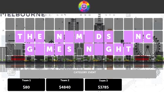
Play several real time games of Wheel of Fortune with 3 teams guessing famous Melbourne events, people and places!
ACTIVITY DESCRIPTION:
Play starts at 7:30pm when everyone will be placed into teams. Ensure you register for this event in order to receive an email with your link so you can join on the night! We will be using the online Zoom application to run this event!
TO BOOK:
Click Get Tickets so you get an invitation email on the day with your link to join the game.
If you haven't used Zoom before, be sure to register for a 'free zoom' account prior so we can place you into teams. See: https://zoom.us/freesignup/
TO PLAY:
At 7:30pm on Friday 7th August, click on the link in your invitation email. (Tip: add a reminder in your phone)!
Once you've joined sit back and relax. Your quiz and game master will run all the behind the scenes work.
LEADER: Jason T. | Email the Leader if you have any questions. Members can access leader contact details under Members | Leader Contacts when logged in to the website.
HOME BACK TO LIST OF EVENTS MEMBERSHIPS

Aug
04
2020
Past Event
Monthly Social Night - August: online via Zoom
20:00 – 21:30
Our regular monthly social night - this event won't be able to proceed at the Mount View Hotel, due to the COVID-19 lockdown, so we will have a Zoom catch up instead. Register via GET TICKETS and we will email you the Zoom link on the day, to enable you to attend online.
ACTIVITY DESCRIPTION:
Join us for our monthly social evening where members can enjoy a meal, talk about upcoming events, compare notes on past activities and float ideas on events they would like to see run.
MEETING TIME | LOCATION: 8pm | online via Zoom. The Zoom link will be emailed on Tuesday to those who registered via Get Tickets.
BOOKING: By Monday 3rd August. Click on Get Tickets to book.
LEADER: Garry O. | Email the Leader if you have any questions. Members can access leader contact details under Members | Leader Contacts when logged in to the website.
HOME BACK TO LIST OF EVENTS MEMBERSHIPS
Jul
28
2020
Past Event
Play 500 Cards with fellow Nomads - Tuesday 28 July
20:00 – 21:30
Although locked down at home, you can still socialise online with Nomads friends. Groups of up to four players per game can play 500 online - and with video and sound enabled, it's almost like being in the same room!
ACTIVITY DESCRIPTION:
During the lockdown period, we are scheduling games of 500 each Tuesday at 8pm (except for Tuesday 4th August when there will be a Social Night get together via Zoom). Go to Online Games for more instructions (and to schedule yourself into a particular game if you wish).
Trickster Cards works well and we've set up a scheduler spreadsheet for you to link up with other Nomads, and even initiate new games of 500, Bridge, Euchre, Hearts, Oh Hell, Pinochle, Spades or Whist at other times if you want to, so that others can join you.
For some other ideas of things to do during lockdown, see Socialising Online.
TO BOOK:
Click Get Tickets and you will get a reminder email on the day with your link to join the game.
Clicking Get Tickets is all you need to do, but if you'd like to schedule yourself into a particular game, go to Online Games (you need to log in to the Nomads website to see this page), click BOOK A GAME and enter your name for the date and time you want.
TO PLAY:
At 8pm on Tuesday 28 July, click on the link in your reminder email. (Tip: add an alert into your phone so you don't forget)!
Once you've joined the game, click on Add Video then click Add.
(If you only want to use audio, select Yes beside Or connect voice-only before you click Add).
TROUBLE SHOOTING:
If you didn't get the reminder email with the link (and it's not in your Spam or Promotions folder):
Go to Online Games (you need to log in to the Nomads website to see this page) and click on BOOK A GAME to get the 5-character code for your pre-booked game.
Go to TricksterCards.com and click on Play at the top right.
Click on 500 (or whichever game you want to play).
Click JOIN a game with friends.
Click I have an Invite to a Game then enter or paste in the 5-character code.
Click Add Video then click Add.
LEADER: Alan D. | Email the Leader if you have any questions. Members can access leader contact details under Members | Leader Contacts when logged in to the website.
HOME BACK TO LIST OF EVENTS MEMBERSHIPS
Jul
26
2020
Past Event
Bayside Walk from Sandringham to Mordialloc - CANCELLED
Flinders Street Railway Station
10:12 – 16:00
Due to the COVID-19 restrictions currently in force by the Victorian Government, this event has been cancelled but will occur on a future date yet to be advised. Please check our website regularly for updates. See our SOCIALISING ONLINE page for some suggested activities during the lockdown period.
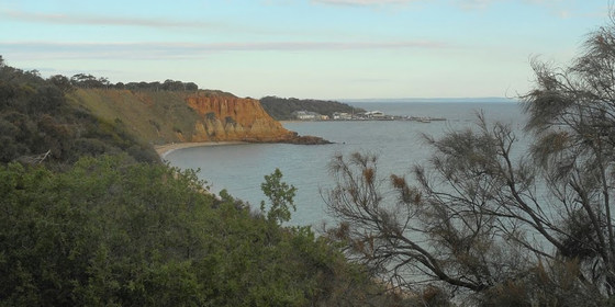
Bay views and beaches feature in this walk with many points of interest to enjoy along the way including Red Bluff Lookout and Ricketts Point Marine Sanctuary. Limit of 10 participants.
This walk forms part of our Winter Bayside Walks: 17 June: City to St Kilda | 1 July: St Kilda to Sandringham | 26 July: Sandringham to Mordialloc.
GRADE | LENGTH | TYPE: A moderate 12 km point-to-point walk with public transport links. The walk includes some short steep paths and steps as we cross between beaches and cliff tops.
ACTIVITY DESCRIPTION:
Our walk commences at Sandringham Railway Station with just a short stroll to reach the bay. The first section of the walk includes cliff top views as we walk along the sandy cliff top tracks of the coastal reserves. As the walk progresses we’ll also walk along beaches and beachside paths. Some steps and short steep paths will be encountered as we move between beaches and cliff tops. We’ll walk through to Mordialloc passing through the beaches of Beaumaris, Mentone and Parkdale. Our walk finishes at Mordialloc Railway Station with trains departing every 10 minutes for the 50 minute journey back to the city.
MEETING TIME | LOCATION: In the front carriage of the Sandringham train departing Flinders Street Railway Station at 10:12am or meet the group en route by arrangement with the event leader.
MAP REFERENCE: Melway map 43 grid H9 | Google map goo.gl/maps/NMdRVJfVevp.
DISTANCE / TIME FROM GPO: Sandringham Railway Station is 19km from the city and takes 30 minutes by train. Our return journey takes 50 minutes from Mordialloc Railway Station which is 27km from the city.
TRANSPORT: Access to and from this walk is by public transport only. We will travel to Sandringham Railway Station in the front carriage of the Sandringham train departing Flinders Street Railway Station at 10:12am or you may choose to meet the group en route by arrangement with the event leader. For the return journey trains depart Mordialloc Railway Station every 10 minutes. All travel is within myki zones 1 & 2 with weekend daily caps of $6.50 full fare, $3.25 concession and free for seniors.
FOOD: Carry lunch, snacks and water for your needs throughout the day.
APPAREL | FOOTWEAR: Wear comfortable walking boots/shoes and dress to meet the forecast weather conditions.
BOOKING: This event is limited to a maximum of 10 participants. Obtaining a ticket from The Nomads website is essential. Visitor tickets are available up to Thursday 23rd July unless shown on the website as "Sold Out". Members are encouraged to obtain their ticket by Thursday 23rd July however member free tickets will remain available after this date unless shown on the website as "Sold Out" or "Sale Ended". Please confirm that you have obtained a ticket by visiting thenomadsinc.tidyhq.com/member/events or by checking your "Order confirmation" email.
LEADER: Peter Tocknell - Email the Leader if you have any questions. Members can access leader contact details under Members->Leader Contacts when logged in to the website.
HOME BACK TO LIST OF EVENTS MEMBERSHIPS
Jul
21
2020
Past Event
Play 500 Cards with fellow Nomads - Tuesday 21 July
20:00 – 21:30
Although locked down at home, you can still socialise online with Nomads friends. Groups of up to four players per game can play 500 online - and with video and sound enabled, it's almost like being in the same room!
ACTIVITY DESCRIPTION:
Go to Online Games to register, and for more instructions.
During the lockdown period, we are scheduling games of 500 each Tuesday at 8pm (except for Tuesday 4th August when there will be a Social Night get together via Zoom).
Trickster Cards works well and we've set up a scheduler spreadsheet for you to link up with other Nomads, or even to initiate new games of 500, Bridge, Euchre, Hearts, Oh Hell, Pinochle, Spades or Whist at other times so that others can join you.
For some other ideas of things to do during lockdown, see Socialising Online.
TO BOOK:
Click Get Tickets so you get a reminder email on the day with your link to join the game.
Go to Online Games (you need to log in to the Nomads website to see this page).
Click BOOK A GAME and enter your name into the next available slot.
TO PLAY:
At 8pm on Tuesday 21 July, click on the link in your reminder email. (Tip: add a reminder in your phone)!
Once you've joined the game, click on Add Video then click Add.
(If you only want to use audio, select Yes beside Or connect voice-only before you click Add).
TROUBLE SHOOTING:
If you didn't get the reminder email with the link (and it's not in your Spam or Promotions folder):
Go to Online Games (you need to log in to the Nomads website to see this page) and click on BOOK A GAME to get the 5-character code for your pre-booked game.
Go to TricksterCards.com and click on Play at the top right.
Click on 500 (or whichever game you want to play).
Click JOIN a game with friends.
Click I have an Invite to a Game then enter or paste in the 5-character code.
Click Add Video then click Add.
LEADER: Alan D. | Email the Leader if you have any questions. Members can access leader contact details under Members | Leader Contacts when logged in to the website.
HOME BACK TO LIST OF EVENTS MEMBERSHIPS
Jul
19
2020
Past Event
Babbington Hill Walk, Lyonville: rescheduled to 6 September
Tram Street & C317
11:00 – 16:00
Due to the COVID-19 restrictions currently in force by the Victorian Government, this event has been rescheduled to Sunday 6 September. Please check our website regularly for updates. See our SOCIALISING ONLINE page for some suggested activities during the lockdown period.
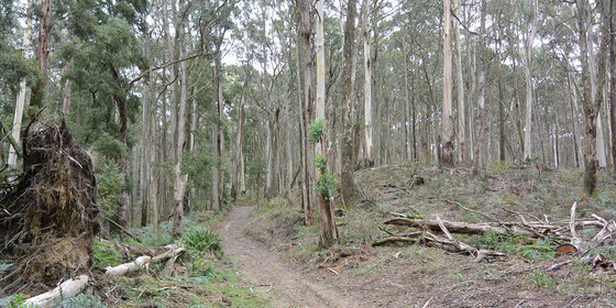
A climb to the top of Babbington Hill in the Wombat State Forest, passing by a hidden reservoir and an historic mineral spring.
GRADE | LENGTH | TYPE: Moderate 9.7 km circuit walk.
ACTIVITY DESCRIPTION:
This scenic walk highlights some of the interesting history of Lyonville, located in the Daylesford Spa Country. The farmlands at the start quickly give way to the densely treed Wombat State Forest, which is what originally attracted James Lyon, after whom the town is named, to build large saw mills in the region. We pass by, and hopefully around, the Bullarto Reservoir then climb Babbington Hill (822m) before descending to the historic Lyonville Spring to taste its waters. The walk will end at the starting point, but attendees will then be invited to go to the nearby Radio (Radium) Springs Hotel, once owned by Ernie Sigley, that will hopefully be able to welcome us for after-walk refreshments and a little more history. If it's not open, a plan B will ensure you get some refreshments prior to heading back home.
FURTHER INFORMATION: Bushwalking Victoria: Babbington Hill Wombat State Forest.
MEETING TIME | LOCATION: 11am on the corner of Tram St and the C137 Daylesford-Trentham Rd.
MAP REFERENCE: Melway map X909 grid D10 | Google map goo.gl/maps/AcrfAxJF7GPZj8Pt6.
DISTANCE | TIME FROM GPO: 102 km, approximately 1 hour 15 minutes via Calder Fwy/M79 to Woodend, then follow directions to Daylesford, taking the Tylden-Woodend Rd, then the C318 Kyneton-Trentham Rd, and finally the C317 Trentham-Daylesford Rd to Lyonville.
PUBLIC TRANSPORT: Take the 9:02am Echuca train from Southern Cross to Woodend, then transfer to the Daylesford coach service, arriving at Main St/Daylesford-Trentham Rd, Lyonville at 10:46am.
FOOD: Carry lunch, snacks and a litre of water.
APPAREL | FOOTWEAR: Comfortable walking boots/shoes and dress according to the weather forecast. Lyonville can be several degrees cooler than Melbourne.
BOOKING: By Thursday 16th July. Click on Get Tickets to register.
LEADER: Robert H. | Email the Leader if you have any questions. Members can access leader contact details under Members | Leader Contacts when logged in to the website.
HOME BACK TO LIST OF EVENTS MEMBERSHIPS
Jul
14
2020
Past Event
Play 500 Cards with fellow Nomads
20:00 – 21:30
Although locked down at home, you can still socialise online with Nomads friends. Groups of up to four players per game can play 500 online - and with video and sound enabled, it's almost like being in the same room!
ACTIVITY DESCRIPTION:
Go to Online Games to register, and for more instructions.
During the lockdown period, we are scheduling games of 500 each Tuesday at 8pm (except for Tuesday 4th August when there will be a Social Night get together via Zoom).
Trickster Cards works well and we've set up a scheduler spreadsheet for you to link up with other Nomads, or even to initiate new games of 500, Bridge, Euchre, Hearts, Oh Hell, Pinochle, Spades or Whist at other times so that others can join you.
For some other ideas of things to do during lockdown, see Socialising Online.
TO BOOK:
Click Get Tickets so you get a reminder email on the day with your link to join the game.
Go to Online Games (you need to log in to the Nomads website to see this page).
Click BOOK A GAME and enter your name into the next available slot.
TO PLAY:
At 8pm on Tuesday 14 July, click on the link in your reminder email. (Tip: add a reminder in your phone)!
Once you've joined the game, click on Add Video then click Add.
(If you only want to use audio, select Yes beside Or connect voice-only before you click Add).
TROUBLE SHOOTING:
If you didn't get the reminder email with the link (and it's not in your Spam or Promotions folder):
Go to Online Games (you need to log in to the Nomads website to see this page) and click on BOOK A GAME to get the 5-character code for your pre-booked game.
Go to TricksterCards.com and click on Play at the top right.
Click on 500 (or whichever game you want to play).
Click JOIN a game with friends.
Click I have an Invite to a Game then enter or paste in the 5-character code.
Click Add Video then click Add.
LEADER: Alan D. | Email the Leader if you have any questions. Members can access leader contact details under Members | Leader Contacts when logged in to the website.
HOME BACK TO LIST OF EVENTS MEMBERSHIPS
Jul
12
2020
Past Event
Lollipop Creek & Werribee River Walk - CANCELLED
Southern Cross Station
10:30 – 16:00
Due to the COVID-19 restrictions currently in force by the Victorian Government, this event has been cancelled but will occur on a future date yet to be advised. Please check our website regularly for updates. See our SOCIALISING ONLINE page for some suggested activities during the lockdown period.
Enjoy a gentle walk alongside Lollipop Creek & Werribee River. Limit of 10 participants.
GRADE | LENGTH | TYPE: An easy 10 km point-to-point walk with public transport links.
ACTIVITY DESCRIPTION:
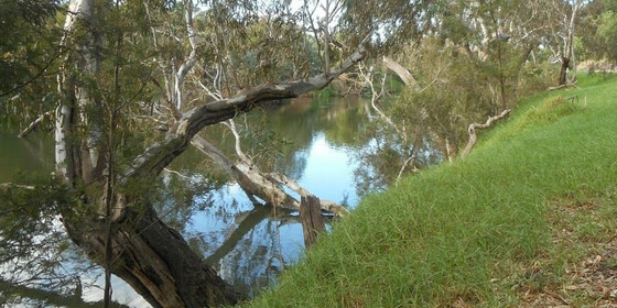
This urban walk follows creek, floodway and river reserves which offer a combination of parkland and natural landscapes to enjoy along the way. Our walk commences at Wyndham Vale Railway Station with a short stroll through Manor Lakes Linear Park which takes us into the Lollipop Creek Reserve. The walk along the Lollipop Creek Trail takes in some of the re-vegetation and conservation measures along the waterway and surrounding wetlands. The croaking of frogs and chirping of birds are likely to be heard coming from the creek and wetlands. Approximately 4 km into the walk we leave Lollipop Creek to follow a path along grassy open space and floodway to reach the Werribee River Linear Reserve. For the remainder of the walk we will follow the Werribee River passing by natural vegetation including some impressive River Red Gums. On reaching Werribee the trail passes under the railway line near the station. Trains depart Werribee Railway Station every 20 minutes for the 50 minute journey back to the city.
MEETING TIME | LOCATION: In the front carriage of the Waurn Ponds train departing Southern Cross Railway Station at 10:30am or meet the group en route by arrangement with the event leader.
MAP REFERENCE: Melway map 43 grid E9 | Google map goo.gl/maps/bCGTVY7pXX72.
DISTANCE / TIME FROM GPO: The walk commences at Wyndham Vale Railway Station which is 40 km and 35 minutes by train from the city. Our return journey takes 50 minutes from Werribee Railway Station which is 32 km from the city.
TRANSPORT: Access to and from this walk is by public transport only. We will travel to Wyndham Vale Railway Station in the front carriage of the Waurn Ponds train departing Southern Cross Railway Station at 10:30am or you may choose to meet the group en route by arrangement with the event leader. For the return journey trains depart Werribee Railway Station every 20 minutes. All travel is within myki zones 1 & 2 with weekend daily caps of $6.50 full fare, $3.25 concession and free for seniors.
FOOD: Carry lunch, snacks and water for your needs throughout the day.
APPAREL | FOOTWEAR: Wear comfortable walking boots/shoes and dress to meet the forecast weather conditions.
BOOKING: This event is limited to a maximum of 10 participants. Obtaining a ticket from The Nomads website is essential. Visitor tickets are available up to Thursday 9th July unless shown on the website as "Sold Out". Members are encouraged to obtain their ticket by Thursday 9th July however member free tickets will remain available after this date unless shown on the website as "Sold Out" or "Sale Ended". Please confirm that you have obtained a ticket by visiting thenomadsinc.tidyhq.com/member/events or by checking your "Order confirmation" email.
LEADER: Peter Tocknell - Email the Leader if you have any questions. Members can access leader contact details under Members->Leader Contacts when logged in to the website.
HOME BACK TO LIST OF EVENTS MEMBERSHIPS
Jul
07
2020
Past Event
Spring Planning & Social Night - via Zoom
20:00 – 21:30
The Spring Planning and Social night will take place online via Zoom, but starting at 8pm. Please get a ticket to register for our quarterly planning night, in conjunction with the regular monthly social night.
ACTIVITY DESCRIPTION:
Do you want to see more of a particular activity, or do you have a particularly favourite area of Victoria you would like to share with others? Do you have an idea for activities we can undertake while "locked down"? Come along to the planning meeting, and then stay for our monthly social evening where members talk about upcoming events, share a meal and compare notes on past activities. All members are welcome – you don't have to volunteer for an activity. New members are especially invited to this meeting as an orientation to Nomads activities.
MEETING TIME | LOCATION: 8pm | online via Zoom. The Zoom link will be emailed on Tuesday to those who registered via Get Tickets.
BOOKING: By Monday 6th July. Click on Get Tickets to secure your place..
LEADER: Garry O. | Email the Leader if you have any questions. Members can access leader contact details under Members -> Leader Contacts when logged in to the website.
HOME BACK TO LIST OF EVENTS MEMBERSHIPS
Jul
05
2020
Past Event
Inner City Nature Walk beside the Yarra
Victoria Park Station
10:30 – 16:00
Cycle, drive or catch a train to this inner city circuit walk along scenic paths beside the Yarra River.
GRADE | LENGTH | TYPE: Easy, approximately 9.5 km, circuit walk.
ACTIVITY DESCRIPTION:
Starting from Victoria Park Station we will meander along a number of paths in the vicinity of the Yarra, taking in landmarks such as Dights Falls, the Studley Park Boathouse, the AIDS Memorial Garden and the Fairfield Park Boathouse prior to returning via a different route to Victoria Park Station.
MEETING TIME | LOCATION: 10:30am at the corner of Lulie and Turner Streets, opposite the eastern exit of Victoria Park Station, Abbotsford.
MAP REFERENCE: Melway map 2C grid J7 | Google map goo.gl/maps/vgav2xv1XtL9MFiK9.
PUBLIC TRANSPORT: Catch a Hurstbridge or Mernda line train to Victoria Park Station. The Mernda line train that departs Flinders Street Station at 10:08am arrives at Victoria Park at 10:26am.
FOOD: Carry lunch, snacks and a litre of water.
APPAREL | FOOTWEAR: Comfortable walking boots/shoes and dress according to the weather forecast.
BOOKING: By Thursday 2nd July. Click on Get Tickets to register.
LEADER: Alan D. | Email the Leader if you have any questions. Members can access leader contact details under Members | Leader Contacts when logged in to the website.
HOME BACK TO LIST OF EVENTS MEMBERSHIPS

Jul
04
2020
Past Event
Wailing At The Full Moon Night Walk - Yarra Bend National Park, Fairfield
Fairfield Cricket Club
19:30 – 22:00
Noting that you have endured many Saturday nights stuck at home with nothing open under COVID-19 lockdown, here is an opportunity to "frock up" in your best winter outfits and head outdoors.
GRADE | LENGTH | TYPE: Easy, approximately 8 km, circuit walk.
ACTIVITY DESCRIPTION:
The July 2020 full moon is due to be observed in Melbourne on Sunday 5 July. We will venture out on Saturday night (with better public transport options) for a sneak preview. Winter provides the best possibility of clear skies to maximise viewing the stunning moonlight. Yarra Bend Park provides an area with minimal artificial light thus maximising the impact of moonlight. The surface for this walk is 100 per cent pavement or compacted “blue metal”. Totally flat or undulating except for two small “huff and puff” inclines:
1) from Kane’s Bridge up to The Boulevard, and
2) from the Water Pipe Bridge up past the Pavilion at Fairfield Park.
The walk will commence at the car park and head south along Yarra Bend Road past the old Fairfield Hospital (now Melbourne Polytechnic) to cross the Yarra at Kane’s bridge. The walk will then proceed along The Boulevard in Kew past Bellbird Park (home to the Fruit Bats), crossing the Eastern Freeway; an area which is a “hot spot” for watching New Years Eve fireworks. Crossing the Yarra River via the Water Pipe Bridge we will re-enter Fairfield Park.
MEETING TIME | LOCATION: 7:30pm at the car park opposite the Fairfield Cricket Club Rooms and Oval, Lot 113C Yarra Bend Rd, Fairfield. Access this from Yarra Bend Road.
MAP REFERENCE: Melway map 30 grid H12 | Google map goo.gl/maps/EE9kCEsq3a4bood46.
TRANSPORT: Dennis Railway Station (Hurstbridge Line) is nearby. If coming from Dennis Railway Station head south along Victoria Rd and Jeffrey St, turn right into Heidelberg Rd (200m only) then left into Yarra Bend Rd. Collection from Dennis Station is possible if pre-arranged.
WHAT TO BRING: Suitable clothing for a night-time event that will see the temperature drop. Comfortable walking boots/shoes and dress according to the weather forecast. Bring a torch; preferably one you can wear on your head. Make sure you have a 1 litre (minimum) water bottle with you.
BOOKING: By Thursday 2nd July. Click on Get Tickets to register.
LEADER: Garry O. | Email the Leader if you have any questions. Members can access leader contact details under Members | Leader Contacts when logged in to the website.
HOME BACK TO LIST OF EVENTS MEMBERSHIPS
