The Nomads Outdoors Group Inc.
Powered by
Past events
All events
Past events
Nov
03
2020
Past Event
Cup Day BYO Picnic
Hays Paddock
12:00 – 17:00
Join fellow NOMADS for a relaxing afternoon on Melbourne Cup Day in the inner eastern suburbs of Melbourne and enjoy one of the first outdoors social events post lockdown #2.
GRADE | LENGTH | TYPE: Social with a gentle post lunch stroll.
ACTIVITY DESCRIPTION:
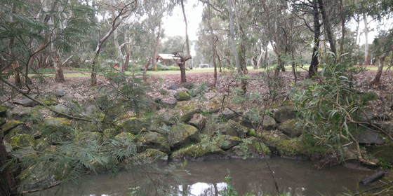
Hays Paddock is the most visited active and passive recreation space in the City of Boroondara. At the time of European settlement, this rich floodplain was occupied by the Wurrundjeri tribe. Crown lands sales in 1845 saw Englishman William Oswin successful and it bacame a dairy farm known as Kilby Farm. Talk of turning the area into open recreaction space commenced in 1943 after many floods. It was finally completed in its current form after re-arrangement of land in North and East Kew with the building of the Eastern Freeway.
The Paddock is planted with native trees and bushes. Glass Creek, which originates in Greythorn, passes through the Park on its way under the Eastern Freeway to join the Yarra River. There is a wetlands area with an associated Hide for bird watching.
A shelter pavilion, BBQ, water taps and toilets are insitu.
FURTHER INFORMATION: www.boroondara.vic.gov.au/recreation-arts/parks-and-gardens/hays-paddock
MEETING TIME | LOCATION: From 12 Noon near the BBQ and Pavilions next to the car park off Leason Street, East Kew.
MAP REFERENCE: Melway map 45 grid J2 | Google map goo.gl/maps/vthct51X7Vo8Lzvb7.
TRANSPORT: 6 km from GPO, approximately 20 minutes to drive. Public transport options are (1) Tram #48 to Stop 41 Clyde Street + Buses 200 and 207 to Leason Street. If travelling via public transport, myki money public holiday capped fares apply. Cycling via the Main Yarra Trail, exit at Belford Road (Kew Golf Club) and cycle along the bike lane on Kilby Road
FOOD: BYO picnic supplies - BBQ available, but it may be popular on a public holiday. Recommend you also bring a camper chair or rug to sit on. Ample trees to protect from the sun.
APPAREL | FOOTWEAR: Comfortable dress according to the weather forecast.
BOOKING: By Monday 2nd November. To register, click on Get Tickets.
LEADER: Garry Oliver | Email the Leader if you have any questions. Members can access leader contact details under Members | Leader Contacts when logged in to the website.
HOME BACK TO LIST OF EVENTS MEMBERSHIPS
Nov
02
2020
Past Event
Darebin Creek Trail Walk *New Date - Monday, 2nd November*
Browning St/Plenty Rd
11:00 – 16:00
With the easing of lockdown restrictionshis this event will now go ahead on Monday, 2nd November. This is the day before Melbourne Cup, which many take as a holiday.
This is an easy walk along one of Melbourne’s outer suburban trails. Limit of 10 people.
GRADE | LENGTH | TYPE: Easy 11 km point-to-point walk. Although it is about 11 km long, it is on a level to downhill path.
ACTIVITY DESCRIPTION:
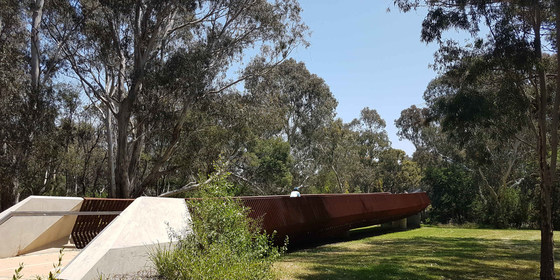
The Darebin Creek Trail is a shared use path for cyclists and pedestrians which follows Darebin Creek in the north-eastern suburbs of Melbourne. Although it starts in Bundoora, we will join the trail a few kilometres south of that. The trail passes through a number of parks and reserves, joined by narrower sections alongside the creek. Towards the end of the walk we will cross the new-ish bridge across the Yarra River into East Kew, joining the Main Yarra Trail towards the city. Lunch will be taken at Darebin Parklands. Toilets and water bubblers are accessible in this location. Apart from right at the starting point, there are no cafes or lunch providors on the route. At the conclusion of the walk, transport it home by #200/207 bus.
FURTHER INFORMATION: en.wikipedia.org/wiki/Darebin_Creek_Trail.
MEETING TIME | LOCATION: 11am at the Browning St/Plenty Rd #86 tram stop in Kingsbury, near La Trobe University.
MAP REFERENCE: Melway map 19 grid C6 | Google map goo.gl/maps/DugEkgnxz38Kob5P6.
DISTANCE | TIME FROM GPO: 16 km, 1 hour by tram from Southern Cross Station. It’s not feasible to drive as the end of walk is in a different area.
PUBLIC TRANSPORT: The last #86 tram that leaves Southern Cross Station at 09:56am (or Bourke Street Mall at 10:03am) arrives at stop 58 (Browning St/Plenty Rd) at 10:56am.
FOOD: Pack food for lunch and snacks; there are no places to buy anything on the way. At least 1 litre of water should be carried.
APPAREL | FOOTWEAR: Wear a hat, clothing to meet the forecast weather conditions and footwear suitable for walking along sealed paths.
BOOKING: By Suday, 1st November. To register, click on Get Tickets.
LEADER: Richard C. | Email the Leader if you have any questions. Members can access leader contact details under Members | Leader Contacts when logged in to the website.
HOME BACK TO LIST OF EVENTS MEMBERSHIPS
Nov
01
2020
Past Event
Inner East Yarra Explorer Circular Walk
Melbourne Tram Museum
10:30 – 16:00
With a favourable weather forecast - 20 degrees - time to blast out the bushwalking cobwebs with the easing of lockdown restrictions by a relaxing walk around the inner east portions of the Yarra River and surrounding environs. The opportunity will be taken to socialise with lunch (safely) in the nearby Burnley Gardens.
GRADE | LENGTH | TYPE: Easy, approximately 7 km, circuit walk.
ACTIVITY DESCRIPTION:
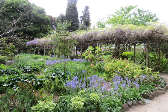
The meeting point is outside the Tramway Museum next to Leonda Receptions on Wallen Road, Hawthorn. From there we will traverse the not well known eastern side of the Yarra River through Fairview Park around to Scotch College. Traversing the boundary of Scotch College, we will the explore the extensive parklands and velodrome opposite Kooyong Tennis Centre. Picking up the Gardiner's Creek Trail we will head west and observe Scotch College (nothern side) and Koogong Tennis Complex and St Kevin's College (southern side). Arriving at Yarra Boulevard, the walk will then proceed north into the Burnely Gardens. After lunch, people can enjoy a self-guided tour of the garden in its spring clothing.
FURTHER INFORMATION: https://ecosystemforest.unimelb.edu.au/engage/visiting-burnley-gardens
MEETING TIME | LOCATION: 10:30am outside the Tram Museum, Wallen Road, Hawthorn (Swan Street extension) next to Leonda Reception Centre.
MAP REFERENCE: Melway map 45 grid B12 | Google map: https://g.page/trammuseum?share
DISTANCE | TIME FROM GPO: 6 km, approximately 15 minutes to drive, 35 minutes by public transport.
TRANSPORT: Trams #70 and #75 from Flinders Street to Stop 29, Riversdale Junction (note NO #75 trams along Bridge Road on Sunday). If travelling by car, its recommended you park in Yarra Boulevard between Swan-Wallen Bridge over the Yarra and Boulevard Drive and walk the short distance to the meeting point. Thus you can leave lunch in the car and collect if upon arrival at Burnley Gardens.
FOOD: Carry snacks and at least 1 litre of water. Refilling water available along the route and in Burnley Gardens.
APPAREL | FOOTWEAR: Comfortable walking boots/shoes and dress according to the weather forecast.
BOOKING: By Friday 30th October. To register, click on Get Tickets.
LEADER: Garry Oliver | Email the Leader if you have any questions. Members can access leader contact details under Members | Leader Contacts when logged in to the website.
HOME BACK TO LIST OF EVENTS MEMBERSHIPS
Oct
29
2020
Past Event
Yanakie/Wilsons Promontory (Cup Day Weekend)-RE-SCHEDULED TO EASTER 2021
Corner Inlet
29 Oct 2020 18:00 – 03 Nov 2020 16:00
** This event has been re-scheduled to Easter 2021. Go to the new event date listed below**
Enjoy the comfort of a home stay, together with access to the world class Wilsons Promontory National Park for day walks.
GRADE | LENGTH | TYPE: Easy – day walks and beach activities.
ACTIVITY DESCRIPTION:
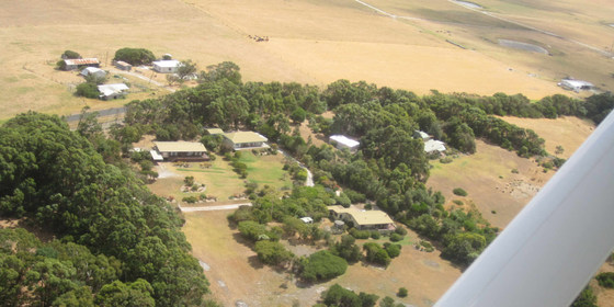
We have a private house at Yanakie overlooking Corner Inlet just near the park entrance. You can come down for as many days as you like. It is quite flexible. There are many nice day walks in the area. We will decide where to walk each day taking into account the condition of the weather and the participants. The base offers hot showers, comfortable accommodation and a log fire to warm up if the day is cold. There is a range of gay themed movies to watch in the evening for movie buffs.
FURTHER INFORMATION: www.parks.vic.gov.au/places-to-see/parks/wilsons-promontory-national-park.
MEETING TIME | LOCATION: You can arrive any time from Thursday as arranged with the leader. You will be given location details after registering.
MAP REFERENCE: Melway map X928/628 grid C10 | VicRoads map 103 grid D7 | Google map goo.gl/maps/A8fupz5R28HgD9Ec9. Detailed directions will be provided after the RSVP date.
DISTANCE | TIME FROM GPO: Approximately 195 km. Yanakie is 2.5 hours drive from Melbourne towards Wilsons Promontory.
TRANSPORT: Public transport not available. We will try to maximise car-pooling as parking is limited at the house.
FOOD: Bring supplies for your own breakfast and lunch. Communal night meals will be arranged once the numbers are known. There are staples at the house like sugar, tea etc.
APPAREL | FOOTWEAR: Warm waterproof gear and changes of clothing. Summery attire is also likely to be needed. It might be warm enough to dive into the sea. Light comfortable walking footwear.
ACCOMMODATION: There are a limited number of beds for the early birds, some floor space and plenty of tent space in the garden. Bring linen and towels.
COST: Free entry to the National Park. Donation towards any meals that are provided.
BOOKING: By Monday 26th October. To register, click on Get Tickets.
LEADER: Roger H. | Email the Leader if you have any questions. Members can access leader contact details under Members | Leader Contacts when logged in to the website.
HOME BACK TO LIST OF EVENTS MEMBERSHIPS
Oct
27
2020
Past Event
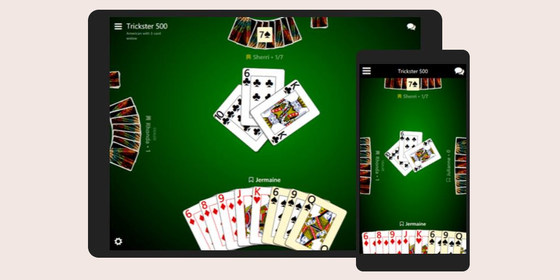
Play 500 Cards with fellow Nomads - Tuesday 27 October
20:00 – 21:30
Although locked down at home, you can still socialise online with Nomads friends. Groups of four or six players per game can play 500 online - and with video and sound enabled, it's almost like being in the same room! During the lockdown period, we are scheduling games of 500 on Tuesdays at 8pm using the Trickster Cards program.
If you're new to the 500 card game, but would like to learn about it, check out our 500 Cards Tutorial Notes. For some other ideas of things to do during lockdown, see Socialising Online.
TO BOOK: Click Get Tickets prior to Tuesday 27th October so you get an invitation email on the day with your link to join the game.
TO PLAY: At 8pm on Tuesday 27th October, click on the link in your invitation email. (Tip: schedule a notification in your phone so you don't forget)!
TROUBLE SHOOTING:
Video isn't yet available for six-handed games, though audio works, and that's all you need to have some lively table talk!
If for some reason you don't get the reminder email with the link, check your Spam or Promotions folder.
LEADER: Alan D. | Email the Leader if you have any questions. Members can access leader contact details under Members | Leader Contacts when logged in to the website.
HOME BACK TO LIST OF EVENTS MEMBERSHIPS
Oct
23
2020
Past Event
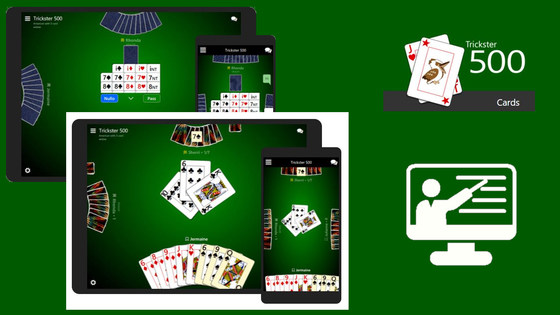
Tutorial on how to play 500 Cards - Friday 23 October
19:30 – 21:30
During the lockdown periods, quite a number of Nomads and friends have been regularly playing 500 cards online using the Trickster Cards program. This works surprisingly well, and with video and sound enabled has really enabled people to stay in touch. A few others have indicated they would like to join in, but don't understand the rules of the game.
So this Friday night we are holding a 500 cards tutorial session via Zoom. You will learn the rules of the 500 cards game, the different types of bidding that can be made, and how many points are won (or lost) depending on the number of tricks you win.
While you watch on, your tutor will play a round or two, showing you his cards and explaining his strategies and decision making processes. After that, you'll be put into a team (of 4 players) to play a game or two yourself using Trickster Cards. To do that you'll leave the Zoom session, but you'll be able to rejoin the Zoom session at any time if you want to ask your tutor any particular questions.
We'll also try to place at least one experienced player into each team, so they can answer any questions and help you make decisions as you play.
TO BOOK: Click Get Tickets prior to Friday 23rd October so you get an invitation email on the day with your Zoom link to join the tutorial.
TO JOIN: At 7:30pm on Friday 23rd October, click on the link in your invitation email.
Tip: schedule a notification in your phone so you don't forget!
If for some reason you don't get the reminder email with the link, check your Spam or Promotions folder.
LEADER: Johnathon M assisted by Alan D. | Email the Leader if you have any questions. Members can access leader contact details under Members | Leader Contacts when logged in to the website.
HOME BACK TO LIST OF EVENTS MEMBERSHIPS

Oct
20
2020
Past Event
Play 500 Cards with fellow Nomads - Tuesday 20 October
20:00 – 21:30
Although locked down at home, you can still socialise online with Nomads friends. Groups of four or six players per game can play 500 online - and with video and sound enabled, it's almost like being in the same room! During the lockdown period, we are scheduling games of 500 on Tuesdays at 8pm using the Trickster Cards program.
For some other ideas of things to do during lockdown, see Socialising Online.
TO BOOK: Click Get Tickets prior to Tuesday 20th October so you get an invitation email on the day with your link to join the game.
TO PLAY: At 8pm on Tuesday 20th October, click on the link in your invitation email. (Tip: schedule a notification in your phone so you don't forget)!
TROUBLE SHOOTING:
Video isn't yet available for six-handed games, though audio works, and that's all you need to have some lively table talk!
If for some reason you don't get the reminder email with the link, check your Spam or Promotions folder.
LEADER: Alan D. | Email the Leader if you have any questions. Members can access leader contact details under Members | Leader Contacts when logged in to the website.
HOME BACK TO LIST OF EVENTS MEMBERSHIPS

Oct
16
2020
Past Event
Online Games & Trivia Night #5 - the last - Friday 16th October
19:30 – 21:30
Join us for the fifth and LAST (at least during lockdown) of the popular series of Nomads online games nights - an evening of fun and socialising from the safety and comfort of your own home! Bring your food and drinks and get ready for two hours of socialising online.
The theme for the fifth games night is Australiana.
Play in teams as you try and outsmart your opponents with an Australiana-themed Trivia Game. You select answers anonymously from Zoom Poll options.
Participate in a game of Jeopardy to score points for the questions hidden behind various categories of boxes.
Play several real time games of Wheel of Fortune with three different teams.
Play starts at 7:30pm when everyone will be placed into teams. Ensure you register for this event in order to receive an email with your link to join on the night! We will be using the online Zoom program and some specialised gaming software to run the event.
TO BOOK:
Click Get Tickets by Thursday 15th October so you get an invitation email on the day with your link to join the game.
If you haven't used Zoom before, be sure to register for a FREE Zoom account prior. See: zoom.us/freesignup
TO PLAY:
At 7:30pm on Friday 16th October, click on the link in your invitation email. (Tip: add a reminder in your phone)!
Once you've joined, sit back and relax. Your quiz and game master will run all the behind-the-scenes work.
LEADER: Jason T. | Email the Leader if you have any questions. Members can access leader contact details under Members | Leader Contacts when logged in to the website.
HOME BACK TO LIST OF EVENTS MEMBERSHIPS

Oct
13
2020
Past Event
Play 500 Cards with fellow Nomads - Tuesday 13 October
20:00 – 21:30
Although locked down at home, you can still socialise online with Nomads friends. Groups of four or six players per game can play 500 online - and with video and sound enabled, it's almost like being in the same room! During the lockdown period, we are scheduling games of 500 on Tuesdays at 8pm using the Trickster Cards program.
For some other ideas of things to do during lockdown, see Socialising Online.
TO BOOK:
Click Get Tickets prior to Tuesday 13th October so you get an invitation email on the day with your link to join the game.
TO PLAY:
At 8pm on Tuesday 13th October, click on the link in your invitation email. (Tip: schedule a notification in your phone so you don't forget)!
Once you've joined the game, click on Add Video then click Add.
(If you wish to use video, do not select Yes beside Or connect voice-only before you click Add).
TROUBLE SHOOTING:
Video isn't yet available for six-handed games, though audio works, and that's all you need to have some lively table talk!
If for some reason you don't get the reminder email with the link, check your Spam or Promotions folder.
LEADER: Alan D. | Email the Leader if you have any questions. Members can access leader contact details under Members | Leader Contacts when logged in to the website.
HOME BACK TO LIST OF EVENTS MEMBERSHIPS
Oct
11
2020
Past Event
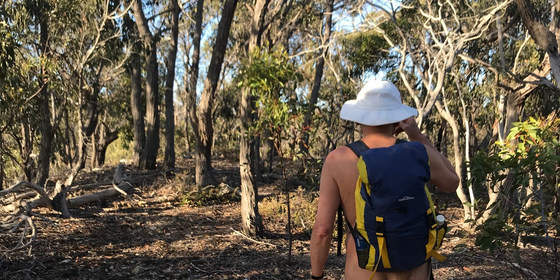
Naturist Forest Walk near Ingliston Gorge, Bacchus Marsh - CANCELLED
65 Grant St
10:30 – 16:00
Please Note: Due to the extension of the Covid-19 government restrictions, this event has been cancelled. There are however, 2 other naturist walks that are scheduled to run in Spring which you are encouraged to consider.
This event will be run at a later date with existing ticket holders to be notified.
Enjoy a naturist bushwalk through the open and hilly forests west of Melbourne for some great gorge views.
GRADE | LENGTH | TYPE: Moderate 6 to 7 km circuit walk.
ACTIVITY DESCRIPTION:
We shall meet at a coffee/ takeaway venue on the outskirts of Bacchus Marsh. From there we will carpool to the start of the walk 14 km away. After applying sunscreen we will head off into the forest with lunch and water in our packs for a pleasant naturist walk in the outdoors. The track varies from sometimes undulating to occasionally steep and at times a bit rocky. Hopefully we can find a spot with a good view for lunch. We then return on a different route to the cars. After the walk there will be the opportunity for us to go to a Bacchus Marsh Hotel for cool drinks or a coffee if you wish (COVID-19 restrictions permitting).
MEETING TIME | LOCATION: 10.30am at the BP Service Station Takeaway, 65 Grant St, Maddingley, a suburb on the outskirts of Bacchus Marsh.
MAP REFERENCE: Melway map X911 grid F2 | Google map goo.gl/maps/hU4LTE1V9aeejdnG9.
DISTANCE | TIME FROM GPO: 65 km, approximately 55 minutes. Various routes are possible but probably using the Western Fwy is best.
PUBLIC TRANSPORT: Take the 9:15am Wendouree (Ballarat) train from Southern Cross. Alight at Bacchus Marsh Railway Station at 10.03am. From there it is a 550m (7 min) walk to the meeting place.
FOOD: Carry lunch, snacks and approximately a litre of water.
APPAREL | FOOTWEAR: Comfortable walking boots/shoes, hat, dark glasses, sunscreen. Bring a small towel in case we get to have a splash in the river. Shorts may be needed for part of the track, Otherwise clothes should not be required. However if cold or windy bring appropriate items.
BOOKING: By Thursday 8th October. To register, click on Get Tickets.
LEADER: Russell W. | Email the Leader if you have any questions. Members can access leader contact details under Members | Leader Contacts when logged in to the website.
HOME BACK TO LIST OF EVENTS MEMBERSHIPS
Oct
09
2020
Past Event
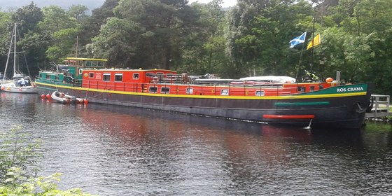
Caledonian Canal Discovery Cruise Slideshow
19:30 – 21:00
This will be an information sharing evening to show you some slides of a trip done last year in Scotland.
GRADE: social - online via Zoom.
ACTIVITY DESCRIPTION:
In July 2019, four Nomads and friends joined a cruise by barge across the width of Scotland.
We followed "The Great Glen", from the Atlantic at Fort William to the North Sea at Inverness, connecting several lochs, including Loch Ness.
The barge was a traditional "Dutch cargo" style, 44m long, holding only twelve passengers, all cabins with en-suite. As recently as ten years before, it was carrying cement in Belgium. The trip was designed as an adventure cruise, with canoes, bikes and the opportunity for walking between stops.
Before and after the cruise, the participants added various other side trips.
MEETING TIME | LOCATION: 7:30pm on Friday 9th October, online via Zoom. The Zoom link will be emailed on the day to those who registered via Get Tickets.
BOOKING: By Thursday 8th October. To register, click on Get Tickets.
LEADER: Richard C. | Email the Leader if you have any questions. Members can access leader contact details underMembers | Leader Contacts when logged in to the website.
HOME BACK TO LIST OF EVENTS MEMBERSHIPS

Oct
06
2020
Past Event
Summer Planning & Social Night - online via Zoom
20:00 – 21:30
Our quarterly planning night, in conjunction with the regular monthly social night - this event won't be able to proceed at the Riversdale Hotel due to the COVID-19 lockdown, so we will have a Zoom catch up instead. Register via GET TICKETS and we will email you the Zoom link on the day to enable you to attend online..
ACTIVITY DESCRIPTION:
Do you want to see more of a particular activity, or do you have a particularly favourite area of Victoria you would like to share with others? Do you have an idea for something apart from the regular walks? Come along to the planning meeting, and then stay for our monthly social evening where members talk about upcoming events and compare notes on past activities. All members are welcome – you don't have to volunteer for an activity. New members are especially invited to this meeting as an orientation to Nomads activities.
MEETING TIME | LOCATION: 8pm | online via Zoom. The Zoom link will be emailed on the Tuesday to those who registered via Get Tickets.
BOOKING: by Monday 5th October | To register, click on Get Tickets.
LEADER: Garry O. | Email the Leader if you have any questions. Members can access leader contact details under Members / Leader Contacts when logged in to the website.
HOME BACK TO LIST OF EVENTS MEMBERSHIPS