

The Nomads Outdoors Group Inc.
Powered by
Past events
All events
Past events
Jan
30
2022
Past Event
Nomads Midsumma Outdoors - Yarra Bend Explorer
Lulie Street & Turner Street
10:30 – 16:00
Enjoy Melbourne's big 260 hectare backyard. This event is part of Midsumma Festival.
GRADE | LENGTH | TYPE: Easy 10 km point-to-point walk with public transport connections.
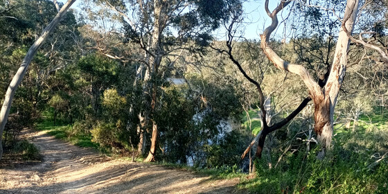
ACTIVITY DESCRIPTION: Join the experienced leaders of the Nomads Outdoors Group Inc to explore one of Melbourne's underrated gems - Yarra Bend Park, which hugs both sides of the Yarra River at the back door of central Melbourne. The park contains both natural bushland and a built environment. It has many historical connections to the development of Marvellous Melbourne in the late 1800s together with the early years of the 1900s. It also has many LGBTI connections. Never static, the park continues to evolve to better serve the city's citizens.
The walk starts at 10:30am sharp at the historic entrance to Victoria Park, which has easy access to multiple public transport services (bus and train). The walk will be mostly on dirt paths, so closed footwear is essential. BYO water container plus snacks and lunch. The lunch break will be taken in Fairfield Park which has access to toilets and water. Expect the walk to conclude around 4pm at Kew Junction with access to tram and bus routes. Other exit points to public transport are available en route.
BOOKING: By Thursday 27th January. To register, click on Get Tickets in this listing or register via midsumma.org.au.
Unsure if you've already booked via The Nomads? Click View my bookings.
NOMADS COVIDSAVE CHECKLIST: Checklist 220130: Nomads Midsumma Outdoors - Yarra Bend Explorer.
MEETING TIME | LOCATION: 10:30am at Victoria Park, cnr Lulie & Turner Sts, Abbotsford.
MAP REFERENCE: Melway map 44 grid E4 | Google map goo.gl/maps/QtRzqaPfAkuD3nKYA.
PUBLIC TRANSPORT: Hurstbridge/Mernda line train to Collingwood. Bus 200, 207, 246, 302-305, 905-907 to Johnston & Hoddle Street area.
FOOD: BYO snacks and Lunch plus at least a 1 Litre water container - there is limited access to food in Fairfield Park on weekends.
APPAREL | FOOTWEAR: Comfortable closed-toe shoes and dress according to the weather forecast.
LEADER: Garry O. | Email LeaderGarryO.thenomadsinc@mail.tidyhq.com if you have any questions.
Members can access leader contact details under Members | Leader Contacts when logged in to the website.
HOME BACK TO LIST OF EVENTS MEMBERSHIPS
Jan
29
2022
Past Event
Pt Addis Naturist Beach Day with evening hike and dinner
Point Addis Boardwalk
10:30 – 21:30
This event will continue as scheduled. Check your email for further details of the event.
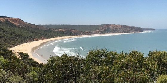
Enjoy a pleasant naturist beach day, with a leisurely lunch and swim. An optional late afternoon clifftop hike with spectacular views followed by dinner is also being offered as part of this event.
GRADE | LENGTH | TYPE: Easy, approximately 1.5 km walk from the car park to the lunch spot on the beach. There are quite a few steps from the road down to the beach, but you can always take your time. The afternoon/evening hike is graded as moderate (the Ironbark Basin Trail is rather flat with a few uphill steps and tracks on a long gradual climb with a few steeper sections through the basin and along the cliffs).
ACTIVITY DESCRIPTION:
Enjoy a pleasant clothes-free beach day, with a leisurely lunch and swim. Optional activities include body surfing in a moderate surf and a 1 km beach walk to the rocky headland towards Southside. As the tide will go out during the day, we could if you like walk around the headland for another kilometre to the very end of the naturist beach at Southside. A beach game or two will also be played.
The optional afternoon clifftop hike through the Ironbark Basin will take place after the official beach day finishes. If time permits and there is enough interest, we will also visit the red ochre rocks at Black Rock Beach, about 2 km away. This beach boasts amazing rich red and black rocks, with a secluded beach and plenty of photo opportunities to be had. This beach will require a 2 km walk (easy to medium walk with some steps) along the Surf Coast Track to get to it.
The evening hike is proposed to run from about 4:30pm/5pm to about 7pm.
At the conclusion of the walk, all participants are invited to an optional dinner (approx. 7:30pm) at the local Chinese restaurant in Torquay to end a most enjoyable day out.
IronBark Basin Hike (Clothed): (3 km return trip): Moderate
A very pleasant hike through the Ironbark Basin, which is part of the massive Great Otway National Park. A mostly sheltered forest trail with features of spectacular clifftop views of Addiscott Beach. At first the trail enters a stringybark woodland, scattered with ironbark trees and an understory of wattle, grass trees and ground covers. The walk affords not only spectacular views of the coast, with opportunities for animal and birdwatching, but also insights into the local Indigenous culture explaining the use of bush food by the local Koori people. Bring your cameras!
The Day's Runsheet:
10:30am - Start of beach day/swim at Point Addis
4:30pm - Start of the Ironbark Basin hike (optional)
7:00pm - Head to the local Chinese restaurant in Torquay or another venue of choice for dinner (optional)
9:30pm - Leave Torquay bound for Melbourne
BOOKING: By Thursday 27th January. To register, click on Get Tickets.
Unsure if you've already booked? Click View my bookings.
NOMADS COVIDSAFE CHECKLIST: Checklist 220129: Pt Addis Beach Day with hike and dinner.
MEETING TIME | LOCATION: 10:30am at Point Addis Beach car park in Pt Addis Rd (this is on the right-hand side of the road and is about 500 metres before the end of the road on the Pt Addis headland). If you arrive later, you can meet us on the beach. Instructions will be emailed prior to the event with the exact spot.
MAP REFERENCE: Melway key map 15 grid A21 | Google map goo.gl/maps/w3hMeN4CigLwvQiV6.
DISTANCE | TIME FROM GPO: 107 km, approximately 1 hour 20 minutes to drive via the M1 freeway.
PUBLIC TRANSPORT: The Apollo Bay coach has a stop at Pt Addis Rd, but you would arrive late to the event.
FOOD: Bring lunch, snacks and drinking water.
APPAREL | FOOTWEAR: Sunscreen, hat, repellent, beach towel, footwear if sand is hot. Shorts required to get from the car park to the appropriate section of the beach. Beach umbrella or shade equipment could be useful. Hand sanitiser and a face mask when a minimum of 1.5 meters cannot be achieved.
LEADER: Jason T. | Email LeaderJasonT.thenomadsinc@mail.tidyhq.com if you have any questions.
Members can access leader contact details under Members | Leader Contacts when logged in to the website.
HOME BACK TO LIST OF EVENTS MEMBERSHIPS
Jan
26
2022
Past Event
Nomads 26th Jan "Rum Rebellion" anniversary Picnic at Blanchfields
Macclesfield
12:00 – 16:00
Enjoy a casual picnic on 26 January on the property of a Macclesfield member, which includes a swimming pool, expansive outdoor picnic area, historic features and some delightful walking trails.
GRADE | LENGTH | TYPE: Social - picnic with optional camp out overnight at "Blanchfields", a private home overlooking the Yarra Valley.
ACTIVITY DESCRIPTION:
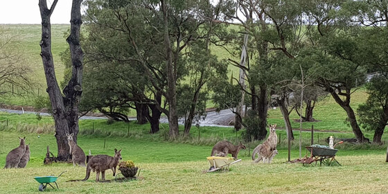
We are very privileged to be invited to a picnic in the private and beautiful gardens of the home of member Robert A. It is a rural property with a large garden of exotic trees and shrubs, grasslands and some bushlands overlooking the Yarra Valley. Robert has also invited guests to stay the night after the day of revelry if you wish. You are welcome to set up your tents or trailers in the gardens and leave the next day. In that case, Robert will direct you where you can set up camp.
The event starts from midday onwards. There are a limited number of chairs and tables as well as a toilet and bathroom for use. Note – this is not a barbeque. Fires are not allowed in a high fire danger area. Enjoy the swimming pool and stay over in your tent or camper if you wish. There will be access to the oven/stove if anything needs cooking or heating up. Plus, the vegetable garden should be in full production if we need additional ingredients. Updates will follow closer to the date. There will be a short walk around the property later in the afternoon.
BOOKING: by Sunday 23rd January. To register, click on Get Tickets.
Unsure if you've already booked? Click View my bookings.
NOMADS COVIDSAFE CHECKLIST: Checklist 220126 BYO Picnic at Blanchfields on 26 Jan.
MEETING TIME | LOCATION: From midday onwards at the private home of member Robert A. located in Macclesfield (past Emerald). Address will be forwarded once you have booked a ticket.
MAP REFERENCE: Melway map X912 grid R4 | Google map goo.gl/maps/KBZiiJpW2uj.
DISTANCE | TIME FROM GPO: 1 hour – about 60 km.
TRANSPORT: No public transport. Travel by car and carpool with someone else if you can. Take the Monash or Eastlink Freeway and exit at Wellington Rd then continue to Macclesfield. The full address and travelling directions will be provided to you upon receipt of your RSVP.
FOOD: Bring your own food and drink. For those staying the night, there will be shared drinks, nibbles and meal on the deck at sunset. Until we know how many will be taking part, let’s just call it a “potluck dinner”, any contributions gratefully received.
APPAREL | FOOTWEAR: Bring your own hat, sunscreen and insect repellent. Dress according to the weather forecast.
LEADER: Robert A. | Email LeaderRobertA.thenomadsinc@mail.tidyhq.com if you have any questions.
Members can access leader contact details under Members | Leader Contacts when logged in to the website.
HOME BACK TO LIST OF EVENTS MEMBERSHIPS
Jan
16
2022
Past Event
Archie 100 - Celebration of The Archies @ Geelong Art Gallery
Southern Cross Station
10:15 – 17:00
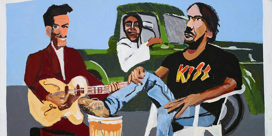
Enjoy the celebration of 100 Years of the famous Archibald Art Prize at the Geelong Art Gallery, the exclusive Victorian venue on this national tour. The exhibition presents a diverse selection of Archibald portraits from the last century—the triumphant and the thwarted—and honours the artists who have made the prize the most sought-after accolade in Australian art today. A stroll along Corio Bay will preceed a pub lunch and visiting the Exhibition. Travel via public transport is possible.
GRADE | LENGTH | TYPE: Easy, approximately 8 km cumulative, point-to-point walks on flat paths.
ACTIVITY DESCRIPTION:
The background to the creation of the Archie 100 exhibition was covered in the 3-part ABC TV series hosted by Rachel Griffiths titled Finding The Archibald. Curated by the staff from the Art Gallery of New South Wales, the exhibition uncovered many portraits not seen in public for many years - for example the portrait of Molly Meldrum.
The plan is to take the 10:30am Geelong line train from Southern Cross Station to North Geelong (Myki Zone 3). Exiting the the train at 11:30am, will see the start of a 3.5 km walk along Victoria Street then Corio Bay to the lunch venue at the Phoenix Hotel in Moorabool Street Geelong.
BOOKING:
Nomads Booking: By Thursday 13th January. To register, click on Get Tickets.
Exhibition Booking: You need to purchase your individual entry ticket for the exhibition via the Geelong Gallery website.
Prices are: ADULT @ $16 and CONCESSION @ $12. See details of discount code below depending on your mode of transport. PLEASE PURCHASE TICKETS FOR THE 2pm session.
Unsure if you've already booked? Click View my bookings.
NOMADS COVIDSAFE CHECKLIST: Checklist 220116: Archie 100 - Celebration of The Archies @ Geelong Art Gallery.
FURTHER INFORMATION: www.geelonggallery.org.au/whats-on/exhibitions/archie-100
MEETING TIME | LOCATION: 10:15am on the relevant platform at Southern Cross Station, Spencer Street Melbourne.
MAP REFERENCE: Melway map 1A grid A6 | Google map goo.gl/maps/8y6FpNrCqEmAEjv87
DISTANCE | TIME FROM GPO: 74 km, approximately 1 hour 3 minutes to drive, and 1 hour by train.
PUBLIC TRANSPORT:
By train: Travel with V/Line and save 20% on exhibition entry by using promotion code 'VLINE' when booking tickets at geelonggallery.org.au/archie100. Return trains from Geelong (Myki Zone 4) depart every 40 minutes on public holidays on a 16 / 56 / 36 cycle. Full Fare for Zone 3 on Myki money is $17.08 and concession is $8.54 (weekend daily cap) @ 2021 prices.
By ferry: Port Phillip Ferries operates fast passenger ferry services from Docklands to Geelong daily. Geelong Gallery is a 15 minute walk through Central Geelong from Steampacket Pier. For fares and timetable information see portphillipferries.com.au then book your Port Phillip Ferries and Archie 100 package.
FOOD: A Group booking has been made for a 12:30pm lunch at the Phoneix Hotel - see menu. Please advise the leader if you do not wish to participate in the lunch.
APPAREL | FOOTWEAR: Comfortable walking shoes and dress according to the weather forecast.
LEADER: Garry Oliver. | Email LeaderGarryo.thenomadsinc@mail.tidyhq.com if you have any questions.
Members can access leader contact details under Members | Leader Contacts when logged in to the website.
Image: Geelong Gallery: Vincent Namatjira, Studio Self-portrait, 2018
HOME BACK TO LIST OF EVENTS MEMBERSHIPS
Jan
15
2022
Past Event
Mixed Naturist Beach Day at Sunnyside Beach North, Mt Eliza followed by optional food or drinks at a restaurant in Frankston.
Sunnyside Road
10:30 – 16:00
UPDATE 14/01/2022 FROM MICHAEL J
WEATHER FORECAST for Saturday 15th March 2022, as issued by Bureau of Meterology, Melbourne
Mornington Peninsula area
Temperature range 16-25 degrees.
Light shower or two.
0.6-3mm possible rain.
Frankston
Humid. Cloudy. High chance of light showers, most likely in the morning. The chance of a thunderstorm in the early morning. Light winds becoming westerly 15 to 20 km/h in the middle of the day then tending southwesterly in the early afternoon.
***
The Sunnyside beach day on Saturday 15th January 2022 will definitely be going ahead.
You may wish to bring a small beach shelter if you have one to provide some protection from wind. Please remember to bring some footwear as the 10min walk from the carpark to the beach would probably be uncomfortable with bare feet.
I spent quite a while at Sunnyside Beach today, it was very nice. I will be arriving early on Saturday morning to claim a good sandy spot on the beach. Our spot will be marked with a blue and white cabana.
The water today felt cool when first jumping in, but the number of people out swimming confirms that after the first cool shock, the water temberature is actually quite nice. Today, the water was nice and clear.
Anyone late to arrive on Saturday, no matter, just follow the track on the Northern end of the main carpark and you will see us once you get to half way along the clothing optional beach, which is well signposted. It is impossible to get lost from the carpark, just stick to the path through the rocks near the water.
UPDATE 13/01/2022 FROM MICHAEL J
I have been advised that our restaurant booking has been cancelled by the restaurant due to a recent Covid outbreak affecting their business, there will not be an alternative restaurant booking. The weather forecast is for a few showers possible in the morning, a mild day with a light wind turning Southerly during the day. As per event description, the beach day is going ahead unless cancelled. Cancellation advice will be provided here, on the Nomads event listing, no later than 8pm on the Friday evening prior to the event. If no cancellation by 8pm, the beach day goes ahead. If showers are forecast, the day will go ahead. If heavier rain or low temperatures are forecast, we will cancel. There are quite a number who have booked for this event, and if possible, the day will go ahead.
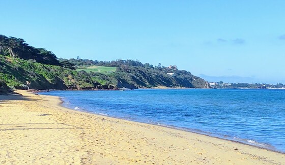
A leisurely day at the beach with a Port Phillip Bay vista in the distance.
GRADE | LENGTH | TYPE: Easy, social day with short walks along the beach. Some rocks to walk over to get from the carpark to the naturist beach.
ACTIVITY DESCRIPTION:
Enjoy a leisurely day sunbaking, walking, swimming and socialising with other Nomads on the beach. Sunnyside is the only officially designated clothing optional beach on Port Phillip Bay, and the closest legal naturist beach to Melbourne.
Sunnyside Beach (North) is a very popular beach with naturists from all over Melbourne and beyond, for very good reasons. It is a safe beach, easy to get to, and offers good swimming and general beach fun. There are a number of rocky areas and reefs close to shore which may also provide snorkelling opportunities if you wish. Most of the beach is sandy with scattered small rocks. This is a family friendly beach, so behaviour needs to be appropriate at all times.
The naturist beach is a very popular location on any sunny day, and the car parking spaces closest to the beach fill up quickly. Arrive early if you would like the best chance of a close park. There are additional all-day parking spaces along the side of Sunnyside Road, but ensure that you read the parking signs carefully as parking inspectors have been known to work over the weekends. We strongly suggest not leaving valuables visible in your car, which of course is good practice everywhere. And, as is common sense, do not leave anything unattended on the beach.
In the main beach carpark are several modern individual toilets, but once we move to the clothing optional beach, there are no facilities at all. You need to be self-sufficient and bring your own food and drink, esky, sun shelter or wind protection if desired, sunscreen, sunnies and hat. Clothing must be worn between the carpark and the beach. Also, we recommend suitable footwear to protect your feet from the sometimes sharp rocks along the short walking track to the beach. The leader will bring a beach shelter which can be used as a communal place to keep small items out of the direct heat of the sun, and as a focal point for our group once on the beach.
We will gather towards the Northern end of the main carpark at the end of Sunnyside Road at 10.30am. If you arrive late, no problem, just follow the rocky track north until the next sandy beach, you will have no problem locating and joining our group.
High tide at Sunnyside will be at 12.39pm while we are on the beach.
You are free to do as much or as little as you want on the beach, it is your day, so make the most of it. There is no planned finishing time, you are free to spend as much or as little time as you wish on the beach.
If the weather forecast for the day is determined as unsuitable by the leader, this beach day may be cancelled, or alternatively may be changed to the following day. Any changes in event details due to adverse weather or other reason will be made to the Nomads event listing no later than 8pm on the evening prior to the event. If no changes to the event details by 8pm, the beach day will go ahead as planned and there is no need to check further.
This is a free event, but to assist with planning, it is requested that you register your attendance. We look forward to seeing as many of you as possible on this naturist beach day.
OPTIONAL FOOD OR DRINKS AT RESTAURANT IN FRANKSTON (CANCELLED 13/01/2022):
If you would like to extend the social atmosphere of the beach day a bit further, a group booking for 12 people has been made at a nice restaurant in Frankston commencing at 5pm.
The Iron River Bar and Grill has been used by us in the past, and most people seem to enjoy their selection of food and drinks. The restaurant is approximately a 20min drive from the carpark at Sunnyside beach. Attendance is entirely optional, but due to the popularity of the venue, we would need to confirm numbers as early as possible on the day. If we require more seats reserved for us, a change of booking at the restaurant can be requested, but there are no guarantees, as they are often fully booked.
If you think that you might like to come along for food or drinks after the beach day, please contact the leader via the link in this event information. No obligation, just helps with planning.
BOOKING: By Wednesday 12th January. To register to attend, click on Get Tickets (no charge for this event).
COVIDSAFE CHECKLIST: Checklist 220115: Beach Day at Sunnyside Beach.
FURTHER INFORMATION: www.melbourneplaygrounds.com.au/sunnyside-beach-mount-eliza#.XVd7kOgzZPY.
MEETING TIME | LOCATION: 10.30am at the Northern end of the main beach carpark at the end of Sunnyside Rd, Mt Eliza.
MAP REFERENCE: Melway map 104 grid K5 | Google map goo.gl/maps/ggsox7nN4KDiCa5z9.
DISTANCE | TIME FROM GPO: 66 km, 1 hour 10 minutes via M1 and M3 | 79 km, 1 hour 20 minutes via M3.
PUBLIC TRANSPORT: From Flinders Street Station, catch the 8:23am Frankston train to Frankston, arriving at 9:28am. The 785 bus departs from Bay D at Frankston Station at 9:40am. Get off at the George Vowell Institute Blind/Nepean Hwy, Mt Eliza at 9:55am. From there it is a 1.3 km walk to the Sunnyside Beach car park. Alternatively, contact the leader, who may be able to arrange car sharing for you.
FOOD: Lunch, snacks, plenty of water/drinks as there are no local facilities immediately available.
LEADER: Michael J. | Email the Leader if you have any questions.
Members can access leader contact details under Members | Leader Contacts when logged in to the website.
HOME BACK TO LIST OF EVENTS MEMBERSHIPS
Jan
11
2022
Past Event
Autumn Planning & Social Night - Skinny Dog Hotel
Skinny Dog Hotel, High Street, Kew VIC, Australia
19:00 – 21:00
Our quarterly planning night, in conjunction with the regular monthly social night - this month at the Skinny Dog Hotel.
GRADE: Social.
ACTIVITY DESCRIPTION: Do you want to see more of a particular activity, or do you have a particularly favourite area of Victoria you would like to share with others? Do you have an idea for something apart from the regular walks? Come along to the planning meeting, and then stay for our monthly social evening where members talk about upcoming events, share a meal and compare notes on past activities. All members are welcome – you don't have to volunteer for an activity. New members are especially invited to this meeting as an orientation to Nomads activities.
Note: The bulk of the planning will have been done via Zoom the previous night. The resultant draft program will be presented on Tuesday, and attendees invited to fill any gaps in the draft program.
BOOKING: By Monday 10th January. To register, click on Get Tickets.
Unsure what you've booked for? Click View my bookings.
MEETING TIME | LOCATION: 7pm at the Skinny Dog Hotel, 155 High St, Kew.
MAP REFERENCE: Melway map 45 grid C6. Google map goo.gl/maps/bwK96JUAv5t.
PUBLIC TRANSPORT and PARKING: The Skinny Dog is right outside stop 33 on tram routes 48 and 109. The terminus of tram route 16 (Cotham Rd and Glenferrie Rd) is a short walk away. Bus routes 200 and 207 from the City via Johnston St stop in Studley Park Rd at Kew Junction before turning left into Princess St. Ample FREE parking is available on-street and right behind the hotel (enter via Brougham St).
LEADER: Garry O. | Email LeaderGarryO.thenomadsinc@mail.tidyhq.com if you have any questions.
Members can access leader contact details under Members | Leader Contacts when logged in to the website.
HOME BACK TO LIST OF EVENTS MEMBERSHIPS

Jan
10
2022
Past Event
Autumn Pre-planning - Online via Zoom
19:00 – 20:00
Preparing the draft Autumn program - online via Zoom.
GRADE: Social.
ACTIVITY DESCRIPTION:
The bulk of the planning for the Autumn program will be done in this pre-planning meeting via Zoom in readiness to present the draft program the next night at the Social evening, where attendees will be invited to provide additional suggestions and help fill any gaps.
BOOKING: By 5pm Monday 10th January. To register, click on Get Tickets. Alternatively, just click on the Zoom link in the reminder email (sent to members on Wed 5 Jan).
Unsure what you've booked for? Click View my bookings.
MEETING TIME | LOCATION: 7pm online via Zoom. You'll be sent the Zoom link by 6pm on Monday evening.
LEADER: Garry O. | Email LeaderGarryO.thenomadsinc@mail.tidyhq.com if you have any questions.
Members can access leader contact details under Members | Leader Contacts when logged in to the website.
Photo by Bich Tran from Pexels.
HOME BACK TO LIST OF EVENTS MEMBERSHIPS
Jan
08
2022
Past Event
*** Postponed *** Men only Naturist Beach Day at Somers + Men's Naturist Afternoon Tea at Bittern
121 Miramar Rd
10:30 – 16:00
*****************EVENT POSPONED****************
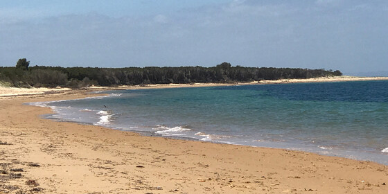
Enjoy a relaxed day out at the Somers naturist beach.
GRADE | LENGTH | TYPE: Easy 7 km circuit walk. It is a pleasant 3.5 km walk along the beach from the car park in Somers towards Sandy Point to a good setup place in the sand dunes. The sand is fairly firm. Walking time is generally about 55 minutes to the setup place. Most of the beach walk can be done minus clothes once we get past the local dog walkers close to Somers. Of course it is another approx 3.5 km back to the cars at the end of the day.
ACTIVITY DESCRIPTION:
This event is for naturists. Enjoy a pleasant relaxing beach day - walk, swim and sunbake with other fellow naturists.
After the beach we have been invited to a men's naturist afternoon tea at a fellow nudist's residence in Bittern, 10 minutes drive away. Afternoon tea, drinks and snacks will probably start around 5pm. (Apologies, the afternoon tea is a men's-only gathering).
BOOKING: By Wednesday 5th January. To register, click on Get Tickets.
Unsure if you've already booked? Click View my bookings.
NOMADS COVIDSAFE CHECKLIST: Checklist 220108: Beach Day at Somers.
MEETING TIME | LOCATION: 10.30am in the car park at 121 Miramar Rd, Somers.
There is no cafe near the meeting place sorry, you will need to bring your coffee with you. (You can get coffee in Bittern at Remuce Cafe or the Bittern Bakery and Cafe).
We plan to depart from the car park for the beach at about 11am. If you should miss us, or wish to come at a different time, walk to the side of the car park nearest the beach and go down the steep steps to the beach. At the bottom of the stairs turn left and walk for about 55 minutes and you should find our camp.
Food Drop off in the Morning: If you'd like to drop off food before you come to the beach, you may drop it at the house in Bittern between 9.45am and 10.15am. The house is 1 hour 20 minutes, and 82 km from Melbourne - a long way! Make sure you plan your time. From the house to the meeting place it is a 10 minute drive.
Address of the Afternoon Tea House: This will be emailed to all those who have booked by 10pm on Wednesday 5th January. It will also be given out on the beach day.
TIDE FORECAST: Low 11:48am - High 6:09pm - Low 11:50pm. The tide will be out when we leave from the carpark for the beach may starting to getting higher when we leave the beach to come back in the afternoon. (For those who haven't been to Somers, it is quite difficult to climb over the fallen trees on the beach at high tide.)
MAP REFERENCE: Melway map 194 grid F11 | Google map goo.gl/maps/6AUdGMw3E9BwtP38A.
DISTANCE | TIME FROM GPO: 86 km, about 1 hour 20 minutes to 1 hour 30 mins depending on which route you take.
FOOD:
FOOD and BEVERAGES for the BEACH DAY: Carry lunch, water and any other food/drinks you may like for the beach day.
FOOD and DRINKS for the AFTERNOON TEA: Please bring some food to share for afternoon tea at the Bittern residence after the beach day. Tea and coffee will be provided. Bring cold drinks if you would prefer those.
APPAREL: Sunscreen, hat, sun glasses, footwear if the sand is hot. Shorts required to get from car park to the naturist beach.
EQUIPMENT: Towel. A picnic blanket with plastic backing or a large plastic sheet is handy, because in some places the grass seeds stick tightly to your towel and are very hard to get out. You may wish to bring a sun shelter. The tea tree provides quite good, but not complete, shade cover. Sporting equipment such as a frisbee, tennis ball, larger ball, small cricket bat etc. could be fun.
LEADER: Peter H. | Email LeaderPeterH.thenomadsinc@mail.tidyhq.com if you have any questions.
Members can access leader contact details under Members | Leader Contacts when logged in to the website.
HOME BACK TO LIST OF EVENTS MEMBERSHIPS
Jan
03
2022
Past Event
Ballarat Foto Biennale - Walking Tour & Pub Lunch: Continues into 2022
Southern Cross
09:00 – 18:30
** This event has been interrupted due to Covid-19 lockdown restrictions. The exhibition has been extended until 9th January 2022. Monday, 3rd January is a public holiday in lieu of New Year's Day**
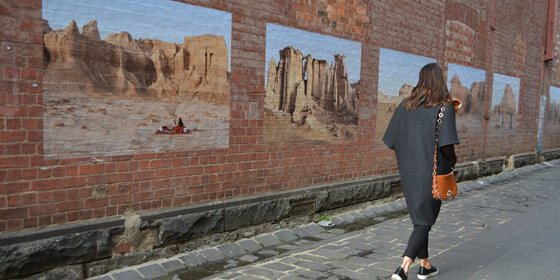
Pound the streets in the historic inner precinct of Ballarat, visiting the multiple locations hosting exhibitions for the extended 2021 International Foto Biennale. Travel via public transport is possible.
GRADE | LENGTH | TYPE: Easy, approximately 5 km, circuit walk on flat paths.
ACTIVITY DESCRIPTION:
Ballarat is home to the National Centre for Photography (NCFP) housed in the old Union Bank building on Lydiard Street North. It's the base for the team behind BIFO.
The Ballarat International Foto Biennale was founded in 2005 and attracts significant international and Australian photographers as one of Australia's pre-eminent photographic festivals. The multiple exhibitions, both free and ticketed, are housed in various historic buildings, laneways and cafes. Full details of the program are available online at ballaratfoto.org. Most exhibitions are open daily from 10am to 5pm.
The featured ticketed events this year include two international exhibitions:
(1) The (late) Linda McCarthy's Retrospective at the Art Gallery of Ballarat, and
(2) Notes From A Queer Mystic, an exhibition of work by the late USA artist, Steven F Arnold (1943 to 1994) at the NCFP building.
Check ballaratfoto.org for details of purchasing 1-day passes to visit the multiple ticketed events.
BOOKING: By Friday 31st December. To register, click on Get Tickets.
Unsure if you've already booked? Click View my bookings.
NOMADS COVIDSAFE CHECKLIST: Checklist 220103: Ballarat Foto Biennale - Walking Tour & Pub Lunch.
MEETING TIME | LOCATION: 10:45am at the Ballarat Railway Station, Lydiard Street North. Travel options are (1) by train (see details below) or (2) driving and parking on the fringes of the Ballarat CBD, as on-street parking in the CBD is time limited and fees may be payable.
MAP REFERENCE: Ballarat Station - Melway map 611 grid A12 | Google map goo.gl/maps/KjS3JEEYfng9UvaE7.
DISTANCE | TIME FROM GPO: 114 km, approximately 1 hour 25 minutes to drive, 1 hour 29 minutes by public transport.
PUBLIC TRANSPORT: The trip is on the train departing Southern Cross Station at 9:16am arriving at 10:41am. It's suggested that we gather in the first carriage (North Melbourne end). Return trains depart Ballarat regularly, for example: 3:24pm, 4:04pm, 4:18pm (coach), 4:48pm and 5:33pm.
FOOD: A booking will be made for a 12:30pm lunch at Irish Murphy's Hotel, 36 Sturt St, Ballarat for those interested. Otherwise do your own thing in between visiting exhibition sites.
APPAREL | FOOTWEAR: Comfortable walking shoes and dress according to the weather forecast.
LEADER: Garry Oliver | Email LeaderGarryO.thenomadsinc@mail.tidyhq.com if you have any questions.
Members can access leader contact details under Members | Leader Contacts when logged in to the website.
Image: Rove.me
HOME | BACK TO LIST OF EVENTS | MEMBERSHIPS
Jan
02
2022
Past Event
Emerald Lake and Lake Nobelius Loop
The Gem Community Arts Centre
11:00 – 16:00
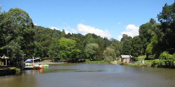
The Emerald Lake and Lake Nobelius Loop is a loop trail located east of Melbourne, that features a lake and is rated as easy.
GRADE | LENGTH | TYPE: Easy 10 km circuit walk, mostly flat, and on easy trails.
ACTIVITY DESCRIPTION:
The Emerald Lake and Lake Nobelius Loop is a 10 km moderately trafficked loop trail located east of Melbourne, in the southern Dandenongs. The trail is primarily used for hiking, walking, running and bird watching. Dogs are also able to use this trail but must be kept on leash.
Emerald Lake Park and Nobelius Heritage Park form the Emerald Lake Precinct. Both parks are owned and managed by Council. The park covers an area of roughly 52 hectares and features Lake Treganowan and Lake Nobelius, ornamental exotic trees and natural bushland. It is home to both native and exotic plants, with fern gullies and open eucalypt forests. The ornamental trees are spectacular, and some significant trees are listed with the National Trust of Australia.
Many animals that live in the park are nocturnal and can be harder to spot during the day. However, you might see lyrebirds, purple swamp hens, Eurasian coots, ducks, dusky moorhens, kookaburras, rosellas, echidnas and black wallabies. The park is one of Puffing Billy Railway’s key destinations.
Four and a half hectares was part of the world-famous Nobelius Nursery, started in 1886 by Swedish immigrant Carl Axel Nobelius. The nursery exported fruit and ornamental trees to five continents and, through the supply of exotic trees to municipalities throughout Australia, had a significant influence on the nation's landscapes. The nursery covered more than 650 hectares at its peak just before WWI, employed 80 people and was the largest exporter of fruit and ornamental trees in the Southern Hemisphere.
BOOKING: By Thursday 30th December. To register, click on Get Tickets.
Unsure if you've already booked? Click View my bookings.
NOMADS COVIDSAFE CHECKLIST: Checklist 220102: Emerald Lake and Lake Nobelius Loop.
FURTHER INFORMATION: www.cardinia.vic.gov.au/info/20036/emerald_lake_park/612/about_emerald_lake_park
MEETING TIME | LOCATION: 11am outside The Gem Community Arts Centre, just south of the centre of Emerald.
MAP REFERENCE: Melway map 127 grid E5 | Google map goo.gl/maps/oeVqgt4q9ibuugeJ9
DISTANCE | TIME FROM GPO: 55 km, 1 hour. The quickest route is via the M1, Wellington Rd (C413) then Belgrave-Gembrook Rd (C412).
PUBLIC TRANSPORT: It is possible to take public transport, but that involves both train (Belgrave Line) and bus (#695), taking more than two hours.
FOOD: Carry lunch, snacks and at least 1 litre of water.
APPAREL | FOOTWEAR: Comfortable walking boots/shoes and dress according to the weather forecast.
LEADER: Richard C. | Email LeaderRichardC.thenomadsinc@mail.tidyhq.com if you have any questions.
Members can access leader contact details under Members | Leader Contacts when logged in to the website.
HOME BACK TO LIST OF EVENTS MEMBERSHIPS
Jan
01
2022
Past Event
New Year's Day BYO Picnic
Hays Paddock
12:00 – 17:00
Join fellow NOMADS for a relaxing afternoon to celebrate a start to (a better hopefully) 2022 in the inner eastern suburbs of Melbourne and enjoy the first outdoors social events for the year.
GRADE | LENGTH | TYPE: Easy, with a gentle post lunch stroll of this unique site.
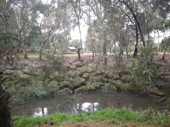
ACTIVITY DESCRIPTION: Hays Paddock is the most visited active and passive recreation space in the City of Boroondara. At the time of European settlement, this rich floodplain was occupied by the Wurundjeri tribe. Crown land sales in 1845 saw Englishman William Oswin successful, and it became a dairy farm known as Kilby Farm. Talk of turning the area into open recreation space commenced in 1943 after many floods. It was finally completed in its current form after re-arrangement of land in both North and East Kew with the building of the Eastern Freeway.
The Paddock is planted with native trees and bushes. Glass Creek, which originates in Greythorn, passes through the park on its way under the Eastern Freeway to join the Yarra River. There is a wetlands area with an associated hide for bird watching.
A shelter pavilion, BBQ, water taps and toilets are available at the site.
BOOKING: By Friday 31st December 2021. To register, click on Get Tickets.
Unsure if you've already booked? Click View my bookings.
NOMADS COVIDSAFE CHECKLIST: Checklist 220101: New Year's Day BYO Picnic.
FURTHER INFORMATION: www.boroondara.vic.gov.au/recreation-arts/parks-and-gardens/hays-paddock
MEETING TIME | LOCATION: From 12 Noon in shade next to the Glass Creek just due east from the three (3) cricket practice nets. Its a short walk from the car park off Leason / Longstaff Streets entrance to the Paddock in East Kew. (If the main car park is full, on-street parking occurs in both Leason and Longstaff Streets).
MAP REFERENCE: Melway map 45 grid J2 | Google map goo.gl/maps/vthct51X7Vo8Lzvb7.
TRANSPORT: 6 km from GPO, approximately 20 minutes to drive. Public transport options are (1) Tram #48 to Stop 41 Clyde Street + Buses 200 and 207 to Leason Street. If travelling via public transport, myki money public holiday capped fares apply ($6:70 full fare and $3.35 concession) + free for Seniors. Cycling via the Main Yarra Trail, exit at Belford Road (Kew Golf Club) and cycle along the bike lane on Kilby Road
FOOD: BYO picnic supplies - BBQ available, but it may be popular on a public holiday. Recommend you also bring a camper chair or rug to sit on. Ample trees to protect from the sun.
APPAREL | FOOTWEAR: Comfortable walking shoes and dress according to the weather forecast.
LEADER: Garry Oliver. | Email LeaderGarryO.thenomadsinc@mail.tidyhq.com if you have any questions.
Members can access leader contact details under Members | Leader Contacts when logged in to the website.
HOME BACK TO LIST OF EVENTS MEMBERSHIPS

Dec
12
2021
Past Event
Trentham Wombat Trail Walk: Sunday 12th December
High Street & Quarry Street
11:00 – 15:00
A short walk within historic Trentham and part of the Wombat Trail, a loop that goes around the edges and through Trentham along well made paths.
GRADE | LENGTH | TYPE: Easy, approximately 7.5 km, circuit walk on formed paths.
ACTIVITY DESCRIPTION: Trentham is a small town on the edge of the Wombat State Forest. There are a number of reserves and walking trails around this historic area, including part of the Wombat Trail, a loop of approximately 7 km, taking the walker around the edge of the Victorian town into the surrounding bushland. The path runs upstream along Stoney Creek and its native bush reserve. After leaving Stoney Creek, you reach the historic Trentham Cemetery (est 1870). Crossing over the Trentham-Blackwood Road we enter Rahills Rd & Golden Point Rd past the Trentham Racecourse, where the last race was run 110 years ago. Returning to Trentham we will make our way back to town via the old Police Camp Reserve, in Camp St (no pun intended), containing a preserved old jail built in 1866. Back into the Trentham township past the historic Red Beard Bakery (run continuously since 1890s) and then onto the 1880s Trentham Railway Station and along the railway line. We return to the Quarry St/High St intersection for the end of the loop and picnic lunch/bbq facilities within the Quarry Street Reserve.
BOOKING: By Thursday 9th December. To register, click on Get Tickets. If you wish to stay on Saturday night, select Saturday from the Accommodation Nights question when booking.
Unsure if you've already booked? Click View my bookings.
NOMADS COVIDSAFE CHECKLIST: Checklist 211212: Trentham Wombat Trail Walk.
It is strongly recommended that you only attend the event if you have been fully vaccinated against COVID-19. Those staying overnight on Saturday night MUST be double vaccinated.
MEETING TIME | LOCATION: 11am on the south side of the Quarry St / High St intersection, Trentham.
MAP REFERENCE: Melway map X909 grid E10 | Google map goo.gl/maps/76ktsq5uc4igUVdr5.
DISTANCE | TIME FROM GPO: 93 km, between 75 and 90 minutes to drive via the M79 Calder Fwy. Parking is available in Quarry St, on the north and the south side of its intersection with High Street (the main Trentham throughfare and just downhill from the Cosmopolitan Hotel).
PUBLIC TRANSPORT: Public transport options are available via train between Southern Cross station and Woodend (or Kyneton), plus a bus to Trentham. Myki cannot be used on the Daylesford bus service - tickets should be purchased online in advance. Recommended options:
Getting There: From Southern Cross, catch the 9:05am Echuca service and alight at Woodend at 10:04am. Transfer to the Daylesford bus service that departs from Woodend at 10:14am and arrives at Trentham Milk Bar/Market St at 10:36am. The bus stop is about 300 metres from the meeting point - from the bus stop head north, then turn left into High St (C318). The second High St intersection is Quarry St, the meeting point.
Returning: either Trentham 2:39pm arriving Southern Cross 4:24pm or Trentham 5:39pm arriving Southern Cross 7:24pm.
For either of these services, catch the Daylesford-Woodend bus service from Trentham Milk Bar/Market St, which should arrive in Woodend to connect to the V/Line train service to Southern Cross Station, departing Woodend about 15 minutes later.
OVERNIGHT OPTION: There is the possibility of staying overnight, as there is space to pitch your tent, campervan etc in the grounds of the leader's home in Trentham, with access to bathroom facilities. There are also a couple of spots available inside the house for lilos. This may be of particular interest to those attending the nearby Mixed Naturist Walk: Wombat State Forest & old logging camps near Blackwood event on Saturday 11th December.
FOOD:
Sunday Lunch: a BYO BBQ will be held at Quarry Street Reserve. BYO meat or vegetarian options for a BBQ lunch beside the meeting point.
Saturday Dinner: for those choosing to spend Saturday night in Trentham, a BYO BBQ will be held at the leader's property in Trentham. BYO everything.
APPAREL | FOOTWEAR: Comfortable walking boots and warm, waterproof layers. Trentham is at 700 metres elevation, so it's likely to be cooler and wetter than Melbourne and the trails may be muddy.
LEADER: Robert H. | Email LeaderRobertH.thenomadsinc@mail.tidyhq.com if you have any questions.
Members can access leader contact details under Members | Leader Contacts when logged in to the website.
HOME BACK TO LIST OF EVENTS MEMBERSHIPS
