

The Nomads Outdoors Group Inc.
Powered by
Past events
All events
Past events
Sep
28
2018
Past Event
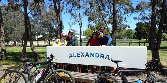
Cycling circuit Tallarook to Alexandra - 2 overnights in Yea
Southern Cross Station
28 Sep 2018 08:00 – 30 Sep 2018 17:30
A three day cycling circuit of part of the Great Victorian Rail Trail, incorporating the Cheviot Tunnel and lunch in Alexandra, with both nights spent in the picturesque town of Yea.
GRADE | LENGTH | TYPE: Medium grade 154km cycling with public transport access. Friday and Sunday will be quite easy days. Saturday will be more difficult, due to both the distance (74km) and some hills, though the hills are relatively small, you’ll only be carrying what’s needed during the day and the whole day will be available for the cycling.
MEETING TIME | LOCATION: Before 8am for an 8:25am departure from Southern Cross Station. The Seymour train that departs Southern Cross at 8:25am arrives in Tallarook at 9:51am.
MAP REFERENCE: Southern Cross Station: Melway map 2E grid K6, or Google map goo.gl/maps/ekQKfLrhCcy.
DISTANCE | TIME FROM GPO: 1 hour 24 minute train journey from Southern Cross Station.
FOOD: Bring snacks if required and a water bottle - there are some water refill points along the way. We will be utilising modest eating cafes, bakeries or pubs for meals when and where possible. You will need money for this.
APPAREL | FOOTWEAR: Bring suitable bike attire to match the weather forecast, and to cater for all possible contingencies. Be sure to bring at least one spare tube and ensure your bike is in good working order. Bring something suitable to wear in the evenings, and perhaps for the return train trip (for the wellbeing of your fellow travellers)! Bring minimal personal effects for the trip as you will have to carry everything with you on your bike.
ACCOMMODATION: A well appointed 2-bedroom villa at Yea Riverside Caravan Park at 1 Court St, Yea, has been reserved by Kevin K. This can accommodate six persons with one room having four bunk beds and the other room with one queen bed. Check it out at yeariverside.com.au/accommodation/2-bedroom-villas. Cost is only $38 per night per person or $76 per person for the 2 nights with 6 persons (2 persons in queen bed - whoever). First in first served - contact Kevin K. asap to secure. Additional accommodation could be arranged by you directly contacting Yea Riverside Caravan Park Ph 5797 2972 - they have queen bed studio suites at $125 per night or close by at Tartan Motel Ph 5797 2202 for a one or two bedroom at $120 per night or at Yea Motel Ph 5797 2660 for a one or two bed room at $140 per night. These places are not far from Yea Riverside Caravan Park. There are other places too, and most also offer “family rooms”, but it would be wise to book asap.
ACTIVITY DESCRIPTION: This is a three day cycling circuit of part of the Great Victorian Rail Trail, with both nights spent in the picturesque town of Yea. It will not be a race or a test of endurance. We will look after each other and stick together. Saturday’s ride is particularly picturesque, with lunch in the beautiful town of Alexandra.
Friday: 40km: train to Tallarook departing 8:25am + cycle Tallarook to Yea (Friday night in Yea)
Saturday: 74km: cycle from Yea to Alexandra via Cathkin, and back to Yea (Saturday night in Yea)
Sunday: 40km: cycle from Yea to Tallarook + 4:15pm depart by train back to Melbourne arriving 5:27pm.
FURTHER INFORMATION: Great Victorian Rail Trail: www.greatvictorianrailtrail.com.au.
LEADER | BOOKING: Kevin K. | by Friday 7th September. Email the Leader if you have any questions. Members can access leader contact details under Members->Leader Contacts when logged in to the website.
Sep
22
2018
Past Event
Naturist Walk in Woodlands Historic Park, Greenvale. Rescheduled.
The Jolly Miller Cafe
10:15 – 16:00
This walk has now been rescheduled for Sat 22nd Sept. Max temp 20 to 21C with a late shower. Chances are we'll be finished before the shower. Will have to be sunny in the morning to get to 21C.
This walk will be repeated on Fri 28 Sept (Grand Final Holiday) if you can't make Sat 22 Sept. Temp 19C and partly sunny is forecast.
______________________
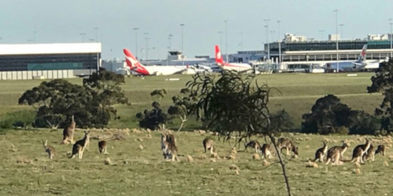
We will visit the old Greenvale TB asylum site, ruins of a grand old house and see many friendly kangaroos and wallabies as well as having great views of Melbourne airport.
GRADE | LENGTH | TYPE: Easy 7km bushwalk on gently undulating grassy hills. This will give us plenty of time to stop and enjoy the interesting features of this historic park.
MEETING TIME | LOCATION: 10:15am at the Jolly Miller Cafe, Shop 7-9, Greenvale Shopping Centre, 1 Greenvale Drive, Greenvale. After about half an hour for coffee, snacks and briefing, we will take all cars in convoy to the start of the walk 2km away.
MAP REFERENCE: Melway map 178 grid J8 | Google map goo.gl/maps/o1bZt2PNXYp.
DISTANCE | TIME FROM GPO: 26km and 30 minutes from the GPO.
TRANSPORT:
Car: travel via the Tullamarine Fwy and take the Mickleham Rd exit.
Public Transport: catch the 9:09am Craigieburn train from Flinders Street to Roxburgh Park Station. From there catch the 543 bus towards Greenvale Gardens, arriving at Greenvale Shopping Centre at 10:11am.
COST: $7, free for Nomads financial members.
FOOD: Carry lunch, snacks and water.
APPAREL | FOOTWEAR: Sunscreen, hat, sunglasses. Wear comfortable walking shoes/boots. Shorts etc. for the start and end of the walk. A small towel to dry off in case you feel like a dip in the large dam in the back paddock.
ACTIVITY DESCRIPTION: This walk is for naturists. Stroll through the gently undulating open forest of this historic park just north of Melbourne which is virtually unused. It has a large population of kangaroos and wallabies who do a wonderful job to manicure the grass. We will visit the site of Melbourne's old North West Hospital where there was once a five storey hospital to house the patients with TB (tuberculosis), a fatal infectious disease of the lungs which was more commonly known as Consumption. Kangaroos now happily graze the extensive lawns. We then move on to to see the beautifully graffitied water towers and may climb into the shorter one, sing a song and check out the wonderful reverberations of your voice. From there it's an easy stroll down the hill with great views of the planes lined up at Melbourne airport to reach the Back Paddock where they are trying to preserve a population of the threatened Eastern Barred Bandicoot. Time for a dip in the large dam if hot, and then on to visit the ruins of a grand old two storey house. As we head homewards look out for the “black wallabies” before we walk through a thick forest of tall spindly eucalypts to eventually escape from the large wired enclosure of the Back Paddock. Then if desired we can take a short side trip to the top of Gellibrand Hill with 360 degree views including the Melbourne skyline and the airport runways. As we return towards the cars we traverse through a most interesting aboriginal cemetery amongst the rocks and trees.
AFTERNOON TEA: After the walk, if you'd like a cool drink, a coffee or a snack, we can go to a nearby hotel - Gladstone Park Hotel at 196 Mickleham Rd, Gladstone Park. It is 6km and 7 minutes from the end of the walk and is on your way back to the Tullamarine Fwy.
FURTHER INFORMATION: parkweb.vic.gov.au/explore/parks/woodlands-historic-park.
LEADER | BOOKING: Russell W. | preferably by Friday 21st September. Email the Leader if you have any questions. Members can access leader contact details under the Members->Leader Contacts tab when logged in to the website.
Tickets dated 15th Sept will be OK. If problems bring cash to the event.
Sep
16
2018
Past Event
Lara By Train and Serendip Sanctuary Walk
Southern Cross Station
10:30 – 16:30
A pleasant day out to Lara by train to visit a scenic linear trail with significant indigenous vegetation, lush groundcovers, flowering native shrubs and trees plus a wildlife sanctuary set in open grassy woodlands and wetlands.
GRADE | LENGTH | TYPE: An easy 9 to 12km walk. The 9km option is available by opting out of two walks within Serendip Sanctuary.
MEETING TIME | LOCATION: In the front carriage of the Waurn Ponds V/Line train departing Southern Cross Railway Station at 10:30am or meet the group en route by arrangement with the event leader.
MAP REFERENCE: Melway map 43 grid E9; Google map https://goo.gl/maps/bCGTVY7pXX72.
DISTANCE | TIME FROM GPO: The walk commences and concludes at Lara Railway Station which is 58 km from the city and takes 45 minutes by train.
FOOD: Pack food for lunch and snacks. At least 1 litre of water should be carried.
APPAREL | FOOTWEAR: Wear a hat and clothing to meet the forecast weather conditions and footwear suitable for walking along concrete, asphalt and unsealed paths.
ACTIVITY DESCRIPTION:
Our day commences with a pleasant journey by V/Line train, quickly leaving the city behind and passing through the open spaces of the western plains before arriving at Lara Railway Station.
Two key features of this walk are Lara’s Kevin Hoffman Walk and Serendip Sanctuary.
Kevin Hoffman Walk is a passive, scenic linear trail with significant indigenous vegetation, lush ground covers, flowering native shrubs and trees set along the eastern bank of the tranquil Hovells Creek.
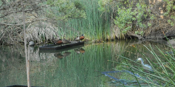
Serendip Sanctuary is a wildlife sanctuary set in the open grassy woodlands and wetlands that are typical of Victoria’s volcanic western plains. The park offers an ideal setting to view some of our more special native animals. The sanctuary has an extensive breeding program which provides an opportunity to view rare and threatened species such as brolgas, Australian bustards and magpie geese. Over 150 species of birdlife common to the western plains of Victoria live in or visit the parklands. Birds can be seen within metres of the viewing areas preening, feeding, incubating eggs and rearing young.
The picnic area at Serendip Sanctuary will provide an ideal setting to enjoy our lunch break.
Two walks within Serendip Sanctuary may be opted out of by arrangement with the group leader on the day for anyone who would prefer to complete a shorter 9km walk for the day.
To complete our walk we will take a more direct route back to Lara Railway Station through quiet residential streets and sporting grounds. Trains depart Lara Railway Station every 40 minutes for the 45 minute journey back to the city.
FURTHER INFORMATION:
http://www.friendsofkevinhoffmanwalk.com.au/
http://parkweb.vic.gov.au/explore/parks/serendip-wetlands-education-facility
LEADER | BOOKING: Peter Tocknell. | by Thursday 13th September. Email the Leader if you have any questions. Members can access leader contact details under the Members->Leader Contacts tab when logged in to the website.
Sep
09
2018
Past Event
Bushrangers Bay Walk: Boneo Rd to Cape Schanck
Bushrangers Bay Walking Track
11:00 – 16:00
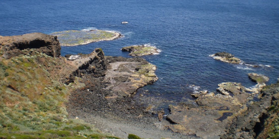
This is a spectacular trail skirting rugged coastline by the waters of Bass Strait.
(Note: this event had originally been scheduled for Sunday 23 September).
GRADE | LENGTH | TYPE: Medium 13km circuit walk.
MEETING TIME | LOCATION: 11am at the start of the Bushrangers Bay Walk and Cape Schanck Walk. When coming from Cape Schanck, this is in the car park on the right (not the first car park on the left) on Boneo Rd (C777: the Rosebud Flinders Rd) in the Mornington Peninsula National Park.
MAP REFERENCE: Melway map 259 grid K8 | UBD map 513 grid A7 | Google map goo.gl/maps/R48zXxjF9Ty.
DISTANCE | TIME FROM GPO: 109km from Melbourne, allow 1.5 hours.
FOOD: Bring your own lunch and at least 1 litre of water.
APPAREL | FOOTWEAR: Sturdy walking footwear, dress for the weather forecast and bring a raincoat just in case!
ACTIVITY DESCRIPTION:
We follow the Main Creek Trail from the car park to Bushrangers Bay. The eucalypt forest gives way to shady thickets of coastal banksia and then to an isolated sandy beach at Bushrangers Bay. From there we follow the trail to Cape Schanck. We’ll have lunch near the 1850s Lighthouse. After lunch, we return the same way and then hopefully, time permitting, have coffee and cake at Flinders Bakehouse.
FURTHER INFORMATION: bushwalkingblog.com.au.
LEADER | BOOKING: Cahal F. | by Thursday 6th September. Email the Leader if you have any questions. Members can access leader contact details under the Members->Leader Contacts tab when logged in to the website.

Sep
04
2018
Past Event
Social Night at Loi Loi Restaurant
19:30 – 21:30
Our regular monthly social night - at Loi Loi Restaurant in Victoria St, Richmond.
MEETING TIME | LOCATION: 7:30pm at Loi Loi Restaurant, 364 Victoria St, North Richmond. See Google map goo.gl/maps/dz57CP2C1o12.
ACTIVITY DESCRIPTION:
Join us for our monthly social evening where members can enjoy a meal, talk about upcoming events, compare notes on past activities and float ideas on events they would like to see run.
LEADER | BOOKING: Don V. | by Monday 3rd September.Email the Leader if you have any questions. Members can access leader contact details under the Members->Leader Contacts tab when logged in to the website.

Sep
03
2018
Past Event
Vehicle based travel to Central NSW and Southern QLD
Broken Hill
03 Sep 2018 10:00 – 21 Sep 2018 20:00
Please be aware that the start date has changed to Monday 3rd September. This is due to the Broken Heel Festival starting on the Friday, and plans to visit Lake Mungo en route. The first weekend (Friday to Sunday) coincides with the Broken Heel Festival in Broken Hill. Those that don’t want to attend that could join the following Monday 10th September in Broken Hill.
This event is being held in conjunction with Motafrenz.
GRADE | LENGTH | TYPE: Easy – car based camping in the National Parks and station camps along the Darling River, and possibly into Southern Queensland. In July we will get in contact and finalise the proposed itinerary taking into account what the participants want to do.
DISTANCE: It takes a long day to drive to Broken Hill (850km) from Melbourne, from where we would drop the pace. This is one long day.
MAP REFERENCE: Google map goo.gl/maps/bJEe4MyMuEN2.
TRANSPORT: We will share vehicles to minimise costs and make the sometimes long drives more interesting. 4WD is not essential, but a vehicle with reasonable clearance is prudent since we will drive on some rough roads. You do not need your own suitable vehicle. Once we know who is interested, we can decide which vehicles to take.
ACTIVITY DESCRIPTION: There are many picturesque and tranquil camping places, outback stations that open for travellers and stunning National Parks. The trip would include attending the Broken Heel Festival (LGBTI) in Broken Hill. This is a peculiar and most unlikely event not to be missed. Highlights would be camping in remote places, experiencing the tranquillity and beauty of the Great Australian Outback, sunsets, sitting around the campfire, birdwatching, strolls, stargazing, visiting historic towns and more. We would not have a rigid program, but would take advantage of nice places we find, and move at the pace that suits us. Two weeks is a minimum to slow down to the pace of the Outback. However you are free to join and leave the group when you wish.
Here are some links to some of the national parks to inspire you. Have a surf on the web to see what there is to do:
www.nationalparks.nsw.gov.au/visit-a-park/parks/mutawintji-national-park
www.nationalparks.nsw.gov.au/visit-a-park/parks/kinchega-national-park
www.nationalparks.nsw.gov.au/visit-a-park/parks/willandra-national-park
www.nationalparks.nsw.gov.au/visit-a-park/parks/paroodarling-national-park
LEADER | BOOKING: Roger H. | ASAP but by 1st August at the latest.
Sep
02
2018
Past Event
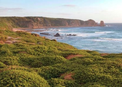
Cape Woolamai Day Walk Phillip Island (Fathers Day)
Woolamai Beach Surf Life Saving Club
10:30 – 19:00
This walk provides grand views over Bass Strait, with its rugged ocean cliffs and beaches.
GRADE | LENGTH | TYPE: Easy 8km point-to-point walk, along the beach, then up over the headland, on tracks all the way.
MEETING POINT | TIME: Carpark at the Woolamai Beach Surf Life Saving Club at 10.30am.
MAP REFERENCE: Melway map 732 grid H10 and map 734 grid D12; Google map goo.gl/maps/Xzacwnzzb9x.
DISTANCE | TIME FROM GPO: 132km, allow 2 hours.
FOOD: Take lunch since there are no shops on the way, and sufficient water for the duration.
APPAREL | FOOTWEAR: Comfortable footwear and warm waterproof clothing - dress for the weather forecast. It can be cold if the wind is strong. And bring the swimming togs for the brave.
ACTIVITY DESCRIPTION: This delightful coastal walk will take us along a surf beach and then up over Cape Woolamai with its rugged and spectacular scenery. It then descends on the sheltered side of the Cape. We will walk along Safety Beach, then cross back over the narrow isthmus to the ocean side and the cars. There are plenty of cafes in San Remo for afternoon tea afterwards.
LEADER | BOOKING: Roger H. | by Thursday 30th August. Email the Leader if you have any questions. Members can access leader contact details under the Members->Leader Contacts tab when logged in to the website.
Aug
26
2018
Past Event
Alphington to Camberwell Walk
Alphington Station
10:30 – 16:00
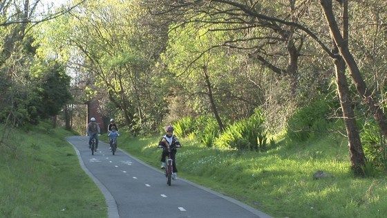
A scenic urban walk through the Darebin Parklands and along the Anniversary Trail, incorporating the superb new river crossing linking the Darebin Parklands to the Main Yarra Trail.
GRADE | LENGTH | TYPE: Medium 12km point-to-point walk (the medium rating is due to the distance plus one embankment ascent/descent).
MEETING TIME | LOCATION: Alphington Railway Station outside Platform 1. Hurstbridge line train departs Flinders Street via the City Loop at 9:58am arriving at Alphington at 10:25am.
MAP REFERENCE: Melway map 31 grid C10; Google map goo.gl/maps/Dgu9aaLhM9Q2.
DISTANCE | TIME FROM GPO: 11km, 30 minutes by train.
COST: Myki money – full fare capped at $6.30; concession fare capped at $3.15; Seniors free.
FOOD: Carry at least 1 litre of water, snacks, plus food for lunch.
APPAREL | FOOTWEAR: Layered clothing to match the weather forecast for a late winter’s day. Comfortable, stout walking boots/shoes, suitable for walking on formed bush tracks and walking tracks.
ACTIVITY DESCRIPTION: Departing from Alphington Station, the walk transverses Darebin Parklands through to Sparks Reserve then into Napier Waller Reserve. At this point we will ascend an embankment to undertake an external inspection of the home and studio of the late Napier Waller. The house features as a silent star of a recent TV series. Advisory: a hiking pole would be useful in particular for the ascent plus the descent.
Returning to the reserve, we take the newly opened path and bridge across the Yarra River into Kew. Proceeding through parkland we connect up to the Anniversary Trail, which started life as the Outer Circle Railway. The walk continues along this paved trail through East Kew, Balwyn, Deepdene, Canterbury and East Camberwell to terminate at Hartwell.
Lunch will be taken in one of the many parks that are integrated into the Trail. Toilets and water bubblers are accessible in the later parts of the Trail. At the conclusion of the walk, there is a choice of public transport to return home: Tram #75 on Toorak Road or Hartwell Station on the Alamein Line with a change at Camberwell.
FURTHER INFORMATION: For trail notes, go to Darebin Yarra Trail Link plus Outer Circle Rail Trail.
LEADER | BOOKING: Garry O. | by Thursday 23rd August. Email the Leader if you have any questions. Members can access leader contact details under the Members->Leader Contacts tab when logged in to the website.
Aug
24
2018
Past Event
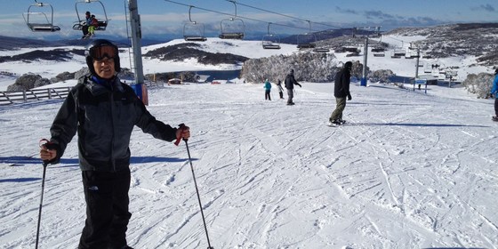
Ski Week at Falls Creek
Cosela Alpine Club
24 Aug 2018 18:00 – 31 Aug 2018 18:00
A cross-country ski, downhill ski and/or snowboard week staying in a cosy lodge at Falls Creek.
GRADE | LENGTH | TYPE: Your choice (choose slopes and equipment to match your skills). One week cross-country ski, downhill ski and/or snowboard.
MEETING TIME | LOCATION: any time | Cosela Ski Lodge, Falls Creek.
MAP REFERENCE: Melway Map X922 grid H10; Google map goo.gl/maps/V7fBUEiNBb62.
DIRECTIONS: There are coach services from Melbourne, Mt Beauty and many other locations to Falls Creek. There are long-term parking facilities in Mt Beauty if you don’t wish to take your car up the mountain. If driving, take the Hume Freeway (M31) to Wangaratta then the Great Alpine Road (B500), turning off to Mt Beauty. On arrival at Falls Creek you should request to unload your luggage at the steps beyond the CFA station, which is lit at night, as you are staying at Cosela and don't need oversnow transport. After unloading, you will return to the attendant to be directed to a parking place. Cosela lodge can then be reached by travelling up the steps and across Snowgum Lane (see map at www.cosela.com.au/HTML/Map.html).
DISTANCE | TIME FROM GPO: 391km, 4.5 hours.
FOOD: It's advisable to bring food for the week; group catering arrangements will be organised after registration. Breakfast cereal, milk, bread, jam, condiments, tea and coffee are provided by the lodge. There’s a local food store for last minute supplies and oversights.
COST: The accommodation cost will be $740 per person for the 7 nights. You can come for the full time or part thereof. The weekend charge for Friday and Saturday is $240 and you have to pay for the two nights, you can’t stay for one weekend night. The cost for staying between Sunday and Thursday is $100 per night.
APPAREL | FOOTWEAR: Bring sheets and pillowcases, towel, washer and toiletries, plus ski gear to suit all possible conditions (or hire it in Mt Beauty or Falls Creek). Don’t forget warm, comfortable clothing for after-ski activities. If driving you will be required to carry chains (these can be hired in Mt Beauty), and you should ensure your radiator has antifreeze.
ACTIVITY DESCRIPTION: A 7-day, or part thereof, ski trip to Falls Creek is being planned for Friday 24th to Friday 31st August. We will be staying at the cosy Cosela Ski Lodge which provides ski-in ski-out access from Wombats Ramble with no oversnow transport requirements. This will be a cross-country ski, downhill ski and/or snowboard week leaving Melbourne on Friday and leaving Falls Creek the following Friday.
FURTHER INFORMATION: www.cosela.com.au/Winter/index.html.
LEADER | BOOKING: Les B. | ASAP.
Aug
19
2018
Past Event
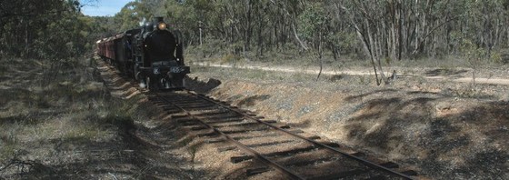
Steam Train Ride: Castlemaine to Maldon for Lunch & Return!
Southern Cross Station
10:00 – 16:00
A steam train ride from Castlemaine to Maldon for Lunch, and return, on the Victorian Goldfields Railway.
GRADE | TYPE: Easy, social.
MEETING TIME | LOCATION: 10am | Southern Cross Station - inside the front carriage of the 10:22am Bendigo service.
MAP REFERENCE: Castlemaine: Melway map X909 grid D6; Google map: goo.gl/maps/xeiTrzC8rvD2.
DISTANCE | TIME FROM GPO: Castlemaine: 129km, approximately 1.5 hours by train.
PUBLIC TRANSPORT: We will travel on the 10:22am Bendigo service from Southern Cross to Castlemaine in Central Victoria.
COST: Return fares on the steam train are: $56/52. Please purchase tickets online now & advise leader when purchase completed. Return Vline fares will be around $33/16 .
FOOD: All available in Castlemaine and Maldon or BYO. A litre of water should be carried.
APPAREL | FOOTWEAR: Dress appropriately for forecast weather conditions.
ACTIVITY DESCRIPTION: Step back in time to the steam era of the Victorian Railways with a ride on a former country branchline, clickety clack, in an area where there were "Gold in them there hills" as we choof choof choof our way between Castlemaine and Maldon in Central Victoria on the VERY POPULAR Victorian Goldfields Railway, tooootttt!!
Our step back in time will commence at Castlemaine Station, after we alight from the V/line service, where we will board our steam "express" for the leisurely 45 minute journey to Maldon where we can enjoy a leisurely lunch at a local eatery after which we will board our return steam service, chugga chugga chugg, woooooo!!, back to Castlemaine, so long as they have kept that steam pressure up, to connect with the return V/line service.
FURTHER INFORMATION: Victorian Goldfields Railway (www.vgr.com.au).
LEADER | RSVP: Peter N-G on 0414503046 or hym@telstra.com by Thursday 16th August.

Aug
16
2018
Past Event
Roger test event 2
10:30 – 16:00
See Procedure to add new event to Website for instructions
------------------- The pro forma description is below. It has been pre-filled with our standard fields and formatting to prompt you. However if you are copying from the Newsletter, just over-write everything. Afterwards, delete this line and everything above it!
This walk provides grand views over Bass Strait, with its rugged ocean cliffs and beaches. {provide a short precis}
GRADE | LENGTH | TYPE: Easy 8km point-to-point walk.
MEETING TIME | LOCATION: 10.30am at the carpark of the Woolamai Beach Surf Life Saving Club.
MAP REFERENCE: Melway map 732 grid H10; Google map goo.gl/maps/Xzacwnzzb9x.
DISTANCE | TIME FROM GPO: 132 km, allow 2 hours.
FOOD: Take lunch, since there are no shops on the way, and sufficient water for the duration.
APPAREL | FOOTWEAR: Comfortable footwear and warm waterproof clothing - dress for the weather forecast. It can be cold if the wind is strong. And bring the swimming togs for the brave.
ACTIVITY DESCRIPTION: This delightful coastal walk will take us along a surf beach and then up over Cape Woolamai with its rugged and spectacular scenery. It then descends on the sheltered side of the Cape. We will walk along Safety Beach, then cross back over the narrow isthmus to the ocean side and the cars. There are plenty of cafes in San Remo for afternoon tea afterwards.
LEADER | BOOKING: Roger H. | by Thursday 30th August. Email the Leader if you have any questions. Members can access leader contact details under the Members->Leader Contacts tab when logged in to the website.
Aug
12
2018
Past Event
Bayside Walk From Sandringham to Mordialloc
Flinders Street Railway Station
10:12 – 16:00
Bay views and beaches feature in this walk with many points of interest to enjoy along the way including Red Bluff Lookout and Ricketts Point Marine Sanctuary.
GRADE | LENGTH | TYPE: A moderate 12km point-to-point walk with public transport links. The walk includes some short steep paths and steps as we cross between beaches and cliff tops.
MEETING TIME | LOCATION: 10:12am | In the front carriage of the Sandringham train departing Flinders Street Railway Station at 10:12am or meet the group en route by arrangement with the event leader. The walk commences at Sandringham Railway Station.
MAP REFERENCE: Sandringham Station: Melway map 76 grid F6; Google map goo.gl/maps/bC4Rovn2TDT2.
DISTANCE | TIME FROM GPO: Sandringham Railway Station is 19km from the city and takes 30 minutes by train. Our return journey takes 53 minutes from Mordialloc Railway Station which is 27km from the city.
PUBLIC TRANSPORT: Access to and from this walk is by public transport only. We will travel to Sandringham Railway Station in the front carriage of the Sandringham train departing Flinders Street Railway Station at 10:12am or you may choose to meet the group en route by arrangement with the event leader. For the return journey trains depart Mordialloc Railway Station every 10 minutes.
COST: Myki money: full fare capped at $6.30; concession fare capped at $3.15; Seniors free.
FOOD | MEALS | WATER: Pack food for lunch and snacks. At least 1 litre of water should be carried.
APPAREL | FOOTWEAR: Wear a hat and clothing to meet the forecast weather conditions and footwear suitable for walking along concrete, asphalt and sandy paths.
ACTIVITY DESCRIPTION: Our walk commences at Sandringham Railway Station with just a short stroll to reach the bay. The first section of the walk includes cliff top views as we walk along the sandy cliff top tracks of the coastal reserves. As the walk progresses we’ll also walk along beaches and beachside paths. Some steps and short steep paths will be encountered as we move between beaches and cliff tops. We’ll walk through to Mordialloc passing through the beaches of Beaumaris, Mentone and Parkdale.
Our walk finishes at Mordialloc Railway Station with cafes nearby for those who wish to stop for coffee before taking the train back to the city. Trains depart Mordialloc Railway Station every 10 minutes for the 53 minute journey back to the city.
LEADER | RSVP: Peter T. | by Thursday 9th August 2018.
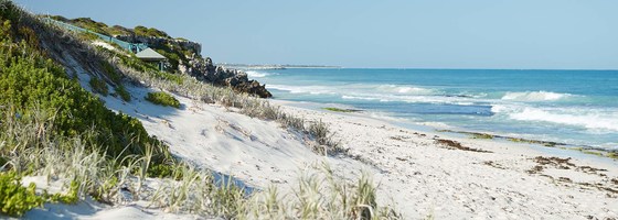
Image: satterley.com.au.
