

The Nomads Outdoors Group Inc.
Powered by
Past events
All events
Past events
Nov
06
2018
Past Event
"CANCELLED" Cup Day Picnic in the Park! Due to weather conditions
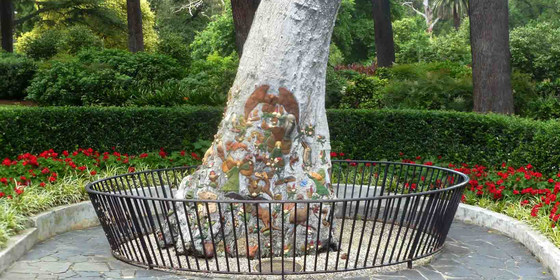
The Fairies Tree
12:00 – 16:00
"PICNIC CANCELLED DUE TO WEATHER CONDITIONS"
Enjoy a BYO-everything picnic in the delightful Fitzroy Gardens (hopefully) on Melbourne Cup Day, with an easy stroll around the gardens afterwards.
GRADE | LENGTH | TYPE: Easy, social.
MEETING TIME | LOCATION: 12 noon at the Fairies Tree opposite the minature Tudor Village & old Pavilion Cafe, Fitzroy Gardens, Wellington Pde, East Melbourne.
MAP REFERENCE: Google map goo.gl/maps/jRw2jXmFFTJ2.
DISTANCE | TIME FROM GPO: 2 km, 10 minutes by public transport.
TRANSPORT: #48 or #75 tram to stop 10 (Jolimont Rd) or Hurstbridge / Mernda line train to Jolimont.
FOOD: All available in the CBD nearby or BYO.
APPAREL | FOOTWEAR: Dress appropriately for the forecast weather conditions, with comfortable footwear for a stroll around the gardens.
ACTIVITY DESCRIPTION: Enjoy a BYO-everything picnic in the delightful Fitzroy Gardens located right next to the CBD, easily accessible by public transport. Please ensure that you bring something comfy to sit on and protection from the late spring sun.
LEADER | BOOKING: Peter N-G. | by Monday 5th November. Email the Leader if you have any questions. Members can access leader contact details under Members->Leader Contacts when logged in to the website.
Nov
03
2018
Past Event
Mt Alexander Naturist Walk, Harcourt with Chewton Overnight
Goldfields Track Café
03 Nov 2018 10:30 – 04 Nov 2018 15:00
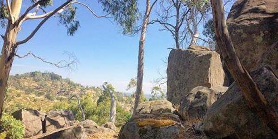
A naturist bushwalk amongst spectacular scenery with large granite outcrops, original native vegetation and wonderful views to the plains.
GRADE | LENGTH | TYPE: This walk is of medium grade and about 7km long, from 10:30am until approximately 4:30pm. We will be walking from the top of the mountain to the bottom and you would expect it to be easy. However the terrain is rather rocky with a few up and downs, and in many places the track is not very good - we need to pick our way through the large rocky outcrops. Towards the middle of the walk it can be soft underfoot as we skirt around a swamp.
MEETING TIME | LOCATION: Meet at 10.30am at the Goldfields Track Cafe, 21 High St, Harcourt for coffee and briefing before we leave in convoy towards the mountain a few kilometres to the east at about 11am.
MAP REFERENCE: Melway map 609 grid D5 | Google map goo.gl/maps/1x8ZfUL8ChD2.
DISTANCE | TIME FROM GPO: 124km and 1 hour 30 minutes from the GPO. Travel via the Calder Freeway and take the Harcourt exit (which is the next exit after the Castlemaine and Chewton exit).
PUBLIC TRANSPORT: There is no public transport arriving in Harcourt over the weekends. Please contact the leader who may be able to arrange a lift for you.
COSTS:
WALK: $7, free for Nomads members.
ACTIVITIES: To cover the cost of heating the big shed and the spas, there is a charge of $10.
BREAKFAST: If you'd like to include breakfast, the total is $15. This needs to be paid by cash at the venue.
FOOD: Carry lunch, snacks and water.
APPAREL | FOOTWEAR: Sunscreen, hat, sunglasses. Wear comfortable walking shoes/boots. Shorts etc. for the start and end of the walk. A small towel to dry off in case we find a place for a cool off dip.
ACTIVITY DESCRIPTION:
This walk is for naturists. Mt Alexander is a significant mountain in this area. The top is 744m above sea level and it rises 350m above the surrounding plain. We will start our walk at the top of the mountain and make our way down to the bottom. The scenery is quite spectacular with large rocky outcrops of granite and wonderful views to the plains below on the eastern side. The vegetation on the eastern side through which we will be walking, is very much undisturbed from its original state. Towards the bottom of the mountain we reach the main Coliban Irrigation Water Channel which was built in the 1870s. At the end of the walk we will reach a few cars which we will have left at the bottom of the mountain earlier in the day. These will be used to transport the car drivers back up the mountain to retrieve the cars which we used to get to the top of the mountain for the start of the walk.
Optional afternoon tea, evening BBQ, Overnight and Breakfast at Chewton: After the walk we have kindly been invited back to "Castlemaine Cosmex", actually Steve and Brett's place in Chewton for further nude socialising. This is 10km and 10 minutes from the end of the walk, and on the way back to Melbourne. The address of the property will be sent to all those who have RSVP'd by midnight on Wednesday 31st October. It will also be given out at the walk on the Saturday, or if you make a booking with Steve by email.
BBQ: BYO meat and drinks. Basic salads and bread will be supplied.
SPA | SHOWER | MASSAGE: Please BYO towels for spa/shower/massage. Looks like we'll have two spas this time! plus massage tables and board games supplied.
OVERNIGHT: For those staying overnight, there are various beds available (double and single). BYO linen, blankets and pillows or sleeping bag. There is room for tents in the back garden. If staying overnight it is essential that you book and arrange your accommodation by emailing Steve at cosmex.melb@gmail.com.
Food can be dropped off at Chewton before the walk if desired. Otherwise, the IGA Supermarket in Castlemaine should have plenty of meat available to purchase after the walk.
For those wanting a bit more nude exercise on the Sunday morning, we may be able to do a short walk of about 1 to 1.5 hours in the forest behind the Chewton property.
If you are unable to come on the Saturday walk, but would still like to come to the BBQ or stay overnight and/or Sunday activities, please email Steve at cosmex.melb@gmail.com.
LEADER | BOOKING: Russell W. preferably by Wednesday 31st October. Email the Leader if you have any questions. Members can access leader contact details under the Members->Leader Contacts tab when logged in to the website.
Nov
01
2018
Past Event
Yanakie/Wilsons Promontory (Cup Day Weekend)
01 Nov 2018 18:00 – 06 Nov 2018 16:00
Enjoy the comfort of a home stay, together with access to the world class Wilsons Promontory National Park for day walks.
GRADE | LENGTH | TYPE: Easy – day walks and beach activities.
MEETING TIME | LOCATION: You can arrive any time from Thursday as arranged with the leader. You will be given location details after registering.
MAP REFERENCE: Melway map X928/628 grid C10 | VicRoads map 103 grid D7 | Google map goo.gl/maps/deXQjAAHQ9w. Detailed directions will be provided after the RSVP date.
DISTANCE | TIME FROM GPO: Approximately 195km. Yanakie is 2.5 hours drive from Melbourne towards Wilsons Promontory.
TRANSPORT: Public transport not available. We will try to maximise car-pooling as parking is limited at the house.
FOOD: Bring supplies for your own breakfast and lunch. Communal night meals will be arranged once the numbers are known. There are staples at the house like sugar, tea etc.
ACCOMMODATION: There are a limited number of beds for the early birds, some floor space and plenty of tent space in the garden. Bring linen and towels.
APPAREL | FOOTWEAR: Warm waterproof gear and changes of clothing. Summery attire is also likely to be needed. It might be warm enough to dive into the sea. Light comfortable walking footwear.
COST: Free entry to the National Park. Donation towards any meals that are provided.
ACTIVITY DESCRIPTION:
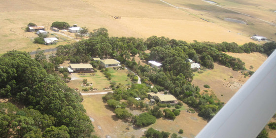
We have a private house at Yanakie overlooking Corner Inlet just near the park entrance. You can come down for as many days as you like. It is quite flexible.
There are many nice day walks in the area. We will decide where to walk each day taking into account the condition of the weather and the participants. The base offers hot showers, comfortable accommodation and a log fire to warm up if the day is cold.
There is a range of gay themed movies to watch in the evening for movie buffs.
FURTHER INFORMATION: Park Notes: parkweb.vic.gov.au/explore/parks/wilsons-promontory-national-park.
LEADER | BOOKING: Roger H. | by Monday 29th October. Email the Leader if you have any questions. Members can access leader contact details under the Members->Leader Contacts tab when logged in to the website.

Oct
28
2018
Past Event
Geelong Art Gallery - Archibald Prize Exhibition
Southern Cross Station
10:20 – 18:35
Visit the Archibald Prize Exhibition in Geelong, Australia’s favourite art award, and one of its most prestigious, plus a pub lunch and an easy short walk.
GRADE | LENGTH | TYPE: Social, 5km circuit walk on bitumen.
MEETING TIME | LOCATION: 10:20am at the train at Southern Cross Railway Station (for 10:30am departure) or at stations en route. We will travel in the front carriage. Check monitors for platform. Be wary of last-minute platform changes.
DISTANCE | TIME FROM GPO: Geelong 72km, 60 minutes by train.
TRANSPORT:
Train: Southern Cross Railway Station, at the train, first carriage, North Melbourne end. Check monitors for platform and be wary of any last-minute platform changes.
Car: via Princes Freeway (M1) to Geelong. Park at or near station. Make way to main waiting area inside the Station. Meet train at 11:30am.
FOOD: Pre gallery tour lunch at the Phoenix Hotel, 59 Moorabool St (corner of Corio St). Participants must register to join the group booking for this communal lunch.
APPAREL | FOOTWEAR: Casual clothing, sunglasses, hat, sunscreen, repellent and camera.
COST: Train (off peak) on Myki money - includes suburban travel: adult $18.48; concession $9.24. Myki card only accepted (no paper tickets).
ACTIVITY DESCRIPTION:
It is a 10-minute walk from the station to the Geelong Gallery.
First awarded in 1921, the Art Gallery of New South Wales’ Archibald Prize is Australia’s favourite art award, and one of its most prestigious. Awarded to the best portrait painting, it’s a who’s who of Australian culture, with subjects often including politicians, celebrities, sporting heroes, authors and artists. In 2018 there were 859 entries from which 57 were selected for judgement and display. From the remainder, the S. H. Ervin Gallery at The Rocks in Sydney selected a further 34 works for an alternative display called the Salon Des Refusés, which has existed since 1992. The Geelong Gallery is delighted to be the exclusive Victorian venue for the 2018 Archibald Prize.
Archibald Prize 2018 is a timed-ticket exhibition, with entry at sixty-minute intervals on the hour until the last entry at 4pm. Adult entry is $16, while Concession is $12. Group bookings of 10+ attract a price of $14 per person via the Gallery website plus a 30 cent booking fee (TryBooking system). The Nomads booking will be scheduled for 2pm.
Upon arrival the Group will proceed to lunch at the Phoenix Hotel in Moorabool St.
At the conclusion of lunch we will walk to the Gallery for the exhibition. Return trains leave Geelong at 16:51pm and 17:31pm for the 64 minute trip back to Southern Cross. Depending on the time taken for the exhibition, any spare time before we head to the station for the return trip will be allocated to a walk around the Geelong waterfront.
FURTHER INFORMATION: geelonggallery.org.au/whats-on/exhibitions/2018-archibald-prize, www.vline.com.au and www.ptv.vic.gov.au.
LEADER | BOOKING: Garry O. | by Wednesday 24th October. Email the Leader if you have any questions. Members can access leader contact details under the Members->Leader Contacts tab when logged in to the website.
Oct
21
2018
Past Event
Tallarook ‘Hock the Ruby’ Cafe for lunch & Rail Trail Walk Inc Afternoon Tea
Southern Cross Station
10:30 – 18:00
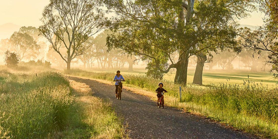
Home style lunch at "Hock the Ruby" in Tallarook is what we are doing, as well as a circuit walk of approximately 10km along part of the Great Victorian Rail Trail and some afternoon tea.
GRADE | LENGTH | TYPE: Easy 10km circuit walk.
MEETING TIME | LOCATION: 10:30am at Southern Cross Coach Terminal, at boarding gate of 10:52am Seymour service.
DISTANCE | TIME FROM GPO: 98km, 1 hour 9 minutes by coach.
FOOD: All available at Southern Cross or Tallarook, please carry at least 1 litre of water especially on the walk.
APPAREL | FOOTWEAR: Dress appropriately for forecast weather conditions and wear comfortable footwear for walking.
ACTIVITY DESCRIPTION:
Our day will commence at Melbourne Southern Cross Coach Terminal from where we shall journey to Tallarook, just a stone’s throw from a cute, country, cottage cafe named "Hock the Ruby" where we'll enjoy a real home style lunch in olde worlde surrounds. After lunch we will walk the short distance to the start of Victoria's longest rail trail, the Great Victorian Rail Trail, which follows the route of the former Tallarook-Mansfield-Alexandra railway, closed in 1978, which in its heyday enjoyed a regular passenger railmotor service on the Mansfield section.
Our exact return walking distance along the Rail Trail is yet to be determined, but it is envisaged that it could be approximately 10km. Once we have completed the outwards part of our walk we can enjoy some BYO afternoon tea, hopefully on some sort of seating with shade, before returning to Tallarook to join our return V/Line coach service to Melbourne.
FURTHER INFORMATION: www.greatvictorianrailtrail.com.au.
LEADER | BOOKING: Peter N-G | by Thursday 18th October. Email the Leader if you have any questions. Members can access leader contact details under Members->Leader Contacts when logged in to the website.
Oct
14
2018
Past Event
Visit Mansfield for Lunch & Historic Town Walk inc. former Railway Station
Mansfield Visitor Information Centre
12:00 – 16:00
IMPORTANT: Car Pooling required for this event so please let leader know if willing to drive & take passengers or if needing a ride so transport for all can be arranged.
Enjoy an afternoon in the picturesque town of Mansfield at the foothills of the Victorian Alps, including lunch and an easy walk around town.
GRADE | LENGTH | TYPE: Easy, Social.
MEETING TIME | LOCATION: 12 noon outside Mansfield Visitor Information Centre, 173 High St, near Ultimo St corner.
MAP REFERENCE: Melway map X922 grid B11; Google map goo.gl/maps/VUbZUvGRVY52.
DISTANCE | TIME FROM GPO: 180 km, approx 2.5 hours by car.
FOOD: All available in Mansfield or BYO.
APPAREL | FOOTWEAR: Dress appropriately for the forecast weather conditions with comfortable footwear for walking around town.
TRANSPORT: As the V/Line coach service in the off snow season only allows us a very short amount of time in town, private vehicle pooling will be required, so please let the leader know if you are willing to drive and take passengers, or if you need a ride.
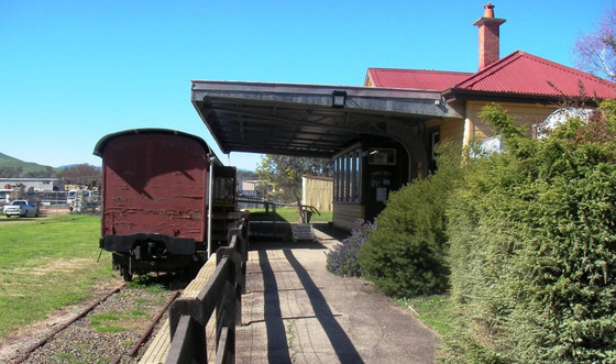
ACTIVITY DESCRIPTION: Enjoy an afternoon in the picturesque town of Mansfield in the foothills of the Victorian Alps where we will first partake of luncheon at a local eatery, then explore the town and surrounds on foot including the former railway station where the local historical society is now located with the snowy playground of Mt Buller in the distance. We might even spot a little bit of that white stuff on the very top.
LEADER | BOOKING: Peter N-G. | by Thursday 11th October. Email the Leader if you have any questions. Members can access leader contact details under the Members->Leader Contacts tab when logged in to the website.
Oct
14
2018
Past Event
Cycling: Belgrave - Lysterfield - Dandenong - Carrum
Belgrave
10:32 – 16:00
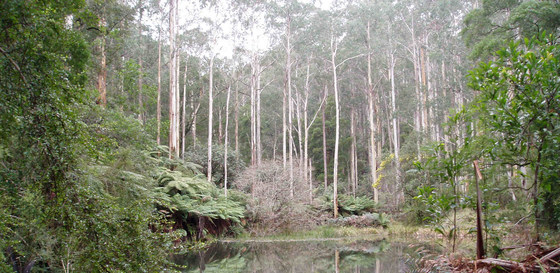
A very scenic ride from the mountains to the sea, taking in Lysterfield Park and Lake. Scenery varies from alpine forest to grasslands, woodlands, urban sections and at the finish follows the Patterson River to the Bay at Carrum.
GRADE | LENGTH | TYPE: Easy to moderate 24km or 38km cycling from Belgrave to either Dandenong or Carrum.
MEETING TIME | LOCATION: 10:32am at Belgrave Railway Station.
PUBLIC TRANSPORT: The Belgrave train departing from Flinders Street platform 3 at 9:06am should arrive in Belgrave at 10:32am (with a two minute platform change in Ringwood).
MAP REFERENCE: Melway map 75 grid F10 | Google map goo.gl/maps/MXxWKVu4eiN2.
DISTANCE | TIME FROM GPO: 48km, 56 minutes by train. Driving is not recommended as it will be time consuming to return to collect your car at the end.
FOOD: Carry 1 litre of water and snacks if you want them. No need to carry lunch - we’ll dine in a restaurant.
APPAREL | EQUIPMENT: Bring your helmet, a spare tube, and dress for the weather forecast. Road bikes are not suitable for this ride as the track is quite rough in places - mountain bikes or solid hybrids are best. Don’t forget sunscreen and sunglasses. Bring bathers and towel if you think you might like a swim at either Lysterfield Lake or Carrum Beach.
ACTIVITY DESCRIPTION:
After a coffee at Bensons Cafe in Belgrave (cnr Burwood Hwy & Bayview Rd) we'll head south, following Station St, Grey St and McNicoll Rd to Birdsland Reserve, which we'll ride through to pick up Dargon Track then Logan Park Track through Lysterfield Park, passing around Lysterfield Lake. After exiting Lysterfield Park, we'll follow Reservoir Rd and Jacques Rd then Glenwood Rd and Heathdale Rd to the Monash Freeway Trail. At that point we'll turn right to follow the Eumemmering Creek Path to Dandenong for lunch at the Payal Indian Restaurant, at 83b Foster St. After lunch we'll ride on to Carrum Beach, by which time a dip in the Bay could be welcome if temperatures are above average.
The distance to Dandenong is 24km, and to Carrum a further 14km. There's only one significant uphill section, on Dargon Track, but for the most part the trail is either downhill or flat. The trail surface is quite rough in places though. You could return home via the Bay Trail if you wished to extend the ride, but most will return via a Frankston line train.
FURTHER INFORMATION: parkweb.vic.gov.au/explore/parks/lysterfield-park.
LEADER | BOOKING: Alan D. | by Friday 12th October. Email the Leader if you have any questions. Members can access leader contact details under the Members->Leader Contacts tab when logged in to the website.
Oct
13
2018
Past Event
Naturist Bushwalk to Waterfalls near Wandong, Optional BBQ & O/night
Kemp's Bakery
13 Oct 2018 10:15 – 14 Oct 2018 16:00
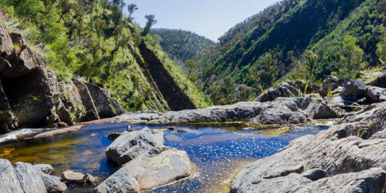
A hard naturist walk in the Clonbinane and Wandong region with some rewarding vistas of Strath Creek Falls, Diggers Gully Falls and the forest.
GRADE | LENGTH | TYPE: Hard 10km naturist circuit walk. There are a couple of short steep ascents and descents as well as a long descent and a long ascent. You need to be reasonably fit for hill walking. About one third of the walk is pleasant easy walking on gently undulating fire trails.
MEETING TIME | LOCATION: 10.15am at Kemp's Bakery Cafe, Shop 4, 3272 Epping Kilmore Road, Wandong. When using your GPS make sure you enter the town of Wandong as there is a chain of Kemp's Bakeries in this region and you could easily end up in the wrong town. (The bakery is in the group of shops near the IGA supermarket). After about half an hour for coffee and briefing, we will carpool to the start of the walk which is 25km and 30 minutes drive from Wandong, which is partly on gravel roads.
MAP REFERENCE: Melway map X910/610 grid L9 | Google map goo.gl/maps/y2vfizFgws72.
DISTANCE | TIME FROM GPO: 71km and 1 hour from the GPO. Travel via the Hume Freeway and take the Wandong Kilmore exit C729.
PUBLIC TRANSPORT: Catch the V/Line train from Southern Cross Station at 9:12am arriving at Wandong Station at 10:04am. After getting off the train go to the main road on the same side of the station from which you got off, and walk back towards Melbourne for 450m, 6 minutes until you reach the shops. Return V/line services in the afternoon are scheduled to depart Wandong station at 5.42 pm and 6.39 pm. The return journey to Southern Cross station takes approximately 50 minutes. While waiting for the train you can have a drink or snack in the Magpie and Stump Hotel across the road from the railway station.
COST: $7, free for Nomads financial members.
FOOD: Carry lunch, snacks and water.
APPAREL | FOOTWEAR: Sunscreen, hat, sunglasses. Wear comfortable walking shoes/boots. Shorts etc. for the start and end of the walk. A small towel to dry off after our splash in the rock pools at the top of the falls.
ACTIVITY DESCRIPTION:
SATURDAY WALK: this walk is for naturists. After parking the cars we descend 144 stairs to a couple of lookouts for excellent views of the 50m falls, now known as Strath Creek Falls, and previously as Murchison Falls. After taking in the great views we venture beyond the lookouts to the head of the falls where we cross on the rocks before climbing a rather steep, but not too long spur. At the top of the spur the forest is now regrowing spectacularly after the February 2009 fires, which totally devastated this area. After a jaunt along one of the many fire tracks we venture down into a back gully to see if we can find Diggers Gully Falls before proceeding to the sheltered valley below. We then return on a different route back to the head of Strath Creek Falls. We will probably be feeling quite hot by this stage and be glad of a cool off dip in the rock pools. It's then up the 144 stairs and back to the cars in the car park.
AFTERNOON TEA: By the time we get back to the cars you will probably be feeling like a cool drink, cup of tea or coffee and snack before we drive the 30 minutes back to Wandong to pick up the cars left there earlier in the day. So bring your supplies for a 30 minute refreshment break before we drive off - cool drinks and/or hot water for tea/coffee and a snack to share. We will then drive back to Wandong to collect the other cars that we had left there in the morning.
OVERNIGHT: Optional evening BBQ, Overnight, Breakfast and Lunch at the Nulla Vale Sheep Farm: After the walk we have kindly been invited back for further nude socialising at the very comfortable Nulla Vale house with open fire. This is 50km and 55 minutes drive from Wandong via Kilmore and Lancefield. The address of the property will be sent to all those who have RSVP'd by midnight on Wednesday 10th October. It will also be given out at the walk on the Saturday.
BBQ: BYO meat and drinks. Basic salads and bread will be supplied.
TOWELS: please BYO towels for sitting on the furniture and for a shower.
OVERNIGHT: for those staying overnight, there are two made-up queen size beds. These need to be booked by emailing Russell, the walk leader. Other people can sleep on the carpeted floor in the spare bedroom or the lounge room - please BYO sleeping bag, sleeping mat/lilo, pillow etc. There are a couple of spare doonas and a couple of spare foam sleeping mats at the property. Or if you like, you can put up your tent on the back lawn.
BREAKFAST: is supplied, and for Sunday lunch there are always plenty of leftovers from the night before.
Food for the BBQ can be dropped off at the Wandong meeting place in the morning. Our host will be there to take it back to his place for the BBQ that evening. For those who would like to have a look around the very picturesque scenery of the farm on the Sunday morning, we may be able to do a short walk of about 1 to 2 hours along Mollison Creek or to the Gorge.
If you are unable to come on the Saturday walk you may still like to come to Nulla Vale for the BBQ, overnight stay and Sunday activities. You may arrive at Nulla Vale any time after 2pm on the Saturday.
LEADER | BOOKING: Russell W. | preferably by Wednesday 10th October at www.thenomadsinc.com.au. One ticket covers all activities you wish to participate in - walk, BBQ and/or overnight. Members can access leaders details under Members Area→ Leader Contacts when logged into the website.
LEADER | BOOKING: Russell W. | preferably by Wednesday 10th October. One ticket covers all activities you wish to participate in - walk, BBQ and/or overnight. Email the Leader if you have any questions. Members can access leader contact details under the Members->Leader Contacts tab when logged in to the website.
RSVP FOR OVERNIGHT ACCOMMODATION: If you wish to stay overnight, please also email the Leader (Russell W.) stating what accommodation you would like - bed, floor or tent.
Oct
07
2018
Past Event
Anakie Gorge (from the top)
Switch Road
11:00 – 16:00
This will be a short walk in the Anakie Gorge (Brisbane Ranges National Park) west of Little River / Werribee.
GRADE | LENGTH | TYPE: Easy/Medium 6-7km circuit walk, but with a steep drop of about 150m into and out of the gorge.
MEETING TIME | LOCATION: 11am. The walk begins at Nelson Track, about 1km down Switch Rd (dirt) from the junction of the Geelong-Ballan Rd (C141). If you start going steeply downhill, you’ve gone too far
*** Note: this is the first day of daylight savings. If you arrive at noon, thinking it’s 11am, you will miss the walk!
MAP REFERENCE: Melway Page (not Map) 11 grid A9/A10 | Google map goo.gl/maps/KH4rZhFVtiu.
DISTANCE | TIME FROM GPO: 85km, 1 hour 30 minutes. There is no viable public transport. Driving towards Ballan, look for Clarkes Rd on left. Switch Rd is a bit past this on the right. Btw, the best route from Melbourne is probably via the Western Highway, not Werribee.
FOOD: Pack food for lunch and snacks. At least 1 litre of water should be carried.
APPAREL | FOOTWEAR: Wear a hat, clothing to meet the forecast weather conditions and footwear suitable for walking mostly along rough-ish tracks. Dress for the weather forecast. Higher sections of the walk may be cold and windy.
ACTIVITY DESCRIPTION:
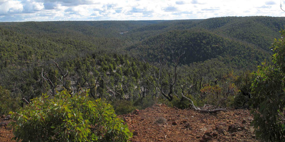
Anakie Gorge features an exceptionally wide variety of plants, along with the remains of gold mining and early water-supply projects for Geelong. Instead of the usual starting point of the Anakie Gorge Picnic Area, we will be starting at the top of the gorge, and descending down to the river, and then returning back to the start. Part of the walk will be the Ted Errey Nature Circuit. We climb to three lookouts with views of Melbourne, Anakie Gorge and the distant Bellarine Peninsula.
FURTHER INFORMATION: parkweb.vic.gov.au/__data/assets/pdf_file/0006/313593/Brisbane-Ranges-National-Park-Visitor-Guide.pdf
LEADER | BOOKING: Richard C. | by Thursday 4th October. Email the Leader if you have any questions. Members can access leader contact details under the Members->Leader Contacts tab when logged in to the website.
Oct
02
2018
Past Event
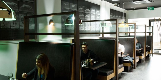
Summer Planning & Social Night
Skinny Dog Hotel
19:00 – 21:00
Our quarterly planning night, in conjunction with the regular monthly social night. A Free event, visitors welcome.
MEETING TIME | LOCATION: 7pm at the Skinny Dog Hotel, 155 High St, Kew for planning followed at around 7:30pm by the monthly social event.
DISTANCE / TIME FROM GPO: 6km and 20 minutes by tram from Collins St.
PUBLIC TRANSPORT AND PARKING: The Skinny Dog is right outside stop 33 on tram routes 48 and 109. The terminus of tram route 16 (Cotham Rd and Glenferrie Rd) is a short walk away. Bus routes 200 and 207 from the City via Johnston St stop in Studley Park Rd at Kew Junction before turning left into Princess St. Ample FREE parking is available on-street and right behind the hotel (enter via Brougham St).
FOOD: Information about the Skinny Dog can be found at www.skinnydoghotel.com.au. Click on “Sports and Entertainment” for details of the Tuesday night steak specials or “Food and Drink” for other options.
ACTIVITY DESCRIPTION: Do you want to see more of a particular activity, or do you have a particularly favourite area of Victoria you would like to share with others? Do you have an idea for something apart from the regular walks? Come along to the planning meeting, and then stay for our monthly social evening where members talk about upcoming events, share a meal and compare notes on past activities. All members are welcome – you don't have to volunteer for an activity. New members are especially invited to this meeting as an orientation to Nomads activities.
LEADER | BOOKING: Richard C. | by Monday 1st October. Email the Leader if you have any questions. Members can access leader contact details under the Members->Leader Contacts tab when logged in to the website.
Sep
30
2018
Past Event
Blackwood circuit walk
Blackwood Hotel
10:30 – 16:00
A walk in the scenic Wombat State Forest that also observes traces of the intensive gold mining in the region dating back to the gold rush era.
GRADE | LENGTH | TYPE: Easy, approximately 10km circuit walk with a couple of short steep hills.
MEETING TIME | LOCATION: 10:30am at the Blackwood Hotel, 22 Martin St, Blackwood. Travel west up the Western Highway, take the C318 exit toward Greendale/Blackwood, turn right onto Greendale Trentham Forest Rd, C318. Turn right onto Martin St and the pub will be on your right. Please park cars away from the main shops and pub, as we will be parked there all day.
MAP REFERENCE: Melway map X909/609 grid E11 | VicRoads map 59 grid F9 or map 585 grid S2 | or Google map goo.gl/maps/YwBHyZYbhx92.
DISTANCE | TIME FROM GPO: Approximately 95km, 80 to 90 minutes drive.
FOOD: Carry lunch, snacks and at least 1 litre of water. We will stop at St Erth Café in Jack Cann Reserve where coffee, tea and quality snacks may be purchased.
APPAREL | FOOTWEAR: Comfortable supporting walking boots/shoes. Choose clothing according to the weather forecast noting that it can be a few degrees cooler than Melbourne.
ACTIVITY DESCRIPTION:
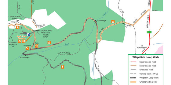
This walk is situated in the Wombat State Forest and traverses part of the Great Dividing Trail. It loops down around Whipstick Creek through some beautiful open eucalypt forest, and mining water races to bring you back to the starting point at the Blackwood Hotel. Along the walk there is historical evidence of various types of mining with both vertical and horizontal shafts. All of the mining in the area was conducted by hand in very difficult conditions. After the walk we can have afternoon tea at the local general store.
FURTHER INFORMATION: www.ffm.vic.gov.au/__data/assets/pdf_file/0020/21476/FS0112_-_Whipstick_Loop_Walk.pdf.
LEADER | BOOKING: Darren W. | by Thursday 27th September. Email the Leader if you have any questions. Members can access leader contact details under the Members->Leader Contacts tab when logged in to the website.
Sep
28
2018
Past Event
Naturist Walk in Woodlands Historic Park, Greenvale. Repeat of earlier walk.
The Jolly Miller Cafe
10:15 – 16:00
This walk is a repeat of the Sat 22 Sept walk and will be held on Fri 28 Sept, the AFL Grand Final Public Holiday.
The Weather for Friday!
Not quite as warm as today (Thurs) unfortunately, but it should be OK, especially in the morning. There should be sun & clouds. Maybe a little cooler in the afternoon. Bring your see-through poncho to keep the wind out (or a light weight windproof jacket).
An Extra Invitation Nude/Clothing Optional BBQ.
One of our kind friends thought that we might like to get warmed up after our walk. So he has invited us for a nude BBQ at his nice warm, farm house with open fire in Nulla Vale. This is 68kms and 55 mins north from the Gladstone Park hotel where we will be gathering after the walk for a coffee, tea, cool drink, snacks.
BYO meat and a drink. A good place to get supplies is the Romsey IGA on the way. Salads, bread, tea coffee is supplied. Don't drink too much, you will have to drive home afterwards - can't stay overnight on this occasion. You can do that on Nov 13 after our next walk.
Exact address will be given out at the walk tomorrow.
______________________
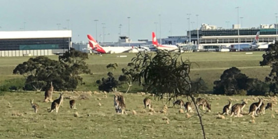
We will visit the old Greenvale TB asylum site, ruins of a grand old house and see many friendly kangaroos and wallabies as well as having great views of Melbourne airport.
GRADE | LENGTH | TYPE: Easy 7km bushwalk on gently undulating grassy hills. This will give us plenty of time to stop and enjoy the interesting features of this historic park.
MEETING TIME | LOCATION: 10:15am Meet in the Food Court in front of the Jolly Miller Cafe, Shop 7-9, Greenvale Shopping Centre, 1 Greenvale Drive, Greenvale. After about half an hour for coffee, snacks and briefing, we will take all cars in convoy to the start of the walk 2km away.
MAP REFERENCE: Melway map 178 grid J8 | Google map goo.gl/maps/o1bZt2PNXYp.
DISTANCE | TIME FROM GPO: 26km and 30 minutes from the GPO.
TRANSPORT:
Car: travel via the Tullamarine Fwy and take the Mickleham Rd exit.
Public Transport: catch the 9:09am Craigieburn train from Flinders Street to Roxburgh Park Station. From there catch the 543 bus towards Greenvale Gardens, arriving at Greenvale Shopping Centre at 10:11am.
COST: $7, free for Nomads financial members.
FOOD: Carry lunch, snacks and water.
APPAREL | FOOTWEAR: Sunscreen, hat, sunglasses. Wear comfortable walking shoes/boots. Shorts etc. for the start and end of the walk. A small towel to dry off in case you feel like a dip in the large dam in the back paddock.
ACTIVITY DESCRIPTION: This walk is for naturists. Stroll through the gently undulating open forest of this historic park just north of Melbourne which is virtually unused. It has a large population of kangaroos and wallabies who do a wonderful job to manicure the grass. We will visit the site of Melbourne's old North West Hospital where there was once a five storey hospital to house the patients with TB (tuberculosis), a fatal infectious disease of the lungs which was more commonly known as Consumption. Kangaroos now happily graze the extensive lawns. We then move on to to see the beautifully graffitied water towers and may climb into the shorter one, sing a song and check out the wonderful reverberations of your voice. From there it's an easy stroll down the hill with great views of the planes lined up at Melbourne airport to reach the Back Paddock where they are trying to preserve a population of the threatened Eastern Barred Bandicoot. Time for a dip in the large dam if hot, and then on to visit the ruins of a grand old two storey house. As we head homewards look out for the “black wallabies” before we walk through a thick forest of tall spindly eucalypts to eventually escape from the large wired enclosure of the Back Paddock. Then if desired we can take a short side trip to the top of Gellibrand Hill with 360 degree views including the Melbourne skyline and the airport runways. As we return towards the cars we traverse through a most interesting aboriginal cemetery amongst the rocks and trees.
AFTERNOON TEA: After the walk, if you'd like a cool drink, a coffee or a snack, we can go to a nearby hotel - Gladstone Park Hotel at 196 Mickleham Rd, Gladstone Park. It is 6km and 7 minutes from the end of the walk and is on your way back to the Tullamarine Fwy.
FURTHER INFORMATION: parkweb.vic.gov.au/explore/parks/woodlands-historic-park.
LEADER | BOOKING: Russell W. | preferably by Wednesday 26th September. Email the Leader if you have any questions. Members can access leader contact details under the Members->Leader Contacts tab when logged in to the website.
Tickets dated 15th Sept will be OK. If problems bring cash to the event.
