The Nomads Outdoors Group Inc.
Powered by
Past events
All events
Past events

May
29
2021
Past Event
Play 500 Cards Online with fellow Nomads
19:00 – 21:00
Although locked down at home, you can still socialise online with Nomads friends using the Trickster Cards program. Groups of four or six players per game can play 500 online - and with video and sound enabled, it's almost like being in the same room!
If you're new to the 500 card game, but would like to learn about it, check out our 500 Cards Tutorial Notes. For some other ideas of things to do during lockdown, see Socialising Online.
GRADE: Social.
BOOKING: Click Get Tickets ASAP. You will be asked to specify your experience level, and we'll attempt to group you on a (virtual) table with others of the same level of proficiency. The sooner you book, the better will be your chances of being well matched!
View my bookings (log in required).
MEETING TIME | LOCATION: 7pm online. You will be sent the link by 6pm on Saturday 29 May to join a game.
LEADER: Alan D. | Email LeaderAlanD.thenomadsinc@mail.tidyhq.com if you have any questions.
Members can access leader contact details under Members | Leader Contacts when logged in to the website.
HOME BACK TO LIST OF EVENTS MEMBERSHIPS

May
23
2021
Past Event
The Nomads at Midsumma Pride March
Ian Johnson Oval
10:30 – 16:00
Gather your friends together, and your Nomads polo shirt, and head along to Fitzroy St, St Kilda to march with The Nomads in the annual Midsumma Pride March.
GRADE | TYPE: Easy, social.
ACTIVITY DESCRIPTION: It's been a helluva ride since the last Midsumma Pride March. The Midsumma Pride March couldn't proceed as originally planned on 31 January, but unless a COVID-19 breakout occurs, it will be occurring as a physical march on 23 May. Marching groups are being encouraged to march as normal, though there may be some restrictions on maximum group sizes. Audiences are encouraged to either watch the parade from any Fitzroy Street venue, or else to watch the live-streamed version from home. Yes, it will be streamed live around the world!
The best view of the parade is always from within it, so register via Get Tickets to join The Nomads in marching proudly down Fitzroy Street. See midsumma.org.au closer to the date for comprehensive details.
BOOKING: By Saturday 22nd May. To register, click on Get Tickets.
** IMPORTANT: In addition, you need to Book a Midsumma Pride March ticket - specifying promo code NOMPM21 to ensure the booking is for the Nomads marchers.
MEETING TIME | LOCATION: Approximately 10:30am at the Ian Johnson Oval, cnr Lakeside Drive and Fitzroy St, St Kilda. Those who have registered will be advised, by the day prior, of the exact meeting time (which depends on where The Nomads group is positioned within the parade).
MAP REFERENCE: Melway map 2P grid B3 | Google map goo.gl/maps/cNxNT994v3Aek5iR9.
PUBLIC TRANSPORT: Cycling or public transport is recommended. Trams will stop running along Fitzroy St at 10:30am, but tram access will remain possible throughout.
TRAM: Route 96 tram to Stop 132 (St Kilda Station), Route 12 to Stop 143 (Park St/Fitzroy St), or any St Kilda Rd tram to Stop 30 (St Kilda Junction).
BUS: Route 246 to St Kilda Rd/Barkly St, Route 600/922 to Robe St/Grey St, or Route 623 to Luna Park/The Esplanade.
FOOD: There will be food stalls and water refill stations at both the start (Ian Johnson Oval) and finish (Catani Gardens) of the parade route. There are also many food and drink options from the traders along Fitzroy St.
APPAREL | FOOTWEAR: Face mask, hand sanitiser, comfortable walking boots/shoes, hat or rainbow parasol, your Nomads polo shirt and anything to add some colour and interest - whistles, streamers, rainbow garlands etc.
LEADER: Garry O. | Email the Leader if you have any questions.
Members can access leader contact details under Members | Leader Contacts when logged in to the website.
HOME BACK TO LIST OF EVENTS MEMBERSHIPS
May
22
2021
Past Event
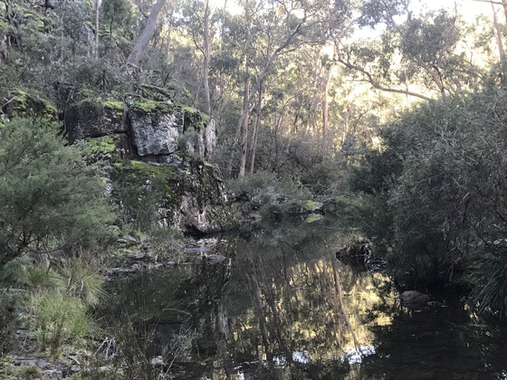
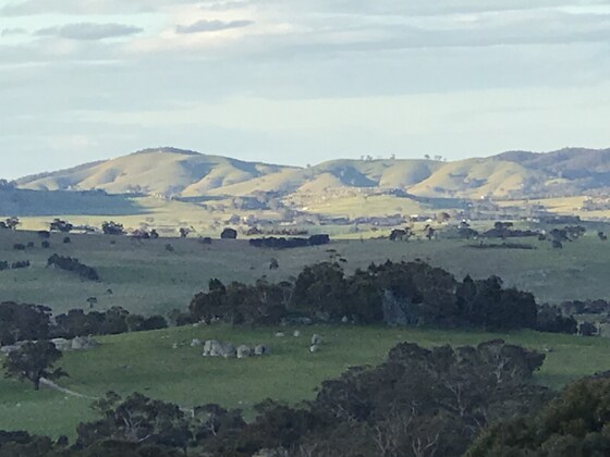
Whiskey Creek Circuit Walk
Square Bottle Track & Mount Blackwood Road
09:30 – 15:00
This interesting, varied walk in the Lerderderg State Park passes an area of grass trees, gold diggings, a water race and views of the Lerderderg Gorge.
GRADE | LENGTH | TYPE: Hard, 11 km, circuit walk. Generally on good tracks but with some steep sections, river crossings and some sections with loose gravel.
ACTIVITY DESCRIPTION: The circuit walk involves three river/creek crossings which requires some rock hopping and possibly wet feet when crossing the Lerderderg River. The walk will be cancelled if there has been recent heavy rainfall in the area. There are two quite steep ascents and descents into the Lerderderg River and Whiskey Creek. Most of the circuit is on quite good tracks. There will be sections which will be gravelly.
BOOKING: By Thursday 20th May. To register, click on Get Tickets.
NOMADS COVIDSAFE CHECKLIST: Checklist 210522: Whiskey Creek Circuit Walk.
FURTHER INFORMATION: bushwalkingvictoria.org.au/item/whiskey-creek-circuit and walkingdroid.com.au/whiskey-creek-lerderderg-state-park.
MEETING TIME | LOCATION: Meet at 9:30am for a 9:45am start at the junction of Square Bottle Track and Mt Blackwood Rd, Greendale.
MAP REFERENCE: Melway map X909 grid E12 | Google map goo.gl/maps/YdDioaTtEuyw1qTN7.
DISTANCE | TIME FROM GPO: 78 km, approximately 1 hour 15 minutes from Melbourne GPO by car.
FOOD: Carry lunch, snacks and at least 2 litres of water.
APPAREL | FOOTWEAR: Strong sturdy walking boots are recommended, and dress according to the weather forecast. Walking poles recommended, particulally for the river/creek crossings where at least one pole would be useful. I have two spare poles if you don't have any. Don't forget face mask and hand sanitiser.
Note: Please ensure that your boots are clean from any mud or soil so as to keep cinnamon fungus at bay from affecting the grass trees.
LEADER: Geoff L. | Email the Leader if you have any questions.
Members can access leader contact details under Members | Leader Contacts when logged in to the website.
HOME BACK TO LIST OF EVENTS MEMBERSHIPS
May
16
2021
Past Event
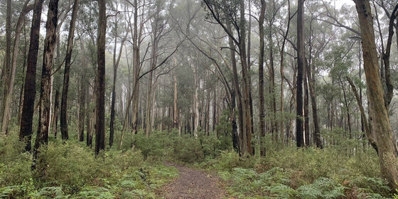
Andrews Hill Circuit Walk, Kinglake NP
11:00 – 16:00
This walk follows tracks over the forested summit of Andrews Hill in Kinglake National Park in the Great Dividing Range, north-east of Melbourne.
GRADE | LENGTH | TYPE: Moderate, 11 km circuit walk. Although this walk is short, the area is hilly, with a total rise of 333m.
ACTIVITY DESCRIPTION:
Kinglake National Park is the largest national park close to Melbourne. It has 22,360 hectares of tall forests, fern gullies and rolling hills, and an extensive network of walking tracks, located about 60 km north-east of Melbourne. The area was logged in the early part of the 20th century, till 1980, and some remnants of logging remain. It also suffered badly in the 2009 Black Saturday bushfires, but the vegetation has mostly recovered. Parks Victoria recorded a video on the park's recovery, see youtube.com/watch?v=b2sIam8qpcQ.
This walk is in a lesser-known loop through regenerated bush in the northern section of the park, north of the Diving Range, and is less likely to be affected by bad weather. Starting from The Gums Camping Area the trail begins by following the Island Creek valley upstream where it passes close to the creek in places and offers a mix of ferns and forest. This section of the trail eventually reaches the Island Creek Picnic Area from which we follow management access trails upwards on the Stringybark Track. Along this section of the trail there's a mix of scrubby bush, forest and occasional ferns. This trail then joins Dusty Miller Track where you'll get your final cardio workout for the day climbing to the highpoint of the trail. From here there is a gradual descent back to The Gums.
BOOKING: By Thursday 13th May. To register, click on Get Tickets.
NOMADS COVIDSAFE CHECKLIST: Checklist 210516: Andrews Hill Circuit Walk, Kinglake NP.
FURTHER INFORMATION: visityarravalley.com.au/activity/andrew-hill-circuit.
MEETING TIME | LOCATION: 11am at The Gums Campground, Kinglake-Glenburn Rd, Kinglake West.
MAP REFERENCE: Melway map X910 grid Q11 | Google map goo.gl/maps/fy2qz63pa1DPNxG26.
DISTANCE | TIME FROM GPO: 65 to 70 km, 1 hour 45 minutes. The way out of Melbourne is a bit complicated, so we strongly recommend using Google Maps or eq.
1. The least complicated route is Lwr Heidelberg Rd, Rossanna Rd (State Route 46), Greensborough Bypass, Diamond Ck Rd, Heidelberg-Kinglake Rd (C746), then Kinglake-Glenburn Rd.
2. The quickest route is probably via M3, Thompsons Rd (State Route 42), Fitzsimons Ln (State Route 47) to Main Rd, then C728 and C746 to Kinglake-Glenburn Rd, as above.
3. If coming from further east, M3, Maroondah Hwy, Melba Rd, C746. This route goes around the park.
FOOD: Pack food for lunch and snacks; there are no places to buy anything along the walk. At least 1 litre of water should be carried.
APPAREL | FOOTWEAR: Bring facemask and hand sanitiser. Wear a hat, clothing to meet the forecast weather conditions and footwear suitable for walking along open forest pathways.
LEADER: Richard C. | Email the Leader if you have any questions.
Members can access leader contact details under Members | Leader Contacts when logged in to the website.
HOME BACK TO LIST OF EVENTS MEMBERSHIPS
May
15
2021
Past Event
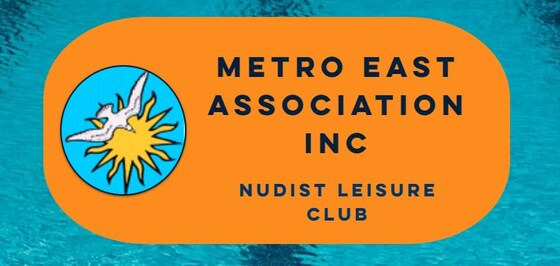
Metro East Naturist Swim Night
Dandenong
19:00 – 22:00
Enjoy a great night of swimming and social naturism around the pool. Spend a relaxing evening at the Metro East Association's pool facilities. This event is strictly for naturists and not a clothing optional event. This is also a strictly non-sexual social event. The venue is a leading sports centre with a 6-lane pool. Some people swim laps, many just socialise in the pool, and some sit around at tables and chairs. Join in at whatever your comfort level is.
TYPE: Social. Some people swim laps, many just socialise in the pool, and some sit around at tables and chairs. Join in at whatever your comfort level is.
ACTIVITY DESCRIPTION:
Join our fellow Metro East Association Inc friends on a special guest night to their naturist swim leisure club. As Nomads guests, we will be welcomed (after a short induction process) to spend an evening naked and socialising with our fellow naturist friends.
Metro East Association Inc is a naturist leisure club located in the outer South Eastern suburbs of Melbourne and organises a social swim night once a month.
Metro East Association Inc is family friendly. All are welcome, regardless of age, gender, sexual preference or body shape. We are a non-discriminatory club. If you agree to abide by our Code of Behavior you will be welcome at our swim nights. All children under 18 must be directly supervised by an adult.
Metro East Association Inc has been running social naturist events since 1980, and is the longest running non landed club in Australia. Non landed means that it does not have its own property. In recent years, the club has been concentrating on hosting its regular monthly night of social naturism around the pool.
The club is run by a small but dedicated group of volunteers.
BOOKING: By Thursday 13th May. To register, click on Get Tickets.
FURTHER INFORMATION: Please check out their website at: metroeastmelbourne.com for more information.
MEETING TIME | LOCATION: Outer South Eastern suburbs of Melbourne. The address will be provided to inducted registered participants only prior to the event.
DISTANCE | TIME FROM GPO: 48 km, approximately 50 minutes to drive from Melbourne CBD.
PUBLIC TRANSPORT: Public transport is available to get to the venue. First, make your own way to Dandenong train station. There are various public transport options to get to Dandenong station, which you can research using either Google or the Public Transport Victoria website or app. Once at Dandenong Station, catch the 893 bus in the direction towards Cranbourne. It leaves Dandenong Station at 6:02, 6:22, and 6:42pm on Saturdays, and takes approximately 10 minutes to get to the venue. To get back to the station afterwards, someone may be able to give you a lift - just ask one of the organisers.
Alternatively, there is plenty of free car parking on the site.
There may be a carpooling option available for this event (subject to COVID-19 restrictions at the time of the event).
FOOD: At the time of writing, there is to be no sharing of food for this event, however, bring your own water or non alcoholic drinks to the venue (no glass due to safety considerations around the pool). Tea and coffee are supplied.
APPAREL | FOOTWEAR: Bring two towels, one to dry yourself and another to sit on. Thongs and a small bag to keep your belongings would also be useful. No swimwear attire is required. Please do not bring valuables to the venue.
LEADER: Jason T. | Email the Leader if you have any questions.
Members can access leader contact details under Members | Leader Contacts when logged in to the website.
HOME BACK TO LIST OF EVENTS MEMBERSHIPS
May
11
2021
Past Event
Annual General Meeting
Bleakhouse Hotel Pub Albert Park
19:00 – 21:00
Our Annual General Meeting, in conjunction with the regular monthly social night.
GRADE: Social.
ACTIVITY DESCRIPTION:
Join us for the AGM followed by dinner in lieu of our regular social gathering. The first part of this night will involve the formal business necessary to satisfy the requirements of our incorporation as an association, including presentation and acceptance of financial and other reports, and the election of office bearers for the next 12 months. After this, please stay for a meal or for socialising. There will be a special mail‐out to all members in advance of the AGM.
A link will be provided here shortly for you to pre-order your meal. Those who haven't pre-ordered will still be able to get meals, but the meals won't get delivered at the same time as the others.
Attend online via Zoom: If you wish, you can attend the AGM online via Zoom. Just select "Online - via Zoom" as the "Attendance Mode" when you get your ticket, and the Zoom link will be emailed to you prior to the meeting.
BOOKING: By Monday 10th May. To register, click on Get Tickets.
MEETING TIME | LOCATION: 7pm at the Bleakhouse Hotel, 97 Beaconsfield Parade, Albert Park (on the corner of Victoria Ave and Beaconsfield Pde).
MAP REFERENCE: Melway map 2J grid H10 | Google map goo.gl/maps/594ZX3oiqidEZrrRA.
PUBLIC TRANSPORT: The tram route #1 terminus is right outside the hotel.
LEADER: Garry O. | Email the Leader if you have any questions.
Members can access leader contact details under Members | Leader Contacts when logged in to the website.
HOME BACK TO LIST OF EVENTS MEMBERSHIPS
May
09
2021
Past Event
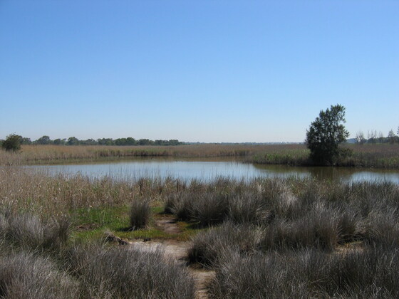
Mordialloc to Seaford Walk
Mordialloc Station
11:02 – 16:30
Enjoy a scenic walk from Mordialloc to Seaford, with an early exit option at Carrum, following creeks, wetlands, canals and the Patterson River.
GRADE | LENGTH | TYPE: Easy to Moderate 10 km, or Moderate to Medium 16.5 km point-to-point walk with public transport connections. The route is entirely flat on a mixture of sealed and gravel paths.
ACTIVITY DESCRIPTION:
Travelling to this event by public transport is recommended. Upon arrival at Mordialloc Station, we'll head for the Mordialloc Creek Path, following that, then the Long Beach Path, through Aspendale, Edithvale, Chelsea and Bonbeach to Carrum (10 km) where we can have lunch on or overlooking the beach. If you're overheating at that point, you may be tempted by the beautiful white sands of Carrum Beach, or you could catch a train from the new skyrail Carrum Station. Those hardy souls wishing to carry on will follow the Patterson River a short distance upstream then wander through the canals and suburban streets of Patterson Lakes to reach the Edithvale-Seaford Wetlands, which we'll follow virtually to the end, to exit via McKenzie St to get to Seaford Station. Some light refreshments can be partaken at the nearby Spanish Bar, just beside the station in Station St, prior to boarding a train home (with departures every 10 minutes).
BOOKING: By Thursday 6th May. To register, click on Get Tickets.
NOMADS COVIDSAFE CHECKLIST: Checklist 210509: Mordialloc to Seaford Walk.
MEETING TIME | LOCATION: 11:02am at Mordialloc Station, upon arrival of the Frankston-bound train that departs from Flinders Street Station at 10:17am.
MAP REFERENCE: Melway map 92 grid F1 | Google map goo.gl/maps/drjYPuUttpK9bVwS8.
DISTANCE | TIME FROM GPO: 45 minutes by train, or 26 km / 35 minutes by car.
PUBLIC TRANSPORT: The Frankston line train that departs Flinders Street Station at 10:17am arrives in Mordialloc Station at 11:02am. The group will travel in the front carriage. For the return trip, trains depart Seaford (or Carrum) Stations every 10 minutes. The train is free for those with a Myki Pass or a Seniors card. Myki Money daily weekend fares are capped at $6.50 full fare and $3.25 for concession holders.
FOOD: Carry lunch, snacks and at least 1 litre of water.
APPAREL | FOOTWEAR: Face mask, hand sanitiser, comfortable walking boots/shoes and dress according to the weather forecast.
LEADER: Michael C. | Email the Leader if you have any questions.
Members can access leader contact details under Members | Leader Contacts when logged in to the website.
Image: Part of the Edithvale-Seaford Wetlands near Austin Road, Seaford, taken in 2007: Wikimedia Commons.
HOME BACK TO LIST OF EVENTS MEMBERSHIPS
May
05
2021
Past Event
Mid-week Men's Farm Visit, Lancefield
High Street & Main Road
10:50 – 16:30
Enjoy a mid-week farm visit, clothing optional, with short walks plus BBQ lunch and drinks (BYO).
GRADE | LENGTH | TYPE: Social/Easy 3 km circuit walks plus BYO BBQ lunch.
ACTIVITY DESCRIPTION:
This is a clothing optional event. Maximum 18 participants. Travel will be by car, but public transport is also an option. Enjoy morning tea on arrival, an optional short walk, BBQ lunch and drinks (BYO), another optional short walk and afternoon tea on a farm.
BOOKING: By Monday 3rd May. To register, click on Get Tickets.
NOMADS COVIDSAFE CHECKLIST: Checklist 210505: Mid-week Men's Farm Visit, Lancefield.
MEETING TIME | LOCATION: 10:50am at the V/Line bus stop, corner High St and Main Rd, Lancefield. From there we will go in convoy to the farm.
MAP REFERENCE: Melway map X909 grid J8 | Google map goo.gl/maps/y5sn4nWk3PpjFjBVA.
DISTANCE | TIME FROM GPO: 80 km, approximately 1 hour 10 minutes to drive.
PUBLIC TRANSPORT: The Sunbury train departing from Southern Cross at 9:13am arrives Sunbury at 9:59am. That connects to a Lancefield bus (bay 1) departing at 10:15am, arriving at Lancefield at 10:49am.
There is a return service at 5pm or get a lift back to Melbourne.
For details, see vline.com.au or ptv.vic.gov.au/journey.
FOOD: Bring what you would like to BBQ plus accompaniments and something to drink.
APPAREL | FOOTWEAR: Casual. Bring face mask, hand sanitiser, sunglasses, hat, sunscreen, repellent. Dress/undress for the weather forecast.
LEADER: Paul K. | Email the Leader if you have any questions.
Members can access leader contact details under Members | Leader Contacts when logged in to the website.
HOME BACK TO LIST OF EVENTS MEMBERSHIPS
May
02
2021
Past Event
Midsumma Cycling Tour to Mount Waverley
Birrarung Marr Playground
10:30 – 16:00
Enjoy a scenic urban ride from Federation Square to Mount Waverley for lunch, and back if you wish. This is a Midsumma Festival event.
GRADE | LENGTH | TYPE: Moderate point-to-point cycling if returning by train from Mount Waverley, or Medium cycling circuit if cycling back after lunch. There are no significant hills and we'll be riding almost entirely on cycling paths, some sealed, some gravel.
ACTIVITY DESCRIPTION:
This relatively easy ride will take us from Federation Square along the Yarra, Gardiners Creek and Scotchmans Creek Trails to beautiful Valley Reserve for a BYO picnic lunch in Mt Waverley. There are also BBQs on-site if you'd like to use those. The leader will bring BBQ tools, oil, sauce, sanitiser wipes and hand sanitiser, but to keep things COVID-Safe, you'll need to BYO everything else. Total distance to lunch is approximately 23 km.
After lunch you can return by train from Mt Waverley Station, or retrace your steps to return towards Federation Square (or return to your home via one of the many trails that intersect with our route).
BOOKING: By Thursday 29th April. To register, click on Get Tickets. Tickets are also available from midsumma.org.au.
COVIDSAFE PUBLIC EVENT REGISTRATION: SubmissionReceipt-COVIDSafePublicEventRegistrationForm-7382-Cycling to Mt Waverley.pdf
MEETING TIME | LOCATION: 10:30am at the Birrarung Marr bike parking, located on the upper level beside the river on Birrarung Marr (between Swanston Street and the MCG, and between the river and the Federation Square Car Park).
MAP REFERENCE: Melway map 1B grid Q11 | Google map goo.gl/maps/dbGrzxrKRU9Ryk738.
PUBLIC TRANSPORT: Any train to Flinders Street Station.
FOOD: Carry lunch, snacks and 1 litre of water. There are excellent picnic and BBQ facilities at our lunch location.
APPAREL | FOOTWEAR: Face mask, hand sanitiser, bike, helmet, spare tube if possible and dress for the weather forecast.
LEADER: Alan D. | Email the Leader if you have any questions.
Members can access leader contact details under Members | Leader Contacts when logged in to the website.
HOME BACK TO LIST OF EVENTS MEMBERSHIPS
Apr
25
2021
Past Event
The NOMADS Salute To Love & Our Parklands - Midsumma Event
Boroondara General Cemetery
10:30 – 16:00
Explore memorials to love in the Boroondara General Cemetery, then traverse a series of connected parklands, finishing at Alphington Railway Station. This is a Midsumma Festival event.
GRADE | LENGTH | TYPE: Easy, approximately 6 km, point-to-point walk.
ACTIVITY DESCRIPTION:
This point-to-point walk starts with a tour of the historic garden style cemetery where we will inspect memorials to love - both gay and straight. The cemetery is noted for its outstanding collection of memorials. Departing the cemetery, the walk will continue through a series of connected parklands to our destination of Alphington Railway Station. The parklands include Victoria Park, Hyde Park, Willsmere-Chandler Park, Kew Billabong, then past golf courses as we cross the Yarra River and enter Napier Waller Reserve followed by Sparks Reserve and finally into Darebin Parklands. We’ll have lunch overlooking the banks of the Yarra River. Travel via public transport is recommended.
Land for the historic 13 hectare Boroondara Cemetery was set aside in 1855 with the first burial taking place in March 1859. The cemetery is laid out in the Victorian garden style with burials allocated by the then practice of religious denomination.
BOOKING: By Thursday 22nd April. To register, click on Get Tickets. Tickets are also available from midsumma.org.au.
COVIDSAFE PUBLIC EVENT REGISTRATION: Nomads Midsumma Walk - SubmissionReceipt-COVIDSafePublicEventRegistrationForm-7384.pdf.
FURTHER INFORMATION: www.kewcemetery.com.au
MEETING TIME | LOCATION: 10:30am at the entrance to Boroondara Cemetery.
MAP REFERENCE: Melway map 45 grid E5 | Google maps goo.gl/maps/vTifVjAfmaFGoBFb7.
DISTANCE | TIME FROM GPO: 8km, approximately 20 minutes to drive, 30 minutes by public transport.
PUBLIC TRANSPORT: Tram #48 - North Balwyn to stop #36 - Parkhill Road. Alternatives are Trams #16 and #109 to the corner of Cotham and Glenferrie Roads then walk along Mary Street (550 metres - 7 minutes).
FOOD: Carry lunch, snacks and at least 1 litre of water, refills plus access to toilets available along the route.
APPAREL | FOOTWEAR: Face mask, hand sanitiser, comfortable walking boots/shoes and dress according to the weather forecast.
LEADER: Garry O. | Email the Leader if you have any questions.
Members can access leader contact details under Members | Leader Contacts when logged in to the website.
HOME BACK TO LIST OF EVENTS MEMBERSHIPS
Apr
24
2021
Past Event
Mixed Naturist Bushwalk near Lancefield v2, optional BBQ & o/night
Lancefield
24 Apr 2021 10:30 – 25 Apr 2021 16:00
THIS IS EVENT WILL BE SIMILAR TO THE EASTER EVENT HELD ON SAT 3RD AND SUN 4TH APRIL.
(This event has just become fully booked with with 22 people booked in. If you would like to be placed on the Waitlist, please send an email to the leader by clicking on 'Russell' )
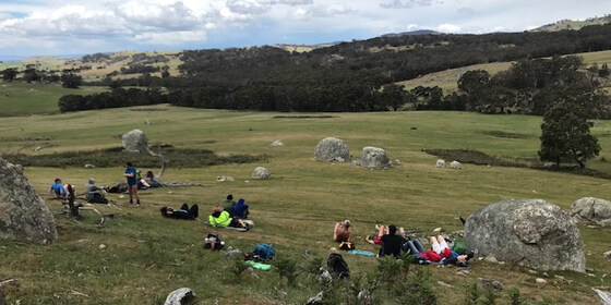
A naturist walk of medium difficulty through two farms in the spectacular granite boulder country north of Lancefield. A picturesque creek, some untouched forest and great views from two of the nearby rocky outcrops that we have not visited before.
GRADE | LENGTH | TYPE: Medium 6 km naturist circuit walk. There is some easy walking through grassy paddocks, a little bit of log hopping along the creek and a few moderate inclines. To get to the views from the rocky outcrops will take a bit more effort, but if you like you can travel around the bottom of the outcrops and we will meet you again as we come down.
ACTIVITY DESCRIPTION:
SATURDAY WALK: This walk is for naturists. We will meet and unload the cars at the overnight farmhouse anytime between 10am and 10:30am. Hot drinks and nibbles will be available until 11am. We will then take some of the cars 3 km to a neighbouring property. From there we plan to get ourselves comfortably unattired and start our walk through the picturesque countryside along the creek and up into the forest with the huge granite boulders. We will then cross into a neighbouring property and ascend two of the rocky outcrops for great views to the north. After our descent we can circle around past an old house ruin to our parked cars. If the weather is warm enough we can have a dip in a farm dam. Following this we can then head back to the overnight farmhouse for drinks and snacks at around 4pm.
OVERNIGHT: Optional evening BBQ, overnight, breakfast and lunch at the farmhouse. After the walk we have been invited back for further nude socialising at the very comfortable farmhouse with its great open fire.
SLEEPING: For those staying overnight, there are two made-up queen size beds. Other people can sleep on the carpeted floor in the library or the lounge room - please BYO sleeping bag, sleeping mat/lilo, pillow etc. There is one spare doona, a few sleeping bags and a couple of spare foam sleeping mats at the property. Or if you like, you can put up your tent on the back lawn. There is also room for campervans etc.
BBQ: BYO meat and drinks. Basic salads and bread will be supplied. A few desserts and other snacks would be appreciated.
TOWELS: Please BYO towels for sitting on and for a shower.
BREAKFAST: Breakfast is supplied, including eggs and bacon, and for Sunday lunch there are always plenty of leftovers from the night before.
OTHER OPTIONS: For those who would like to have a look around the very picturesque scenery at the overnight farm on the Sunday morning, we plan to do a short nude walk of about 1.5 to 2 hours along Mollison Creek, or to the Gorge, or to the host's back paddocks. This wil be followed by lunch to eat up the spare food.
BOOKING: By Wednesday 21st April. To register, click on Get Tickets. One ticket covers all activities you may wish to participate in - walk, BBQ and/or overnight.
RSVP FOR OVERNIGHT ACCOMMODATION: If you wish to stay overnight, you will need to SEND AN EMAIL to Colin, our farmhouse host, on LeaderColinP.thenomadsinc@mail.tidyhq.com to book your accommodation. Please state what accommodation you would like - bed, floor, tent or campervan. Please also include a contact phone number.
Sleeping places in the house are limited to 18.
There is no limit on tents and campervans.
NOMADS COVIDSAFE CHECKLIST: Checklist 210424 Bushwalk near Lancefield, optional BBQ & O/night.
COST: Free for Nomads financial members, $10 for visitors.
MEETING TIME | LOCATION: Any time between 10am and 10:30am at a farmhouse 15 km north of Lancefield. The exact address will be sent to those who have purchased a ticket by 10am on Thursday 22nd April. We plan to drive 3 km to the start of the walk at about 11am.
Tea, coffee and snacks will be provided at the farmhouse. If you'd like egg and bacon sandwiches/rolls and a latte etc beforehand, the best place to get these would be from a cafe in the towns of Romsey or Lancefield.
MAP REFERENCE: Melway map X909/609 grid J7 | Google Map: goo.gl/maps/5tjy71DBz9waYR9a6.
DISTANCE | TIME FROM GPO: 87 km and 1 hour 15 minutes from the GPO. The farm and the town of Lancefield are due north of Tullamarine Airport.
PUBLIC TRANSPORT: Catch the 7:48am Metro train from Southern Cross to Sunbury station arriving at 8:32am. At Sunbury catch the 9am regional bus to Lancefield. From there we will need to arrange a ride to the farm for you. It probably would be easier for you to email the leader, Russell, on LeaderRussellW.thenomadsinc@mail.tidyhq.com to see if he can arrange a lift from your home for you.
FOOD: Carry lunch, snacks and water for the Saturday naturist walk.
APPAREL | FOOTWEAR: Bring face mask, hand sanitiser, sunscreen, hat, sunglasses. Wear comfortable walking shoes/boots. A small towel to dry off after a swim in the farm dam if it's warm enough. We are hoping for a sunny day but It could be getting cool by this time of the year. Bring appropriate clothing to keep youself comfortably warm.
LEADER: Russell W. | Email the Leader if you have any questions.
Members can access leader contact details under Members | Leader Contacts when logged in to the website.
HOME BACK TO LIST OF EVENTS MEMBERSHIPS
Apr
18
2021
Past Event
Merri Creek & Inner Circle Rail Trail Walk
Coburg Lake Reserve
10:45 – 16:00
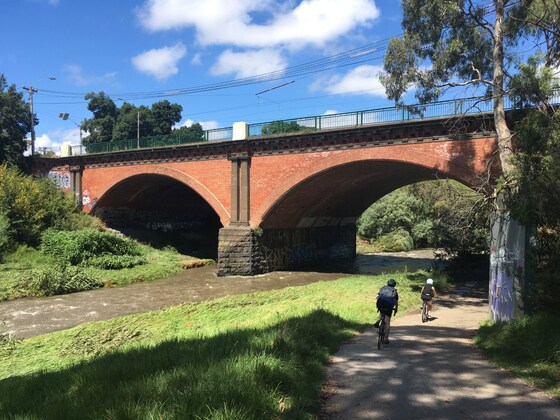
Enjoy a pleasant day walking along the picturesque Merri Creek on a moderate walk through the inner northern suburbs of Melbourne. The walk includes some hidden gems as well as a good array of birdlife, the result of many years of replanting indigenous vegetation. The often-shady trail hugs the creek intimately, with wetlands, cable suspension bridges, parks and veggie gardens. We then pick up the Inner Circle Rail Trail, with its remnants of the old inner circle rail line which once connected North Fitzroy to Parkville and is now a linear park. Your guide will talk about the history of the rail line and its importance to Melbourne's railway past.
This is intended to be a public transport friendly event where the start and end points will be accessible by train and tram.
GRADE | LENGTH | TYPE: Moderate, approximately 11.5 km point-to-point walk on mostly flat paths.
ACTIVITY DESCRIPTION:
Our walk starts at the very popular Coburg Lake Reserve, where the Merri Creek will be waiting for us. After briefly exploring the lake, we make our way south along the Merri Creek Path where we will closely follow the creek over a number of bridges, parklands, wetlands and reserves. We will stop for lunch beside the Merri Creek to enjoy the views and sounds of the creek.
After crossing the old trestle railway bridge, we will then pick up the Inner Circle Rail Trail, a linear reserve remaining from what is left of the abandoned railway line that stopped running in 1981 after a long history of service. The trail now serves as a shared bicycle path connecting the Merri and Moonee Ponds Creeks. We will discuss the history of the line and your leader will point out the locations of the old stations and the existing infrastructure that remains today.
Moving further west our walk concludes at Royal Park Station (next to the Melbourne Zoo), where those who travelled by car will take the train back to the beginning point of the walk.
BOOKING: By Thursday 15th April. To register, click on Get Tickets.
NOMADS COVIDSAFE CHECKLIST: Checklist 210418: Merri Creek & Inner Circle Rail Trail Walk.
FURTHER INFORMATION: Merri Creek Brochure.
MEETING TIME | LOCATION: 10:30am | Lake Grove Carpark, Coburg Lake Reserve, Coburg North.
MAP REFERENCE: Melway map 17 grid H10 | Google map goo.gl/maps/s29AJAqkwh7ejgU87.
DISTANCE | TIME FROM GPO: 9.5 km, approximately 30 minutes to drive, 25-35 minutes by public transport. There is car parking available at the Lake Reserve in Lake Grove free of charge. You will need a Myki card to return back to your car by public transport, either by tram or train.
PUBLIC TRANSPORT:
By Train: Take the Upfield train line from the CBD and get off at Batman Station. Walk east for 4 minutes to the starting point. The conclusion of the walk will be at Royal Park station (same train line) where you can return back to the CBD.
By Tram: Take the Route 19 Tram from Elizabeth Street CBD. Get off at Stop 37 (Gaffney Street/Sydney Road). Walk 2 minutes east to the starting point. The conclusion of the walk will cross the same tram line (Stop 18) where you can return back to the CBD.
FOOD/DRINKS: Carry lunch, snacks and at least 1 litre of water. Also carry sunscreen and a hat, your facemask and hand sanitizer. Bring your Myki card for the return trip by tram or train for those travelling by car back to the starting point.
APPAREL | FOOTWEAR: Comfortable walking boots/shoes and dress according to the weather forecast. Ensure your shoes are waterproof as some of the paths may be wet or muddy if it has rained heavily prior to the event.
LEADER: Jason T. | Email the Leader if you have any questions.
Members can access leader contact details under Members | Leader Contacts when logged in to the website.
HOME BACK TO LIST OF EVENTS MEMBERSHIPS