

The Nomads Outdoors Group Inc.
Powered by
Past events
All events
Past events

Apr
19
Past Event
Bike Ride: Williamstown to Mordialloc via the Westgate Punt
Tick Tok
10:30 – 15:00
Enjoy a scenic bike ride from Williamstown to Mordialloc, crossing the Yarra River on the Westgate Punt.
GRADE | LENGTH | TYPE: Medium Grade 38.5 km point-to-point cycling, mostly on concrete off-road cycling paths. The distance to the lunch spot (The Brighton Beach Hotel), is 22 km and the Brighton Beach Station is next door if you wish to exit the ride immediately after lunch.
ACTIVITY DESCRIPTION: From the cafe in Williamstown we'll follow the Bay Trail W. to the Westgate Punt pier (just prior to the Westgate Bridge). We'll cross the river on the punt, then cycle through Westgate Park and along the Bay Trail all the way to the Brighton Beach Hotel, 4 Esplanade Ave, Brighton (beside the Brighton Beach railway station), where we'll stop for lunch. After lunch there's the option to exit via the Brighton Beach Station, but the ride will continue along the Bay Trail to Mordialloc, where you can board a Frankston line train to return towards the CBD.
BOOKING: By Friday 17th April. To register click on Get Tickets.
Unsure if you've already booked? Click View my bookings.
MEETING TIME | LOCATION: 10:30am at Tick Tok, 181 Nelson Pl, Williamstown. If you'd like a coffee, you should arrive at the cafe no later than 10am. See Public Transport below.
MAP REFERENCE: Google map maps.app.goo.gl/G3Nr9tCviDAMit1S7.
PUBLIC TRANSPORT:
WITH COFFEE: Take the Werribee line service that departs Flinders Street platform 9 at 9:20am, and change to the Williamstown service at Newport (on the same platform), which arrives at Williamstown Station at 9:50am.
NO COFFEE: Take the Werribee line service that departs Flinders Street platform 9 at 10am, and change to the Williamstown service at Newport (on the same platform), which arrives at Williamstown Station at 10:30am.
Note: To get to the cafe from Williamstown Station, ride along Ann St to the end and turn left into Nelson Place. The cafe is just before the first roundabout.
RETURN: Mordialloc Station is on the Frankston line, with trains at least once every 10 minutes.
FOOD: Lunch will be purchased at the Brighton Beach Hotel.
COST: $5 for the Westgate Punt + lunch cost based on what you order - see menu.
APPAREL | FOOTWEAR: Comfortable attire that's suitable for the weather forecast, in addition to your bike and helmet. A spare bike tube is advisable as well as a waterproof layer if any chance of rain is forecast.
LEADER: Alan P. | Email LeaderAlanP@nomads.org.au if you have any questions.
Members can access leader contact details under Members | Leader Contacts when logged in to the website.
Image: Pavel Danilyuk, Pexels
HOME BACK TO LIST OF EVENTS MEMBERSHIPS
Apr
18
Past Event
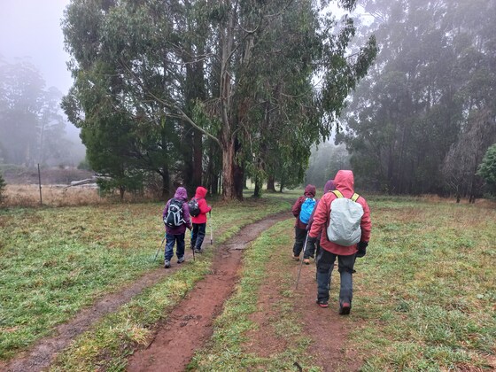
Sassafras and Sherbrooke Forest circuit walk
Ferny Creek Recreation Reserve Hall
10:00 – 16:00
Enjoy a stroll in the Dandenongs. Travel via public transport is an option.
GRADE | LENGTH | TYPE: Grade 3: Moderate 13.5 km (graded according to the AWTGS: Australian Walking Tracks Grading System), although relatively easy within this grade.
ACTIVITY DESCRIPTION: This walk is in a pretty part of the Dandenong Ranges. At the start of the walk we will head downhill through the Alfred Nicholas Memorial Gardens and uphill via Sassafras Creek to the Sassafras shops. Here we can eat BYO lunch in the town rotunda, or you can brave the crowds and purchase lunch. After lunch the second part of the walk will be in Sherbrooke Forest to the Sherbrooke Falls and back to the starting point via a boundary fire track.
Bring boots and poles if you use them, morning tea and lunch, and appropriate weather gear. There are toilets at the starting point and at the lunch spot.
BOOKING: By Thursday 16th April. To register, click on Get Tickets.
Unsure if you've already booked? Click View my bookings.
MEETING TIME | LOCATION: 10:00am at the Ferny Creek Recreation Reserve Hall, Hilton Rd, Ferny Creek.
MAP REFERENCE:
Starting Point - Google map: maps.app.goo.gl/AN9iic5g7Sgnn8Lq6
PUBLIC TRANSPORT: Take the 8.06am train from Flinders St station towards Belgrave, disembarking at Upper Ferntree Gully at 9.14am. Take the #688 Croydon bus at 9.19, disembarking at the corner of Hilton Road and Mt Dandenong Tourist Road at 9.33am. Walk to the Ferny Creek Recreation Reserve via Hilton Road, arriving 9.45am.
FOOD: BYO lunch or purchase at the Sassafras shops.
APPAREL | FOOTWEAR: Comfortable walking boots/shoes and dress according to the weather forecast. Bring poles too if you usually use them.
LEADER: Darren M. | Email LeaderDarrenM@nomads.org.au if you have any questions.
Members can access leader contact details under Members | Leader Contacts when logged in to the website.
HOME BACK TO LIST OF EVENTS MEMBERSHIPS
Apr
17
Past Event
Beginners Overnight Grampians Hike
Wannon Crossing Campground
17 Apr 2026 18:00 – 20 Apr 2026 18:00
THIS EVENT IS FULL. GET A WAITLIST TICKET IF YOU ARE INTERESTED.
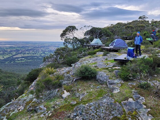
A beginners two night/three day hike in the Grampians with stunning views. This is your hike to discover the joy and serenity of escaping from the rat race for a few days. We will assist with what to pack and what to leave behind. We also have some spare equipment if you don't have it all.
GRADE | LENGTH | TYPE: Grade 3: Medium, 42 km hike along well established hiking trails (graded according to the AWTGS: Australian Walking Tracks Grading System). There are a few climbs but we will go slowly. We will walk up to 16 km each day. A reasonable level of fitness will make it more enjoyable, but it is also an opportunity to improve your fitness.
ACTIVITY DESCRIPTION: We will drive to the Wannon Crossing Campground on Friday night for a good start on Saturday. This campground is car accessible, and is free with no booking required.
Saturday morning we need to do a car shuffle, then a 16 km walk to Djardji-kjawara camp site. Day 2 is 9.3 km over Signal Peak and Mt Abrupt to Mud-Dadjug campsite. Day 3 (Monday) is 16.5 km over Sturgeon Peak to Dunkeld and drive home in the evening. A total of 42 km.
Here is the Parks Vic website with a lot of info that will help in planning: Parks Vic Website.
If the temperature is forecast to be above 30 deg C we will cancel the trip, as it is hot country. Also possibly a fire risk.
The focus of this trip is not to break any records, but rather to enjoy the beautiful scenery, company and joy of camping out.
BOOKING: 1st March - or ASAP! Note that you need to book and pay for your own campsites!
Campsite Bookings: You need to book for Djardji-Djawara campsite on Saturday 18th April, and Mud-Dadjung on Sunday 19th April. Book now since campsites do book out (don't wait). That is why we have selected such an early RSVP date. Also if we don't get at least 6 participants we will cancel the trip.
Wannon Crossing Campground (Friday 17th April) is free and no booking is required.
Nomads Booking: Please also select Get Tickets here to let the leaders know you are joining the group.
If you are not sure this event is for you, please email one of the leaders (details below) to discuss.
Unsure if you've already booked? Click View my bookings.
MEETING TIME | LOCATION: We will drive to Wannon Crossing campground on Friday night to get a good start on Saturday. This is about 3 hours from Melbourne.
DISTANCE | TIME FROM GPO: 280 km, approximately 3 hours drive from Melb GPO. I will try and car share.
COST: All participants need to book and pay for their own campsites via Parks Vic. Here is the link: Campsite Booking. It costs $53 per night for a camp site on a tent platform (i.e. a total of $106pp). If you share a tent it will cost $53 pp for 2 nights. This includes use of the cooking shelters. If you have one person in the tent it still costs $53 each night. Contact the leader about sharing a platform if you don't know who is going.
FOOD | APPAREL | FOOTWEAR: All food for the event will need to be carried in our packs. A suggested packing list, including food requirements, will be sent to those who register. We will share our night meals to make cooking easier. Dont worry if you don't have all the gear as we have a lot of spare, and many items can be shared.
LEADER: Stephan C and Roger H. | Email leaderstephanc@nomads.org.au and LeaderRogerH@nomads.org.au (joint leaders) if you have any questions.
Members can access leader contact details under Members | Leader Contacts when logged in to the website.
HOME BACK TO LIST OF EVENTS MEMBERSHIPS
Apr
14
Past Event
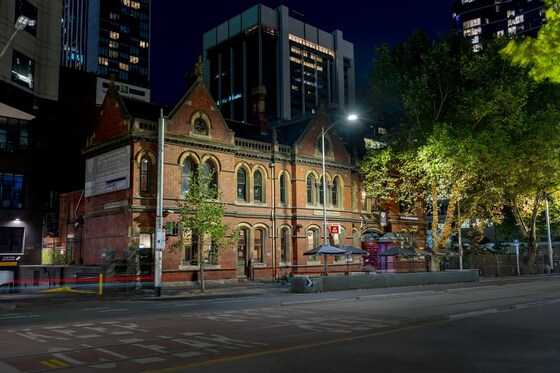
April Social Night - Royal Melbourne Hotel
Royal Melbourne Hotel
19:00 – 21:00
Our regular monthly social night - this month at The Royal Melbourne Hotel, 629 Bourke St, Melbourne.
GRADE: Social.
ACTIVITY DESCRIPTION: Join us for our monthly social evening where members can enjoy a meal, compare notes and float ideas on events they would like to see run, and simply have a chat. Do you want to see more of a particular activity, or do you have a particularly favourite area of Victoria you would like to share with others? Do you have an idea for a walk we haven't done before? If so, we'd love to hear from you. Everyone is welcome – new members are especially invited to any of the monthly Nomads social evenings.
See The Royal Melbourne Hotel website for more details, including their menu. Tuesday night is Parma Night - with various types of parma, including vegetarian, plus wine, beer or soft drink for $26.
BOOKING: By Sunday 12th April. To register, click on Get Tickets.
Unsure if you've already booked? Click View my bookings.
MEETING TIME | LOCATION: 7pm at The Royal Melbourne Hotel, 629 Bourke St, Melbourne.
MAP REFERENCE: Google map maps.app.goo.gl/BE48Kp47nuFUWZAZ9.
PUBLIC TRANSPORT: The Royal Melbourne Hotel is located on the corner of Bourke and King Streets, close to Southern Cross Station as well as to the trams on Bourke St, Collins St or Spencer St.
LEADER: Alan D. | Email LeaderAlanD@nomads.org.au if you have any questions.
Members can access leader contact details under Members | Leader Contacts when logged in to the website.
HOME BACK TO LIST OF EVENTS MEMBERSHIPS

Apr
13
Past Event
Winter Program Pre-planning - Online via Zoom
19:00 – 20:00
Preparing the draft Winter program of events - online via Zoom.
GRADE: Social.
ACTIVITY DESCRIPTION: The bulk of the planning for the upcoming Winter program will be done in this pre-planning meeting via Zoom in readiness to present the draft program the next night at the Social Evening, where attendees will be invited to provide additional suggestions and help fill any gaps.
BOOKING: By 5pm Monday 13th April. To register, click on Get Tickets. Alternatively, simply click on the Zoom link in the reminder email sent to members a few days prior to the event.
Unsure if you've already booked? Click View my bookings.
DRAFT PROGRAM: Nomads Draft Program. You may add your suggestions to this online spreadsheet - be sure to click to some other cell once you've finished, so that your suggestion gets saved.
MEETING TIME | LOCATION: 7pm online via Zoom. Those who registered will be sent the Zoom link by 6pm on Monday evening.
LEADER: Alan D. | Email LeaderAlanD@nomads.org.au if you have any questions.
Members can access leader contact details under Members | Leader Contacts when logged in to the website.
Photo by Bich Tran from Pexels.
HOME BACK TO LIST OF EVENTS MEMBERSHIPS
Apr
10
Past Event
South Gippsland Rail Trail Ride based in Toora
Toora
10 Apr 2026 10:00 – 12 Apr 2026 17:00
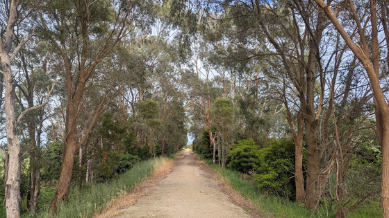
Cycle sections of the Great Southern Rail Trail from Friday to Sunday, staying overnight at a private home in Toora. Toora is a small historic town located on the South Gippsland Highway between Foster and Welshpool.
GRADE | LENGTH | TYPE: Medium grade rides of 30 km, 44 km and 61.5 km on Friday, Saturday and Sunday respectively. Being a rail trail, there are no significant hills. Some previous cycling experience is essential.
ACTIVITY DESCRIPTION: This event is limited to eight riders, plus the leader. Four riders will travel by public transport with their bikes to Morwell Station and be picked up from there. The other four riders will need to bring their own vehicles, or share with other drivers, to transport themselves and their bikes to and from Toora.
We will ride a separate section of the Great Southern Rail Trail each day - see the Proposed Rides below for details.
Upon completion of the Sunday ride, the leader will transport the public transport users back to Morwell Station, and the private transport users will depart from Meeniyan at their leisure. An option to depart Monday is also a possibility, if it suits.
Proposed Rides:
Friday: Toora to Port Welshpool return 11:45am – 4:00pm (30 km total)
Saturday: Toora to Fish Creek return 9:am – 2:30pm (44 km total)
Sunday: Meeniyan to Korumburra return 9am-3pm (61.5 km total)
Optional Additional activities:
Friday afternoon: Walk around Toora township and historic houses or chill at the house.
Saturday afternoon: Drive to Mt Best/Agnes Falls or Waratah Bay to walk/swim. Or chill/relax.
BOOKING: By Monday 6th April, or ASAP to ensure you don't miss out (limit of 8 riders: 4 x public transport and 4 x private vehicle). To register click on Get Tickets. This event is only open to Nomads Members.
Unsure if you've already booked? Click View my bookings.
FURTHER INFORMATION:
Toora facilities: Supermarket (with bottle shop), Toora Deli, Pharmacy, Post Office, Wood Fired Pizza, Windmill Cafe. The pub is currently out of action.
MEETING TIME | LOCATION:
Train Users: 9:51am Friday 10 April at Morwell Station. The leader will transfer you and your bikes to the Toora house.
Drivers: Arrive at the Toora house Friday morning by 10:30am or Thursday afternoon/evening (9 April). The address of the property in Toora, and instructions for getting there, will be provided to the drivers after they register for the event.
DISTANCE | TIME FROM GPO: It is 183 km from Melbourne CBD, approximately 2 hrs 15 mins drive depending on departure time and traffic.
PUBLIC TRANSPORT:
Friday arrival: departure 7:17am from Southern Cross (7:38am from Caulfield), arriving Morwell at 9:22am or, departure 7:39am from Flinders Street (7:52am from Caulfield), arriving Morwell 9:51am
Sunday departure: The leader will transfer the four V/Line users from the ride endpoint in Meeniyan to Morwell, from where they can catch a V/Line train to Melbourne: departures from Morwell at 3:54pm, 4:34pm, 5:15pm etc.
ACCOMMODATION: The house has 3 double bedrooms which can accommodate singles, partners, or two mates willing to share, a double mattress on the lounge floor (1 or 2), an L-shaped sofa (1, or 2 at a pinch). Additionally, there are two stretcher beds and room for a couple of 2-man tents (BYO) in the back yard.
NOTE: Please bring your own sheets & pillowcase or sleeping bag, and towel.
FOOD:
Dinner Friday night and breakfasts on Saturday and Sunday will be provided at the Toora house. Contribution $20.
Lunches Fri, Sat and Sun will be at stops along the rail trail (Port Welshpool, Fish Creek, Korumburra).
Saturday dinner will be at Trulli in Meeniyan or at the Foster pub.
APPAREL | FOOTWEAR: Appropriate cycling gear with layers to cater for all contingencies, including a wet weather layer. Plus the usual hat, sunscreen, sunnies and togs/towel if you plan to swim. Light casual clothing for the evenings. At least one spare tube that fits your bike is essential.
LEADER: Bryan S. | Email LeaderBryanS@nomads.org.au if you have any questions.
Members can access leader contact details under Members | Leader Contacts when logged in to the website.
HOME BACK TO LIST OF EVENTS MEMBERSHIPS
Apr
03
Past Event
BOOKED OUT. WAITLIST ONLY. Easter at Healesville
McGrettons Road
03 Apr 2026 08:00 – 06 Apr 2026 16:00
WAITLIST ONLY. CONTACT LEADER. EVENT STARTS FRIDAY MORNING. PLEASE CONTACT LEADER IF YOU WANT TO ARRIVE EARLIER.
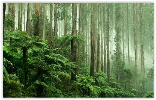
Enjoy the comfort of a home base, together with day walks and activities in the Yarra Valley.
GRADE | LENGTH | TYPE: Grade 2 or 3 | Easy/Medium – day walks and other activities (graded according to the AWTGS: Australian Walking Tracks Grading System).
ACTIVITY DESCRIPTION: We have a private house on an 8 acre farm 2 km out of the town of Healesville. You can come down for as many days as you like. It is quite flexible. There are many nice day walks in the area. We will decide where to walk each day taking into account the condition of the weather and the participants. The house has a hot shower, large kitchen and living areas, wood fired outside spa, and a log fire to warm up if it is cold. There are plenty of flat and protected sites for caravans and tents. The event is limited to 20 participants.
Shower and toilet facilities are available in the house. Bed and floor space is limited in the house, so it will be allocated on a needs basis. Alternatively you can look for accommodation close by, but book early as Easter time is busy.
There are many eating places in the main street and we will take advantage of them. There are also supermarkets in town so we can buy food for BBQs, or take-aways such as pizza. It's not intended to organise evening meals prior to arriving.
Bring your own breakfasts and lunches.
The property is owned by the leader's brother, and there is a small fee of $21 per person to cover costs for 4 nights accommodation. To make things simple it is the same fee whether you camp, or squash into the house. Visitors should take out a Temporary 1 month membership (cost $8) prior to selecting Get Tickets.
BOOKING: By Friday 27th March. To register, click on Get Tickets. There is a limit of 20 people, and it is on a first-booked first-served basis.
Unsure if you've already booked? Click View my bookings.
FURTHER INFORMATION: Activites we could do include walks around Maroondah Dam, Mt DomDom, Mt Riddell, Badger Creek walk and BBQ, Park Run, Tarawarra Gallery, Historic train trip through the Tunnel, Sylvia Falls, Vineyards, Gin Distillery etc etc. We might split up into different interest groups each day.
MEETING TIME | LOCATION: You can arrive any time after 4pm on Thursday as arranged with the leader. You will be given location details after registering.
MAP REFERENCE: Detailed address will be provided after the RSVP date.
DISTANCE | TIME FROM GPO: Approximately 80 km. 1 hour 15 mins by car.
PUBLIC TRANSPORT: There are public transport options. Catch a suburban train to Lilydale, then a Healesville Sanctuary bus. Get off at the Healesville tourist railway station (2.5 hour journey and all on a Myki card). From there it is a 1 km walk (or phone for a lift).
FOOD: Bring supplies for your own breakfast and lunch. We will decide on night meals after we arrive, as there are plenty of options in town.
There will be plenty of communal staples provided like coffee, tea, bread, milk, sugar etc.
There is limited fridge space. Consider bringing an esky to keep things cold. Ice is available in town.
APPAREL | FOOTWEAR: Warm waterproof gear and changes of clothing. Summery attire is also likely to be needed. Easter time is unpredictable. Light comfortable walking footwear.
ACCOMMODATION: There are a limited number of beds, some floor space, and plenty of tent space in the garden. Bring a sleeping mat and sleeping bag if sleeping inside. Also bring your own towel.
COST: Accommodation charge of $21 (to be paid when you "Get Tickets"). Free entry to the National Park. Cash donation towards any meals that are provided.
LEADER: Roger H. | Email leaderrogerh@nomads.org.au if you have any questions.
Members can access leader contact details under Members | Leader Contacts when logged in to the website.
HOME BACK TO LIST OF EVENTS MEMBERSHIPS
Apr
02
Past Event
Autumn ConFest 2026
7599 Pretty Pine Rd, Moulamein NSW 2733, Australia
02 Apr 2026 12:00 – 07 Apr 2026 12:00
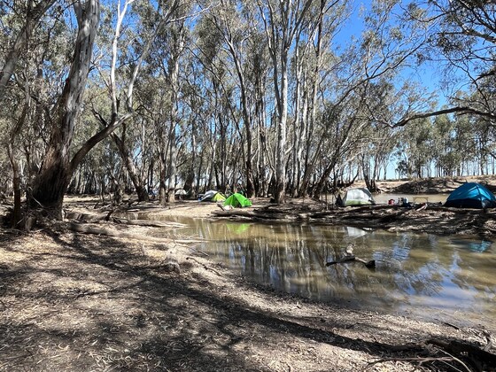
ConFest (Conference/Festival) is a gathering of people wishing to share talents, skills, ideas, concerns and philosophies in a caring, fun loving and tolerant atmosphere. The presentation of workshops, demonstrations, entertainments and the maintenance of site facilities are all performed by volunteers, monetary payment is neither accepted nor made.
The event works with the energy and participation of the people who attend. Everyone is encouraged to get involved and help out where possible. At ConFest, everybody shares the responsibility of making the event as fantastic as possible.
For more information please see: ConFest - Australia's leading Alternative Lifestyle Festival
ACTIVITY DESCRIPTION: The Nomads will be present at ConFest and you are welcome to join us at Nudies or Rainbow villages. Email the event leader if you wish to learn more about attending the event as a first timer. There is plenty of information on the ConFest website, including what to bring.
The Nomads will run a clothing optional 2-3 hour easy walk on the Sunday. Meet Sun 10am at the information tent. The information boards for 'Nudies' will contain more information. Bring with you a hat, sunscreen, towel, sunglasses and comfortable walking shoes. Also advisable to bring 1L of drinking water on the walk. You are welcome to also come along and experience ConFest with friends or even make new friends during your time at ConFest.
BOOKING: Earliest check-in is from Midday on Thursday 2nd, and you must be off-site by Midday Tuesday 7th April. You may book for however many days you wish to be at the festival.
To register:
NOTE: All ticket purchases are online via website: Confest - Tickets ONLY. (Can be purchased at the gate via online booking, no cash will be accepted at gate!).
Photo ID will be requested upon initial entry to ConFest. Please ensure your ticket name matches the name on your identity document. Please have this ready for presentation before you arrive at the scanning point. We will also need your vehicle registration for traffic direction to your booked section onsite.
Standard Ticket (16 years of age and over) - $200 + GST + 2 hours volunteer contribution
Child Ticket (15 Years old and under) - $10 + GST
Vehicle Ticket: - $10 + GST
RV Ticket - $20 + GST
FURTHER INFORMATION:
Important Note: Vehicles Are Restricted From Moving Around The Grounds At Night due to safety reasons.
Arriving during the the day allows for ease of setting up your campsite.
Please arrive before 7pm otherwise you will be directed to a holding area overnight.
You may be able to walk into the ConFest site at night. For more information, please visit the arriving at night page. For more Parking Info
Please note that there are no permanent toilets or showers on site. There are outdoor public showers at the Arts village and portable toilets around site. It is a good idea to bring hand sanitiser with you!
LOCATION: 7599 Pretty Pine Road, Moulamein NSW
MAP REFERENCE: Google map Click here to view the ConFest location on Google Maps.
GETTING THERE: Please note the leader will provide information only. There is no car pooling arrangements for this event, please make your own travel arrangements.
From Melbourne - via Echuca and Deniliquin 385km
Take the M31 from Melbourne (Hume Hwy) and take the exit B75 (Cobb Hwy) to Echuca. Continue on the B75 to Deniliquin (these are the last shops before ConFest).
From Deniliquin follow the B75 north of town and turn left at Pretty Pine towards Moulamein. The festival is around 70km along this road on the left hand side.
From Melbourne - via Kerang and Moulamein 373km
Take the M79 (Calder Fwy) from Melbourne and continue along the A79 past Bendigo. Turn right into the C274 towards Serpentine and follow B260 towards Kerang.
From Kerang head to Barham along the C264 and from Barham take Moulamein Rd following signs to Moulamein. In Moulamein follow signs to Deniliquin, festival site is short drive on the right.
PUBLIC TRANSPORT:
Weekly bus From Swan Hill to Moulamein
Wakool Shire office and Swan Hill Visitors Information Centre now have the following information:
A bus departs from outside the Swan Hill Visitors Information Centre, in Campbell Street, directly across from the train station, for Moulamein, each Thursday only. Departing at 1.30pm it arrives at Moulamein at 2.30pm, passing by the ConFest site.
It is a private business service and as seating is limited, advance bookings are required. Phone Wayne or Andrea DAVIES on 0431 593 155 to make a reservation and for any further information on the bus service eg when does it depart Moulamein for Swan Hill?
Carpooling and Transport Facebook Page
Looking for a lift or have one to offer? Visit our carpooling and transport forum section to view and post regarding carpooling and transport to ConFest. You may just find that lift you're looking for or be able to help someone in need.
ConFest Rideshare
ConFest Transport & Rideshare
Please note the Nomads will not be organising carpooling for its members, please make your own arrangements or use the links above to organise your trip.
FOOD: Food (Vegan only) and drinks can be purchased at the onsite Market but it is advisable to also bring your own food/drinks/snacks to the event as you would for a 3-4 day camping trip. There is drinking water available all over the site and is very safe to consume.
Please note this an alcohol and recreational drug free event.
APPAREL | FOOTWEAR: Comfortable walking boots/shoes and dress according to the weather forecast. A pair of thongs and comfotable shoes during the event. Moulamein can be several degrees hotter than Melbourne during the day and cooler in the evenings.
If camping in the forest, bring your usual camping equipment, sleeping bag and warm clothes in the evening. Try to pack light as you will need to walk approx. 1 km from the car park to the camping area. Trolleys are available onsite and there is also a bus to drop you off at certain stops. The Welcome crew can help direct you if using this service.
LEADER: Jason T. | Email LeaderJasonT@nomads.org.au if you have any questions.
Members can access leader contact details under Members | Leader Contacts when logged in to the website.
HOME BACK TO LIST OF EVENTS MEMBERSHIPS
Mar
29
Past Event
Brimbank Park Loop Track Walk
Green Gully Reserve Playground
11:00 – 15:30
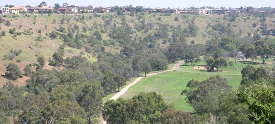
The Brimbank Park Loop is a 10 km trail located near the airport in Melbourne’s North West, that follows part of the upper Maribyrnong River and Brimbank Park.
GRADE | LENGTH | TYPE: Grade 2: Moderate, approximately 10 km, circuit walk with a total rise of 150m (graded according to the AWTGS: Australian Walking Tracks Grading System).
ACTIVITY DESCRIPTION: Brimbank Park sits approximately 55 metres below the surrounding western plains. It was first settled by Europeans in the 1830s. The name is thought to have originated from the farmers moving their sheep and cattle 'around the brim of the bank' of the Maribyrnong River.
This is a loop walk starting at Green Gully. The route uses a combination of sealed and well maintained gravel paths. There is one short, but fairly steep climb on the walk (70m), plus the ascent out of the valley at the end.
A wetlands area has been extensively revegetated. Birds commonly seen in the park include blue wrens, yellow-tailed thornbills, flame robins, parrots and galahs, and a variety of water birds. Residing in the river red gums are brushtail and ringtail possums. You may see a blue-tongued lizard sunbaking, or catch sight of some swamp wallabies.
The former Dodd farm is of regional historical significance for its association with the original European settlement and farming of the Maribyrnong Valley.
Note: Dogs are permitted but must be kept on a lead at all times.
BOOKING: By Friday 27th March. To register, click on Get Tickets.
Unsure if you've already booked? Click View my bookings.
FURTHER INFORMATION: visitvictoria.com/regions/melbourne/see-and-do/nature-and-wildlife/national-parks-and-reserves/brimbank-park.
MEETING TIME | LOCATION: 11:00am at the parking area near Green Gully Reserve playground, McCrae Blvd, Keilor Downs, off Green Gully Rd, not the cafe. This is a fairly large parking area, but if sporting events are on, you may have to try surrounding streets.
MAP REFERENCE: Google maps goo.gl/maps/AxSpZu2M1GWVwELh6.
DISTANCE | TIME FROM GPO: 25 km, approximately 30 minutes to drive.
PUBLIC TRANSPORT: Public transport is possible by train (Metro) via Sunbury Line leaving Town Hall station at 10:04 to Keilor Plains Station, then Bus #421 (St Albans) to Green Gully Rd/Driscolls Rd, about 60 minutes.
FOOD: Carry lunch, snacks and at least 1 litre of water. We will be stopping near the cafe for lunch, if you want to buy something there (but they're slow).
APPAREL | FOOTWEAR: Comfortable walking boots/shoes and dress according to the weather forecast. Much of the walk is exposed, so wear sunblock and hat.
LEADER: Richard C. | Email LeaderRichardC@nomads.org.au if you have any questions.
Members can access leader contact details under Members | Leader Contacts when logged in to the website.
HOME BACK TO LIST OF EVENTS MEMBERSHIPS
Mar
29
Past Event
Men's Naturist Day Walk on a private farm near Lancefield with optional BBQ
Lancefield
10:45 – 22:30
Please Note: This event has been rescheduled to Sunday 29th March due to poor weather forecasted on Saturday.
There are 4 spots left for Sunday, if you are intending to participate, please book your ticket now to avoid disapointment.
This is a day event only Please respect the wishes of the host that no provisions for overnight stay at the property will be made before or after the event.
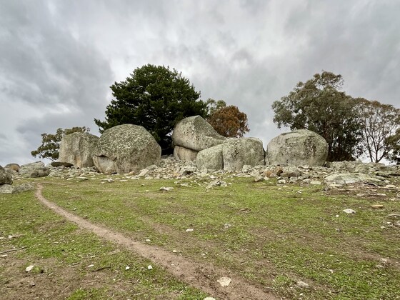
Enjoy a naturist day out, walking in the beautiful and spectacular country near Lancefield courtesy of one of our Nomads members who has a farm in the area. Meet at the farm for morning tea, coffee and refreshments before the hike. We are planning an optional BYO BBQ dinner for those wishing to extend their stay on the farm into the evening.
GRADE | LENGTH | TYPE: Grade 2: Moderate 6-8 km circuit walk in quite hilly open country (graded according to the AWTGS: Australian Walking Tracks Grading System). Walking is on 4WD tracks, animal pads and through grassy paddocks. Please ensure that you are fit enough to hike 6-8 km up and down hills, and over sometimes rocky and slippery terrain. Please contact one of the event leaders if you have any concerns.
ACTIVITY DESCRIPTION: We will meet at the farm property. Tea, coffee and refreshments will be available when you arrive. After introductions and the briefing for the day, the group will carpool about 3 km on good gravel and bitumen roads to the start of the walk on a neighbouring farm property. Clothes can be shed once we park the cars at the designated location on the neighbouring farm. We will walk for a while to build our appetites and then stop for lunch at a good spot with a view.
After lunch, we continue our exploration of the picturesque farm and the spectacular rock boulder formations before returning to our cars to drive back to the farmhouse. There you can have tea, coffee, nibbles and a drink while enjoying the lovely open fire if the weather is cool before departing for home or staying on for the optional dinner.
For those wishing to stay on, the optional BBQ dinner has been planned around 6pm. BYO meat and drinks and anything else you wish to contribute. Salads, bread, sauce, tea, coffee etc will be provided. The BBQ dinner is planned to wind up around 10:30pm.
BOOKING: By Friday 27th March. To register click on Get Tickets.
Unsure if you've already booked? Click View my bookings.
MEETING TIME | LOCATION: 10:45am at the farm, which is 14 km north of Lancefield. The exact address will be sent out on Friday 27th March to all those who have registered by 11pm on Thursday 26th March.
Please do not arrive before 10:00am on the day, to give the host enough time to finish preparing for our arrival.
MAP REFERENCE: Google maps goo.gl/maps/y5sn4nWk3PpjFjBVA (approx location).
DISTANCE | TIME FROM GPO: 82 km, approximately 1 hour 15 minutes to drive.
If you are returning home at dusk it is safer to drive at 60 km/h or less (between the farm and Lancefield and Kilmore-Lancefield Rd) and keep an eye out for wombats and kangaroos on the road when driving via that route.
PUBLIC TRANSPORT AND REQUESTS FOR ASSISTANCE WITH TRANSPORT: Public transport will only get you to Lancefield, 14 km short of the farm so is not a practical option.
Anyone without transport to or from the property can seek the limited assistance of LeaderMichaelJ@nomads.org.au to co-ordinate a pick-up using the following procedure:
1 The person seeking a lift needs to email LeaderMichaelJ@nomads.org.au requesting assistance with transport.
2 The email is to contain the full name, mobile phone number and pick up suburb requested.
3 A person requesting a lift must agree that their full name, mobile phone number and pick up suburb be provided to all people registered to attend the event.
4 LeaderMichaelJ@nomads.org.au will email all participants as at the time of the request and provide full name, mobile phone number and pick up suburb for the person requesting a lift.
5 It is up to those who receive the email to decide if they will be prepared to provide a lift and make their own arrangements directly with the person who seeks a lift as per the provided details.
6 If no one contacts the person seeking a lift, then unless they are able to make other arrangements, they will be unable to attend the event.
7 There will be no other coordination of lifts provided by the event leaders. Please understand that we are extremely busy arranging other events and with life in general.
8 Anyone who has purchased a ticket but is unable to attend due to not having transport will be entitled to a refund of ticket cost.
FOOD: Carry lunch, snacks and water for your day out in the country. If after the walk you'd like cheese, biscuits, nibbles and a drink other than tea or coffee, could you please bring a contribution.
APPAREL | FOOTWEAR: Sunhat and sunscreen. Sunglasses could be useful. A warm top and beanie if there is a fresh breeze. If the day should unfortunately be a bit cool, feel free to put on clothes to keep yourself comfortable. Wear walking shoes or boots suitable for hiking on 4WD tracks, animal tracks and through the paddocks.
As this is a naturist event, we ask that everyone brings a towel to sit when at the house. No bare bums on seats please.
WEATHER REPORT: The nearest town to get an appropriate weather forecast is Pyalong, just north of the Great Dividing Range.
LEADER: Jason T. and Michael J. | Email Jason on LeaderJasonT@nomads.org.au or Michael on LeaderMichaelJ@nomads.org.au if you have any questions.
Members can access leader contact details under Members | Leader Contacts when logged in to the website.
HOME BACK TO LIST OF EVENTS MEMBERSHIPS
Mar
21
Past Event
Weekend in Sale
Sale
21 Mar 2026 07:41 – 22 Mar 2026 20:53
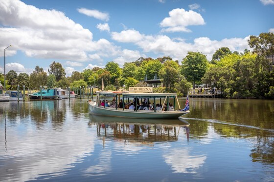
Have a relaxing Saturday afternoon on the "Rubeena" as we cruise the Flooding Creek and Thompson River to the Swing Bridge (1883) at the junction of the Latrobe River. On Sunday we walk around the Sale Common or The Sale Common State Game Refuge. The Sale Common covers approximately 300 hectares, 70 percent of which is freshwater marsh. The remaining area is covered by red gum woodland and grasslands.
GRADE | LENGTH | TYPE:
Saturday: Grade 1: Easy, approximately 9 km walking on flat concrete, bitumen and gravel paths.
Sunday: Grade 3: Medium, 15 km, plus another 300m from accommodation to start of Common walk and 1.5 km to the railway station after the walk. mostly on flat, formed gravel tracks and boardwalks. Taxis are available if required.
(walks graded according to the AWTGS: Australian Walking Tracks Grading System).
ACTIVITY DESCRIPTION: An early start for our trip to Sale, this can be by COACH or car if you are going for the full weekend or for Saturday only. If you are only doing the Sunday walk, the only option for travel is by car as the train arrives too late. We arrive back in Melbourne on Sunday at 2109. If you are only doing Saturday walk/cruise or Sunday walk, you may also stay overnight on Saturday. Please only bring items that will fit in your backpack as you will be carrying them around during the weekend and they will be sitting on your lap during the cruise, especially if the cruise is full. We are staying at the M Hotel and you may also leave items there.
Saturday: On arrival we will walk into town, via the Goanna Savannah before we have lunch at the Star Hotel bistro. After lunch, we will visit the Central Gippsland Visitor Centre and the attached small Art Gallery (free) then to the Water Tower. We make our way to Lake Guyatt, see the historic powder magazine and see some bats. This walk is not covered by tomorrows walk. In the evening we see the Rocky Horror Show at the Wedge Performing Arts Centre.
Sunday: 10:00 Departure: Today is a 15 km walk around the Sale Common (start/finish near/at the Port of Sale). This walk is totally flat with a couple of raised viewing areas. We will start by walking past Lake Guthridge, through the small Botanical Gardens then past Lake Guyatt before entering the Common. We will take the Flooding Creek Track this morning and return via the Boardwalks in the afternoon. We will see lots of bird life and also the LaTrobe & Thompson Rivers & will be able to walk across Swing Bridge (1883). After returning to town, we will have a look at the Port of Sale then have refreshments, before heading off to catch the 17:59 coach home.
Note: Additional walking: Sale Station to/from M Hotel (each way) - 1.9 km, 25 min; M Hotel to/from Port (each way) - 700m, 10 min; M Hotel to/from Star Hotel (each way) - 400m, 6 min.
BOOKING: ASAP for Accommodation and/or River Cruise. Please carefully select Ticket options when booking.
ACCOMMODATION: We have currently booked one 3-bedroom apartment (FULL) and three stand-alone Queen Rooms - 1 AVAILABLE (2 Full). Sleeps one or two persons. ALSO 1 Twin apartment - 1 Queen bed and 1 single bed AVAILABLE Sleeps 1, 2 or 3 persons. (if SHARING for 2 or 3 - email the leader to book). Other limited options are still available and will be booked when required. If the M Hotel is booked out, the leader will try to get accommodation nearby. The caravan park is suitable if you are driving. To book your accommodation, click on Get Tickets and select the accommodation type you require (or select a Waiting List ticket if the option you want has booked out).
CRUISE: River Cruise has been Cancelled as no longer operating. (saleheritagecruises.com.au).
TRAIN: This is now a COACH in both directions and departs from the Southern Cross Coach Terminal. If not driving, book your train ticket via vline.com.au. See PUBLIC TRANSPORT below.
WALK ONLY: Book by Wednesday 18th March if not cruising, if you have your own accommodation arrangements or if you are doing the Sunday walk only. To register, click on Get Tickets and select a "Walks Only" ticket.
Visitors are advised to take out a 1 month temporary membership (cost $8) prior to making any bookings.
Note: Accommodation is limited within walking distance of central Sale.
Unsure if you've already booked? Click View my bookings.
CANCELLATIONS:
M Hotel: Must be cancelled by 2pm Tuesday 17th March for refund - after 2pm Tuesday - No refunds.
Cruise: Must be cancelled by 10am Tuesday 17th March for refund - after 10am Tuesday - No refunds.
FURTHER INFORMATION: V/Line | M. Hotel | salemotorvillage | saleheritagecruises | Port of Sale | starhotelsale menu
MEETING TIME | LOCATION: 07:30am at Southern Cross Station, Train usually departs platforms 15/16 Southern Cross. If you have a reserved seat, you can sit there or in the unreserved rear car.
MAP REFERENCES:
Southern Cross: Melway Map 1A grid A6 | Google: maps.app.goo.gl/6DEJVBQY9tmKUuBy5
Sale: Melway Map X928 Grid G6 | Google: maps.app.goo.gl/5tmPVXMa37o3ZjjZ6
DISTANCE | TIME FROM GPO: 216 km, approximately 2 hours 46 minutes to drive, 3 hours 09 minutes by train.
PUBLIC TRANSPORT: Vline Coach from Southern Coss to Sale and return. Coach Reservations are not required. E-Tickets available via vline.com.au. No MYKI - paper tickets only (or eTickets). You can choose to receive your ticket via eTicket or as a paper ticket collected from a staffed station or agent at least 30 minutes prior to travel, or posted to you (please allow 10 business days for postage). Taxis are available in Sale if required.
COSTS:
Vline Return Fares: Full: $16.00 | Concession $8.00 | Senior $free (includes suburban travel zones 1 & 2) Conncession can use a Free Travel Voucher (Voucher - phone bookings only).
Accommodation: From $66.00 Twin Share to $170.00 (single or couple).
FOOD:
Saturday lunch: Star Hotel Star Hotel menu
Saturday Dinner: The York (M Hotel restraunt & bar) - The York Menu.
Sunday Breakfast: Cafe in town or BYO.
Sunday Lunch: BYO. Carry lunch, snacks and at least 2 litres of water for Sunday's walk.
APPAREL | FOOTWEAR: Comfortable walking boots/shoes and dress according to the weather forecast.
LEADER: Paul K. | Email LeaderPaulk@nomads.org.au if you have any questions.
Members can access leader contact details under Members | Leader Contacts when logged in to the website.
Image: Sale Heritage Cruises
HOME BACK TO LIST OF EVENTS MEMBERSHIPS

Mar
17
Past Event
Understanding how leaders lead events - Online via Zoom
19:00 – 20:30
You might think leaders just turn up on the day and start to lead. This forum provides an under the bonnet (and de-mystification) of the wider leadership role. This is for all members, but especially Emerging Leaders - the lifeblood of the Nomads. This is also a very timely refresher for existing leaders, and we want them to pass on their vast experience. The forum will be held online via Zoom.
GRADE: Social and educational.
ACTIVITY DESCRIPTION: This forum is to demonstrate to our emerging leaders just how easy it is to lead an event. The expectations of our event leaders is a constantly changing space. This is the second online forum we have facilitated.
This is also a forum for open discussion about the leadership role.
An online event is used as it is easier for people to attend, recognising that we all have busy lives. We encourage both emerging and interested leaders to make an attempt to attend.
The meeting will be led by Roger H. The topic will be sources of information, resources, and training that leaders have available to plan and execute events.
POSSIBLE AGENDA: This will be firmed up prior to the forum, but topics could include:
Why do I lead events?
Self Growth.
How to decide where to go?
Event recces prior to the event.
"I don't have any experience" - mentoring and co-leading.
What resources are available to guide me?
What if things go wrong?
How does our insurance work?
What power do I have over the event?
Conduct on the day - how to manage unruly participants.
How to put up my first event - Nomads website functionality and access.
Privacy.
Formal Leader registration.
It's expected that the formal presentation will take 45 minutes, followed by 45 minutes of open discussion and questions.
Please let the leader know (before the event) of any other topics you would like covered.
BOOKING: By 5pm Tuesday 17th March. To register, click on Get Tickets. A Zoom link (to enable you to attend the online session) will be provided to those who have registered, and in the reminder email sent to members a few days prior to the event.
Unsure if you've already booked? Click View my bookings.
MEETING TIME | LOCATION: 7pm online via Zoom. Those who registered will be sent the Zoom link by 6pm on Tuesday evening.
LEADER: Roger H. | Email LeaderRogerH@nomads.org.au if you have any questions.
Members can access leader contact details under Members | Leader Contacts when logged in to the website.
Photo by Jon Anders Wiken.
HOME BACK TO LIST OF EVENTS MEMBERSHIPS
