

The Nomads Outdoors Group Inc.
Powered by
Past events
All events
Past events
Dec
29
2024
Past Event
Moe - Yallourn Rail Trail Return Walk
Southern Cross Train Station
08:00 – 17:50
Note - this trip will not proceed if the projected maximum temperature will be 32 degrees plus !!!
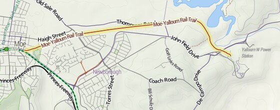
Based on Gunaikurnai country, the railway from Moe to Yallourn was constructed in the 1950s to replace the original branch line, which joined the main line between Morwell and Moe. The new line saved the heavy coal trains from climbing the Haunted Hills. The line was closed in 1986 when briquette production was shifted to Morwell.
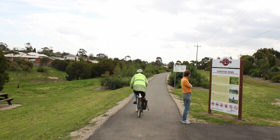
Flora along the trail includes several species of wattle and eucalypt, such as blackwood, silver and black wattles, messmate and swamp gums. Low growing bluebells, various orchids and pea flowers, and Victoria's floral emblem, the common heath, can also be seen. Local birds include the superb blue wren, crimson rosella, welcome swallow, Australian magpie, grey shrike-thrush, kookaburra, sacred ibis and red wattle bird.
GRADE | LENGTH | TYPE: Grade 3: Medium (due to distance) 17 km return walk (graded according to the AWTGS: Australian Walking Tracks Grading System).
ACTIVITY DESCRIPTION: The trail consists of fine gravel and passes through farmland and native heathland. There are also distant mountain views plus it passes close by both the Moe Botanic Garden (at the start) and Lake Narracan (mid point). The imposing Yallourn power station provides an industrial interest at the end of the trail.
On the day, the planned lunch spot is the Graeme Edwards Memorial Gardens, close to the power station.
BOOKING: By Friday 27th December. To register click on Get Tickets.
Unsure if you've already booked? Click View my bookings.
FURTHER INFORMATION: Latrobe City - Walking Trails | Wiki Yallourn Railway Line | V/line - Gippsland Timetable
MEETING TIME | LOCATION: 10:50am at the Moe Railway Station.
MAP REFERENCE:
Southern Cross Station - Melway map 1A grid A7 | Google map goo.gl/maps/s6DUsRG8CWz2K97eA
Moe Railway Station - Melway map X927 grid B2 | Google map goo.gl/C5jkY7DNY2CZrScm9
DISTANCE | TIME FROM GPO: 131 km, approximately 1 hour 45 minutes via Monash/Princes M1 Freeways. Travelling by train it's a journey of 2 hours and 4 minutes.
PUBLIC TRANSPORT:
The trip starts on the train departing Southern Cross Station at 08:54am arriving into Moe at 10:50am. Pick-ups can be made en route in the Metro area at Flinders Street, Richmond, Caulfield, Clayton and Dandenong.
The return trains depart from Moe at 4:45pm, 5:43pm and 6:43pm with the trip taking just under 2 hours.
Day return weekend fares are capped at $7.20 (Full) and $3.60 (Concession & Seniors).
FOOD: Carry lunch, snacks and at least 2 litres of water. This post-Christmas walk allows you to use up left-overs from holiday feasting !!!
APPAREL | FOOTWEAR: Comfortable walking boots/shoes and dress according to the weather forecast.
LEADER: Garry Oliver | Email LeaderGarryO@nomads.org.au if you have any questions.
Members can access leader contact details under Members | Leader Contacts when logged in to the website.
HOME BACK TO LIST OF EVENTS MEMBERSHIPS
Dec
13
2024
Past Event
Cycling Round the Bay Lite, with overnights in Ocean Grove
Southern Cross
13 Dec 2024 09:10 – 15 Dec 2024 18:00
** Nomads email addresses have changed to the format LeaderFredN@nomads.org.au, and may go into your Junk Folder as a result. See Some Recommendations about Nomads Emails to prevent that **
Enjoy a “Round The Bay Lite” scenic tour from Geelong to Frankston, with an overnight stay in Ocean Grove. ** Limit of 10 riders **
GRADE | TYPE | LENGTH: Grade 4: Hard 129 km point-to-point cycling. Day 1: Grade 4 - Hard 51 km | Day 2: Ride or Rest day in Ocean Grove | Day 3: Grade 4 - Hard 78 km.
The route has on-road sections as well as both sealed and unsealed cycling trails, and very limited early exit options.
Graded according to the AWTGS: Australian Walking Tracks Grading System. The official Round The Bay ride of more than 210 km in a single day is totally off the Nomad’s grading scale!
There are some sections on busy roads.
ACTIVITY DESCRIPTION: This is a three day cycling weekend with Fri/Sat overnight stay in a private house in Ocean Grove.
Friday: we'll travel via V/Line train to Lara, then cycle to Ocean Grove via Corio Bay and the Bellarine Rail Trail. Night in Ocean Grove house.
Saturday: An optional ride, walk or rest day. Options are to walk along some of the rugged Bass Strait beaches, around Lake Connewarre, or a ride towards Torquay. Dependent on weather and inclination. Night in Ocean Grove house.
Sunday: we'll cycle to Queenscliff to catch the ferry across to Sorrento. From there we'll cycle via the Bay Trail to Safety Beach after which we'll head inland. First through some quiet, scenic suburban streets, Bruce Rd and the Nepean Hwy to The Briars Community Forest. We'll cycle/walk through the wetlands then some quiet suburban streets to Old Moorooduc Rd, which takes us on a wide shoulder to the start of the Peninsula Link Trail. From there it's an excellent, wide path all the way to the Baxter Trail for the final 4 km descent to Frankston Station.
Notes:
You will need a sleeping bag (or similar), pillow slip and towel. There will be a car at Lara train station to deposit them in, and they will be transported to Ocean Grove for you.
We will abort the Sorrento to Frankston ride on Sunday if any of the following occur: a threat of bad rain, a forecast for hot temperature, trains cancelled on the Frankston line, or the likelihood of a strong headwind. If that happens the options are 1) ride to Portarlington and catch the ferry to Southbank, or 2) cycle back to Geelong via another route, then catch a V/Line train back to Melbourne.
BOOKING: By Monday 9th December or ASAP. To register, click on Get Tickets. Limit of 10 participants. If sold out, email LeaderRogerH@nomads.org.au to see if any other arrangements are possible.
Unsure if you've already booked? Click View my bookings.
FURTHER INFORMATION: www.railtrails.org.au/trail?view=trail&id=139
MEETING TIME | LOCATION: Friday approximately 9am at Southern Cross Station to catch the train to Waurn Ponds (though we will get off at Lara Station). It is prudent to arrive early to ensure we get all our bikes on the train. Final train times will be advised closer to the date depending on any late timetable changes.
MAP REFERENCE: Melway map 1E grid A9 | Google map goo.gl/maps/WUzR7kSmTVzW3yjx6.
DISTANCE | TIME FROM GPO: around 80 km to Lara Station, 54 minutes by train from Southern Cross Station.
ACCOMMODATION: basic, but comfortable accommodation will be provided in a private house in Ocean Grove. Only 10 beds are available. We will buy in food to cook each night, or eat out. Bring your own cereals for breakfast, and any special food for lunch. Staples will all be available in Ocean Grove. Bring a sleeping bag and towel and pillow slip.
COST:
Ferry: $19 full fare or $17 concession. Bikes are carried at no additional charge.
Lunches: can be made before we leave, or purchased individually en route each day.
Accommodation & Meals: a small contribution is suggested to contribute to breakfast and accommodation expenses. At night we might go out for dinner, or buy ingredients for a BBQ at the Ocean Grove house.
PUBLIC TRANSPORT: Travel to and from this event is via public transport.
Fri 16 Dec: meet at Southern Cross Station about 9 am train to Geelong.
Sun 18 Dec: trains depart Frankston every 10 minutes for Flinders Street.
FOOD: Carry 2 litres of water. We will purchase lunch along the way, though there will be long stretches with no food options, so it would be advisable to bring some snacks.
APPAREL | FOOTWEAR:
A hybrid bike is best due to the diversity in tracks. Quite a lot of the route will be on sealed trails or roads, but some of the tracks, including the sealed sections, can be quite rough. Bring clothing based on the weather forecast, but be prepared for changeable conditions.
You will need a sleeping bag (or similar), pillow slip and towel (drop off into car at Lara Station.
LEADER: Roger H. | Email LeaderRogerH@nomads.org.au if you have any questions.
Members can access leader contact details under Members | Leader Contacts when logged in to the website.
HOME BACK TO LIST OF EVENTS MEMBERSHIPS
Image: railtrails.org.au
Dec
08
2024
Past Event
Mixed Naturist Walk in the remote Bungal State Forest, including the Moorabool River & Waterholes
Park Rotunda 131 Inglis St Ballan (Old Melbourne Rd)
10:00 – 16:30
We have had to change the date of this walk from Sun 1st Dec to Sun 8th Dec, as the original date clashed with another major naturist event. Sorry about that. We are looking forward to enoying this event on the new date.
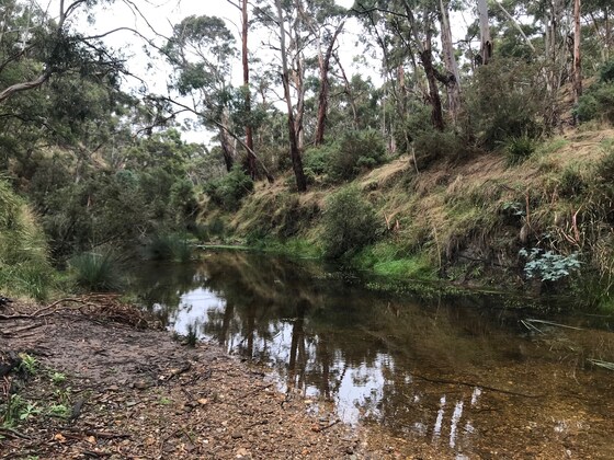
Enjoy a clothes-free walk through a little known forest, south of Ballan. Cool your feet in the East Moorabool River or jump in for a skinny dip if you prefer.
GRADE | LENGTH | TYPE: Grade 3: Medium 8 km circuit walk along 4WD tracks, animal pads beside the river and through the open forest (graded according to the AWTGS: Australian Walking Tracks Grading System). There are a couple of steepish sections, but we will take our time.
ACTIVITY DESCRIPTION: This event is for naturists. We will first meet in Ballan for a coffee, snacks and introductions. After this, the leader will give an outline of the day and we will then arrange car pooling for the 21 km (30 min) trip south of Ballan, to the start of the walk. Cars going into the forest should have average, or higher, ground clearance. Other cars can be left all day in Ballan until we return. Once in the forest we can discard our clothes, apply sunscreen and enjoy a leisurely walk through the open forest to reach the river. Once there we can have a relaxed lunch before exploring more of the river and waterholes before returning through the forest to the cars. We then plan to return to Ballan to the Commercial Hotel where we can relax and have cool drinks /coffee and chips. If you wish you can stay on and have dinner at the hotel.
Afternoon Tea/Drinks: After the walk we will return to Ballan where we can have cool drinks, a beer or coffee at the Commercial Hotel, 151 Inglis St, Ballan.
BOOKING: Preferably by Thursday 5th December. To book, click on Get Tickets.
Unsure if you've already booked? Click View my bookings.
MEETING TIME | LOCATION: 10am at the Park Rotunda, 131 Inglis St Ballan. (Inglis St is also known as Old Melbourne Rd). Suggested parking is in Fisken St on the side of the little park. Coffee and eats are available at cafes on the opposite side of the main street e.g. Zest Cafe. The car convoy to the walk start (about 21 km and 30 minutes) will leave at about 10:40am. Optus mobile coverage in Ballan can be poor. If necessary, try a text.
If you haven't got transport to the event you could send an email to Russell on LeaderRussellW@nomads.org.au who may be able to arrange a lift from Melbourne for you. Otherwise you can use public transport, see details below.
MAP REFERENCE: Google map maps.app.goo.gl/Pkh9x3CEw6PFLAJf7
The walk start is located 21 km SW of Ballan in the Bungal State Forest. We plan to go into the forest along Little Forest Rd.
DISTANCE | TIME FROM GPO: 75 km. Approximately 1 hour 5 minutes.
PUBLIC TRANSPORT: V/Line train leaves Southern Cross Railway Station at 8:14am and arrives in Ballan at 9:16am. The meeting place is 7 minutes walk from Ballan Railway Station.
You could alternatively catch the 9:14am train arriving in Ballan at 10:16am. But in this case you'd miss out on coffee and arrive just in time for the briefing scheduled for 10:25am.
FOOD: Lunch, snacks, water/drinks to take on walk.
APPAREL | FOOTWEAR: Comfy shoes/boots. Sunscreen, sunhat, sunglasses. Small towel to dry off after swimming. Maybe you could carry a fig leaf (or shorts) in your backpack, though it's very rare to see anyone else in this forest.
COST: $5. Free for financial members of the Nomads Outdoors Group.
LEADER: Russell W. | Email LeaderRussellW@nomads.org.au if you have any questions.
Members can access leader contact details under Members | Leader Contacts when logged in to the website.
HOME BACK TO LIST OF EVENTS MEMBERSHIPS
Dec
07
2024
Past Event
From Garfield Water Wheel to the Welsh Village, The ‘Rez’ – return via Forest Creek - Castlemaine. (NOTE: Train travel not recommended for 7th December due to two rail works impacting the Bendigo line train)
Castlemaine
10:31 – 16:49
** Nomads email addresses have changed to the format LeaderFredN@nomads.org.au, and may go into your Junk Folder as a result. See Some Recommendations about Nomads Emails to prevent that **
Travel by train is NOT recommended, due to sgnificant train disruptions on 7th December - see Public Transport travel update below - therefore travel by car to Castlemaine is recommended, and enjoy a day walk in the historic Castlemaine Diggings National Heritage Park and your BYO picnic lunch. We will also invite members of 'The Alluvians', Castlemaine's gay men's social group to join the walk.
GRADE | LENGTH | TYPE: Grade 3: Medium walking - approximately 10 km circuit walk on paths that are at times rocky and steep (graded according to the AWTGS: Australian Walking Tracks Grading System).
ACTIVITY DESCRIPTION: Meeting at 10:31am outside the Midland Hotel (2 Templeton Street, cnr Templeton & Kennedy Streets) just opposite the Castlemaine Station car park. If you are travelling to Castlemaine by train, PLEASE tick the 'public transport' option when you register.
We introduce ourselves and then car-share with those who have driven from Melbourne or are Castlemaine locals. If there are insufficient cars, then a taxi mini bus will be pre-booked (small extra shared cost). There are NO lunch shops near the railway station, so you will need to bring your lunch, snacks and water with you.
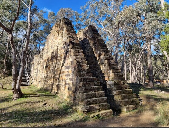
It is about a 15-minute drive to the Castlemaine Diggings National Heritage Park. We leave our cars, admire the ruins of the massive 1887 Garfield Water Wheel, and learn from the information boards the scale of development that was once there.
We commence the walk uphill through the Castlemaine Diggings National Heritage Park and past the remains of many mines, some surprisingly deep. We are heading for the stone-hut ruins of the Welsh Village, and here we will take a break to inspect the remains of a once-thriving community. Continuing to gain height, we reach our highest point, the banks of the Expedition Pass Reservoir, the source of water for the waterwheel, and locally known as ‘The Rez’, named after it was noted on Major Mitchell's 'Australia Felix' expedition. We will stop for lunch at a suitable spot along the way.
The walk is easier now, returning downhill on the easy Forest Creek Track, and at Chinamans Point Road taking the track back to the Garfield Water Wheel.
We leave the Garfield Water Wheel by about 4pm, and we travel back to the Castlemaine Station where some will board the 4.49pm train to arrive at Southern Cross at 6.24pm, and others drive home.
BOOKING: By 6pm Friday 6th December. To register click on Get Tickets.
Unsure if you've already booked? Click View my bookings.
FURTHER INFORMATION:
Parks Vic: Heritage Notes for the Quartz Hill Walk and Welsh Village Walk
BendigoRegion.com.au: Castlemaine, Maldon & Surrounds - Outdoors and Nature
MountAlexander.vic.gov.au: Mount Alexander Shire Council - Community events and things to do
MEETING TIME | LOCATION: Meeting outside the Midland Hotel, 2 Templeton Street; cnr Templeton and Kennedy Streets) just opposite the Castlemaine Railway Station at 10:31am. For those tempting fate and PTV, and travelling by bus/train service from Melbourne .. the train now arrives at 9.50am, so you will need to wait and meet us at 10.31am NOTE: You need to bring lunch, snacks and water with you to this meeting point as there are no food shops near the station and we will not be stopping to buy food or drink during our short drive from the station to Garfield Water Wheel.
MAP REFERENCE: Melway map X909 grid C6 | Google map maps.app.goo.gl/93kAUPqBE8NUKt4r6.
DISTANCE | TIME FROM GPO: Castlemaine is about 130 km, approximately 1 hour 30 minutes by train or 1 hour 30 minutes to drive via the Calder Highway, exiting at the marked B180 turnoff to Castlemaine. .
PUBLIC TRANSPORT: NOTE: On Saturday 7th December train travel to Castlemaine is disrupted by two events - (i) level crossing removal at Diggers Rest and (2) Metro tunnel works. See the PTV Journey Planer for more information. As of this morning, 30th November, if you hope to depart from Southern Cross plan for the 7.50am express bus to Gisbone (New Gisborne) then a 9.05am Bendigo line train will take you 3 stops to Castlemaine, arriving at 9.50am. There regular ~ hourly train service from Southern Cross Station to Castlemaine (the Bendigo line) that takes about 1 1/2hr is not running on the 7th December 2024!
FOOD: Bring picnic lunch and we suggest you carry snacks and at least 1 litre of water. Note: we will not be stopping in Castlemaine township to buy food or drink.
APPAREL | FOOTWEAR: Comfortable walking boots/shoes, jacket, hat and dress according to the Castlemaine (not Melbourne) weather forecast.
Average daily temperatures for Castlemaine in early December range from 11 - 26 degrees C, but it may be hotter. Therefore you should consult the Castlemaine weather forecast (not Melbourne) a day or two before the event and wear weather-appropriate clothing and footwear for walking.
LEADER: Ian G. | Email LeaderIanG@nomads.org.au if you have any questions.
Members can access leader contact details under Members | Leader Contacts when logged in to the website.
HOME BACK TO LIST OF EVENTS MEMBERSHIPS
Dec
03
2024
Past Event
Annual Pre-Christmas BBQ
Yarra Bank Reserve
18:30 – 21:00
** Nomads email addresses have changed to the format LeaderFredN@nomads.org.au, and may go into your Junk Folder as a result. See Some Recommendations about Nomads Emails to prevent that **
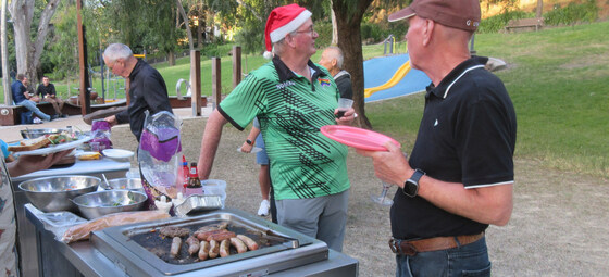
Join us for the popular annual Christmas BBQ beside the Yarra River in a tranquil, little-known park in Hawthorn.
GRADE: Social.
ACTIVITY DESCRIPTION: Join your friends on the banks of the Yarra River at Hawthorn for a pre-Christmas BBQ in lieu of our monthly indoors social evening. The venue is a secluded spot that is protected from wind and extreme sun. The reserve has four tables with bench seats and two BBQs. Water is on tap and a public toilet is located on Creswick St.
BOOKING: By Sunday 1st December. To register, click on Get Tickets.
Unsure if you've already booked? Click View my bookings.
MEETING TIME | LOCATION: From 6:30pm at Yarra Bank Reserve, on the Hawthorn side of the Yarra River (“under” the Bridge Rd bridge).
MAP REFERENCE: Google map goo.gl/maps/mjZWxZRLASy.
DISTANCE | TIME FROM GPO: 5 km by car – enter the reserve via the corner of Creswick and Denham Streets, Hawthorn or else park in Creswick St.
PUBLIC TRANSPORT: Trams are best, to tram stop 23 (Burwood Road / Church Street junction) via either route 48 (from Collins St) or route 75 (from Flinders St). Alternatively, it's a 15 minute walk from Hawthorn Station, on the Lilydale, Belgrave and Alamein lines.
FOOD: The Nomads will supply pre-meal nibbles plus bread and salads to accompany the main meal. You need to BYO your preferred main meal item for the BBQ. All beverages are BYO. A limited supply of disposable plates, cups and cutlery will be available. You are recommended to bring your preferred utensils.
APPAREL | FOOTWEAR: Daylight saving will be active. Bring insect repellent plus a lightweight and waterproof jacket if showers are forecast. It is likely to turn cool once the sun sets.
LEADER: Garry O. | Email LeaderGarryO@nomads.org.au if you have any questions.
Members can access leader contact details under Members | Leader Contacts when logged in to the website.
HOME BACK TO LIST OF EVENTS MEMBERSHIPS
Dec
01
2024
Past Event
Bacchus Marsh by Train and Foot
Bacchus Marsh
10:00 – 16:30
** Nomads email addresses have changed to the format LeaderFredN@nomads.org.au, and may go into your Junk Folder as a result. See Some Recommendations about Nomads Emails to prevent that **
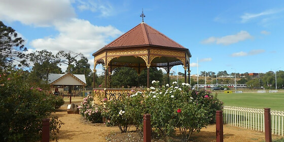
Enjoy a very pleasant day out at Bacchus Marsh experiencing frequent sightings of native birds and trees as well as colonial era deciduous-tree avenues, travelling there by train, then on foot exploring the area surrounding the Werribee River and some colonial points of interest, including Bacchus Marsh's connection to Captain Moonlight, Australia's only known gay bushranger, and the Georgian home of Captain William Bacchus, after whom Bacchus Marsh is named.
GRADE | LENGTH | TYPE: Grade 2: Easy to Moderate, approximately 10 km, circuit walk on sealed and unsealed footpaths, with shorter options of 6.5 km or 4 km available (graded according to the AWTGS: Australian Walking Tracks Grading System).
ACTIVITY DESCRIPTION: This is a relatively easy walk with shorter options of 6.5 km and 4 km available for anyone who chooses. The Werribee River flows between the township and the railway line and we’ll walk along the foot tracks beside the river and enjoy magnificent specimens of River Red Gums.
A reserve on the banks of the river with undercover picnic tables will be our lunch spot. After lunch we’ll head in an easterly direction along the river then turn to flank the township, passing by market gardens and several handsome Edwardian and Victorian houses including Captain William Bacchus's Georgian home.
We’ll head through to Masons Lane Reserve and take in the scenic vistas of the hills to the north and navigate our way to the site of Captain Moonlight's connection with Bacchus Marsh - Holy Trinity Anglican Church.
We will stop for an afternoon tea in the cosy Baby Black Espresso Bar in Church St, built in 1868.
A final crossing of the river and a wander through Maddingley Park will take us back to the station for the return journey to the city. Our choice of trains are scheduled to arrive back at Southern Cross Railway Station at 3.48pm or 4:48pm.
BOOKING: By Friday 29th November. To register click on Get Tickets.
Unsure if you've already booked? Click View my bookings.
MEETING TIME | LOCATION: 10am for a 10:14am departure from Southern Cross Station. Meet in the front carriage of the Wendouree train departing Southern Cross Railway Station at 10:14am or join the group en route by arrangement with the event leader.
The train will arrive in Bacchus Marsh at 10.58am. We will assemble in the station carpark.
MAP REFERENCE: Google map: www.google.com/maps/d/edit?mid=1UhpUyRJBrbL_OYxj2XA-pp4zJ2Rczlk&usp=sharing
PUBLIC TRANSPORT: We travel by V/Line train with a 45 minute journey to Bacchus Marsh on the Wendouree (Ballarat) train departing Southern Cross Railway Station at 10:14am. For the return journey we will aim to catch the 2:56pm or 3:56pm train from Bacchus Marsh which are scheduled to arrive at Southern Cross Railway Station at 3:48pm and 4:48pm, respectively. All travel is within myki zones 1 & 2 with weekend daily caps of $7.20 full fare, $3.60 concession and free for seniors.
If travelling by car, parking is available in the station car park, entered from Station St.
FOOD: Carry lunch, snacks and a litre of water.
APPAREL | FOOTWEAR: Comfortable walking boots/shoes and dress according to the weather forecast.
LEADER: Don Vogt | Email LeaderDonV@nomads.org.au if you have any questions.
Members can access leader contact details under Members | Leader Contacts when logged in to the website.
HOME BACK TO LIST OF EVENTS MEMBERSHIPS
Dec
01
2024
Past Event
Date now changed to Sun 8 Dec for "Naturist Walk in the remote Bungal State Forest, including the Moorabool River & Waterholes"
Park Rotunda 131 Inglis St Ballan (Old Melbourne Rd)
10:00 – 16:30
Please Note: We have had to change the date of this bushwalk from Sun 1 Dec to Sun 8 Dec, becase the original date clashed with another major naturist event. To get a ticket for this event go to Sun 8th Dec in the Nomads events and click on "Get Tickets".
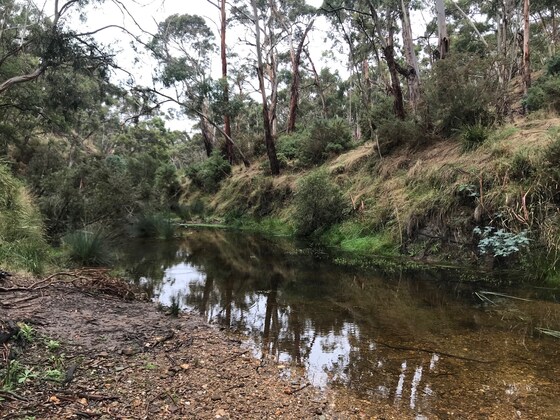
Enjoy a clothes-free walk through a little known forest, south of Ballan. Cool your feet in the East Moorabool River or jump in for a skinny dip if you prefer.
GRADE | LENGTH | TYPE: Medium 8 km circuit walk along 4WD tracks, animal pads beside the river and through the open forest (graded according to the Leaders Guide - Appendix A: Activity Grading Guidelines). There are a couple of steepish sections, but we will take our time.
ACTIVITY DESCRIPTION: This event is for naturists. We will first meet in Ballan for a coffee, snacks and introductions. After this, the leader will give an outline of the day and we will then arrange car pooling for the 21 km (30 min) trip south of Ballan, to the start of the walk. Cars going into the forest should have average, or higher, ground clearance. Other cars can be left all day in Ballan until we return. Once in the forest we can discard our clothes, apply sunscreen and enjoy a leisurely walk through the open forest to reach the river. Once there we can have a relaxed lunch before exploring more of the river and waterholes before returning through the forest to the cars. We then plan to return to Ballan to the Commercial Hotel where we can relax and have cool drinks /coffee and chips. If you wish you can stay on and have dinner at the hotel.
Afternoon Tea/Drinks: After the walk we will return to Ballan where we can have cool drinks, a beer or coffee at the Commercial Hotel, 151 Inglis St, Ballan.
BOOKING: Preferably by Thursday 28th November. To book, click on Get Tickets.
Unsure if you've already booked? Click View my bookings.
MEETING TIME | LOCATION: 10am at the Park Rotunda, 131 Inglis St Ballan. (Inglis St is also known as Old Melbourne Rd). Suggested parking is in Fisken St on the side of the little park. Coffee and eats are available at cafes on the opposite side of the main street e.g. Zest Cafe. The car convoy to the walk start (about 21 km and 30 minutes) will leave at about 10:40am. Optus mobile coverage in Ballan can be poor. If necessary, try a text.
If you haven't got transport to the event you could send an email to Russell on LeaderRussellW@nomads.org.au who may be able to arrange a lift from Melbourne for you. Otherwise you can use public transport, see details below.
MAP REFERENCE: Google map maps.app.goo.gl/Pkh9x3CEw6PFLAJf7
The walk start is located 21 km SW of Ballan in the Bungal State Forest. We plan to go into the forest along Little Forest Rd.
DISTANCE | TIME FROM GPO: 75 km. Approximately 1 hour 5 minutes.
PUBLIC TRANSPORT: V/Line train leaves Southern Cross Railway Station at 8:14am and arrives in Ballan at 9:16am. The meeting place is 7 minutes walk from Ballan Railway Station.
You could alternatively catch the 9:14am train arriving in Ballan at 10:16am. But in this case you'd miss out on coffee and arrive just in time for the briefing scheduled for 10:25am.
FOOD: Lunch, snacks, water/drinks to take on walk.
APPAREL | FOOTWEAR: Comfy shoes/boots. Sunscreen, sunhat, sunglasses. Small towel to dry off after swimming. Maybe you could carry a fig leaf (or shorts) in your backpack, though it's very rare to see anyone else in this forest.
COST: $5. Free for financial members of the Nomads Outdoors Group.
LEADER: Russell W. | Email LeaderRussellW@nomads.org.au if you have any questions.
Members can access leader contact details under Members | Leader Contacts when logged in to the website.
HOME BACK TO LIST OF EVENTS MEMBERSHIPS
Nov
24
2024
Past Event
Devilbend Reservoir Circuit Walk
Devilbend natural features reserve
11:00 – 15:00
** Nomads email addresses have changed to the format LeaderFredN@nomads.org.au, and may go into your Junk Folder as a result. See Some Recommendations about Nomads Emails to prevent that **
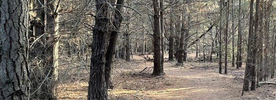
A circuit walk in the Mornington Peninsula, SE of Melbourne.
GRADE | LENGTH | TYPE: Moderate 12 km circuit walk (graded according to the Leaders Guide - Appendix A: Activity Grading Guidelines).
ACTIVITY DESCRIPTION: This trail explores the Devilbend Natural Features Reserve, which is great for walking, running or mountain biking. Parking is available at the trailhead, from where you'll loop around the reservoir near Tuerong, Victoria. The trail itself is relatively flat and easy, with varying scenery along the way. The first half is through the forest and the second half is more open.
The track can get muddy after rain, so be sure to set out with good footwear if there's been recent rainfall.
BOOKING: By Friday 22nd November. To register, click on Get Tickets.
Unsure if you've already booked? Click View my bookings.
MEETING TIME | LOCATION: 11am at Devilbend Recreation Reserve, Tuerong.
PUBLIC TRANSPORT: Public transport is not feasible.
MAP REFERENCE: Google map: goo.gl/UmUKYMjDnA43NyC97.
FOOD: Carry lunch, snacks and a litre of water.
APPAREL | FOOTWEAR: Comfortable walking boots and dress according to the weather forecast.
LEADER: Richard C. | Email LeaderRichardC@nomads.org.au if you have any questions.
Members can access leader contact details under Members | Leader Contacts when logged in to the website.
HOME BACK TO LIST OF EVENTS MEMBERSHIPS
Nov
17
2024
Past Event
Postponed to Dec 1. Mixed Naturist Walk in the remote Bungal State Forest, including the Moorabool River & Waterholes
Park Rotunda 131 Inglis St Ballan (Old Melbourne Rd)
10:00 – 16:00
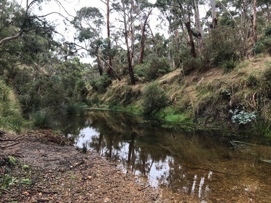
The Date for this Walk has been changed, because of unsuitable weather forecast for Sun 17th Nov - cool and showers.
The new date for this bushwalk is Sun 1 Dec, a 2 week postponement, for the chance of a better day.
To make a Booking please go to the new listing at 1st Dec.
__________________
** Nomads email addresses have changed to the format LeaderFredN@nomads.org.au, and may go into your Junk Folder as a result. See Some Recommendations about Nomads Emails to prevent that **
Enjoy a clothes-free walk through a little known forest, south of Ballan. Cool your feet in the East Moorabool River or jump in for a skinny dip if you prefer.
GRADE | LENGTH | TYPE: Medium 8 km circuit walk along 4WD tracks, animal pads beside the river and through the open forest (graded according to the Leaders Guide - Appendix A: Activity Grading Guidelines). There are a couple of steepish sections, but we will take our time.
ACTIVITY DESCRIPTION: This event is for naturists. We will first meet in Ballan for a coffee, snacks and introductions. After this, the leader will give an outline of the day and we will then arrange car pooling for the 21 km (30 min) trip south of Ballan, to the start of the walk. Cars going into the forest should have average, or higher, ground clearance. Other cars can be left all day in Ballan until we return. Once in the forest we can discard our clothes, apply sunscreen and enjoy a leisurely walk through the open forest to reach the river. Once there we can have a relaxed lunch before exploring more of the river and waterholes before returning through the forest to the cars. We then plan to return to Ballan to the Commercial Hotel where we can relax and have cool drinks /coffee and chips. If you wish you can stay on and have dinner at the hotel.
Afternoon Tea/Drinks: After the walk we will return to Ballan where we can have cool drinks, a beer or coffee at the Commercial Hotel, 151 Inglis St, Ballan.
BOOKING: Preferably by Thursday 14th November. To book, click on Get Tickets.
Unsure if you've already booked? Click View my bookings.
MEETING TIME | LOCATION: 10am at the Park Rotunda, 131 Inglis St Ballan. (Inglis St is also known as Old Melbourne Rd). Suggested parking is in Fisken St on the side of the little park. Coffee and eats are available at cafes on the opposite side of the main street e.g. Zest Cafe. The car convoy to the walk start (about 21 km and 30 minutes) will leave at about 10:40am. Optus mobile coverage in Ballan can be poor. If necessary, try a text.
If you haven't got transport to the event you could send an email to Russell on LeaderRussellW@nomads.org.au who may be able to arrange a lift from Melbourne for you. Otherwise you can use public transport, see details below.
MAP REFERENCE: Google map maps.app.goo.gl/Pkh9x3CEw6PFLAJf7
The walk start is located 21 km SW of Ballan in the Bungal State Forest. We plan to go into the forest along Little Forest Rd.
DISTANCE | TIME FROM GPO: 75 km. Approximately 1 hour 5 minutes.
PUBLIC TRANSPORT: V/Line train leaves Southern Cross Railway Station at 8:14am and arrives in Ballan at 9:16am. The meeting place is 7 minutes walk from Ballan Railway Station.
You could alternatively catch the 9:14am train arriving in Ballan at 10:16am. But in this case you'd miss out on coffee and arrive just in time for the briefing scheduled for 10:25am.
FOOD: Lunch, snacks, water/drinks to take on walk.
APPAREL | FOOTWEAR: Comfy shoes/boots. Sunscreen, sunhat, sunglasses. Small towel to dry off after swimming. Maybe you could carry a fig leaf (or shorts) in your backpack, though it's very rare to see anyone else in this forest.
COST: $5. Free for financial members of the Nomads Outdoors Group.
LEADER: Russell W. | LeaderRussellW@nomads.org.au if you have any questions. Members can access leader contact details under Members | Leader Contacts when logged in to the website.
HOME BACK TO LIST OF EVENTS MEMBERSHIPS

Nov
15
2024
Past Event
Reflection 2024 |Rainbow on the Plains Festival - Hay, N.S.W.
Hay
15 Nov 2024 16:00 – 17 Nov 2024 13:30
** Nomads email addresses have changed to the format LeaderFredN@nomads.org.au, and may go into your Junk Folder as a result. See Some Recommendations about Nomads Emails to prevent that **
UPDATED ACCOMMODATION info below.
Reflection 2024 | Rainbow on the Plains Festival, Hay Mardi Gras, Hay N.S.W. This has been an annual event since 2018 and started by the local LGBTQIA community. It has Friday and Saturday evening entertainment at the Hay Services Club, a Mardi Gras street parade and Fair Day on Saturday. Also there is Drag Bingo on Thursday night in South Hay and we will do some short walks. Think of this as a mini "Chillout".
GRADE | LENGTH | TYPE: Easy, flat walking through the town's streets, up to 1.1 km - 1.5 km to/from each venue from motels. Up to 2.6 km for bush campers. Sunday morning walk 6 km.
ACTIVITY DESCRIPTION: Spend a weekend in Hay and support the local LBGTQIA community.
Friday - check in to your accommodation/set up camp, then dinner at a hotel bistro followed by a walk of about 1 km to the Hay Services Club for the Rainbow on the Greens event (6pm to 9pm). Afterwards, walk back to your accommodation for the night.
Saturday morning we will visit the Hay Gaol Museum, built in 1878 (Open 9am to 5pm) then watch the Mardi Gras street parade (12pm to 12:30pm). Lunch at a venue then walk to the Engie Fair Day event, at Hay Park, for the afternoon (12:30pm to 4pm), optional visit to the Dunera Museum at Hay Railway Station during the afternoon (open 10am to 4pm). Dinner at a local venue then walk to the Hay Services Club for the After Party (from 6:30pm to Late).
Sunday Morning Walk: by 10am, we will walk along the main shopping area of Hay to the Bidgee Riverside walk and along the Murrumbidgee River, walk through the Hay Sandy Point campground, then make our way to view the Hay Water Tower Art. We will then have lunch and leave Hay by 1:30pm for the drive home. For anyone interested, there is the Pride Cup (AFL) from 12pm to 3pm. Optional visit to Shear Outback, South Hay (9am to 3pm).
BOOKING: ASAP for your motel accommodation, cabins, Showgrounds or Hay Services Club Camping. Bush camping has no bookings.
Rainbow on the Greens tickets $30.00 and After Party $45.00 - available until sold out (from Reflection 2024 website) AND
Nomads Registration by Wednesday 13th November. To register with The Nomads, click on Get Tickets.
Unsure if you've already booked? Click View my bookings.
NON MEMBERS: Not a Nomads member? Purchase a temporary one-month membership before getting your Nomads ticket (cost $8).
FURTHER INFORMATION: Reflection 2024 | Rainbow on the Plains | Hay Mardi Gras | Hay : NSW TrainLink : Hay Gaol Museum : Dunera Museum : shearoutback : Visit Hay :
MEETING TIME | LOCATION: Hay, N.S.W. From 4pm Friday, The Saltbush Motor Inn / Commercial Hotel/Motel will be used for meeting up to attend all activities - Friday night, Saturday and Sunday morning only. This motel is central to all activites by easy walking or as localy arranged.
MAP REFERENCE: Melway map X915 grid F7 | Google map https://maps.app.goo.gl/duNjK5YXV3pjfvjs8
DISTANCE | TIME FROM GPO: 420 km, approximately 4 hours 50 minutes drive, plus any stops, via Kilmore and Echuca. (M31 and B75). Note: Driving across the Hay Plains can be dangerous at Dusk and Dawn with large numbers of Kangaroos/Wallabies crossing the road. For train/coach see Public Transport.
ACCOMMODATION: Free Bush Camping; Caravan Parks - tents, caravans & cabins, Hotels (pubs) - the Commercial Hotel/Motel (Sold Out) is next door to the Saltbush Motor Inn (Sold Out) and several other motels nearby. (Leader is staying at the Saltbush Motor Inn). Two bedroom motel rooms and cabins and other room types are available to share.
There is camping at the Hay Services Club (pet friendly), has shower but no power. Phone (02) 6993 1206 for information. The Hay Showgrounds (1km) $20 per night with water, power and no power sites and showers. If you like to pre book at the showgrounds, call Kevin on 0408353806 (caretaker).
Note: Accommodation in central Hay is almost sold out with only a few rooms available. In South Hay, the Comfort Inn Bishops Lodge is sold out with at least 4 rooms at the Outbact Quarters Hay Motel still available, plus 2 caravan parks. If you are planning on going, you need to book your accommodation NOW. Best camping option is at the Hay Showgrounds.
PUBLIC TRANSPORT: Thursday or Friday - Train to Cootamundra then Coach to Hay. About 900km/11 hours. Full: Ecomony $89.54 and First $116.20 Each Way. Concession/Seniors Card: Ecomony $62.25 (possible for $7.80! - ask me how) and First $80.70 Each Way. Dep Southern Cross at 08:30, Arr Hay (Hay Coach Stop, South Hay) at 19:18. Note: If the train is late leaving Melbourne or is delayed enroute, you could miss your Coach Connection in Cootamundra, there is only 17 minutes layover (Alternative connections at Wagga/Griffith). The return trip Departs Hay (Hay Coach Stop, South Hay) at 07:25, Arr Southern Cross 18:30. (Sunday or Monday). Car pooling can be arranged.
COSTS:
ACCOMMODATION: Varies from Free Bush Camping at the Hay Sandy Point Capmpground on the Murrumbigee River with free BBQ and toilets (No Camp Fires) and $2.00 Showers at the Visitors Centre (1.5 km) to over $200.00 for a 2 bedroom apartment/cabin per night - shareing as low as $19.00 per person per night. Also camping at the Hay Services Club and the Hay Showgrounds for $20 per night. If you are not camping and wish to share a cabin, hotel or motel room with someone, let me know the type of room you would like and with how many others you want to share with. This should work out from $19.00 to $80.00 per person, per night. There is also the Hay Caravan Park, South Hay - camping $15 & $39 (Power), Cabins: $49. $90, $110 & $130 - sleeps 7 = $19.00 per person. Rates are per night. The Big 4 Caravan Park is also nearby.
Train/Coach: Full Fare Return Travel - Ecy $179.28; First $232.40. Concession/Seniors Card - Ecy $124.50 First $161.40 Note: For Concession/Seniors it is possible to travel for $15.60 Ecy Return.
Car Pooling: 2 persons $147.00, 3 persons $98.00, 4 persons $73.50 These amounts are based on a return trip of 840km @ ,35 cents per km, per person, including driver.
Rainbow on the Greens event $30.00, At the Door $40.00 After Party $45.00, At the Door $50.00 (Note: At the Door tickets - If still available).
Hay Gaol: $4.00.
Dunera Museum: $5.00
Shear Outback: Full $20.00, Concession $15.00.
NON MEMBERS: Not a Nomads member? Purchase a temporary one-month membership before getting your Nomad ticket (cost $8).
FOOD: Meals will be at local venues. With the large number of people in town, getting a table may be difficult. Events also have limited food.
APPAREL | FOOTWEAR: Comfortable walking boots/shoes, Shady hat and dress according to the weather forecast. Hay daytime tempatures should be around 30C.
LEADER: Paul K. | Email LeaderPaulK@nomads.org.au if you have any questions.
Members can access leader contact details under Members | Leader Contacts when logged in to the website.
Image: Reflection 2024
HOME BACK TO LIST OF EVENTS MEMBERSHIPS
Nov
12
2024
Past Event
Social Night - Temperance Hotel
426 Chapel St
19:00 – 21:00
** Nomads email addresses have changed to the format LeaderFredN@nomads.org.au, and may go into your Junk Folder as a result. See Some Recommendations about Nomads Emails to prevent that **
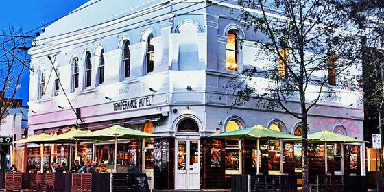
Our regular monthly social night - this month at the Temperance Hotel.
GRADE: Social.
ACTIVITY DESCRIPTION: The Nomads hold a social night each month, where members and guests can enjoy a meal, talk about upcoming events, compare notes on past activities and float ideas on events they would like to see run. New members are especially invited to our social nights as an orientation to Nomads activities.
Tuesday night is Parma Night at the Temperance Hotel - $20 parmas. Or you can order from their regular menu.
BOOKING: By Sunday 10th November. To register, click on Get Tickets.
Unsure whether you have booked? Click View my bookings.
MEETING TIME | LOCATION: 7pm at the Temperance Hotel, 426 Chapel St, South Yarra.
MAP REFERENCE: Google map goo.gl/maps/8jh5oWmraU2Vn1BE6.
PUBLIC TRANSPORT and PARKING: The Temperance Hotel is well served by public transport, but parking is limited. Suggested options:
Tram 72 to stop 30 (Prahran Market / Commercial Rd)
Tram 6 to stop 30 (Prahran Station / High St)
Tram 58 to stop 128 (Chapel St / Toorak Rd)
Tram 78 to stop 48 (Wilson St / Chapel St)
Train: Cranbourne, Pakenham, Frankston or Sandringham line to South Yarra
LEADER: Garry O. | Email LeaderGarryO@nomads.org.au if you have any questions.
Members can access leader contact details under Members | Leader Contacts when logged in to the website.
HOME BACK TO LIST OF EVENTS MEMBERSHIPS

Nov
11
2024
Past Event
Leaders Forum - Online via Zoom
19:00 – 20:30
** Nomads email addresses have changed to the format LeaderFredN@nomads.org.au, and may go into your Junk Folder as a result. See Some Recommendations about Nomads Emails to prevent that **
Keeping our highly valued leaders up to date with latest procedures, expectations, and resources to plan and run great and safe events. We will have a formal presentation, followed by a question and discussion time - online via Zoom. Non leaders are also very welcome.
GRADE: Social and educational.
ACTIVITY DESCRIPTION: The expectations of our event leaders is a constantly changing space. To ensure our leaders are supported by the executive, we are trialling an online leadership forum. If deemed useful it could become a regular event. The safety and success of any event depends largely on the planning, before we even jump in the car.
An online event is proposed so it is easier for our leaders to attend, recognising that we all have busy lives. We encourage all of our leaders to make an attempt to attend.
This is not a bitch session and we acknowledge our organisation can always be improved. If there is an issue that cannot be sorted out at the meeting (within 5 minutes) it will be put onto a to-do list. Someone has to take ownership of the issue, do some research and present back later.
The first meeting will be led by Roger H. The topic will be sources of information, resources, and training that leaders have available to plan and execute events. The presentation will last approximately 45 minutes, which leaves 45 minutes for open discussion.
BOOKING: By 5pm Monday 11th November. To register, click on Get Tickets. Alternatively, simply click on the Zoom link in the reminder email sent to members a few days prior to the event.
Unsure if you've already booked? Click View my bookings.
MEETING TIME | LOCATION: 7pm online via Zoom. Those who registered will be sent the Zoom link by 6pm on Monday evening.
LEADER: Roger H. | Email LeaderRogerH@nomads.org.au if you have any questions.
Members can access leader contact details under Members | Leader Contacts when logged in to the website.
Photo by Jon Anders Wiken.
HOME BACK TO LIST OF EVENTS MEMBERSHIPS
